Cruz Alta, Rio Grande do Sul
| Cruz Alta | |||
|---|---|---|---|
| Municipality | |||
| Mui Leal cidade do divino espírito Santo de Cruz Alta | |||
|
Vista da Rua Coronel Pillar (Monumento de Fátima). | |||
| |||
|
Nickname(s): "Terra de Érico Veríssimo" "Terra dos tropeiros" "Terra de Júlio de Castilhos" "Ninho dos Pica-paus" | |||
 | |||
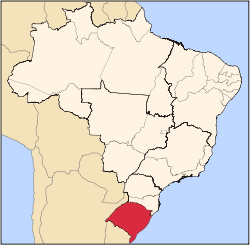
 Cruz Alta Location in Brazil | |||
| Coordinates: 28°38′19″S 53°36′23″W / 28.63861°S 53.60639°WCoordinates: 28°38′19″S 53°36′23″W / 28.63861°S 53.60639°W | |||
| Country |
| ||
| State | Rio Grande do Sul | ||
| Mesoregion | Mesorregião do Noroeste Rio-Grandense | ||
| Microregion | Microrregião de Cruz Alta | ||
| Founded | August 18, 1821 | ||
| Government | |||
| • Mayor | Juliano da Silva(PMDB) | ||
| Area | |||
| • Total | 1,360.37 km2 (525.24 sq mi) | ||
| Elevation | 452 m (1,483 ft) | ||
| Population (2010)[1] | |||
| • Total | 62,776 | ||
| • Density | 46/km2 (120/sq mi) | ||
| Demonym(s) | cruz-altense or cruz-altino | ||
| Time zone | UTC-3 (UTC-3) | ||
| • Summer (DST) | UTC-2 (UTC-2) | ||
| Postal Code | 98005-970 | ||
| Area code(s) | +55 55 | ||
| Website | http://www.cruzalta.rs.gov.br/ | ||


Cruz Alta is a municipality in the state Rio Grande do Sul, Brazil. The town is the seat of the Roman Catholic Diocese of Cruz Alta. Was founded on August 18, 1821.
It is the birthplace of the writer Érico Veríssimo and of Júlio Prates de Castilhos, a journalist and politician.
The municipality is known to have given rise to a large number of other municipalities as Ijuí, Santa Maria, Passo Fundo, Santo Angelo and their initial territory led to more other, became known by the northwestern mother.[2] The municipality belongs to the Northwest Mesoregion Riograndense and Microregion Cruz Alta. It is located at latitude 28 º 38 '19 "south and longitude 53 º 36' 23" west, with an average elevation of 452 meters above sea level. Access to the city is by BR-158, in the north-south axis, the BR-377 to the east, and also by the RS-342 on the west.
The location of the city is of strategic importance, being considered as a major trunk road and rail in the north central part of the state, with the presence of a dry port in the northeast of the city.

References
- ↑ FEE. "FEE 2012". Fundação de Economia e Estatística. Retrieved February 10, 2013.
- ↑ FEE. "Data de criação dos municípios do RS". Fundação de Economia e Estatística. Retrieved February 11, 2013.