Maçambara
| Maçambara | |
|---|---|
| Municipality | |
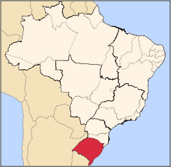
 Map of the state of Rio Grande do Sul, Brazil highlighting Maçambara | |
| Coordinates: 29°8′34″S 56°3′54″W / 29.14278°S 56.06500°WCoordinates: 29°8′34″S 56°3′54″W / 29.14278°S 56.06500°W | |
| Country | Brazil |
| Region | South |
| State | Rio Grande do Sul |
| Micro-region | Campanha Ocidental |
| Founded | October 22, 1997 |
| Area | |
| • Total | 1,682.82 km2 (649.74 sq mi) |
| Population (2015) | |
| • Total | 4,824 |
| • Density | 2.9/km2 (7.4/sq mi) |
| Time zone | BRT (UTC-3) |
| • Summer (DST) | BRST (UTC-2) |
| Postal code | 97560-xxx |
| Distance from the capital | 590 km (370 mi) |
| Website | macambara.rs.gov.br |
Maçambara is a small Brazilian municipality in the western part of the state of Rio Grande do Sul. The population is 4,824 (2015 est.) in an area of 1,682.82 km².[1] Its elevation is 110 m. It is located west of the state capital of Porto Alegre and northeast of Alegrete.
The municipality contains part of the 4,392 hectares (10,850 acres) São Donato Biological Reserve, a strictly protected conservation unit created in 1975 that protects an area of wetlands on the Butuí River, a tributary of the Uruguay River.[2]
Neighbouring municipalities
References
- ↑ Instituto Brasileiro de Geografia e Estatística
- ↑ Inaugurado em São Borja Escritório da Reserva Biológica do São Donato (in Portuguese), Secretaria do Ambiente e Desenvolvimento Sustentável do Rio Grande do Sul, 27 May 2002, retrieved 2016-04-19
External links
- http://www.citybrazil.com.br/rs/macambara/ (Portuguese)
This article is issued from Wikipedia - version of the 5/26/2016. The text is available under the Creative Commons Attribution/Share Alike but additional terms may apply for the media files.