Mata, Rio Grande do Sul
| Mata | |||
|---|---|---|---|
 | |||
| |||
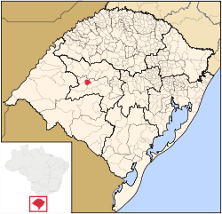 Location in Rio Grande do Sul, Brazil | |||
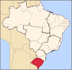
 Mata Location in Brazil | |||
| Coordinates: 29°33′57″S 54°27′36″W / 29.56583°S 54.46000°WCoordinates: 29°33′57″S 54°27′36″W / 29.56583°S 54.46000°W | |||
| Country | Brazil | ||
| Region | South | ||
| State | Rio Grande do Sul | ||
| Government | |||
| • Mayor | Sergio Roni Bruning | ||
| Area | |||
| • Total | 312.120 km2 (120.510 sq mi) | ||
| Elevation | 127 m (417 ft) | ||
| Population (2010) | |||
| • Total | 5,111 | ||
| • Density | 16/km2 (42/sq mi) | ||
| Time zone | UTC-3 (UTC-3) | ||
| • Summer (DST) | UTC-2 (UTC-2) | ||


Mata is a municipality in Rio Grande do Sul in Brazil.
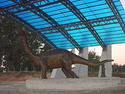
Paleontology
The city of Mata has large deposits of petrified trees.
Museum of the city that have fossils:

 Petrified wood in the Paleobotanic Park
 São Roque community
References
External links
-
 Mata travel guide from Wikivoyage
This article is issued from Wikipedia - version of the 5/15/2016. The text is available under the Creative Commons Attribution/Share Alike but additional terms may apply for the media files.