Bossoroca
| Bossoroca | |
|---|---|
| Municipality | |
 Location in Rio Grande do Sul state | |
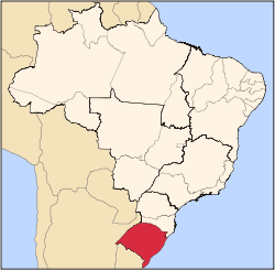
 Bossoroca Location in Brazil | |
| Coordinates: 28°43′48″S 54°54′0″W / 28.73000°S 54.90000°WCoordinates: 28°43′48″S 54°54′0″W / 28.73000°S 54.90000°W | |
| Country |
|
| State | Rio Grande do Sul |
| Micro-region | Santo Ângelo |
| Area | |
| • Total | 1,610.57 km2 (621.84 sq mi) |
| Population (2015) | |
| • Total | 6,873 |
| • Density | 4.3/km2 (11/sq mi) |
| Time zone | BRT (UTC-3) |
| • Summer (DST) | BRST (UTC-2) |
| Postal code | 97850-xxx |
| Website |
www |
Bossoroca is a municipality of the western part of the state of Rio Grande do Sul, Brazil. The population is 6,873 (2015 est.) in an area of 1610.57 km².[1] The name comes from the Guarani language, and may mean erosion. It is located 524 km west of the state capital of Porto Alegre, northeast of Alegrete.
Bounding municipalities
History
The area was first inhabited by the Guarani tribes. In the 17th and 18th centuries, Jesuit missions were established in the area. The municipality of Bossoroca was created on March 4, 1967.
References
External links
- http://www.citybrazil.com.br/rs/bossoroca/ (Portuguese)
This article is issued from Wikipedia - version of the 5/15/2016. The text is available under the Creative Commons Attribution/Share Alike but additional terms may apply for the media files.