Cambará do Sul
| Cambará do Sul | |||
|---|---|---|---|
| Municipality | |||
|
Canyons Itaimbezinho | |||
| |||
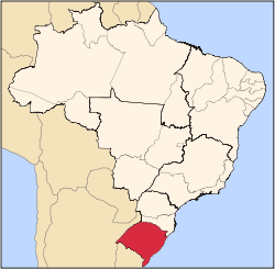
 Location within Rio Grande do Sul | |||
 Cambará do Sul Location in Brazil | |||
| Coordinates: 29°22′S 50°08′W / 29.367°S 50.133°WCoordinates: 29°22′S 50°08′W / 29.367°S 50.133°W | |||
| Country |
| ||
| State | Rio Grande do Sul | ||
| Time zone | UTC-3 (UTC-3) | ||
| • Summer (DST) | UTC-2 (UTC-2) | ||
| Website | http://cambaradosul.rs.gov.br/ | ||


Cambará do Sul is a municipality in the state Rio Grande do Sul, Brazil. Its population was approximately 6,600 in 2010. It has an area of approximately 1212 km².
The city is one of the coldest in Brazil and sometimes there is chance of snow.
It is located 185 kilometers from Porto Alegre, at an altitude of 1,031 m, and coordinates latitude 29º02'52 "south and longitude 50º08'41" West. Its estimated population in 2005 was 6,682 inhabitants according to the Brazilian Institute of Statistics - IBGE, Human Development Index (HDI) of 0.76 according to the Atlas of Human Development / UNDP (2000).
The municipality has an area of 1,213 km² and was installed in 1963 from dismemberment of São Francisco de Paula.
In Cambara do Sul are the headquarters of Aparados da Serra National Park and Serra Geral National Park, where they are located, among several others, known canyons Itaimbezinho, Fortaleza, Churriado and Malacara.
The Aparados da Serra National Park is also partly located in the municipality of Praia Grande, in the state of Santa Catarina , bathed by Rio do Boi, where they have numerous waterfalls, such as Leite de Moça and Braço Forte, which are the main.
The city today is an ecotourism point that has been organized, with several inns, beautiful countryside and mountain climate, registering record low temperatures during the winter, sometimes accompanied by snow.