Bartow, Georgia
| Bartow, Georgia | |
|---|---|
| Town | |
 Location in Jefferson County and the state of Georgia | |
| Coordinates: 32°52′52″N 82°28′20″W / 32.88111°N 82.47222°WCoordinates: 32°52′52″N 82°28′20″W / 32.88111°N 82.47222°W | |
| Country | United States |
| State | Georgia |
| County | Jefferson |
| Area | |
| • Total | 1.1 sq mi (2.9 km2) |
| • Land | 1.1 sq mi (2.9 km2) |
| • Water | 0 sq mi (0 km2) |
| Elevation | 243 ft (74 m) |
| Population (2010) | |
| • Total | 286 |
| • Density | 202.7/sq mi (76.9/km2) |
| Time zone | Eastern (EST) (UTC-5) |
| • Summer (DST) | EDT (UTC-4) |
| ZIP code | 30413 |
| Area code(s) | 478 |
| FIPS code | 13-05680[1] |
| GNIS feature ID | 0354475[2] |
Bartow is a town in Jefferson County, Georgia, United States. As of the 2010 census, the city had a population of 286.[3] Initially the town was known as "Spier's Turnout", but was changed to honor the first Confederate officer to die in battle, Colonel Francis S. Bartow of Savannah, Georgia, who was killed at the Battle of Manassas, Virginia on July 21, 1861.
Geography
Bartow is located at 32°52′52″N 82°28′20″W / 32.88111°N 82.47222°W (32.881111, -82.472222).
Demographics
| Historical population | |||
|---|---|---|---|
| Census | Pop. | %± | |
| 1880 | 248 | — | |
| 1890 | 437 | 76.2% | |
| 1900 | 286 | −34.6% | |
| 1910 | 384 | 34.3% | |
| 1920 | 582 | 51.6% | |
| 1930 | 416 | −28.5% | |
| 1940 | 438 | 5.3% | |
| 1950 | 347 | −20.8% | |
| 1960 | 366 | 5.5% | |
| 1970 | 333 | −9.0% | |
| 1980 | 357 | 7.2% | |
| 1990 | 292 | −18.2% | |
| 2000 | 223 | −23.6% | |
| 2010 | 286 | 28.3% | |
| Est. 2015 | 262 | [4] | −8.4% |
As of the census[1] of 2000, there were 223 people, 95 households, and 68 families residing in the town. The population density was 196.1 people per square mile (75.5/km²). There were 106 housing units at an average density of 93.2 per square mile (35.9/km²). The racial makeup of the town was 40.36% White and 59.64% African American. Hispanic or Latino of any race were 1.35% of the population.
There were 95 households out of which 27.4% had children under the age of 18 living with them, 48.4% were married couples living together, 20.0% had a female householder with no husband present, and 28.4% were non-families. 26.3% of all households were made up of individuals and 7.4% had someone living alone who was 65 years of age or older. The average household size was 2.35 and the average family size was 2.82.
In the town the population was spread out with 23.8% under the age of 18, 4.5% from 18 to 24, 30.5% from 25 to 44, 27.4% from 45 to 64, and 13.9% who were 65 years of age or older. The median age was 38 years. For every 100 females there were 99.1 males. For every 100 females age 18 and over, there were 91.0 males.
The median income for a household in the town was $23,750, and the median income for a family was $31,250. Males had a median income of $32,083 versus $16,667 for females. The per capita income for the town was $11,873. About 25.4% of families and 30.0% of the population were below the poverty line, including 44.9% of those under the age of 18 and 22.9% ages 65 or older.
See also
References
- 1 2 "American FactFinder". United States Census Bureau. Archived from the original on 2013-09-11. Retrieved 2008-01-31.
- ↑ "US Board on Geographic Names". United States Geological Survey. 2007-10-25. Retrieved 2008-01-31.
- ↑ http://factfinder2.census.gov/faces/tableservices/jsf/pages/productview.xhtml?pid=DEC_10_SF1_GCTP2.ST13&prodType=table
- ↑ "Annual Estimates of the Resident Population for Incorporated Places: April 1, 2010 to July 1, 2015". Retrieved July 2, 2016.
- ↑ "Census of Population and Housing". Census.gov. Archived from the original on May 11, 2015. Retrieved June 4, 2015.
External links
- The News and Farmer and Wadley Herald/ Jefferson Reporter, the county's weekly newspaper and the oldest weekly newspaper in Georgia.
Municipalities and communities of Jefferson County, Georgia, United States | ||
|---|---|---|
| Cities | 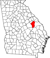 | |
| Town | ||
| CDP | ||
| Footnotes | ‡This populated place also has portions in an adjacent county or counties | |