Evans, Georgia
| Evans, Georgia | |
|---|---|
| Census-designated place | |
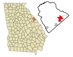 Location in Columbia County and the state of Georgia | |
| Coordinates: 33°32′15″N 82°7′40″W / 33.53750°N 82.12778°WCoordinates: 33°32′15″N 82°7′40″W / 33.53750°N 82.12778°W | |
| Country | United States |
| State | Georgia |
| County | Columbia |
| Area | |
| • Total | 26.6 sq mi (68.8 km2) |
| • Land | 25.3 sq mi (65.4 km2) |
| • Water | 1.3 sq mi (3.3 km2) |
| Elevation | 417 ft (127 m) |
| Population (2010) | |
| • Total | 29,011 |
| • Density | 1,148/sq mi (443.3/km2) |
| Time zone | Eastern (EST) (UTC-5) |
| • Summer (DST) | EDT (UTC-4) |
| ZIP code | 30809 |
| Area code(s) | 706 |
| FIPS code | 13-28044[1] |
| GNIS feature ID | 0355729[2] |
Evans is a census-designated place (CDP) in Columbia County, Georgia, United States. It is a suburb of Augusta and is part of the Augusta metropolitan area. The population was 29,011 at the 2010 census,[3] up from 17,727 at the 2000 census.
Evans, possibly named after Confederate General Clement A. Evans,[4] is the de facto county seat of Columbia County, although Appling still holds the de jure designation.[4] The Columbia County Government Center, the Government Complex Addition, and the Columbia County Courthouse Annex are all located in Evans.[4]
Geography
Evans is located in eastern Columbia County, bordered to the northeast by the Savannah River, which forms the South Carolina state line. To the southeast is the CDP of Martinez. Downtown Augusta is 11 miles (18 km) to the southeast.
The original community of Evans is centered on North Belair Road (Georgia State Route 383) southwest of Washington Road (GA 104). The CDP extends west from this point to Gibbs Road and Crawford Creek and south as far as Columbia Road (GA 232). Most of the current CDP, however, is north of Washington Road and Evans to Locks Road, extending west as far as Little Kiokee Creek and east to Stevens Creek Dam on the Savannah River.[5]
According to the United States Census Bureau, the CDP has a total area of 26.6 square miles (68.8 km2), of which 25.3 square miles (65.4 km2) is land and 1.3 square miles (3.3 km2), or 4.87%, is water.[3]
Demographics
As of the census[1] of 2000, there were 17,727 people, 6,319 households, and 4,973 families residing in the CDP. The population density was 1,784.1 people per square mile (688.6/km²). There were 6,632 housing units at an average density of 667.5 per square mile (257.6/km²). The racial makeup of the CDP was 84.61% White, 10.22% African American, 0.25% Native American, 2.69% Asian, 0.05% Pacific Islander, 0.67% from other races, and 1.53% from two or more races. Hispanic or Latino of any race were 2.23% of the population.
There were 6,319 households out of which 41.8% had children under the age of 18 living with them, 65.9% were married couples living together, 10.0% had a female householder with no husband present, and 21.3% were non-families. 18.5% of all households were made up of individuals and 8.1% had someone living alone who was 65 years of age or older. The average household size was 2.75 and the average family size was 3.15.
In the CDP the population was spread out with 28.4% under the age of 18, 6.9% from 18 to 24, 30.5% from 25 to 44, 23.4% from 45 to 64, and 10.8% who were 65 years of age or older. The median age was 36 years. For every 100 females there were 92.3 males. For every 100 females age 18 and over, there were 86.9 males.
The median income for a household in the CDP was $66,200, and the median income for a family was $76,128. Males had a median income of $49,863 versus $30,002 for females. The per capita income for the CDP was $22,280. About 2.9% of families and 3.7% of the population were below the poverty line, including 2.7% of those under age 18 and 8.7% of those age 65 or over.
Highways
Schools
Evans is served by the Columbia County Public School System.
Elementary schools
Eight public elementary schools serve Evans: Bel Air Elementary, Blue Ridge Elementary, Brookwood Elementary, Evans Elementary, Greenbrier Elementary, Lewiston Elementary, North Columbia Elementary, River Ridge Elementary, Riverside Elementary, Stevens Creek Elementary, and South Columbia Elementary.[6]
Middle schools
Six public middle schools serve Evans: Columbia Middle School, Evans Middle School, Greenbrier Middle School, Lakeside Middle School, Riverside Middle School, and Stallings Island Middle School.[6]
High schools
Four public high schools serve Evans: Evans High School, Greenbrier High School, Lakeside High School, and as of fall 2009, Grovetown High School.[6]
See also
References
- 1 2 "American FactFinder". United States Census Bureau. Archived from the original on September 11, 2013. Retrieved 2008-01-31.
- ↑ "US Board on Geographic Names". United States Geological Survey. 2007-10-25. Retrieved 2008-01-31.
- 1 2 "Geographic Identifiers: 2010 Demographic Profile Data (G001): Evans CDP, Georgia". U.S. Census Bureau, American Factfinder. Retrieved July 29, 2014.
- 1 2 3 Columbia Court House at Carl Vinson Institute of Government, University of Georgia, website. Accessed 15 February 2008.
- ↑ "TigerWEB". esri.
- 1 2 3 "Columiba County Board of Education - School Zones". Retrieved 2008-02-03.
External links
Municipalities and communities of Columbia County, Georgia, United States | ||
|---|---|---|
| Cities | 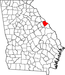 | |
| CDPs | ||
| Unincorporated community | ||