Harlem, Georgia
| Harlem, GA | |
|---|---|
| City | |
 Location in Columbia County and the state of Georgia | |
| Coordinates: 33°25′1″N 82°18′50″W / 33.41694°N 82.31389°WCoordinates: 33°25′1″N 82°18′50″W / 33.41694°N 82.31389°W | |
| Country | United States |
| State | Georgia |
| County | Columbia |
| Area | |
| • Total | 4.54 sq mi (11.75 km2) |
| • Land | 4.52 sq mi (11.71 km2) |
| • Water | 0.02 sq mi (0.04 km2) |
| Elevation | 554 ft (169 m) |
| Population (2010) | |
| • Total | 2,667 |
| • Density | 590/sq mi (227.7/km2) |
| Time zone | Eastern (EST) (UTC-5) |
| • Summer (DST) | EDT (UTC-4) |
| ZIP code | 30814 |
| Area code(s) | 706 |
| FIPS code | 13-36696[1] |
| GNIS feature ID | 0331913[2] |
| Website |
harlemga |
Harlem is a city in Columbia County, Georgia, United States. It is part of the Augusta, Georgia metropolitan area. The population was 2,666 at the 2010 census,[3] up from 1,814 at the 2000 census. Harlem is the birthplace of comedian Oliver Hardy; the annual Harlem Oliver Hardy Festival is held on the first Saturday each October on Main Street in his honor.
History
From the building of the Georgia Railroad which passes through town until at least the 1860s, Harlem was known as "Saw Dust". The town is twinned with Ulverston in England, the birthplace of Stan Laurel, the partner of Oliver Hardy.
Geography
Harlem is located in southern Columbia County at 33°25′1″N 82°18′50″W / 33.41694°N 82.31389°W (33.416822, -82.313762),[4] with its western boundary following the McDuffie County line. U.S. Routes 78 and 278 pass through the center of town, leading east 23 miles (37 km) to downtown Augusta and west 12 miles (19 km) to Thomson. U.S. Route 221 crosses US 78/278 in the center of town, leading north 5 miles (8 km) to Interstate 20 and 21 miles (34 km) to the South Carolina border, and south 16 miles (26 km) to Wrens.
According to the United States Census Bureau, Harlem has a total area of 4.5 square miles (11.7 km2), of which 0.02 square miles (0.04 km2), or 0.36%, is water.[3]
Demographics
| Historical population | |||
|---|---|---|---|
| Census | Pop. | %± | |
| 1880 | 292 | — | |
| 1890 | 647 | 121.6% | |
| 1900 | 527 | −18.5% | |
| 1910 | 736 | 39.7% | |
| 1920 | 798 | 8.4% | |
| 1930 | 784 | −1.8% | |
| 1940 | 736 | −6.1% | |
| 1950 | 1,033 | 40.4% | |
| 1960 | 1,423 | 37.8% | |
| 1970 | 1,540 | 8.2% | |
| 1980 | 1,485 | −3.6% | |
| 1990 | 2,199 | 48.1% | |
| 2000 | 1,814 | −17.5% | |
| 2010 | 2,666 | 47.0% | |
| Est. 2015 | 2,967 | [5] | 11.3% |
As of the census[1] of 2000, there were 1,814 people, 704 households, and 506 families residing in the city. The population density was 719.9 people per square mile (277.9/km²). There were 763 housing units at an average density of 302.8 per square mile (116.9/km²). The racial makeup of the city was 70.95% White, 25.41% African American, 0.33% Native American, 0.88% Asian, 1.10% from other races, and 1.32% from two or more races. Hispanic or Latino of any race were 2.26% of the population.
There were 704 households out of which 38.9% had children under the age of 18 living with them, 47.3% were married couples living together, 20.2% had a female householder with no husband present, and 28.0% were non-families. 24.1% of all households were made up of individuals and 9.8% had someone living alone who was 65 years of age or older. The average household size was 2.58 and the average family size was 3.07.
In the city the population was spread out with 29.2% under the age of 18, 8.7% from 18 to 24, 29.0% from 25 to 44, 20.6% from 45 to 64, and 12.6% who were 65 years of age or older. The median age was 34 years. For every 100 females there were 80.3 males. For every 100 females age 18 and over, there were 75.8 males.
The median income for a household in the city was $30,500, and the median income for a family was $36,307. Males had a median income of $27,833 versus $22,098 for females. The per capita income for the city was $15,439. About 15.1% of families and 17.0% of the population were below the poverty line, including 24.1% of those under age 18 and 16.3% of those age 65 or over.
See also
References
- 1 2 "American FactFinder". United States Census Bureau. Retrieved 2008-01-31.
- ↑ "US Board on Geographic Names". United States Geological Survey. 2007-10-25. Retrieved 2008-01-31.
- 1 2 "Geographic Identifiers: 2010 Demographic Profile Data (G001): Harlem city, Georgia". U.S. Census Bureau, American Factfinder. Retrieved July 29, 2014.
- ↑ "US Gazetteer files: 2010, 2000, and 1990". United States Census Bureau. 2011-02-12. Retrieved 2011-04-23.
- ↑ "Annual Estimates of the Resident Population for Incorporated Places: April 1, 2010 to July 1, 2015". Retrieved July 2, 2016.
- ↑ "Census of Population and Housing". Census.gov. Retrieved June 4, 2015.
External links
- City of Harlem official website
- Harlem at Georgia.gov
Municipalities and communities of Columbia County, Georgia, United States | ||
|---|---|---|
| Cities | 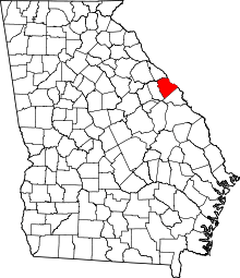 | |
| CDPs | ||
| Unincorporated community | ||