Thomson, Georgia
| Thomson, Georgia | |
|---|---|
| City | |
 Location in McDuffie County and the state of Georgia | |
| Coordinates: 33°28′2″N 82°29′58″W / 33.46722°N 82.49944°WCoordinates: 33°28′2″N 82°29′58″W / 33.46722°N 82.49944°W | |
| Country | United States |
| State | Georgia |
| County | McDuffie |
| Area | |
| • Total | 4 sq mi (10.2 km2) |
| • Land | 4 sq mi (10.2 km2) |
| • Water | 0 sq mi (0 km2) |
| Elevation | 531 ft (162 m) |
| Population (2010) | |
| • Total | 6,778 |
| • Density | 1,694,5/sq mi (664.5/km2) |
| Time zone | Eastern (EST) (UTC-5) |
| • Summer (DST) | EDT (UTC-4) |
| ZIP code | 30824 |
| Area code(s) | 706 |
| FIPS code | 13-76280[1] |
| GNIS feature ID | 0356589[2] |
| Website | Thomson website |
Thomson, originally called Slashes is a city in McDuffie County, Georgia, United States. The population was 6,778 at the 2010 census. The city is the county seat of McDuffie County.[3] Thomson's nickname is "The Camellia City of the South", in honor of the thousands of camellia plants throughout the city. Thomson was founded in 1837 as a depot on the Georgia Railroad. It was renamed in 1853 for railroad official John Edgar Thomson and incorporated February 15, 1854 as a town and in 1870 as a city. It is part of the Augusta – Richmond County Metropolitan Statistical Area.
History
Thomson, originally called Slashes, was founded in 1837 as a depot on the Georgia Railroad. It was renamed in 1853 for railroad official John Edgar Thomson. In 1870, Thomson was designated seat of the newly formed McDuffie County. It was incorporated as a town in 1854 and as a city in 1870.[4]
The Old Rock House, built in 1785, is said to be one of Georgia's oldest documented houses with its original design intact. Built by Thomas Ansley, the home is said to be the home of ancestors of former president Jimmy Carter.
Geography
Thomson is located at 33°28′2″N 82°29′58″W / 33.46722°N 82.49944°W (33.467346, -82.499450).[5]
According to the United States Census Bureau, the city has a total area of 1.95 square miles (5.1 km2)
Thomson is considered part of the Central Savannah River Area geographical designation.
Demographics
| Historical population | |||
|---|---|---|---|
| Census | Pop. | %± | |
| 1880 | 700 | — | |
| 1890 | 836 | 19.4% | |
| 1900 | 1,154 | 38.0% | |
| 1910 | 2,151 | 86.4% | |
| 1920 | 2,140 | −0.5% | |
| 1930 | 1,914 | −10.6% | |
| 1940 | 3,088 | 61.3% | |
| 1950 | 3,489 | 13.0% | |
| 1960 | 4,522 | 29.6% | |
| 1970 | 6,503 | 43.8% | |
| 1980 | 7,001 | 7.7% | |
| 1990 | 6,862 | −2.0% | |
| 2000 | 6,828 | −0.5% | |
| 2010 | 6,778 | −0.7% | |
| Est. 2015 | 6,689 | [6] | −1.3% |
As of the census[1] of 2000, there were 6,828 people, 2,609 households, and 1,792 families residing in the city. The population density was 1,726.9 people per square mile (667.4/km2). There were 2,895 housing units at an average density of 732.2 per square mile (283.0/km2). The racial makeup of the city was 42.38% White, 56.28% African American, 0.07% Native American, 0.28% Asian, 0.03% Pacific Islander, 0.23% from other races, and 0.72% from two or more races. Hispanic or Latino of any race were 1.27% of the population.
There were 2,609 households out of which 36.2% had children under the age of 18 living with them, 35.7% were married couples living together, 28.4% had a female householder with no husband present, and 31.3% were non-families. 28.2% of all households were made up of individuals and 12.6% had someone living alone who was 65 years of age or older. The average household size was 2.50 and the average family size was 3.05.
In the city the population was spread out with 28.6% under the age of 18, 9.3% from 18 to 24, 27.2% from 25 to 44, 19.6% from 45 to 64, and 15.3% who were 65 years of age or older. The median age was 34 years. For every 100 females there were 81.3 males. For every 100 females age 18 and over, there were 73.5 males.
The median income for a household in the city was $23,179, and the median income for a family was $30,015. Males had a median income of $25,882 versus $20,607 for females. The per capita income for the city was $14,976. 27.6% of the population and 23.8% of families were below the poverty line. 1.7% of those under the age of 18 and 100% of those 65 and older were living below the poverty line.
Landmarks
- Rock House (1785) – oldest stone residence in Georgia
- Hickory Hill – home of US senator Thomas E. Watson (1856–1922), noted author, statesman, and lawyer; known as the father of Rural Free Delivery
Education
The McDuffie County School District holds pre-school to grade twelve, and consists of four elementary schools, a middle school, a high school and an alternative school.[8] The district has 262 full-time teachers and over 4,312 students.[9]
- Dearing Elementary School
- Maxwell Elementary School
- Norris Elementary School
- Thomson Elementary School
- Thomson Middle School
- Thomson High School
- McDuffie County Achievement Center
Notable people
- Marcus Allen - former professional basketball player forward, tried out for Denver Nuggets and the Euroleague, CEO Big Brothers Big Sisters
- Darius Eubanks - linebacker for the NFL'S Dallas Cowboys
- Casper Brinkley - Former Defensive End for the Carolina Panthers
- Zebedee Armstrong - outsider artist
- Jasper Brinkley - linebacker for the NFL's New York Giants
- Chris Crenshaw - jazz trombone player and vocalist
- Vonteego Cummings - former professional basketball guard, played in the NBA and the Euroleague
- Ray Guy - NFL punter for the Oakland Raiders and namesake of the Ray Guy Award, presented each year to college football's top punter. He is the first and only punter admitted to the NFL Hall of Fame.
- Richard E. Hawes - Navy admiral, World War II hero, and namesake of guided missile frigate USS Hawes
- Eddie Lee Ivery - running back for the Georgia Tech Yellow Jackets and the Green Bay Packers
- Millie Jackson - R & B singer
- Franklin Langham - PGA Tour golfer (1992–2005)
- Jerry Mays - running back for the Georgia Tech Yellow Jackets and the San Diego Chargers
- Blind Willie McTell - singer and blues musician, wrote "Statesboro Blues;" Thomson sponsors an annual blues festival in his honor
- Chris Mohr - NFL punter for the Tampa Bay Buccaneers, Buffalo Bills and Atlanta Falcons (1989–2004); published songwriter
- Ken Roberson - Broadway choreographer noted for his work in the 2004 Tony Award-winning "Avenue Q" and "All Shook Up;" movie credits as choreographer include HBO's "Lackawanna Blues" and independent film "Preaching to the Choir"
- Emerson Spartz - founder and CEO of MuggleNet, website devoted to Harry Potter
- Tom Watson - U.S. Senator, Populist Party leader, and renowned orator of the late 19th century; noted for establishing Rural Free Delivery, which set up rural mail service for the nation
- Romulus Moore - In 1868, the Rev. Moore was elected as one of the first African American legislators to the Georgia State Assembly in Atlanta. The Rev. Moore’s legacy as one of the first African American men elected under reconstruction and as a member of the Constitutional Committee makes him among the founding fathers of the civil rights movement.
References
- 1 2 "American FactFinder". United States Census Bureau. Retrieved 2008-01-31.
- ↑ "US Board on Geographic Names". United States Geological Survey. 2007-10-25. Retrieved 2008-01-31.
- ↑ "Find a County". National Association of Counties. Retrieved 2011-06-07.
- ↑ Hellmann, Paul T. (May 13, 2013). Historical Gazetteer of the United States. Routledge. p. 249. Retrieved 30 November 2013.
- ↑ "US Gazetteer files: 2010, 2000, and 1990". United States Census Bureau. 2011-02-12. Retrieved 2011-04-23.
- ↑ "Annual Estimates of the Resident Population for Incorporated Places: April 1, 2010 to July 1, 2015". Retrieved July 2, 2016.
- ↑ "Census of Population and Housing". Census.gov. Retrieved June 4, 2015.
- ↑ Georgia Board of Education, Retrieved June 23, 2010.
- ↑ School Stats, Retrieved June 23, 2010.
External links
Municipalities and communities of McDuffie County, Georgia, United States | ||
|---|---|---|
| City | 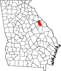 | |
| Town | ||
| Unincorporated community | ||