Elko, South Carolina
| Elko, South Carolina | |
|---|---|
| Town | |
 Location of Elko, South Carolina | |
| Coordinates: 33°22′50″N 81°22′46″W / 33.38056°N 81.37944°WCoordinates: 33°22′50″N 81°22′46″W / 33.38056°N 81.37944°W | |
| Country | United States |
| State | South Carolina |
| County | Barnwell |
| Area | |
| • Total | 1.0 sq mi (2.7 km2) |
| • Land | 1.0 sq mi (2.7 km2) |
| • Water | 0.0 sq mi (0.0 km2) |
| Elevation | 338 ft (103 m) |
| Population (2010) | |
| • Total | 193 |
| • Density | 184/sq mi (71.0/km2) |
| Time zone | Eastern (EST) (UTC-5) |
| • Summer (DST) | EDT (UTC-4) |
| ZIP code | 29826 |
| Area code(s) | 803 |
| FIPS code | 45-23335[1] |
| GNIS feature ID | 1247656[2] |
Elko is a town in Barnwell County, South Carolina, United States. The population was 193 at the 2010 census.[3]
Geography
Elko is located in northern Barnwell County at 33°22′50″N 81°22′46″W / 33.38056°N 81.37944°W (33.380563, -81.379321).[4] U.S. Route 78 passes through the center of the town, leading east 6 miles (10 km) to Blackville and west 2 miles (3 km) to Williston. South Carolina Highway 37 crosses US 78 at the center of Elko, leading south 10 miles (16 km) to Barnwell, the county seat, and northeast 10 miles (16 km) to Springfield.
According to the United States Census Bureau, the town of Elko has a total area of 1.0 square mile (2.7 km2), all of it land.[3]
Demographics
| Historical population | |||
|---|---|---|---|
| Census | Pop. | %± | |
| 1880 | 149 | — | |
| 1890 | 100 | −32.9% | |
| 1900 | 208 | 108.0% | |
| 1910 | 114 | −45.2% | |
| 1920 | 188 | 64.9% | |
| 1930 | 210 | 11.7% | |
| 1940 | 206 | −1.9% | |
| 1950 | 142 | −31.1% | |
| 1960 | 194 | 36.6% | |
| 1970 | 202 | 4.1% | |
| 1980 | 329 | 62.9% | |
| 1990 | 214 | −35.0% | |
| 2000 | 212 | −0.9% | |
| 2010 | 193 | −9.0% | |
| Est. 2015 | 187 | [5] | −3.1% |
As of the census[1] of 2000, there were 212 people, 92 households, and 65 families residing in the town. The population density was 183.0 people per square mile (70.6/km²). There were 102 housing units at an average density of 88.0 per square mile (34.0/km²). The racial makeup of the town was 41.51% White and 58.49% African American.
There were 92 households out of which 29.3% had children under the age of 18 living with them, 42.4% were married couples living together, 23.9% had a female householder with no husband present, and 28.3% were non-families. 26.1% of all households were made up of individuals and 9.8% had someone living alone who was 65 years of age or older. The average household size was 2.30 and the average family size was 2.73.
In the town the population was spread out with 24.5% under the age of 18, 2.8% from 18 to 24, 29.7% from 25 to 44, 28.8% from 45 to 64, and 14.2% who were 65 years of age or older. The median age was 42 years. For every 100 females there were 92.7 males. For every 100 females age 18 and over, there were 86.0 males.
The median income for a household in the town was $23,571, and the median income for a family was $37,500. Males had a median income of $35,536 versus $27,083 for females. The per capita income for the town was $15,973. About 19.0% of families and 22.9% of the population were below the poverty line, including 36.1% of those under the age of eighteen and 51.5% of those sixty five or over.
References
- 1 2 "American FactFinder". United States Census Bureau. Retrieved 2008-01-31.
- ↑ "US Board on Geographic Names". United States Geological Survey. 2007-10-25. Retrieved 2008-01-31.
- 1 2 "Geographic Identifiers: 2010 Demographic Profile Data (G001): Elko town, South Carolina". U.S. Census Bureau, American Factfinder. Retrieved April 3, 2014.
- ↑ "US Gazetteer files: 2010, 2000, and 1990". United States Census Bureau. 2011-02-12. Retrieved 2011-04-23.
- ↑ "Annual Estimates of the Resident Population for Incorporated Places: April 1, 2010 to July 1, 2015". Retrieved July 2, 2016.
- ↑ "Census of Population and Housing". Census.gov. Retrieved June 4, 2015.
Municipalities and communities of Barnwell County, South Carolina, United States | ||
|---|---|---|
| City | 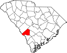 | |
| Towns | ||
| Ghost town | ||