Salley, South Carolina
| Salley, South Carolina | |
|---|---|
| Town | |
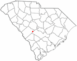 Location of Salley, South Carolina | |
| Coordinates: 33°33′57″N 81°18′15″W / 33.56583°N 81.30417°WCoordinates: 33°33′57″N 81°18′15″W / 33.56583°N 81.30417°W | |
| Country | United States |
| State | South Carolina |
| County | Aiken |
| Area | |
| • Total | 0.76 sq mi (1.97 km2) |
| • Land | 0.75 sq mi (1.94 km2) |
| • Water | 0.01 sq mi (0.03 km2) |
| Elevation | 374 ft (114 m) |
| Population (2010) | |
| • Total | 398 |
| • Density | 531/sq mi (205.0/km2) |
| Time zone | Eastern (EST) (UTC-5) |
| • Summer (DST) | EDT (UTC-4) |
| ZIP code | 29137 |
| Area code(s) | 803 |
| FIPS code | 45-63115[1] |
| GNIS feature ID | 1250735[2] |
Salley is a town in Aiken County, South Carolina, United States. The population was 398 at the 2010 census.[3] It is part of the Augusta, Georgia metropolitan area. Salley is known for hosting the Chitlin Strut, a town-wide festival, every November.
History
The Salley Historic District was listed on the National Register of Historic Places in 2000.[4]
Geography
Salley is located at 33°33′57″N 81°18′15″W / 33.565941°N 81.304080°W[5] in eastern Aiken County.
According to the United States Census Bureau, the town has a total area of 0.77 square miles (2.0 km2), of which 0.012 square miles (0.03 km2), or 1.41%,is water.[3]
Demographics
| Historical population | |||
|---|---|---|---|
| Census | Pop. | %± | |
| 1890 | 252 | — | |
| 1900 | 241 | −4.4% | |
| 1910 | 311 | 29.0% | |
| 1920 | 400 | 28.6% | |
| 1930 | 433 | 8.3% | |
| 1940 | 443 | 2.3% | |
| 1950 | 407 | −8.1% | |
| 1960 | 403 | −1.0% | |
| 1970 | 450 | 11.7% | |
| 1980 | 584 | 29.8% | |
| 1990 | 451 | −22.8% | |
| 2000 | 410 | −9.1% | |
| 2010 | 398 | −2.9% | |
| Est. 2015 | 417 | [6] | 4.8% |
As of the census[1] of 2000, there were 410 people, 165 households, and 110 families residing in the town. The population density was 529.0 people per square mile (203.0/km2). There were 194 housing units at an average density of 250.3 per square mile (96.0/km2). The racial makeup of the town was 49.27% African American, 46.83% White, 1.71% Native American, 0.98% Asian, and 1.22% from two or more races. Hispanic or Latino of any race were 0.24% of the population.
There were 165 households out of which 26.1% had children under the age of 18 living with them, 40.0% were married couples living together, 21.8% had a female householder with no husband present, and 33.3% were non-families. 30.3% of all households were made up of individuals and 17.6% had someone living alone who was 65 years of age or older. The average household size was 2.48 and the average family size was 3.10.
In the town the population was spread out with 22.9% under the age of 18, 8.8% from 18 to 24, 26.1% from 25 to 44, 22.2% from 45 to 64, and 20.0% who were 65 years of age or older. The median age was 40 years. For every 100 females there were 83.9 males. For every 100 females age 18 and over, there were 80.6 males.
The median income for a household in the town was $28,750, and the median income for a family was $41,250. Males had a median income of $39,063 versus $18,661 for females. The per capita income for the town was $12,250. About 28.6% of families and 28.4% of the population were below the poverty line, including 46.1% of those under age 18 and 36.1% of those age 65 or over.
References
- 1 2 "American FactFinder". United States Census Bureau. Retrieved 2008-01-31.
- ↑ "US Board on Geographic Names". United States Geological Survey. 2007-10-25. Retrieved 2008-01-31.
- 1 2 "Geographic Identifiers: 2010 Demographic Profile Data (G001): Salley town, South Carolina". U.S. Census Bureau, American Factfinder. Retrieved August 5, 2013.
- ↑ National Park Service (2010-07-09). "National Register Information System". National Register of Historic Places. National Park Service.
- ↑ "US Gazetteer files: 2010, 2000, and 1990". United States Census Bureau. 2011-02-12. Retrieved 2011-04-23.
- ↑ "Annual Estimates of the Resident Population for Incorporated Places: April 1, 2010 to July 1, 2015". Retrieved July 2, 2016.
- ↑ "Census of Population and Housing". Census.gov. Retrieved June 4, 2015.
External links
Municipalities and communities of Aiken County, South Carolina, United States | ||
|---|---|---|
| Cities | 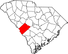 | |
| Towns | ||
| CDPs | ||
| Unincorporated communities | ||
| Footnotes | ‡This populated place also has portions in an adjacent county or counties | |