North Augusta, South Carolina
| North Augusta, South Carolina | ||
|---|---|---|
| City | ||
|
Downtown North Augusta | ||
| ||
| Motto: "South Carolina's Riverfront" | ||
 Location of North Augusta, South Carolina | ||
| Coordinates: 33°30′47″N 81°57′46″W / 33.51306°N 81.96278°WCoordinates: 33°30′47″N 81°57′46″W / 33.51306°N 81.96278°W | ||
| Country | United States | |
| State | South Carolina | |
| Counties | Aiken, Edgefield | |
| Area | ||
| • Total | 20.5 sq mi (53.1 km2) | |
| • Land | 20.0 sq mi (51.9 km2) | |
| • Water | 0.5 sq mi (1.2 km2) | |
| Elevation | 387 ft (118 m) | |
| Population (2010)[1] | ||
| • Total | 21,348 | |
| • Estimate (2016)[2] | 23,110 | |
| • Density | 1,066/sq mi (411.5/km2) | |
| Time zone | Eastern (EST) (UTC-5) | |
| • Summer (DST) | EDT (UTC-4) | |
| ZIP codes | 29800-29899 | |
| Area code(s) | 803 | |
| FIPS code | 45-50695[3] | |
| GNIS feature ID | 1231597[4] | |
| Website |
www | |


North Augusta is a city in Aiken and Edgefield counties in the U.S. state of South Carolina, on the north bank of the Savannah River. The population was 21,348 at the 2010 census.[5] The city is included in the Central Savannah River Area (CSRA) and is part of the Augusta, Georgia metropolitan area.
History
North Augusta is located on the Fall Line along the Savannah River, across from Augusta, Georgia. Three earlier towns have stood in the same general area. The English established a trading post known as Savannah Town over 300 years ago. This town was abandoned when Augusta proved to be more prosperous and attractive to traders. Campbelltown was established by John Hammond as a trading point for tobacco and Indian traders over 200 years ago. Again, competition, sometimes violent opposition, from the Georgia side of the Savannah River, coupled with a recession in the tobacco market spelled the end of Campbelltown in the early 19th century.
With the explosion of the cotton economy, this area became an important market for the increasingly valuable produce of planters throughout upper Georgia and South Carolina. In 1821 the town of Hamburg was established by the mechanical genius and entrepreneur Henry Shultz in direct commercial competition with Augusta. In 1833 the South Carolina Rail Road was established, further connecting the cotton collected at Hamburg to the seaport of Charleston. The 1848 construction of the Augusta Canal channeled produce from upriver away from Hamburg. When a bridge linked the South Carolina Rail Road to Augusta allowing traffic to bypass the doomed town of Hamburg, white citizens began to move out of the town, being replaced by blacks after the Civil War. The final blow came in 1876, when a white mob attacked and looted the primarily black town, taking and executing several prisoners, while also wounding several others and attempting to kill the town's elected representatives. Henry Shultz died in poverty and reportedly is buried upright on the bluff overlooking Hamburg with his back to Augusta.
Avoiding the commercial pretensions of its predecessors, North Augusta was founded as a residential and resort town. Much of its development can be traced back to the establishment of the Hampton Terrace Hotel, built in 1902 by James U. Jackson on a hill overlooking the city of Augusta. At the time, the hotel was one of the largest and most luxurious in the nation, and it served many of the travelers who visited Augusta in the early part of the century. An interurban trolley line was constructed through the town with a terminus at the Hampton Terrace, dubbed the Augusta–Aiken Railway and Electric Corporation and later extended to Aiken. Trolley service ended around the time of the Great Depression. North Augusta was originally selected as the site for Hollywood, and many speculate that it was only because of the hotel burning down that it was moved to California. By the time the hotel burned down on New Year's Eve 1916, North Augusta was thriving and remains a major part of the Augusta metropolitan area today.
North Augusta is home to many historic homes, including Rosemary Hall and Lookaway Hall.
On April 21–23, 2006, North Augusta celebrated its 100th anniversary.
The Georgia Avenue-Butler Avenue Historic District, Charles Hammond House, Lookaway Hall, Britton Mims Place, Rosemary Hall and B.C. Wall House are listed on the National Register of Historic Places.[6]
North Augusta is also notable for nearby Murphy Village, a community of about 2,500 Irish Travelers that was featured on a 2012 episode of the TLC show, "My Big Fat American Gypsy Wedding."[7]
Riverview Park Activities Center
The Riverview Park Activities Center is located in North Augusta along the Savannah River. Riverview Park is the host site for Nike's annual premier summer events, the Nike Peach Jam (boys) and the Nike Nationals (girls). The nation's top high school basketball prospects and college coaches gather in North Augusta each year for the tournaments. Notable athletes that have played in the Peach Jam include Yao Ming, Metta World Peace, Dirth Nowitzki, J.J. Redick, Kevin Durant, Derrick Rose, John Wall, Andrew Wiggins, and many more. Notable Nike Nationals alumni include Maya Moore, Britney Griner, and others.
Geography
North Augusta is located in western Aiken County at 33°30′47″N 81°57′46″W / 33.51306°N 81.96278°W (33.512935, -81.962640).[8] A small part of the city extends north into Edgefield County.
According to the United States Census Bureau, the city has a total area of 20.5 square miles (53.1 km2), of which 20.0 square miles (51.9 km2) is land and 0.46 square miles (1.2 km2), or 2.25%, is water.[5]
Highways
Schools
North Augusta public schools include two high schools, North Augusta High School and Fox Creek High School. North Augusta High School is in Aiken County and operates under the Aiken County School District. Fox Creek High School is located in Edgefield County and is a charter school operated under the South Carolina Public Charter School District.
Two middle schools, Paul Knox Middle School and North Augusta Middle School, and four elementary schools (Hammond Hill Elementary, Belvedere Elementary, North Augusta Elementary, and the newest, Mossy Creek Elementary), serve the community. There are also several church-based smaller schools, such as one at Our Lady of Peace Catholic Church, one at Victory Baptist Church, and a kindergarten at Grace United Methodist Church. Some students attend private schools across the river, such as Augusta Preparatory Day School, Augusta Christian, Curtis Baptist and Westminster Schools of Augusta.
Demographics
| Historical population | |||
|---|---|---|---|
| Census | Pop. | %± | |
| 1910 | 1,136 | — | |
| 1920 | 1,742 | 53.3% | |
| 1930 | 2,003 | 15.0% | |
| 1940 | 2,629 | 31.3% | |
| 1950 | 3,659 | 39.2% | |
| 1960 | 10,348 | 182.8% | |
| 1970 | 12,883 | 24.5% | |
| 1980 | 13,593 | 5.5% | |
| 1990 | 15,351 | 12.9% | |
| 2000 | 17,574 | 14.5% | |
| 2010 | 21,348 | 21.5% | |
| Est. 2014 | 22,300 | [9] | 4.5% |
| U.S. Decennial Census[10] 2013 Estimate[2] | |||
As of the census[3] of 2010, there were 21,348 people, 9,003 households, and 4,764 families residing in the city. The population density was 1,213 people per square mile (508.7/km²). There were 9,726 housing units at an average density of 552.6 per square mile (213.8/km²). The racial makeup of the city was 74.2% White, 20.4% African American, 0.3% Native American, 1.1% Asian, 0.04% Pacific Islander, 2% from other races, and 2% from two or more ethnic groups. Hispanic or Latino of any race were 4.2% of the population.
In 2000, there were 7,330 households out of which 32.5% had children under the age of 18 living with them, 48.8% were married couples living together, 13.0% had a female householder with no husband present, and 35.0% were non-families. 30.5% of all households were made up of individuals and 10.6% had someone living alone who was 65 years of age or older. The average household size was 2.35 and the average family size was 2.96.
In the city the population was spread out with 25.2% under the age of 18, 8.4% from 18 to 24, 30.8% from 25 to 44, 21.3% from 45 to 64, and 14.2% who were 65 years of age or older. The median age was 36 years. For every 100 females there were 88.5 males. For every 100 females age 18 and over, there were 84.4 males.
The median income for a household in the city was $45,600, and the median income for a family was $58,472. Males had a median income of $42,089 versus $28,790 for females. The per capita income for the city was $23,099. About 9.8% of families and 11.0% of the population were below the poverty line, including 16.6% of those under age 18 and 10.7% of those age 65 or over.
Notable people
- Scott Brown - professional golfer on the PGA Tour
- Matthew Campbell - former NFL player
- Tyler Colvin - 1st round MLB draft pick by Chicago Cubs, currently with San Francisco Giants
- Matt Hazel - current NFL player for the Miami Dolphins and former Coastal Carolina standout
- Sharon Jones - Soul singer
- Fred Vinson - former college football All-American at Vanderbilt, former NFL player
- Charlie Waters - former NFL player for Dallas Cowboys, recognized by ESPN as one of the "50 Greatest Cowboys"
References
- ↑ "American FactFinder". United States Census Bureau. Retrieved February 26, 2015.
- 1 2 "Population Estimates". United States Census Bureau. Retrieved February 26, 2015.
- 1 2 "American FactFinder". United States Census Bureau. Retrieved 2008-01-31.
- ↑ "US Board on Geographic Names". United States Geological Survey. 2007-10-25. Retrieved 2008-01-31.
- 1 2 "Geographic Identifiers: 2010 Demographic Profile Data (G001): North Augusta city, South Carolina". U.S. Census Bureau, American Factfinder. Retrieved August 5, 2013.
- ↑ National Park Service (2010-07-09). "National Register Information System". National Register of Historic Places. National Park Service.
- ↑ "North Augusta episode of 'My Big Fat American Gypsy Wedding' was most 'revelatory,' producer says". The Augusta Chronicle. Archived from the original on 19 July 2012.
- ↑ "US Gazetteer files: 2010, 2000, and 1990". United States Census Bureau. 2011-02-12. Retrieved 2011-04-23.
- ↑ "Annual Estimates of the Resident Population for Incorporated Places: April 1, 2010 to July 1, 2014". Retrieved June 4, 2015.
- ↑ "U.S. Decennial Census". Census.gov. Retrieved February 26, 2015.
- "North Augusta". Geographic Names Information System. United States Geological Survey. Retrieved September 7, 2010.
- "City of North Augusta". Geographic Names Information System. United States Geological Survey. Retrieved September 7, 2010.
External links
Municipalities and communities of Aiken County, South Carolina, United States | ||
|---|---|---|
| Cities | 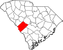 | |
| Towns | ||
| CDPs | ||
| Unincorporated communities | ||
| Footnotes | ‡This populated place also has portions in an adjacent county or counties | |
Municipalities and communities of Edgefield County, South Carolina, United States | ||
|---|---|---|
| City |  | |
| Towns | ||
| CDP | ||
| Footnotes | ‡This populated place also has portions in an adjacent county or counties | |