Ascension Parish, Louisiana
| Ascension Parish, Louisiana | |
|---|---|
 Ascension Parish Courthouse | |
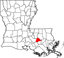 Location in the U.S. state of Louisiana | |
 Louisiana's location in the U.S. | |
| Founded | 1807 |
| Named for | Ascension of Our Lord Church in Donaldsonville |
| Seat | Donaldsonville |
| Largest city | Gonzales |
| Area | |
| • Total | 303 sq mi (785 km2) |
| • Land | 290 sq mi (751 km2) |
| • Water | 13 sq mi (34 km2), 3.75 |
| Population (est.) | |
| • (2013) | 114,393 |
| • Density | 370/sq mi (143/km²) |
| Congressional districts | 2nd, 6th |
| Time zone | Central: UTC-6/-5 |
| Website |
www |
Ascension Parish (French: Paroisse de l'Ascension) is a parish located in the U.S. state of Louisiana. As of the 2010 census, the population was 107,215.[1] Its parish seat is Donaldsonville.[2] The parish was created in 1807.[3]
Ascension Parish is part of the Baton Rouge, LA Metropolitan Statistical Area as well as the Baton Rouge–Pierre Part Combined Statistical Area. It is one of the fastest growing parishes in the state.
During the American Civil War, desertions had been of major concern to the Confederate States Army. Henry Watkins Allen, before he was governor, reported more than eight thousand deserters and draft-dodgers about Bayou Teche. There were some 1,200 deserters in Livingston, St. Tammany, and Ascension parishes.[4]
Planters in Ascension Parish later complained of raids by guerrillas. In 1864, planter W.R. Hodges requested soldiers to protect the planted fields from such attacks. Union soldiers were accused of "wandering about at will, and helping themselves . . . to whatever could be found," explains the historian John D. Winters in his The Civil War in Louisiana (1963).[5]
Law and government
Long a Democratic bastion, since the late 20th century, like much of the rest of the South, Ascension Parish has registered more Republicans and election results have shifted. Since 2000, nearly 14,000 new voters have registered in Ascension Parish, and fewer than 1,000 of those are Democrats.
Democrats still lead in registrants with 28,181; Republicans follow with 16,218. There are also 13,052 "No Party" registrants, as permitted under Louisiana law.
Ascension Parish also had a small number of voters registered as upper case Independents. As of April 2007 there were 31 Libertarian Party members and 33 Reform Party registrants. The total registrants in April 2007 stood at 58,221.[6]
Republican Eddie J. Lambert, an attorney in Gonzales who resides in Prairieville, has represented Ascension Parish in the Louisiana House of Representatives since 2004.[7] He unseated Juba Diez, the representative from 1976 to 2004. He is term-limited in the nonpartisan blanket primary scheduled for October 24, 2015.
Joe Sevario, a Prairieville businessman, served in the state Senate for District 18, including Ascension Parish, from 1976 to 1994.
Geography
According to the U.S. Census Bureau, the parish has a total area of 303 square miles (780 km2), of which 290 square miles (750 km2) is land and 13 square miles (34 km2) (4.2%) is water.[8] It is the fourth-smallest parish in Louisiana by total area.
Waterways
- Alligator Bayou
- Amite River
- Amite River Diversion Canal
- Anderson Canal
- Babin Canal
- Bayou Antoine
- Bayou Manchac
- Bayou Narcisse
- Bayou Pierre
- Bayou Reponds Pas
- Bayou Conway
- Bayou Francois
- Bayou Lafourche
- Bayou Napoleon
- Bayou Verret
- Bayou Vicknair
- Black Bayou
- Blind River
- Boudreau Bayou
- Boyle Bayou
- Braud Bayou
- Cocodrie Bayou
- Cotton Bayou
- Crowley Ditch
- Duckroost Bayou
- Flat Lake
- Grand Goudine Bayou
- Hackett Canal
- Heath Bayou
- Henderson Bayou
- Jim Bayou
- Johnson Bayou
- Lake Millet
- Lake Villars
- Laurel Ridge Canal
- McCall Bayou
- Mississippi River
- Muddy Creek
- New River
- New River Canal
- Old New River
- Panama Canal
- Pipeline Canal
- Rocky Canal
- Roddy Bayou
- Saveiro Canal
- Sides Bayou
- Smith Bayou
- Spanish Lake
- Welsh Gully
Major highways
Adjacent parishes
- East Baton Rouge Parish (north)
- Livingston Parish (northeast)
- St. John the Baptist Parish (east)
- St. James Parish (southeast)
- Assumption Parish (southwest)
- Iberville Parish (west)
Demographics
| Historical population | |||
|---|---|---|---|
| Census | Pop. | %± | |
| 1810 | 2,219 | — | |
| 1820 | 3,728 | 68.0% | |
| 1830 | 5,246 | 40.7% | |
| 1840 | 6,951 | 32.5% | |
| 1850 | 10,752 | 54.7% | |
| 1860 | 11,484 | 6.8% | |
| 1870 | 11,577 | 0.8% | |
| 1880 | 16,895 | 45.9% | |
| 1890 | 19,545 | 15.7% | |
| 1900 | 24,142 | 23.5% | |
| 1910 | 23,887 | −1.1% | |
| 1920 | 22,155 | −7.3% | |
| 1930 | 18,438 | −16.8% | |
| 1940 | 21,215 | 15.1% | |
| 1950 | 22,387 | 5.5% | |
| 1960 | 27,927 | 24.7% | |
| 1970 | 37,086 | 32.8% | |
| 1980 | 50,068 | 35.0% | |
| 1990 | 58,214 | 16.3% | |
| 2000 | 76,627 | 31.6% | |
| 2010 | 107,215 | 39.9% | |
| Est. 2015 | 119,455 | [9] | 11.4% |
| U.S. Decennial Census[10] 1790-1960[11] 1900-1990[12] 1990-2000[13] 2010-2013[1] | |||
As of the 2010 United States Census, there were 107,215 people residing in the parish. 73.3% were White, 22.2% Black or African American, 0.9% Asian, 0.3% Native American, 0.1% Pacific Islander, 1.9% of some other race and 1.2% of two or more races. 4.7% were Hispanic or Latino (of any race). 26.3% were of French, French Canadian or Cajun, 7.9% American, 7.3% German, 5.7% English, 5.5% Italian and 5.5% Irish ancestry.
As of the census[14] of 2000, there were 76,627 people, 26,691 households, and 20,792 families residing in the parish. The population density was 263 people per square mile (101/km²). There were 29,172 housing units at an average density of 100 per square mile (39/km²). The racial makeup of the parish was 77.39% White, 20.28% Black or African American, 0.27% Native American, 0.34% Asian, 0.02% Pacific Islander, 0.99% from other races, and 0.70% from two or more races. 2.46% of the population were Hispanic or Latino of any race. 94.46% of the population spoke only English at home, while 2.76% spoke French or Cajun French, and 2.41% spoke Spanish.[15]
There were 26,691 households out of which 42.50% had children under the age of 18 living with them, 60.10% were married couples living together, 13.30% had a female householder with no husband present, and 22.10% were non-families. 18.30% of all households were made up of individuals and 5.90% had someone living alone who was 65 years of age or older. The average household size was 2.85 and the average family size was 3.25.
In the parish the population was spread out with 30.10% under the age of 18, 9.50% from 18 to 24, 32.60% from 25 to 44, 20.20% from 45 to 64, and 7.70% who were 65 years of age or older. The median age was 32 years. For every 100 females there were 96.90 males. For every 100 females age 18 and over, there were 93.50 males.
The median income for a household in the parish was $44,288, and the median income for a family was $50,626. Males had a median income of $41,109 versus $23,054 for females. The per capita income for the parish was $17,858. About 10.70% of families and 12.90% of the population were below the poverty line, including 16.30% of those under age 18 and 15.40% of those age 65 or over.
Education
Ascension Parish School Board operates the local public schools.
The parish is also home to private schools and — since 1998, to River Parishes Community College.
National Guard
The 922nd Engineer Company (Horizontal), a unit of the 769th Engineer Battalion and the 225th Engineer Brigade. The 1021st Vertical Engineer Company also resides in Gonzales, Louisiana.
Media
Two newspapers are based in Ascension Parish's two cities, Donaldsonville and Gonzales. The Gonzales Weekly Citizen is a bi-weekly newspaper formed after the merger of The Gonzales Weekly (founded 1920) and The Ascension Citizen (founded 1996). The Donaldsonville Chief, founded in 1871, is the parish's longest-continually-published newspaper.
KKAY 1590 AM is headquartered in Donaldsonville on historic Railroad Avenue. It is a local radio station that airs programs from local ministers and churches and about local high school softball and football.
Communities

Cities
- Donaldsonville (parish seat)
- Gonzales
Town
Census-designated places
Unincorporated communities
- Abend
- Acy
- Barmen
- Barton
- Belle Helene
- Bowden
- Brignac
- Brittany
- Brusly McCall
- Bullion
- Burnside
- Cofield
- Cornerview
- Darrow
- Duckroost
- Duplessis
- Dutchtown
- Galvez
- Geismar
- Hillaryville
- Hobart
- Hohen Solms
- Hope Villa
- Lake
- Little Prairie
- McElroy
- Marchand
- Miles
- Modeste
- Mount Houmas
- Oak Grove
- Noel
- Palo Alto
- Philadelphia Point
- Saint Elmo
- Saint Amant
- Smoke Bend
- Southwood
- Weber City
See also
- Acadian Coast
- National Register of Historic Places listings in Ascension Parish, Louisiana
- Johnny Berthelot
- Ralph Falsetta
- Philip Barton Key, Jr.
- Eddie J. Lambert
- Sidney McCrory
- Edward J. Price
- Mert Smiley
References
- 1 2 "State & County QuickFacts". United States Census Bureau. Retrieved August 20, 2013.
- ↑ "Find a County". National Association of Counties. Archived from the original on 2011-05-31. Retrieved 2011-06-07.
- ↑ "Ascension Parish". Center for Cultural and Eco-Tourism. Retrieved September 5, 2014.
- ↑ John D. Winters, The Civil War in Louisiana, Baton Rouge: Louisiana State University Press, 1963, ISBN 0-8071-0834-0, p. 306
- ↑ Winters p. 394
- ↑ John McMillan, Advocate (Baton Rouge), River Parishes Bureau, April 29, 2007, p. 1B.
- ↑ "Eddie Lambert's 2011 Seafood Fundraiser". eddielambert.com. Retrieved July 16, 2011.
- ↑ "2010 Census Gazetteer Files". United States Census Bureau. August 22, 2012. Retrieved August 20, 2014.
- ↑ "County Totals Dataset: Population, Population Change and Estimated Components of Population Change: April 1, 2010 to July 1, 2015". Retrieved July 2, 2016.
- ↑ "U.S. Decennial Census". United States Census Bureau. Archived from the original on May 11, 2015. Retrieved August 20, 2014.
- ↑ "Historical Census Browser". University of Virginia Library. Retrieved August 20, 2014.
- ↑ "Population of Counties by Decennial Census: 1900 to 1990". United States Census Bureau. Retrieved August 20, 2014.
- ↑ "Census 2000 PHC-T-4. Ranking Tables for Counties: 1990 and 2000" (PDF). United States Census Bureau. Retrieved August 20, 2014.
- ↑ "American FactFinder". United States Census Bureau. Archived from the original on 2013-09-11. Retrieved 2008-01-31.
- ↑ "Archived copy". Archived from the original on 2013-08-15. Retrieved 2013-08-23.
Further reading
- McCulloh, R. P., P. V. Heinrich, and J. Snead, 2003, Ponchatoula 30 x 60 minute geologic quadrangle. Louisiana Geological Survey, Baton Rouge, Louisiana.
External links
| Wikimedia Commons has media related to Ascension Parish, Louisiana. |
- Ascension Parish government's website
- Ascension Parish Sheriff's website
- Weekly Citizen newspaper
- Ascension Parish Library
- Explore the History and Culture of Southeastern Louisiana, a National Park Service Discover Our Shared Heritage Travel Itinerary
- Census shows shift
- Radio station website
 |
East Baton Rouge Parish | Livingston Parish | | |
| Iberville Parish | |
St. John the Baptist Parish | ||
| ||||
| | ||||
| Assumption Parish | St. James Parish |
Municipalities and communities of Ascension Parish, Louisiana, United States | ||
|---|---|---|
| Cities | | |
| Town | ||
| CDPs | ||
| Other unincorporated communities |
| |
| Footnotes | ‡This populated place also has portions in an adjacent parish or parishes | |
Coordinates: 30°12′N 90°55′W / 30.20°N 90.91°W