Iberville Parish, Louisiana
| Iberville Parish, Louisiana | |
|---|---|
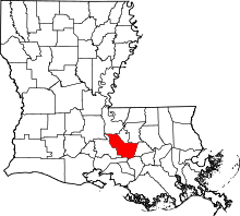 Location in the U.S. state of Louisiana | |
 Louisiana's location in the U.S. | |
| Founded | 1807 |
| Named for | Pierre Le Moyne d'Iberville |
| Seat | Plaquemine |
| Largest city | Plaquemine |
| Area | |
| • Total | 653 sq mi (1,691 km2) |
| • Land | 619 sq mi (1,603 km2) |
| • Water | 34 sq mi (88 km2), 5.2% |
| Population | |
| • (2010) | 33,387 |
| • Density | 54/sq mi (21/km²) |
| Congressional districts | 2nd, 6th |
| Time zone | Central: UTC-6/-5 |
| Website |
www |
Iberville Parish (French: Paroisse d'Iberville) is a parish located south of Baton Rouge in the U.S. state of Louisiana. As of the 2010 census, the population was 33,387.[1] Its seat is Plaquemine.[2] The parish was formed in 1807.[3]
Iberville Parish is part of the Baton Rouge, LA Metropolitan Statistical Area.
History
The parish is named for Pierre Le Moyne d'Iberville, who founded the French colony of Louisiana.[4]
A few archeological efforts have been made in the Parish, mainly to excavate the Native American burial mounds that have been identified there. The first expedition, led by Clarence B. Moore, was an attempt at collecting data from a couple of the sites, and it set the groundwork for later projects. Clarence was mainly interested in the skeletal remains of the previous inhabitants, rather than excavating for archeological items. Archeologists are especially interested in these sites because of their uniformity and size. Some of the mounds are seven hundred feet long, a hundred feet wide and six feet tall. Most of them contain human remains.[5]
Iberville Parish is represented in the Louisiana State Senate by a Republican, attorney Rick Ward, III, a former member of the Louisiana House of Representatives, who has served in the Senate since 2012. The parish is currently represented in the state House by Democrat Major Thibaut of Oscar in Pointe Coupee Parish.
Geography
According to the U.S. Census Bureau, the parish has a total area of 653 square miles (1,690 km2), of which 619 square miles (1,600 km2) is land and 34 square miles (88 km2) (5.2%) is water.[6]
Major highways
 Interstate Highway 10
 Louisiana Highway 1
 Louisiana Highway 30
 Louisiana Highway 69
 Louisiana Highway 75
 Louisiana Highway 76
 Louisiana Highway 77
Adjacent parishes
- Pointe Coupee Parish (northwest)
- West Baton Rouge Parish (north)
- East Baton Rouge Parish (northeast)
- Ascension Parish (east)
- Assumption Parish (southeast)
- Iberia Parish (south)
- St. Martin Parish (west)
National protected area
Demographics
| Historical population | |||
|---|---|---|---|
| Census | Pop. | %± | |
| 1820 | 4,414 | — | |
| 1830 | 7,049 | 59.7% | |
| 1840 | 8,495 | 20.5% | |
| 1850 | 12,278 | 44.5% | |
| 1860 | 14,661 | 19.4% | |
| 1870 | 12,347 | −15.8% | |
| 1880 | 17,544 | 42.1% | |
| 1890 | 21,848 | 24.5% | |
| 1900 | 27,006 | 23.6% | |
| 1910 | 30,954 | 14.6% | |
| 1920 | 26,806 | −13.4% | |
| 1930 | 24,638 | −8.1% | |
| 1940 | 27,721 | 12.5% | |
| 1950 | 26,750 | −3.5% | |
| 1960 | 29,939 | 11.9% | |
| 1970 | 30,746 | 2.7% | |
| 1980 | 32,159 | 4.6% | |
| 1990 | 31,049 | −3.5% | |
| 2000 | 33,320 | 7.3% | |
| 2010 | 33,387 | 0.2% | |
| Est. 2015 | 33,095 | [7] | −0.9% |
| U.S. Decennial Census[8] 1790-1960[9] 1900-1990[10] 1990-2000[11] 2010-2013[1] | |||
As of the 2010 United States Census, there were 33,387 people residing in the parish. 49.3% were Black or African American, 48.8% White, 0.3% Asian, 0.2% Native American, 0.6% of some other race and 0.8% of two or more races. 2.0% were Hispanic or Latino (of any race).
As of the census[12] of 2000, there were 33,320 people, 10,674 households, and 8,016 families residing in the parish. The population density was 54 people per square mile (21/km²). There were 11,953 housing units at an average density of 19 per square mile (7/km²). The racial makeup of the parish was 49.26% White, 49.70% Black or African American, 0.18% Native American, 0.26% Asian, 0.01% Pacific Islander, 0.14% from other races, and 0.45% from two or more races. 1.03% of the population were Hispanic or Latino of any race.
There were 10,674 households, 36.20% of which contained children under age 18, 49.60% of which were married couples living together, 20.40% of which had a female householder with no husband present, and 24.90% were non-families. 21.90% of the households were made up of individuals and 8.50% had someone living alone who was 65 years of age or older. The average household size was 2.81 and the average family size was 3.29.
26.20% of the population was under age 18; 10.50% was 18–20 years of age; 31.10% was 25–34 years of age; 21.50% was 45–64 years of age; and 10.70% was age 65 or older. The median age was 34 years. For every 100 females there were 99.80 males. For every 100 females age 18 and over, there were 98.50 males.
The median income for a household in the parish was $29,039, and the median income for a family was $34,100. Males had a median income of $32,074 versus $20,007 for females. The per capita income for the parish was $13,272. About 19% of families and 23% of the population were below the poverty line, including 30% of those under age 18 and 18% of those age 65 or over.
Government and infrastructure
The Louisiana Department of Public Safety and Corrections operates two prisons, Elayn Hunt Correctional Center and Louisiana Correctional Institute for Women (LCIW), in St. Gabriel in Iberville Parish.[13][14] LCIW houses the female death row.[15][16]
Education
Primary and secondary schools
Iberville Parish School Board operates the public schools within Iberville Parish.
Public libraries
Iberville Parish Library operates libraries in the parish. The Parish Headquarters Library is located in Plaquemine. Branches include Bayou Pigeon (Unincorporated area), Bayou Sorrel (Unincorporated area), East Iberville (St. Gabriel), Grosse Tete (Grosse Tete), Maringouin (Maringouin), Rosedale (Rosedale), White Castle (White Castle).[17]
National Guard
The Gillis W. Long Center, located on the outskirts of Carville, LA, is operated by the Louisiana Army National Guard. This post is home to the 415TH MI (Military Intelligence) Battalion, the 241ST MPAD, and the 61st Troop Command. The 415TH MI is a subunit of the 139TH RSG (regional support group).
Communities

Cities
- Plaquemine (parish seat)
- St. Gabriel
Towns
Villages
Unincorporated communities
- Alhambra
- Bayou Pigeon
- Bayou Sorrell
- Crescent
- Seymourville
See also
- National Register of Historic Places listings in Iberville Parish, Louisiana
- Moon Griffon, radio talk show host born in Iberville Parish in 1961
- Jessel Ourso, sheriff of Iberville Parish from 1964-1978; suspended, 1968-1972
- Edward J. Price, state representative for District 58, which includes Iberville Parish
- Karen St. Germain, state representative for District 60, which includes Iberville and Assumption parishes
References
- 1 2 "State & County QuickFacts". United States Census Bureau. Retrieved August 9, 2013.
- ↑ "Find a County". National Association of Counties. Retrieved 2011-06-07.
- ↑ "Iberville Parish". Center for Cultural and Eco-Tourism. Retrieved September 6, 2014.
- ↑ Gannett, Henry (1905). The Origin of Certain Place Names in the United States. Govt. Print. Off. p. 164.
- ↑ Ford, James A: "Measuring the Flow of Time", page 415. The University of Alabama Press, 1999
- ↑ "2010 Census Gazetteer Files". United States Census Bureau. August 22, 2012. Retrieved August 20, 2014.
- ↑ "County Totals Dataset: Population, Population Change and Estimated Components of Population Change: April 1, 2010 to July 1, 2015". Retrieved July 2, 2016.
- ↑ "U.S. Decennial Census". United States Census Bureau. Retrieved August 20, 2014.
- ↑ "Historical Census Browser". University of Virginia Library. Retrieved August 20, 2014.
- ↑ "Population of Counties by Decennial Census: 1900 to 1990". United States Census Bureau. Retrieved August 20, 2014.
- ↑ "Census 2000 PHC-T-4. Ranking Tables for Counties: 1990 and 2000" (PDF). United States Census Bureau. Retrieved August 20, 2014.
- ↑ "American FactFinder". United States Census Bureau. Retrieved 2008-01-31.
- ↑ "Elayn Hunt Correctional Center." (Profile) Louisiana Department of Public Safety and Corrections. Retrieved 20 July 2010
- ↑ "Directions to EHCC." Elayn Hunt Correctional Center. Retrieved on July 20, 2010.
- ↑ "Louisiana Correctional Institute for Women." Louisiana Department of Public Safety & Corrections. 14/40. Retrieved 24 August 2010
- ↑ "Classification–Where Inmates Serve Their Time." Inside the System: How Inmates Live and Work. Louisiana Department of Public Safety & Corrections. 14/40. Retrieved 30 June 2010
- ↑ "to the Library Catalog." Iberville Parish Library. Retrieved 29 January 2011
External links
- Ibervillle Parish government's website
- Iberville Parish Tourist Commission website
- Explore the History and Culture of Southeastern Louisiana, a National Park Service Discover Our Shared Heritage Travel Itinerary
- Iberville Parish Sheriff's Office
Geology
- Heinrich, P. V., and W. J. Autin, 2000, Baton Rouge 30 x 60 minute geologic quadrangle. Louisiana Geological Survey, Baton Rouge, Louisiana
 |
Pointe Coupee Parish | West Baton Rouge Parish | East Baton Rouge Parish | |
| St. Martin Parish | |
Ascension Parish | ||
| ||||
| | ||||
| Iberia Parish | Assumption Parish |
Municipalities and communities of Iberville Parish, Louisiana, United States | ||
|---|---|---|
| Cities | | |
| Towns | ||
| Villages | ||
| CDPs |
| |
| Other unincorporated communities |
| |
| Ghost towns | ||
Coordinates: 30°16′N 91°21′W / 30.26°N 91.35°W