Assumption Parish, Louisiana
| Assumption Parish, Louisiana | |
|---|---|
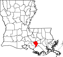 Location in the U.S. state of Louisiana | |
 Louisiana's location in the U.S. | |
| Founded | 1807 |
| Named for | Assumption Roman Catholic Church |
| Seat | Napoleonville |
| Largest community | Pierre Part |
| Area | |
| • Total | 365 sq mi (945 km2) |
| • Land | 339 sq mi (878 km2) |
| • Water | 26 sq mi (67 km2), 7.1% |
| Population | |
| • (2010) | 23,421 |
| • Density | 69/sq mi (27/km²) |
| Congressional districts | 2nd, 6th |
| Time zone | Central: UTC-6/-5 |
Assumption Parish (French: Paroisse de l'Assomption) is a parish located in the U.S. state of Louisiana. As of the 2010 census, the population was 23,421.[1] Its parish seat is Napoleonville.[2] Assumption Parish was established in 1807, as one of the original parishes of the Territory of Orleans.[3]
Assumption Parish is one of the twenty-two Acadiana parishes. Its major product is sugar cane. In proportion to its area, Assumption Parish produces the most sugar of any parish of Louisiana.
Assumption Parish is represented in the Louisiana House of Representatives by Beryl Amedee (Republican) and the Democrat Chad Brown.
History
In 1807, Assumption became the eighth parish of the Orleans Territory. Its history is rooted in its waterways and its large expanse of fertile soils ideal for farming. Settled in the middle 18th century by French and Spanish settlers, the area retains strong cultural ties to its past with conversational French still common among residents. Assumption was also a final destination for many of the French Acadians exiled from Nova Scotia between 1755 and 1764.
After the Confederacy forced the surrender of Fort Sumter, South Carolina, in 1861, the Assumption Parish Police Jury appropriated $1,000 to provide uniforms for military volunteers against the Union. By contrast, Lafayette Parish contributed $6,000. Plaquemines Parish approved a gift of $10 to $15 per month for needy volunteer families.[4]
In 1936, Assumption Parish broke heavily from state and national political trends to support Governor Alfred Landon of Kansas, the Republican nominee for U.S. President in the race against Franklin D. Roosevelt. Though Landon received only 11.1 percent of the vote in Louisiana, he took 60.6 percent in Assumption and 41.5 percent in another sugar-growing parish, Lafourche.[5]
Geography
According to the U.S. Census Bureau, the parish has a total area of 365 square miles (950 km2), of which 339 square miles (880 km2) is land and 26 square miles (67 km2) (7.1%) is water.[6]
Major highways
Adjacent parishes
- Iberville Parish (north)
- Ascension Parish (north)
- St. James Parish (northeast)
- Lafourche Parish (east)
- Terrebonne Parish (southeast)
- St. Mary Parish (southwest)
- Iberia Parish (northwest)
- St. Martin Parish (west)
Demographics
| Historical population | |||
|---|---|---|---|
| Census | Pop. | %± | |
| 1810 | 2,472 | — | |
| 1820 | 3,576 | 44.7% | |
| 1830 | 5,669 | 58.5% | |
| 1840 | 7,141 | 26.0% | |
| 1850 | 10,538 | 47.6% | |
| 1860 | 15,379 | 45.9% | |
| 1870 | 13,234 | −13.9% | |
| 1880 | 17,010 | 28.5% | |
| 1890 | 19,629 | 15.4% | |
| 1900 | 21,620 | 10.1% | |
| 1910 | 24,128 | 11.6% | |
| 1920 | 17,912 | −25.8% | |
| 1930 | 15,990 | −10.7% | |
| 1940 | 18,541 | 16.0% | |
| 1950 | 17,278 | −6.8% | |
| 1960 | 17,991 | 4.1% | |
| 1970 | 19,654 | 9.2% | |
| 1980 | 22,084 | 12.4% | |
| 1990 | 22,753 | 3.0% | |
| 2000 | 23,388 | 2.8% | |
| 2010 | 23,421 | 0.1% | |
| Est. 2015 | 22,842 | [7] | −2.5% |
| U.S. Decennial Census[8] 1790-1960[9] 1900-1990[10] 1990-2000[11] 2010-2013[1] | |||
As of the 2010 United States census, there were 23,421 people residing in the parish. 66.8% were White, 30.5% Black or African American, 0.6% Native American, 0.2% Asian, 0.1% Pacific Islander, 1.0% of some other race and 0.9% of two or more races. 2.1% were Hispanic or Latino (of any race). 38.2% were of French, French Canadian or Cajun and 9.4% American ancestry.[12]
As of the census[13] of 2000, there were 23,388 people, 8,239 households, and 6,311 families residing in the parish. The population density was 69 people per square mile (27/km²). There were 9,635 housing units at an average density of 28 per square mile (11/km²). The racial makeup of the parish was 67.17% White, 31.52% Black or African American, 0.31% Native American, 0.24% Asian, 0.01% Pacific Islander, 0.17% from other races, and 0.59% from two or more races. 1.21% of the population were Hispanic or Latino of any race. 81.14% of the population over the age of five spoke only English at home, while 17.58% reported speaking French or Cajun French .
There were 8,239 households out of which 37.90% had children under the age of 18 living with them, 56.80% were married couples living together, 14.90% had a female householder with no husband present, and 23.40% were non-families. 20.30% of all households were made up of individuals and 9.20% had someone living alone who was 65 years of age or older. The average household size was 2.81 and the average family size was 3.26.
In the parish the age distribution of the population shows 28.50% under the age of 18, 9.80% from 18 to 24, 28.70% from 25 to 44, 22.20% from 45 to 64, and 10.90% who were 65 years of age or older. The median age was 34 years. For every 100 females there were 93.90 males. For every 100 females age 18 and over, there were 90.90 males.
The median income for a household in the parish was $31,168, and the median income for a family was $36,052. Males had a median income of $35,941 versus $18,065 for females. The per capita income for the parish was $14,008. About 19.50% of families and 21.80% of the population were below the poverty line, including 28.40% of those under age 18 and 21.70% of those age 65 or over.
Education
The Assumption Parish School Board operates local public schools. Assumption High School serves the whole parish.
National Guard
The 928th Sapper Company, a unit of the 769th Engineer Battalion and the 225th Engineer Brigade.
Communities

Village
Napoleonville is the largest incorporated community in the parish.
Census-designated places
Unincorporated communities
See also
- Bayou Corne sinkhole
- National Register of Historic Places listings in Assumption Parish, Louisiana
- Isleños in Louisiana#Valenzuela
- Samuel A. LeBlanc, I
- J. E. Jumonville, Sr.
- Karen St. Germain
References
- 1 2 "State & County QuickFacts". United States Census Bureau. Retrieved August 20, 2013.
- ↑ "Find a County". National Association of Counties. Archived from the original on May 31, 2011. Retrieved 2011-06-07.
- ↑ "Assumption Parish". Center for Cultural and Eco-Tourism. Retrieved September 5, 2014.
- ↑ John D. Winters, The Civil War in Louisiana, Baton Rouge: Louisiana State University Press, 1963, ISBN 0-8071-0834-0, p. 38
- ↑ Billy Hathorn, The Republican Party in Louisiana, 1920-1980, (Natchitoches: Northwestern State University, 1980), p. 30
- ↑ "2010 Census Gazetteer Files". United States Census Bureau. August 22, 2012. Retrieved August 20, 2014.
- ↑ "County Totals Dataset: Population, Population Change and Estimated Components of Population Change: April 1, 2010 to July 1, 2015". Retrieved July 2, 2016.
- ↑ "U.S. Decennial Census". United States Census Bureau. Archived from the original on May 11, 2015. Retrieved August 20, 2014.
- ↑ "Historical Census Browser". University of Virginia Library. Retrieved August 20, 2014.
- ↑ "Population of Counties by Decennial Census: 1900 to 1990". United States Census Bureau. Retrieved August 20, 2014.
- ↑ "Census 2000 PHC-T-4. Ranking Tables for Counties: 1990 and 2000" (PDF). United States Census Bureau. Retrieved August 20, 2014.
- ↑ "American FactFinder"
- ↑ "American FactFinder". United States Census Bureau. Archived from the original on September 11, 2013. Retrieved 2008-01-31.
External links
- Assumption Parish Website
- Assumption Parish Area Chamber of Commerce
- Explore the History and Culture of Southeastern Louisiana, a National Park Service Discover Our Shared Heritage Travel Itinerary
- Assumption Parish Sheriff's Office
Geology
- Heinrich, P. V., and W. J. Autin, 2000, Baton Rouge 30 x 60 minute geologic quadrangle. Louisiana Geological Survey, Baton Rouge, Louisiana.
 |
Iberia Parish | Iberville Parish and Ascension Parish | St. James Parish | |
| St. Martin Parish | |
Lafourche Parish | ||
| ||||
| | ||||
| St. Mary Parish | Terrebonne Parish |
Municipalities and communities of Assumption Parish, Louisiana, United States | ||
|---|---|---|
| Village | | |
| CDPs | ||
| Other unincorporated communities |
| |
Coordinates: 29°54′N 91°04′W / 29.90°N 91.06°W