Caldwell Parish, Louisiana
| Caldwell Parish, Louisiana | |
|---|---|
|
Trees shield the Caldwell Parish Courthouse in Columbia, constructed in 1937 and renovated in 1971. | |
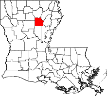 Location in the U.S. state of Louisiana | |
 Louisiana's location in the U.S. | |
| Founded | 1838 |
| Named for | Local Caldwell family |
| Seat | Columbia |
| Largest village | Clarks |
| Area | |
| • Total | 541 sq mi (1,401 km2) |
| • Land | 529 sq mi (1,370 km2) |
| • Water | 11 sq mi (28 km2), 2.1% |
| Population | |
| • (2010) | 10,132 |
| • Density | 19/sq mi (7/km²) |
| Congressional district | 5th |
| Time zone | Central: UTC-6/-5 |


Caldwell Parish (French: Paroisse de Caldwell) is a parish located in the U.S. state of Louisiana. As of the 2010 census, the population was 10,132,[1] making it the fifth-least populous parish in Louisiana. The parish seat is Columbia.[2] Most residents live in the country even beyond the three rural communities in the parish.
History
Originally a part of Catahoula and Ouachita parishes, Caldwell Parish was established within its present boundaries on March 6, 1838, with earlier settlements recorded to have been made soon after the Louisiana Purchase in 1803. Columbia, the parish seat, was founded in 1827, at a natural crossing on the Ouachita River—a river with a national reputation for its natural beauty. The Ouachita divides the parish into delta farmland and wetlands on the east, and piney woods hill country on the west. In the 1800s, Columbia became a steamboat town for the transport of timber staves and cotton. Forestry and agriculture are still the prominent industries in the parish.
Geography
According to the U.S. Census Bureau, the parish has a total area of 541 square miles (1,400 km2), of which 529 square miles (1,370 km2) is land and 11 square miles (28 km2) (2.1%) is water.[3]
Major highways
Adjacent parishes
- Ouachita Parish (north)
- Richland Parish (northeast)
- Franklin Parish (east)
- Catahoula Parish (southeast)
- La Salle Parish (south)
- Winn Parish (southwest)
- Jackson Parish (northwest)
Demographics
| Historical population | |||
|---|---|---|---|
| Census | Pop. | %± | |
| 1840 | 2,017 | — | |
| 1850 | 2,815 | 39.6% | |
| 1860 | 4,833 | 71.7% | |
| 1870 | 4,820 | −0.3% | |
| 1880 | 5,767 | 19.6% | |
| 1890 | 5,814 | 0.8% | |
| 1900 | 6,917 | 19.0% | |
| 1910 | 8,593 | 24.2% | |
| 1920 | 9,514 | 10.7% | |
| 1930 | 10,430 | 9.6% | |
| 1940 | 12,046 | 15.5% | |
| 1950 | 10,293 | −14.6% | |
| 1960 | 9,004 | −12.5% | |
| 1970 | 9,354 | 3.9% | |
| 1980 | 10,761 | 15.0% | |
| 1990 | 9,810 | −8.8% | |
| 2000 | 10,560 | 7.6% | |
| 2010 | 10,132 | −4.1% | |
| Est. 2015 | 9,993 | [4] | −1.4% |
| U.S. Decennial Census[5] 1790-1960[6] 1900-1990[7] 1990-2000[8] 2010-2013[1] | |||
As of the census[9] of 2000, there were 10,560 people, 3,941 households, and 2,817 families residing in the parish. The population density was 20 people per square mile (8/km²). There were 5,035 housing units at an average density of 10 per square mile (4/km²). The racial makeup of the parish was 80.43% White, 17.90% Black or African American, 0.45% Native American, 0.14% Asian, 0.47% from other races, and 0.61% from two or more races. 1.49% of the population were Hispanic or Latino of any race.
There were 3,941 households out of which 32.10% had children under the age of 18 living with them, 55.40% were married couples living together, 12.60% had a female householder with no husband present, and 28.50% were non-families. 25.40% of all households were made up of individuals and 11.70% had someone living alone who was 65 years of age or older. The average household size was 2.50 and the average family size was 2.99.
In the parish the population was spread out with 24.70% under the age of 18, 9.60% from 18 to 24, 28.50% from 25 to 44, 23.30% from 45 to 64, and 13.90% who were 65 years of age or older. The median age was 37 years. For every 100 females there were 103.00 males. For every 100 females age 18 and over, there were 100.20 males.
The median income for a household in the parish was $26,972, and the median income for a family was $33,653. Males had a median income of $29,677 versus $19,475 for females. The per capita income for the parish was $13,884. About 17.70% of families and 21.20% of the population were below the poverty line, including 27.10% of those under age 18 and 19.50% of those age 65 or over.
Culture
Having a very diverse geographical and plant environment, Caldwell Parish is home to a one-thousand acre preserve, located near Copenhagen. Run by the Nature Conservancy, it attracts botanical and archeological enthusiasts from a wide area. The University of Louisiana at Monroe owns a one-hundred acre outdoor classroom, located near Hough Bend, that is used primarily for tree identification. The U.S. Army Corps of Engineers owns an outdoor preserve located on Lock and Dam Road. Together with its rivers, lakes and bayous, and the 65,000 acre Boeuf Wildlife Preserve, Caldwell is a huge attraction for hunters and anglers.
Caldwell Parish has been home to The Louisiana Art and Folk Festival since 1956. Held during the second weekend of October on Main Street in Columbia, this festival celebrates the history and culture of Caldwell Parish, with hundreds of pieces of arts and craft, entertainment, and good food. The Louisiana Artists Museum, also on Main Street in the historic Schepis Building, features rotating exhibits and is listed in the National Register of Historic Places. The Martin Homeplace Museum showcases artifacts and memorabilia from Caldwell Parish's rich cultural history in a farmhouse built in 1878 on an 1816 Spanish land grant. It too is on the National Register of Historic Places. The annual Lions Club Championship Rodeo is a three-day event every June, recognized as the longest continuous running rodeo in the state, where more than 15,000 hot dogs are consumed each year.
The Morengo Swamp Mudride, the world's largest four-wheeler mud ride in the world, is held the first weekend in June. Thousands of riders from across the nation converge on Hebert in the northeast part of the parish for this spectacular event. Proceeds from the ride go to the "Wish I Could" Foundation.
Education
The Caldwell Parish School Board serves the parish. There are three elementary schools Columbia Elementary, Central Elementary, and Grayson Elementary in the parish, one Jr high, Caldwell Parish Jr High, and one high school, Caldwell Parish High School, located between Columbia and Grayson.
National Guard
1023RD Engineer Company (Vertical) of the 225TH Engineer Brigade resides in Clarks, Louisiana.
Communities

Town
- Columbia (parish seat)
Villages
Census-designated place
Unincorporated communities
- Copenhagen
- Corey
- Hebert
- Kelly
- Ward 5
Notable residents
- Buddy Caldwell, Louisiana State Attorney General, elected in 2007
- Benny Gay Christian, state representative from 1964 to 1974, represented Caldwell Parish during part of his tenure.
- Graves B. Erskine, U.S. Marine Corps general; combat officer in World War I, having received the Silver Star and Purple Heart; U.S. Commander of the 3rd Marine Division in World War II in the Battle of Iwo Jima, having earned the Navy Distinguished Service Medal
- J.D. DeBlieux, Louisiana State Senator representing East Baton Rouge Parish, 1956-1960 & 1964-1976
- Hubert D. Humphreys, Louisiana historian and native of Grayson
- Jack Keahey, former president of the Caldwell Parish School Board and the Louisiana School Boards Association; national president of Aerial Applicators Association, and former president of the Tensas Basin Levee Board
- Pam Kelly, recipient of the Wade Trophy, the most valuable women's collegiate basketball player in the nation
- John J. McKeithen, governor of Louisiana (1964–1972); Louisiana Public Service Commissioner (1955–1964); state representative (1948–1952); U.S. Army combat officer (1942–1945) having received two Bronze Stars in the battles of Okinawa and Iwo Jima
- W. Fox McKeithen, Louisiana House of Representatives (1984–1988); five-term Louisiana Secretary of State (1988–2005)
- Neil Riser, Louisiana State Senator elected in 2007 from the 32nd District, which includes Caldwell Parish, the first Republican from this district since Reconstruction
- Chet D. Traylor, Louisiana Supreme Court, 1997–2009
Gallery
-
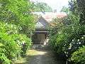
Martin Homeplace Museum outside Columbia
-
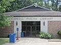
The Caldwell Parish Library is located behind the courthouse in Columbia
-

Caldwell Parish High School
-

Caldwell Memorial Hospital in Columbia
-

Long Lake in Caldwell Parish; a landowner builds a pier with slide and diving board.
See also
References
- 1 2 "Caldwell Parish, Louisiana". quickfacts.census.gov. Retrieved November 21, 2012.
- ↑ "Find a County". National Association of Counties. Archived from the original on 2011-05-31. Retrieved 2011-06-07.
- ↑ "2010 Census Gazetteer Files". United States Census Bureau. August 22, 2012. Retrieved August 27, 2014.
- ↑ "County Totals Dataset: Population, Population Change and Estimated Components of Population Change: April 1, 2010 to July 1, 2015". Retrieved July 2, 2016.
- ↑ "U.S. Decennial Census". United States Census Bureau. Archived from the original on May 11, 2015. Retrieved August 27, 2014.
- ↑ "Historical Census Browser". University of Virginia Library. Retrieved August 27, 2014.
- ↑ "Population of Counties by Decennial Census: 1900 to 1990". United States Census Bureau. Retrieved August 27, 2014.
- ↑ "Census 2000 PHC-T-4. Ranking Tables for Counties: 1990 and 2000" (PDF). United States Census Bureau. Retrieved August 27, 2014.
- ↑ "American FactFinder". United States Census Bureau. Archived from the original on 2013-09-11. Retrieved 2008-01-31.
 |
Jackson Parish | Ouachita Parish | Richland Parish | |
| |
Franklin Parish | |||
| ||||
| | ||||
| Winn Parish | La Salle Parish | Catahoula Parish |
Municipalities and communities of Caldwell Parish, Louisiana, United States | ||
|---|---|---|
| Town | | |
| Villages | ||
| CDP | ||
| Other unincorporated communities | ||
Coordinates: 32°05′N 92°07′W / 32.09°N 92.12°W