Albion, Queensland
| Albion Brisbane, Queensland | |||||||||||||
|---|---|---|---|---|---|---|---|---|---|---|---|---|---|
 Panorama from Albion towards Bowen Hills, c. 1915 | |||||||||||||
| Population | 1,986 (2011 census)[1] | ||||||||||||
| • Density | 1,320/km2 (3,430/sq mi) | ||||||||||||
| Postcode(s) | 4010 | ||||||||||||
| Area | 1.5 km2 (0.6 sq mi) | ||||||||||||
| Location | 6 km (4 mi) NNE of Brisbane central business district | ||||||||||||
| LGA(s) |
City of Brisbane (Hamilton Ward) | ||||||||||||
| State electorate(s) | Clayfield | ||||||||||||
| Federal Division(s) | Brisbane | ||||||||||||
| |||||||||||||
Albion is an inner north-eastern suburb of the City of Brisbane, the state capital of Queensland, Australia.[2]
Geography
Albion is bounded by Wooloowin in the north, Ascot in the east, Newstead in the south, and Windsor to the west, with Breakfast Creek defining the suburb border in its south and south-west. Sandgate Road, a major road on the north side of Brisbane, runs through the middle of the suburb. A variety of housing styles, from former workers' cottages through to modern brick homes and unit blocks, can be found in Albion.
The Albion Park Paceway, first established in the 1880s, is a harness racing club and greyhound racing track found in Breakfast Creek, a locality in southern Albion.
History

The name Albion comes from the Albion Hotel built by Thomas Hayseldon (also written as Hazeldon), which was so called because the white wall of John Petrie's quarry reminded Hayseldon of the England's white cliffs (Albion being an old name for Great Britain, from the Latin albus meaning white). From 1866 to 1870, the proprietor was Edward Hudson.[2]
Heritage listings


Albion has a number of heritage-listed sites, including:
- Abbotsford Road: Abbotsford Road Bridge[3]
- 21 Birkbeck Street: Dunaverty[4]
- 12 Gore Street: former MUIOOF Lodge Hall[5]
- 58 Grove Street: Early Cottage[6]
- 32 Higgs Street: Holy Triad Temple[7]
- 60 Hudson Street: former Albion Flour Mill[8]
- 2 Kingsford Smith Drive: Breakfast Creek Hotel[9]
- 17 Lever Street: Herberton Cottage[10]
- 16 McLennan Street: Fire of Hope Baptist Church Manse & Hall[11]
- 27 McLennan Street: residence 'Emerald' (now 'Fakenham') [12]
- 40 McLennan Street: residence 'Argyle'[13]
- Sandgate Road: Remnants of the 2nd Breakfast Creek Bridge (North)[14]
- 282 Sandgate Road: Shops[15]
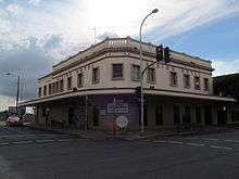
- 297 Sandgate Road: Albion Building[16]
- 299 Sandgate Road: Wyllie's Buildings (Shops)[17]
- 300 Sandgate Road: Albion Hotel[18] (the second hotel on the site, not the one that gave the name to the suburb)
- 327 Sandgate Road: former Commonwealth Bank[19]
- 334 Sandgate Road: Albion Exchange[20]
- 336 Sandgate Road: Shops[21]
- 344 Sandgate Road: former Albion Public Hall[22]
- 349 Sandgate Road: former Albion Post Office[23]
- 366 Sandgate Road: Corner Shop and original baker's oven[24]
- 414 Sandgate Road: Shop and residence[25]
- 469 Sandgate Road: St Columban's Christian Brothers College, Whytecliffe, Highlands (former)[26]
- 475 Sandgate Road: Shops[27]
- 10 Stoneleigh Street: Residence 'Whetfield'[28]
- 24 Stoneleigh Street: 19th century cottage[29]
- 63 & 65 Stoneleigh Street: Duplex 'Caders'[30]
Demographics
In the 2011 census, Albion recorded a population of 1,986 people, 48.4% female and 51.6% male.
The median age of the Albion population was 33 years, 4 years below the national median of 37.
67.7% of people living in Albion were born in Australia, compared to the national average of 69.8%; the next most common countries of birth were New Zealand 4.4%, England 3.1%, India 3%, Italy 1.2%, China 1.1%.
79% of people spoke only English at home; the next most popular languages were 2.1% Italian, 1.2% Mandarin, 1.1% Nepali, 1% Arabic, 0.8% Punjabi.
Of the total population in Albion, 1.2% were Indigenous persons.[31]
In wealth terms, the median weekly individual income in Albion is approximately A$200 higher than the Australian average, and a median weekly family income A$220 higher. The suburb has a significantly higher proportion of residents that have never married (49.0%) compared to the Australian average (33.2%) and, in turn, a lower proportion of married persons (29.6% vs 49.6%).[31]
Transport
On the Queensland Rail City network, Albion is serviced by Albion railway station on the Airport, Doomben, Caboolture, Shorncliffe and Sunshine Coast lines.
Historically, Albion lay on the Clayfield tram line, along Sandgate Road. It was operated by the Brisbane City Council until 13 April 1969.
References
- ↑ Australian Bureau of Statistics (31 October 2012). "Albion, Qld (State Suburb)". 2011 Census QuickStats. Retrieved 24 October 2013.
- 1 2 "Albion (entry 43601)". Queensland Place Names. Queensland Government. Retrieved 21 February 2014.
- ↑ "Abbotsford Road Bridge". Brisbane Heritage Register. Brisbane City Council. Retrieved 16 February 2014.
- ↑ "Dunaverty (entry 600045)". Queensland Heritage Register. Queensland Heritage Council. Retrieved 6 July 2013.
- ↑ "MUIOOF Lodge Hall (former)". Brisbane Heritage Register. Brisbane City Council. Retrieved 16 February 2014.
- ↑ "Early Cottage". Brisbane Heritage Register. Brisbane City Council. Retrieved 16 February 2014.
- ↑ "The Holy Triad Temple (entry 600056)". Queensland Heritage Register. Queensland Heritage Council. Retrieved 6 July 2013.
- ↑ "Albion Flour Mill (former)". Brisbane Heritage Register. Brisbane City Council. Retrieved 16 February 2014.
- ↑ "Breakfast Creek Hotel (entry 600057)". Queensland Heritage Register. Queensland Heritage Council. Retrieved 6 July 2013.
- ↑ "Herberton Cottage". Brisbane Heritage Register. Brisbane City Council. Retrieved 16 February 2014.
- ↑ "Fire of Hope Baptist Church Manse & Hall". Brisbane Heritage Register. Brisbane City Council. Retrieved 16 February 2014.
- ↑ "Residence 'Emerald' (former)". Brisbane Heritage Register. Brisbane City Council. Retrieved 16 February 2014.
- ↑ "Residence 'Argyle'". Brisbane Heritage Register. Brisbane City Council. Retrieved 16 February 2014.
- ↑ "Remnants of the 2nd Breakfast Creek Bridge (North)". Brisbane Heritage Register. Brisbane City Council. Retrieved 16 February 2014.
- ↑ "Shops". Brisbane Heritage Register. Brisbane City Council. Retrieved 16 February 2014.
- ↑ "Albion Building". Brisbane Heritage Register. Brisbane City Council. Retrieved 16 February 2014.
- ↑ "Wyllie's Buildings (Shops)". Brisbane Heritage Register. Brisbane City Council. Retrieved 16 February 2014.
- ↑ "Albion Hotel". Brisbane Heritage Register. Brisbane City Council. Retrieved 16 February 2014.
- ↑ "Commonwealth Bank (former)". Brisbane Heritage Register. Brisbane City Council. Retrieved 16 February 2014.
- ↑ "Albion Exchange". Brisbane Heritage Register. Brisbane City Council. Retrieved 16 February 2014.
- ↑ "Shops". Brisbane Heritage Register. Brisbane City Council. Retrieved 16 February 2014.
- ↑ "Albion Public Hall (former)". Brisbane Heritage Register. Brisbane City Council. Retrieved 16 February 2014.
- ↑ "Albion Post Office (former)". Brisbane Heritage Register. Brisbane City Council. Retrieved 16 February 2014.
- ↑ "Corner Shop and original baker's oven". Brisbane Heritage Register. Brisbane City Council. Retrieved 16 February 2014.
- ↑ "Shop & Residence". Brisbane Heritage Register. Brisbane City Council. Retrieved 16 February 2014.
- ↑ "St Columban's Christian Brothers College, Whytecliffe, Highlands (former)". Brisbane Heritage Register. Brisbane City Council. Retrieved 16 February 2014.
- ↑ "Shops". Brisbane Heritage Register. Brisbane City Council. Retrieved 16 February 2014.
- ↑ "Residence 'Whetfield'". Brisbane Heritage Register. Brisbane City Council. Retrieved 16 February 2014.
- ↑ "19th Century Cottage". Brisbane Heritage Register. Brisbane City Council. Retrieved 16 February 2014.
- ↑ "Duplex 'Caders'". Brisbane Heritage Register. Brisbane City Council. Retrieved 16 February 2014.
- 1 2 Australian Bureau of Statistics (25 October 2007). "Albion (Brisbane City) (State Suburb)". 2006 Census QuickStats. Retrieved 20 May 2008.
External links
| Wikimedia Commons has media related to Albion, Queensland. |
- University of Queensland: Queensland Places: Albion
- "Albion". BRISbites. Brisbane City Council. Archived from the original on 20 July 2008.
- "Albion". Our Brisbane. Brisbane City Council. Archived from the original on 27 September 2007.
Coordinates: 27°25′55″S 153°02′46″E / 27.43194°S 153.04611°E