The Gap, Queensland
| The Gap Brisbane, Queensland | |||||||||||||
|---|---|---|---|---|---|---|---|---|---|---|---|---|---|
 Walton Bridge Reserve at The Gap | |||||||||||||
| Coordinates | 27°26′38″S 152°57′11″E / 27.44389°S 152.95306°ECoordinates: 27°26′38″S 152°57′11″E / 27.44389°S 152.95306°E | ||||||||||||
| Population | 16,395 (2008)[1] | ||||||||||||
| • Density | 1,344/km2 (3,481/sq mi) | ||||||||||||
| Postcode(s) | 4061 | ||||||||||||
| Area | 12.2 km2 (4.7 sq mi) | ||||||||||||
| LGA(s) |
City of Brisbane (The Gap Ward)[2] | ||||||||||||
| State electorate(s) | Ashgrove | ||||||||||||
| Federal Division(s) | Ryan | ||||||||||||
| |||||||||||||
The Gap is a leafy and hilly suburb of Brisbane, in Queensland, Australia, located approximately 8 kilometres (5.0 mi) west of the Brisbane CBD.
Geography
The Gap was named for its geographical location - a valley - as it is surrounded by hills on four sides - Mount Coot-tha, Taylor Range, Mount Nebo and Mount Glorious. The name "The Gap" is from the gap between Taylor Range and Mt Coot-tha which was the only access to this area in the early days. Now there is access over Taylor Range via Settlement Road and Dillon Road/Gap Creek Road which passes to the back of Mt Coot-tha, as well as the road over Mt Nebo/Mt Glorious.
History
Initially inhabited by the Turrbal people, The Gap was originally heavily forested. With the arrival of European settlement, timber felling became the first industry in the area, and with the removal of the timber the area was turned over to farming. The first crown lease of land was in 1851, to Darby McGrath who ran a sheep station across the entire valley. The first freehold land sale was made in 1858, to P.B. and J. Paten in the area where Paten road runs today.[3] Access to The Gap in the 1850s was via tracks which became Waterworks and Payne Roads. They also provided access to Enoggera Dam which was built in 1866 to provide a water supply for Brisbane. Following World War I the area was broken up into smaller farms for returned servicemen, many of whom farmed poultry and dairy cattle. Many of these farms were too small to be commercially successful, however small pockets of farming remained in The Gap until the 1980s.
From 1879 The Gap was part of the Ithaca local government division, then part of the Shire of Enoggera from 1887 to 1925.
Masons jam factory used to be located to the east of the Ashgrove Golf Course, but has not existed for the past two decades.[4][5] A gold mine was located near the entrance to Payne Road Primary School. The billabong between The Gap State High School and Payne Road Primary School used to be a favourite swimming location and over the years has been home to turtles, eels and platypus. It was named Shepherd's Pool, supposedly after a shepherd who was killed by aborigines in 1852, although the name may derive from a P.A. Shepherd, who leased the adjacent land in the 1930s.[6] There used to be a toll gate located on Waterworks Road near what is now the entrance to Brisbane Forest Park.[7]

The Gap War Memorial is located at Walton Bridge Reserve and commemorates those who served in World War I and World War II.[8]
Severe storm
The Gap was severely affected by a major storm on the afternoon of 16 November 2008. A microburst hit The Gap with extremely high winds, causing many trees to fall onto homes and major roads, as well as causing many houses to lose their roofs.[9][10] The Australian Prime Minister, Kevin Rudd, toured the suburb (which he likened to a "war zone"), on 18 November, accompanied by the Premier of Queensland, Anna Bligh, as well as the State Member for Ashgrove, Kate Jones, and the Lord Mayor of Brisbane, Campbell Newman. Also touring the suburb to survey the storm damage was the Minister for Resources and Energy, Martin Ferguson. Kevin Rudd pledged Commonwealth support for residents affected by the disaster and the State Government also provided financial assistance for storm victims.[11][12][13][14] [15][16][17]
Brisbane City Council commented that there would be water exemptions for cleaning up debris from the storm, and that extra garbage collections would take place, specifically to collect rotten food following long-lasting power loss to storm victims.[18]
Debris from the storm was so extensive that bus services to The Gap were disrupted on Monday, 17 November 2008 (the day following the storm), with buses terminating at West Ashgrove instead of continuing driving to The Gap.[19]
Attractions
The district was later subdivided into blocks of land for housing estates. The recreational activities of inhabitants of the suburb are well catered for, with many facilities including many sporting clubs (Soccer, Tennis, Athletics, Swimming and Golf etc.) and there are a number of lush green parks.
The Gap is also where the main entrance to the Brisbane Forest Park is located. A major bushland area in Brisbane's west, Brisbane Forest Park has many Australian wildlife species, including marsupials, birds, fish and reptiles. Brisbane Forest Park also has an information and wildlife education centre.
Ashgrove Golf Club is located in the Brisbane suburb of The Gap, at 863 Waterworks Road. Ashgrove Golf Club was formed in April 1939 as a nine-hole format. Over time the club expanded to eighteen holes utilizing freehold and leased land.[20] The land was originally a dairy farm and market garden. Mark Winston was the original owner who leased the land to the club until the club bought the land in 1950 for ₤12,000. The club celebrated the 75th anniversary of the formation of the club with a week-long celebration of golf and social events in April 2014.[20]
Facilities
The suburb has a small shopping village (which extends from Walton Bridge Reserve to The Gap State High School and Payne Road State School).
There are also Christian churches of many denominations, as well as a local Police Station in the suburb.
Ashgrove Fire Brigade, which is at West Ashgrove, is also in close proximity to The Gap. Also, an ambulance station has now been opened close to The Gap.
The Enoggera Dam is located in the suburb and was the water supply for the area for many years. Waterworks Road, which is the main road into The Gap was named for the water works at the dam. There are bush walking tracks around the dam and it is a popular walking area. Swimming and paddle craft are now allowed on the dam at 'The Gap Beach'.[21]
The Gap is served by a fortnightly visit of the Brisbane City Council's mobile library service at the car park in the sports ground at the end of Glenaffric Street.[22]
Schools
The primary and secondary schools in The Gap include:
- The Gap State High School (public state school)
- The Gap State School (public state school)
- Hilder Road State School (public state school)
- Payne Road State School (public state school)
- St Peter Chanel Primary School (independent school)[23]
Transport
Travel to, and within, The Gap is by road. As well as private vehicles, The Gap has a good public bus service. The main arterial road through The Gap is Waterworks Road, which heads east through the suburbs St Johns Wood, Ashgrove and Red Hill and then, as Musgrave Road, it continues to Brisbane city. Waterworks Road was widened, from two lanes to four lanes, along the 8 kilometres (5.0 mi) stretch of road between The Gap and Red Hill between July 1999 and December 2003. Total cost was $50 million.
Popular culture
In 2009, scenes for the feature film Jucy (2010) were shot in the suburb.
Photos of The Gap
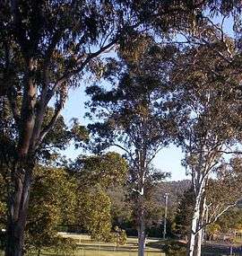
 Enoggera Hill at The Gap
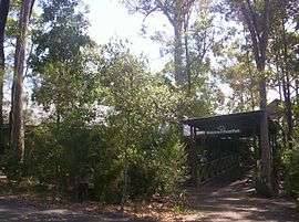
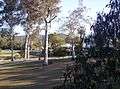 Walton Bridge Reserve at The Gap
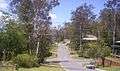
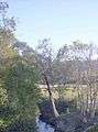 Walton Bridge Reserve at The Gap
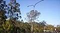
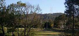 Mount Coot-tha and the Television Towers, and Walton Bridge Reserve
References
- ↑
- ↑
- ↑ Paten, Dick (editor) (2010). Ashgrove and The Gap - Aspects of History 1849-2003. Ashgrove, Queensland: Ashgrove Historical Society Inc. pp. 7–12. ISBN 978-0-646-53532-6.
- ↑ Larsen, Jim. "St. John's Woods memories". St Johns Wood, Ashgrove. Retrieved 3 June 2014.
- ↑ Dayman (nee Peake), Joan. "St. John's Woods memories". St Johns Wood, Ashgrove. Retrieved 3 June 2014.
- ↑ Paten (2010), p.19
- ↑ The Gap Historical Society
- ↑ "The Gap War Memorial (Brisbane)". Wikimapia. Retrieved 6 April 2014.
- ↑ "SEQ Severe Thunderstorm and Microburst at The Gap". Australian Government: Bureau of Meteorology.
- ↑ Video footage of the storm
- ↑ Ironside, Robyn; Dalton, Trent; Schwartz, Natascha (18 November 2008). "Floods to follow brutal storm". The Courier-Mail. Brisbane. Retrieved 18 November 2008.
- ↑ "Brisbane storm areas like war zone: PM". Yahoo! News.
- ↑ "Photo of Australian Prime Minister, Kevin Rudd, and Queensland Premier, Anna Bligh, surveying the storm damage at The Gap". The Courier-Mail.
- ↑ "Photo of storm damage at The Gap". The Courier-Mail.
- ↑ "Another photo of storm damage". The Courier-Mail.
- ↑ The Courier-Mail, Wednesday, 19 November 2008
- ↑ The Western Echo, November 2008
- ↑ North West Brisbane Community Newsletter, Friday, 21 November 2008
- ↑ "Brisbane Times" 17 November, 2008
- 1 2 Ashgrove Golf Club Diamond Jubilee. Ashgrove Golf Club. 2014. p. 1.
- ↑ Enoggera opened to swimming, paddling and fishing
- ↑ "Mobile library services". Brisbane City Council. Retrieved 3 June 2014.
- ↑ "School website". St Peter Chanel Catholic Primary School. Retrieved 26 April 2014.