Carina, Queensland
| Carina Brisbane, Queensland | |||||||||||||
|---|---|---|---|---|---|---|---|---|---|---|---|---|---|
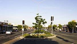 Old Cleveland Road in Carina | |||||||||||||
| Population | 10,301 (2011 census)[1] | ||||||||||||
| • Density | 2,289/km2 (5,930/sq mi) | ||||||||||||
| Postcode(s) | 4152[2] | ||||||||||||
| Area | 4.5 km2 (1.7 sq mi) | ||||||||||||
| Location | 7 km (4 mi) E of Brisbane CBD[3] | ||||||||||||
| LGA(s) |
City of Brisbane (Doboy Ward)[4] | ||||||||||||
| State electorate(s) | |||||||||||||
| Federal Division(s) | |||||||||||||
| |||||||||||||
Carina is a suburb of Brisbane, Australia. It is located 7 kilometres (4.3 mi) east of the CBD,[3][5] and borders Carindale, Carina Heights, Cannon Hill and Camp Hill.
Carina is a mostly residential suburb.[6] The Clem Jones Centre (a large sporting complex), and a Brisbane City Council bus depot are both situated on Creek Road in Carina. The suburb is home to the Carina Tigers Rugby League Football Club.
Toponymy
Carina took its name from an estate on Creek Road constructed in the 1850s. The property belonged to Ebenezer Thorne, and was itself named after Thorne's daughter Kate Carina.[3][5]
History
Carina was originally inhabited by Murris; most likely the Jagera.[7]
The area was first settled by Europeans in the 1850s, with the land mainly used for farming and timber-getting.[6] Growth occurred during the 1880s and early 1900s,[6] when it was the main place of settlement in the Shire of Belmont.[3] However the area remained mostly rural until after World War II, when the construction of public housing contributed to a rapid population increase in the 1950s and 1960s.[6]
One of the public housing projects in 1952 involved the use of prefabricated houses from Italy.[8] Unfortunately one of the shipments was found to have infestations of the sirex woodwasp and all the timber on board had to be sprayed and fumigated before it could be used.[9]
Between 1954[10] and 1969 the suburb was served by trolleybuses operated by the Brisbane City Council, which ran along Stanley Road, terminating at the intersection of Creek Road. Trams ran along Old Cleveland Road with the service terminating at Carina. The Old Cleveland Road Tramway Tracks are still visible and are listed on the Queensland Heritage Register.[11]
Public Transport
There has been no railway station in Carina since the closure of the Belmont Tramway in 1926. However, the suburb is served effectively by three radial bus corridors; Richmond Road along its northern border, Meadowlands Road-Stanley Road centrally, and Old Cleveland Road along its southern border. Richmond East is an express bus stop on Richmond Road that is serviced relatively frequently by two alternating, direct routes between Cannon Hill bus station and Brisbane's central business district. Numerous stops on Stanley Road are serviced relatively frequently by two alternating, direct all-stops routes between Fortitude Valley, and Cannon Hill bus station and Carindale bus station respectively. These routes largely follow the corridor of the former trolleybus routes that closed in 1969. A peak period limited-stops route also services Stanley Road. Old Cleveland Road has numerous stops, the most significant being Carina bus stop at Carina's shopping precinct, which is serviced by a regular all-stops route that largely follows the corridor of the former tram route that closed in 1969, along with two alternating, high frequency express routes that travel between Brisbane's central business district and Carindale, and an express route that travels between The University of Queensland and Carindale bus station. Additional peak-only routes service Old Cleveland Road.
Carina is also serviced by three limited-stops bus routes along the Creek Road corridor, which strategically connect key metropolitan centres across Brisbane including Carindale shopping centre and Cannon Hill shopping centre. These routes service Meadowlands, Carina Depot, Carina North, and Old Stockyards express stops. One route operates frequently, seven days per week between Brisbane's north east and south east suburbs. The other two operate less frequently and not at all on Sunday, but circumnavigate Brisbane's outer suburbs, one clockwise and the other anti-clockwise.
The suburb straddles TransLink Zones 2 and 3 from west to east. The western portion of the suburb is marginally more attractive to city commuters with respect to relatively cost effective transit travel.
Walking and Cycling
Carina's terrain varies from flat on the Bulimba Creek floodplain in the suburb's east, to hilly in the suburb's west towards Seven Hills and Camp Hill. Traffic conditions are busy along its major roads including Old Cleveland Road, Meadowlands Road and Stanley Road, Richmond Road, and Creek Road. Recreational cycling opportunities are consequently limited on the west side of the suburb. However, the presence of Porter's Paddock parkland including the Bulimba Creek Cycleway provides for good opportunities on its east side. As at February 2016 several city-wide, on-road cycle routes pass through Carina. Old Cleveland Road is a radial route that includes intermittent, formal bicycle lanes. Meadowlands Road is a radial route that contains paved shoulders that serve as informal cycle lanes, while Stanley Road is line-marked as a Bicycle Awareness Zone (yellow stencil stylized bicycle marked on edge of vehicle travel lane). Richmond road contains a formal bicycle lane westbound and a Bicycle Awareness Zone eastbound, while parts of Creek Road have paved shoulders that serve as informal cycle lanes. Packs of cyclists are commonplace along Old Cleveland Road early on weekend mornings.
The hilly terrain in the suburb's west side and busy traffic conditions also impose some impediment to local walking opportunities. However, the grid structure of the road and street network and the presence of urban borders (verges) on almost all roadways promote relatively direct and safe walking conditions. The higher order local streets and the major roads mostly have paved footpaths on one or both sides. The major roads contain numerous signalised intersections with pedestrian control, which are typically located adjacent to bus stops. Refuge islands support safe crossing of certain other roads and streets. In addition to local pocket parks, nearby recreational walking attractions include Seven Hills Bushland Reserve to the northwest, and Potter's Paddock parkland in the suburb's east.
Demographics
The 2011 Census recorded 10,301 residents in Carina, of whom 52.7% were female and 47.3% were male. The median age of the population was 34; 3 years younger than the Australian average.[6]
71.6% of people living in Carina were born in Australia, with the next most common countries of birth being New Zealand (4.8%), England (3.3%), India (1.3%), South Africa (0.9%), and the Philippines (0.7%). 81.4% of people spoke English as their first language, while the other most common responses were Spanish (1.3%), Cantonese (1%), Italian (0.9%), Mandarin (0.8%), and Greek (0.6%).[6]
See also
References
- ↑ Australian Bureau of Statistics (31 October 2012). "Carina, Qld (State Suburb)". 2011 Census QuickStats. Retrieved 10 October 2013.
- ↑ "Find a postcode". Australia Post. Retrieved 23 October 2013.
- 1 2 3 4 Centre for the Government of Queensland. "Carina". Retrieved 26 October 2013.
- ↑ "Doboy Ward". Brisbane City Council. Retrieved 3 January 2014.
- 1 2 "Carina (entry 42562)". Queensland Place Names. Queensland Government. Retrieved 11 April 2014.
- 1 2 3 4 5 6 Australian Bureau of Statistics. "Carina". Retrieved 26 October 2013.
- ↑ Williams, Brian. "Secrets of Brisbane's suburbs: C". News Ltd. Retrieved 3 January 2014.
- ↑ "ITALIAN HOUSES.". The Courier-Mail. Brisbane: National Library of Australia. 21 November 1951. p. 3. Retrieved 11 April 2014.
- ↑ "TIMBER PEST IN PRE-FAB CARGO.". Townsville Daily Bulletin. Qld.: National Library of Australia. 19 June 1952. p. 2. Retrieved 11 April 2014.
- ↑ "TROLLEY BUS TO CARINA.". The Courier-Mail. Brisbane: National Library of Australia. 3 November 1954. p. 8. Retrieved 11 April 2014.
- ↑ "Old Cleveland Road Tramway Tracks (entry 601839)". Queensland Heritage Register. Queensland Heritage Council. Retrieved 6 July 2013.
External links
![]() Media related to Carina, Queensland at Wikimedia Commons
Media related to Carina, Queensland at Wikimedia Commons
Coordinates: 27°29′09″S 153°06′03″E / 27.48583°S 153.10083°E