Tarragindi, Queensland
| Tarragindi Brisbane, Queensland | |||||||||||||
|---|---|---|---|---|---|---|---|---|---|---|---|---|---|
 Junction of Sandy and Norman Creeks | |||||||||||||
| Population | 9,965 (2011 census)[1] | ||||||||||||
| • Density | 2,214/km2 (5,740/sq mi) | ||||||||||||
| Established | 1857 | ||||||||||||
| Postcode(s) | 4121 | ||||||||||||
| Area | 4.5 km2 (1.7 sq mi) | ||||||||||||
| LGA(s) | City of Brisbane | ||||||||||||
| State electorate(s) | Yeerongpilly, Greenslopes | ||||||||||||
| Federal Division(s) | Griffith, Moreton | ||||||||||||
| |||||||||||||
Tarragindi is a suburb on the southern side of Brisbane, Queensland, Australia.[2] It is represented through the Holland Park and Moorooka Ward councillors on the Brisbane City Council.
Demographics
In the 2011 census, Tarragindi recorded a population of 9,965 people, 51.3% female and 48.7% male.
The median age of the Tarragindi population was 37 years, the same as the national median.
80.2% of people living in Tarragindi were born in Australia, compared to the national average of 69.8%. The other top responses for country of birth were England 3.6%, New Zealand 2.5%, South Africa 0.6%, India 0.5%, Vietnam 0.5%.
88.1% of people spoke only English at home; the next most popular languages were 1.1% Greek, 0.7% Spanish, 0.6% Vietnamese, 0.6% Italian, 0.5% German.[1]
History
Prior to European occupation beginning in the early 19th century the area covered by the suburb was inhabited by Aboriginal people. The Coorparoo sub-group of the wider Jagera group occupied land south of the Brisbane River clustered around Oxley, Norman and Bulimba creeks.[3] It is also possible that the Yerongpan sub-group lived in the area.[4] The Coorparoo group had cultural links to other neighboring communities including territorially-neutral pathways, river crossings and ceremonies. A bora ring was known to have been maintained in Tarragindi, possibly between present-day Barnehurst and Isabella Streets.[4] One trace of this early occupation persists in the locality and creek name, "Ekibin". According to Queensland Department of Natural Resources and Mines (2003) the modern name is derived from the aboriginal "Yekkabin" which referred to aquatic plants (probably Blechnum indicum) with edible roots which grew in the creek. The edible roots were common in the diet of Aboriginals of the Moreton Bay area; a sharp stick was used to dig out the stem, which was then dried, roasted, and pounded with a stone.[5]
European settlement
European settlement began 1857 with a survey of land by George Pratten. An early land-owner (and later Mayor of Brisbane and member of parliament), Thomas Stephens, established a woolscour and later a fellmongery in the northern part of the suburb near Essie Avenue. Another land-holder was James Toohey who leased properties for cattle runs.
World War 2
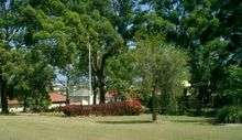
During the Second World War, Tarragindi was the site of a field hospital administered first by the American Army (for soldiers treated for shell shock) and later by the British and Australian forces. The Ekibin Hospital was bounded by Sexton Street and Toohey Road and encompassed parts of Cracknell, Effingham, Fingal and Lutzow streets.[6] After the war, the site was used by the Housing Commission to accommodate displaced persons. Today, little remains of the establishment except for possible foundations of a gun emplacement in the midsection of Fingal Street. The Ekibin Memorial Park on Cracknell Road commemorates the establishment of the hospital.
Origin of the name

The suburb was named after a native from the Loyalty Islands (near modern-day New Caledonia) who was transported in the late nineteenth century to Queensland.[7] Such people, called Kanakas, were a cheap source of labour for sugarcane production. Apparently he escaped and was subsequently employed by Alfred Foote of Ipswich. Later, he cleared land for William Grimes (related to Alfred Foote) on a hill near Sandy Creek and the property was named after him.[8] Tarragindi remained with the Foote family in Ipswich until just before he died, aged 63. The grave of Tarra Gindi Tasserone is located in the Ipswich General Cemetery.[9]
Geography

The main part of the suburb lies in a valley running north-south, surrounded by ridges marked by Wellers Hill to the east and Tarragindi Hill to the west. Sandy Creek has it source in Toohey Forest to the south and flows through the major part of the suburb. The eastern flank of the Wellers Hill ridge drains into Ekibin Creek.
Schools
Tarragindi hosts two primary schools.
Wellers Hill State School is located on the junction of Weller and Toohey Roads.[10] The school has a very active music program which is renowned within the area and has flourished under the care of several dedicated musical instructors. The motto of this school is 'Strive to Succeed' and this motto is upheld visibly in the conduct of student and teacher. Its sports houses, named after Australian native animals, are Platypus (yellow), Emu (blue), Kangaroo (red), and Koala (green).[11] In December 2006 and June 2013 the school lost some buildings due to an arson attack.[12]
St. Elizabeth's Catholic Primary School is located at 55 Effingham Street on the corner of Cracknell Road.[13] The school has 3 sporting houses, all named after people involved in the school's development and significant people in the Christian faith: Bergin (gold) named after Fr Basil Bergin the first parish priest when the school opened, Elliot (red) which is named after Fr Graham Elliott who was a parish priest at St Elizabeth's from 1976–1999 and Nagle (blue) which is named after Nano Nagle. The school's motto is "Caritas Christi", which is displayed on the boys' uniform and on the balcony of the Christi Centre where the students participate in art & music. There is an OSHC Centre downstairs. The school has a chapel, which used to be a church until the installation of the Prep Rooms.
References
- 1 2 Australian Bureau of Statistics (31 October 2012). "Tarragindi". 2011 Census QuickStats. Retrieved 11 August 2014.
- ↑ "Tarragindi (entry 44348)". Queensland Place Names. Queensland Government. Retrieved 29 August 2013.
- ↑ Kidd, Ros (2000). "Aboriginal History of the Princess Alexandra Hospital Site" (PDF). Diamantina Health Care Museum Association Inc. Retrieved 28 August 2013.
- 1 2 "Tarragindi: Aboriginal History". BRISbites: Suburban Sites. Brisbane City Council Library Service. Archived from the original on 25 July 2008.
- ↑ Potter, R. "Place Names of South-East Queensland Australia". Archived from the original on 27 Sep 2007. Retrieved 5 February 2005.
- ↑ Dunn, Peter. "102nd Australian General Hospital at Ekibin, Brisbane, QLD during WW2". Retrieved 4 February 2006.
- ↑ Unidentified (1905), Foote family on holidays at Land's End, Southport, Queensland, John Oxley Library, State Library of Queensland, retrieved 29 August 2013
- ↑ "Who was Tarragindi Tasserone?". State Library of Queensland. Retrieved 14 November 2013.
- ↑ "Ipswich General Cemetery Then & Now" (PDF). Ipswich City Council. Retrieved 2 October 2005.
- ↑ "Location". Wellers Hill State School. Wellers Hill State School. Retrieved 28 August 2013.
- ↑ "School Sports Houses". Wellers Hill State School. Wellers Hill State School. Retrieved 28 August 2013.
- ↑ Fire in school at Brisbane's south destroys two buildings, five classrooms, The Courier-Mail, 27 June 2013.
- ↑ "St Elizabeth's Catholic Primary School, Tarragindi". St Elizabeth's Catholic Primary School. Retrieved 28 August 2013.
External links
- Ekibin: Queensland Places
- Tarragindi: Queensland Places
- Ekibin St Luke's Anglican columbarium
- "Tarragindi". BRISbites. Brisbane City Council. Archived from the original on 23 July 2008.
- "Tarragindi". Our Brisbane. Brisbane City Council. Archived from the original on 12 February 2008.
- St. Elizabeth's Catholic Primary School
Coordinates: 27°31′54″S 153°02′24″E / 27.5317°S 153.04°E