Brisbane Airport (suburb)
| Brisbane Airport Brisbane, Queensland | |||||||||||||
|---|---|---|---|---|---|---|---|---|---|---|---|---|---|
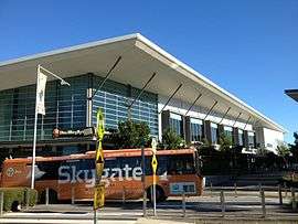 Skygate Village and bus | |||||||||||||
| Postcode(s) | 4008 | ||||||||||||
| Location | 14 km (9 mi) from Brisbane CBD | ||||||||||||
| LGA(s) | City of Brisbane | ||||||||||||
| State electorate(s) | Clayfield | ||||||||||||
| Federal Division(s) | Lilley | ||||||||||||
| |||||||||||||
Brisbane Airport is a suburb of Brisbane, Queensland, Australia.[1] Brisbane Airport is located approximately 14 kilometres (9 mi) north-east from the Brisbane central business district. The majority of the land is occupied by the Brisbane Airport. Airport Drive and Moreton Drive link the airport with the Gateway Motorway.
History
The land occupied by the Brisbane airport was originally part of the suburbs of Eagle Farm and Pinkenba. In 2011, Rachel Nolan, the Queensland minister for Finance, Natural Resources, and the Arts, published an official notice amending the boundaries of Eagle Farm, Pinkenba, and Hamilton, and establishing the new suburb of Brisbane Airport.[2]
Facilities
The Skygate Airport Village consists of an 80-hectare precinct that is designated for retail and commercial usage including: a GP Clinic available to the public,[3] the warehouse retail factory outlet DFO[4] and Novotel airport hotel.[5]
The Airport Industrial Park is a proposed precinct which includes 100 hectares of land designated for light and general industry. Development in this precinct is expected to occur in 2015.[6]
The Domestic Terminal railway station and International Terminal railway station provide access to commuter railway services. The Airtrain services are privatised and are integrated with the Citytrain commuter rail network. Government-subsidised TransLink fares are exempted for Airtrain services. There is also an inter-terminal bus connecting the two terminals, and the Skygate Shopping Precinct including DFO and Novotel Hotel.

References
- ↑ "Brisbane Airport (entry 47581)". Queensland Place Names. Queensland Government. Retrieved 17 September 2013.
- ↑ "Place Name Decision Notice (No 08) 2011 and Place Name Decision Notice (No 09) 2011" (PDF). Queensland Government Gazette. 5 August 2009. p. 799. Retrieved 12 February 2013.
- ↑ http://skygate.com.au/info/store/sonic-healthplus-medical-centre, accessed 14 December 2014
- ↑ https://web.archive.org/web/20080803033758/http://www.bne.com.au/content/standard_v4.asp?name=TheBigVision_OverviewAirportVillage. Archived from the original on 3 August 2008. Retrieved 19 August 2008. Missing or empty
|title=(help) - ↑ "Win a sneak peek at Novotel airport hotel". City News. 19 November 2009. Archived from the original on 20 November 2009. Retrieved 19 November 2009.
- ↑ "Archived copy". Archived from the original on 3 August 2008. Retrieved 2008-08-19.
Coordinates: 27°23′38.87″S 153°06′55.22″E / 27.3941306°S 153.1153389°E