Ellen Grove, Queensland
| Ellen Grove Brisbane, Queensland | |||||||||||||
|---|---|---|---|---|---|---|---|---|---|---|---|---|---|
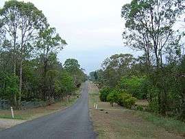 Lovat Street, Ellen Grove | |||||||||||||
| Population | 2,529 (2011 census)[1] | ||||||||||||
| Established | 1962 | ||||||||||||
| Postcode(s) | 4078 | ||||||||||||
| Location | 20 km (12 mi) from Brisbane GPO | ||||||||||||
| LGA(s) | City of Brisbane | ||||||||||||
| State electorate(s) | Electoral district of Inala | ||||||||||||
| Federal Division(s) | Division of Oxley | ||||||||||||
| |||||||||||||
Ellen Grove is an outer suburb of Brisbane, Queensland, Australia and is located 20 kilometres (12 mi) south-west of the Brisbane central business district.[2] At the 2011 Australian Census the population was recorded as 2,529.[1]
History
Ellen Grove was subdivided for housing around 1959, with the name of the suburb gazetted in 1962 due to lobbying from the Ellen Grove Progress Association.[3] The subdivision were between two and four acres in area with no services provided. In 2009, the suburb was extended both to the north and south, increasing the population significantly from 351 to 5,209 people.[3]
The owner of the original land was R.P. Spinks who had a daughter named Ellen Dabing. She often played with local aboriginals in a grove of trees along Bullockhead Creek.[3] The area became known as Ellen's Grove.
Geography
The southern boundary of the suburb is partially marked by the Logan Motorway. The Centenary Highway passes through the suburb from north to south.[4] The Richlands and Inala reservoirs were built in the suburb to increase water pressure for residents in the surrounding suburbs.
Amenities
It is a quiet suburb with a primary school and a small shopping centre. There is easy access to trains and the motorway. A public swimming pool was opened in 1995.[3]
Ellen Grove is serviced by a fortnightly visit of the Brisbane City Council's mobile library service at the Carole Park State School, 260 Waterford Road.[5]
Demographics
In the 2011 census, Ellen Grove recorded a population of 2,529 people, 51% female and 49% male.[1] The median age of the Ellen Grove population was 28 years of age, 9 years below the Australian median. 55.9% of people living in Ellen Grove were born in Australia, compared to the national average of 69.8%; the next most common countries of birth were New Zealand 5.5%, Vietnam 5.4%, Samoa 2.9%, England 2.1%, Philippines 1.2%. 59.3% of people spoke only English at home; the next most popular languages were 9.8% Vietnamese, 5.3% Samoan, 1% Kirundi (Rundi), 1% Mandarin, 0.9% Arabic.[1]
References
- 1 2 3 4 Australian Bureau of Statistics (31 October 2012). "Ellen Grove (State Suburb)". 2011 Census QuickStats. Retrieved 14 January 2013.
- ↑ "Ellen Grove (entry 48323)". Queensland Place Names. Queensland Government. Retrieved 21 June 2015.
- 1 2 3 4 Mynott, Wicki (2009). 150 years: Richlands, Inala & neighbouring suburbs in Brisbane's South West. Richlands, Inala & Suburbs History Group. pp. 101–104.
- ↑ "Queensland Globe". State of Queensland. Retrieved 21 June 2015.
- ↑ "Mobile library services". Brisbane City Council. Retrieved 3 June 2014.
External links
![]() Media related to Ellen Grove, Queensland at Wikimedia Commons
Media related to Ellen Grove, Queensland at Wikimedia Commons
Coordinates: 27°37′S 152°57′E / 27.617°S 152.950°E