Williamson Mound Archeological District
|
Williamson Mound Archeological District | |
|
View from the west | |
  | |
| Location | East of U.S. Route 42 on the western edge of the Wetherington Golf and Country Club[1] |
|---|---|
| Nearest city | Maud, Ohio |
| Coordinates | 39°22′1″N 84°23′4″W / 39.36694°N 84.38444°WCoordinates: 39°22′1″N 84°23′4″W / 39.36694°N 84.38444°W |
| Area | 25 acres (10 ha) |
| NRHP Reference # | 75001334[2] |
| Added to NRHP | May 29, 1975 |

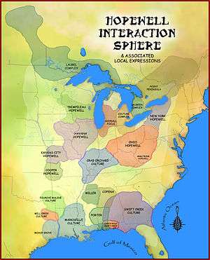
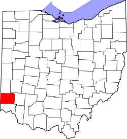
The Williamson Mound Archeological District is an archaeological site in the southwestern part of the U.S. state of Ohio. Located north of Maud in Butler County,[3] the mound appears to have been the work of peoples of the Hopewell tradition.[4]
Although a small hole was dug into the top of the Williamson Mound at some point before 1972, the mound remains in premium condition. It sits atop a ridgeline above an intermittent stream in a rural part of increasingly urbanized Butler County.[4]
As one of the best preserved Hopewell mounds in its region, the Williamson Mound is potentially a significant archaeological site.[4] For this reason, it was listed on the National Register of Historic Places in 1975.[2]
References
- ↑ Koleszar, Stephen C. An Archaeological Survey of Southwestern Ohio. Columbus: Ohio Historical Society, 1970, 54.
- 1 2 National Park Service (2009-03-13). "National Register Information System". National Register of Historic Places. National Park Service.
- ↑ 44 FR 7552
- 1 2 3 Owen, Lorrie K., ed. Dictionary of Ohio Historic Places. Vol. 1. St. Clair Shores: Somerset, 1999, 108.
| Topics | |
|---|---|
| Lists by states |
|
| Lists by insular areas | |
| Lists by associated states | |
| Other areas | |
| |
This article is issued from Wikipedia - version of the 11/26/2016. The text is available under the Creative Commons Attribution/Share Alike but additional terms may apply for the media files.