| [3] |
Name on the Register[4] |
Image |
Date listed[5] |
Location |
City or town |
Description |
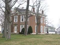
|---|
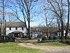
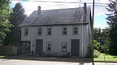
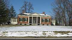
| 1 |
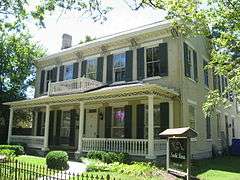
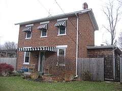
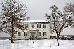
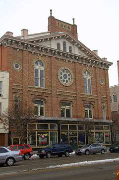
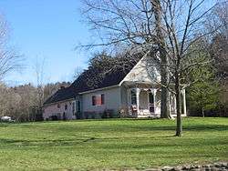
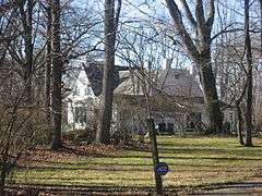
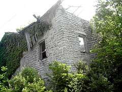
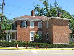
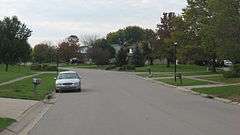
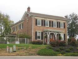
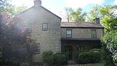
Dr. William S. Alexander House |
|
000000001987-03-18-0000March 18, 1987
(#86003498) |
22 N. College Ave.
39°30′40″N 84°44′44″W / 39.511111°N 84.745556°W / 39.511111; -84.745556 (Dr. William S. Alexander House) |
Oxford |
|
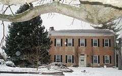
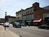
| 2 |
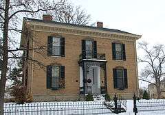
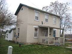
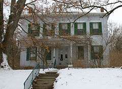
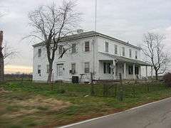
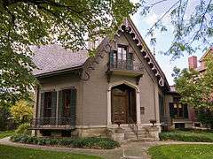
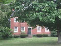
Anderson-Shaffer House |
|
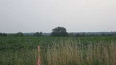
000000001974-01-18-0000January 18, 1974
(#74001402) |
404 Ross Ave.
39°24′15″N 84°34′18″W / 39.404167°N 84.571667°W / 39.404167; -84.571667 (Anderson-Shaffer House) |
Hamilton |
|
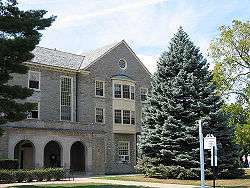
| 3 |
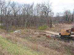
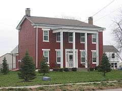
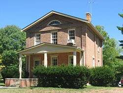
Augspurger Grist Mill |
|
000000001984-11-01-0000November 1, 1984
(#84000211) |
Wayne-Madison Rd. at Woodsdale
39°25′48″N 84°28′38″W / 39.430000°N 84.477222°W / 39.430000; -84.477222 (Augspurger Grist Mill) |
St. Clair Township |
|
| 4 |
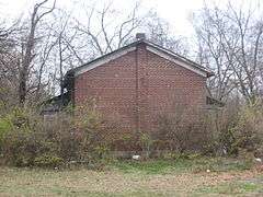
Augspurger Paper Company Rowhouse 1 |
|
000000001984-11-01-0000November 1, 1984
(#84000216) |
1698 Wayne-Madison Rd. at Woodsdale[6]
39°26′02″N 84°28′33″W / 39.433889°N 84.475833°W / 39.433889; -84.475833 (Augspurger Paper Company Rowhouse 1) |
Madison Township |
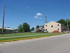
|
| 5 |
Augspurger Paper Company Rowhouse 2 |
|
000000001984-11-01-0000November 1, 1984
(#84000215) |
1692 Wayne-Madison Rd. at Woodsdale[7]
39°26′01″N 84°28′33″W / 39.433611°N 84.475833°W / 39.433611; -84.475833 (Augspurger Paper Company Rowhouse 2) |
Madison Township |
|
| 6 |
Augspurger Schoolhouse |
|
000000001984-11-01-0000November 1, 1984
(#84000212) |
Wayne-Madison Rd. at Woodsdale
39°26′06″N 84°28′32″W / 39.435000°N 84.475694°W / 39.435000; -84.475694 (Augspurger Schoolhouse) |
Madison Township |
|
| 7 |
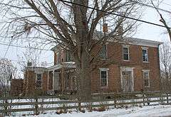
Frederick Augspurger Farm |
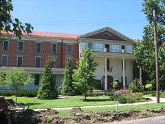
|
000000001984-08-03-0000August 3, 1984
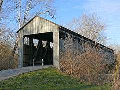
(#84002900) |
1856 Wayne-Madison Rd., south of Trenton
39°26′18″N 84°28′33″W / 39.438333°N 84.475833°W / 39.438333; -84.475833 (Frederick Augspurger Farm) |
Madison Township |
|
| 8 |
John Augspurger Farm No. 1 |
|
000000001984-08-03-0000August 3, 1984
(#84002901) |
2731 Woodsdale Rd., south of Trenton
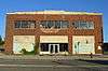
39°27′51″N 84°27′02″W / 39.464167°N 84.450556°W / 39.464167; -84.450556 (John Augspurger Farm No. 1) |
Madison Township |
|
| 9 |
John Augspurger Farm No. 2 |
|
000000001984-11-01-0000November 1, 1984
(#84000208) |
3046 Pierson Rd.
39°27′57″N 84°27′34″W / 39.465833°N 84.459444°W / 39.465833; -84.459444 (John Augspurger Farm No. 2) |
Trenton |
|
| 10 |
Samuel Augspurger Farm |
|
000000001984-11-01-0000November 1, 1984
(#84000209) |
2070 Woodsdale Rd., south of Trenton
39°26′40″N 84°27′42″W / 39.444444°N 84.461667°W / 39.444444; -84.461667 (Samuel Augspurger Farm) |
Madison Township |
|
| 11 |
Samuel Augspurger House |
|
000000001984-11-01-0000November 1, 1984
(#84000213) |
1659 Wayne-Madison Rd. at Woodsdale[8]
39°25′58″N 84°28′36″W / 39.432778°N 84.476667°W / 39.432778; -84.476667 (Samuel Augspurger House) |
St. Clair Township |
|
| 12 |
Austin-Magie Farm and Mill District |
|
000000001982-12-21-0000December 21, 1982
(#82001360) |
Section 14 in Oxford Township
39°31′32″N 84°43′56″W / 39.525556°N 84.732222°W / 39.525556; -84.732222 (Austin-Magie Farm and Mill District) |
Oxford Township |
|
| 13 |
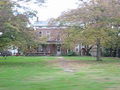
Beckett-Manrod House |
|
000000001977-11-11-0000November 11, 1977
(#77001044) |
2019 Stillwell-Beckett Rd., northwest of Hamilton
39°27′10″N 84°37′42″W / 39.452778°N 84.628333°W / 39.452778; -84.628333 (Beckett-Manrod House) |
Hanover Township |
|
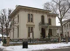
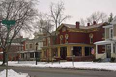
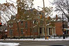
| 14 |
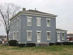
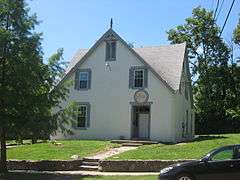
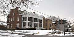
Benninghofen House |
|
000000001973-05-17-0000May 17, 1973
(#73001388) |
327 N. 2nd St.
39°24′14″N 84°33′37″W / 39.403889°N 84.560278°W / 39.403889; -84.560278 (Benninghofen House) |
Hamilton |
|
| 15 |
Big Four Depot |
|
000000002013-12-24-0000December 24, 2013
(#13000979) |
25 Charles St.
39°30′50″N 84°23′32″W / 39.513889°N 84.392222°W / 39.513889; -84.392222 (Big Four Depot) |
Middletown |
|
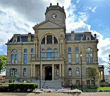
| 16 |
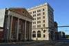
Butler County Courthouse |
|
000000001981-06-22-0000June 22, 1981
(#81000429) |
2nd and High Sts.
39°23′59″N 84°33′46″W / 39.399722°N 84.562778°W / 39.399722; -84.562778 (Butler County Courthouse) |
Hamilton |
|
| 17 |
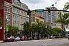
Central Avenue Historic District |
|
000000002014-08-08-0000August 8, 2014
(#14000480) |
Central Ave.
39°30′59″N 84°24′08″W / 39.516389°N 84.40222°W / 39.516389; -84.40222 (Central Avenue Historic District) |
Middletown |
|
| 18 |
Cochran Farm |
|
000000001973-07-16-0000July 16, 1973
(#73001390) |
2900 State Route 129, west of Millville
39°23′18″N 84°39′35″W / 39.388472°N 84.659722°W / 39.388472; -84.659722 (Cochran Farm) |
Ross Township |
|
| 19 |
Dayton-Campbell Historic District |
|
000000001983-06-30-0000June 30, 1983
(#83001947) |
Primarily Dayton, High, and Campbell Ave. between 6th and 11th Sts.
39°23′55″N 84°33′07″W / 39.398611°N 84.551944°W / 39.398611; -84.551944 (Dayton-Campbell Historic District) |
Hamilton |
|
| 20 |
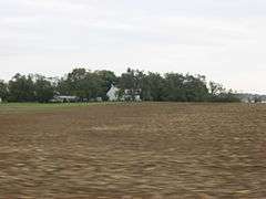
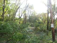
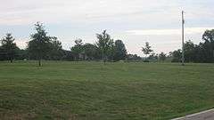
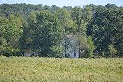
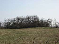
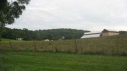
Demoret Mound |
Upload image |
000000001975-10-21-0000October 21, 1975
(#75001337) |
2,700 feet (820 m) west of the lake at the former Ross Trails Girl Scout Camp[9]:51
|
Ross Township |
|
| 21 |
Henry P. Deuscher House |
|
000000001984-02-09-0000February 9, 1984
(#84002902) |
2385 Woodsdale Rd., south of Trenton
39°27′06″N 84°26′47″W / 39.451667°N 84.446389°W / 39.451667; -84.446389 (Henry P. Deuscher House) |
Madison Township |
|
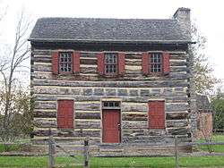
| 22 |
Zachariah Price Dewitt Cabin |
|
000000001973-04-13-0000April 13, 1973
(#73001392) |
East of Oxford on State Route 73
39°30′38″N 84°43′07″W / 39.510556°N 84.718611°W / 39.510556; -84.718611 (Zachariah Price Dewitt Cabin) |
Oxford Township |
|
| 23 |
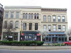
Dixon-Globe Opera House-Robinson-Schwenn Building |
|
000000002000-07-14-0000July 14, 2000
(#00000799) |
221 High St.
39°23′58″N 84°33′39″W / 39.399444°N 84.560833°W / 39.399444; -84.560833 (Dixon-Globe Opera House-Robinson-Schwenn Building) |
Hamilton |
|
| 24 |
Edgeton |
|
000000001975-04-03-0000April 3, 1975
(#75001331) |
575 Harrison Ave.
39°24′21″N 84°35′11″W / 39.405833°N 84.586389°W / 39.405833; -84.586389 (Edgeton) |
Hamilton |
|
| 25 |
Christian Ehresman Farm |
|
000000001984-08-03-0000August 3, 1984
(#84002903) |
900 Woodsdale Rd.
39°28′12″N 84°27′11″W / 39.470000°N 84.453056°W / 39.470000; -84.453056 (Christian Ehresman Farm) |
Trenton |
|
| 26 |
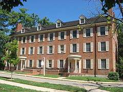
Elliott and Stoddard Halls |
|
000000001973-04-03-0000April 3, 1973
(#73001391) |
Miami University campus
39°30′31″N 84°44′07″W / 39.508611°N 84.735278°W / 39.508611; -84.735278 (Elliott and Stoddard Halls) |
Oxford |
|
| 27 |
Fairfield Township Works I |
|
000000001971-11-05-0000November 5, 1971
(#71000631) |
Eastern bank of the Great Miami River, 4 miles (6.4 km) above Hamilton[9]:43
39°25′28″N 84°29′00″W / 39.424444°N 84.483333°W / 39.424444; -84.483333 (Fairfield Township Works I) |
Fairfield Township |
Near Hamilton
|
| 28 |
Fitz Randolph-Rogers House |
Upload image |
000000001978-02-08-0000February 8, 1978
(#78002014) |
5467 Liberty-Fairfield Rd., east of Hamilton
39°25′08″N 84°28′45″W / 39.418889°N 84.479167°W / 39.418889; -84.479167 (Fitz Randolph-Rogers House) |
Fairfield Township |
|
| 29 |
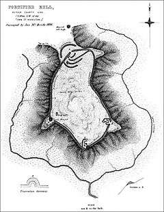
Fortified Hill Works |
|
000000001974-07-12-0000July 12, 1974
(#74001403) |
Western side of the Great Miami River, 3 miles (4.8 km) below Hamilton[10]
39°21′46″N 84°35′33″W / 39.362708°N 84.592500°W / 39.362708; -84.592500 (Fortified Hill Works) |
Ross Township |
|
| 30 |
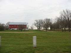
Garver-Rentschler Barn |
Upload image |
000000001980-08-11-0000August 11, 1980
(#80002947) |
1030 New London Rd., southwest of Hamilton[11]
39°23′17″N 84°36′14″W / 39.388056°N 84.603944°W / 39.388056; -84.603944 (Garver-Rentschler Barn) |
Ross Township |
|
| 31 |
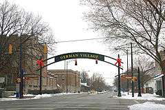
German Village Historic District |
|
000000001991-02-07-0000February 7, 1991
(#90002216) |
Roughly bounded by Vine, Dayton, Riverfront Plaza, and Martin Luther King, Jr. Boulevard
39°24′12″N 84°33′33″W / 39.403333°N 84.559167°W / 39.403333; -84.559167 (German Village Historic District) |
Hamilton |
|
| 32 |
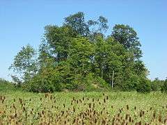
Great Mound |
|
000000001971-10-07-0000October 7, 1971
(#71000633) |
West of Middletown[10]
39°30′56″N 84°28′35″W / 39.515556°N 84.476250°W / 39.515556; -84.476250 (Great Mound) |
Madison Township |
|
| 33 |
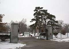
Greenwood Cemetery |
|
000000001994-07-22-0000July 22, 1994
(#94000771) |
1602 Greenwood Ave.
39°24′12″N 84°32′34″W / 39.403333°N 84.542778°W / 39.403333; -84.542778 (Greenwood Cemetery) |
Hamilton |
|
| 34 |
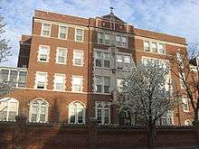
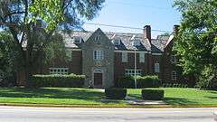
Hamilton Catholic High School |
|
000000001986-07-24-0000July 24, 1986
(#86001917) |
533 Dayton St.
39°24′01″N 84°33′20″W / 39.400278°N 84.555556°W / 39.400278; -84.555556 (Hamilton Catholic High School) |
Hamilton |
|
| 35 |
Hamilton Downtown Historic District |
|
000000002016-07-18-0000July 18, 2016
(#16000458) |
135-245 and 250-358 High, 9-21 N. 3rd, 6-222 S. 2nd, 2-306 and 11-301 S. 3rd, 105-309 and 224-234 Court, and 311-316 Ludlow Sts.
39°23′57″N 84°33′36″W / 39.399167°N 84.560000°W / 39.399167; -84.560000 (Hamilton Downtown Historic District) |
Hamilton |
|
| 36 |
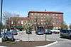
Hamilton Historic Civic Center |
|
000000001995-06-29-0000June 29, 1995
(#94000170) |
Roughly bounded by Market St., High St., Court St., and Monument Ave., including High-Main St. Bridge
39°24′04″N 84°33′53″W / 39.401111°N 84.564722°W / 39.401111; -84.564722 (Hamilton Historic Civic Center) |
Hamilton |
|
| 37 |
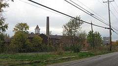
Harding-Jones Paper Company District |
|
000000001975-05-29-0000May 29, 1975
(#75001330) |
Both sides of S. Main St. at its junction with railroad tracks in Excello
39°28′34″N 84°25′14″W / 39.476111°N 84.420556°W / 39.476111; -84.420556 (Harding-Jones Paper Company District) |
Lemon Township |
|
| 38 |
Herron Gymnasium |
|
000000001979-11-29-0000November 29, 1979
(#79001788) |
Miami University campus
39°30′34″N 84°44′02″W / 39.509444°N 84.733889°W / 39.509444; -84.733889 (Herron Gymnasium) |
Oxford |
Demolished
|
| 39 |
James P. Hidley Cottage |
|
000000001980-08-18-0000August 18, 1980
(#80002951) |
1820 Oxford-Reily Rd., south of Oxford
39°26′05″N 84°45′31″W / 39.434722°N 84.758611°W / 39.434722; -84.758611 (James P. Hidley Cottage) |
Reily Township |
|
| 40 |
High Street Commercial Block |
|
000000002004-03-03-0000March 3, 2004
(#04000113) |
228, 232, and 236 High St.; 216-226 High Street
39°23′59″N 84°33′39″W / 39.399722°N 84.560833°W / 39.399722; -84.560833 (High Street Commercial Block) |
Hamilton |
Boundary increased in May 2014
|
| 41 |
Hogan-Borger Mound Archeological District |
|
000000001975-10-21-0000October 21, 1975
(#75001338) |
Eastern side of Hamilton-New London Rd., north of Ross[9]:46
39°20′41″N 84°39′34″W / 39.344722°N 84.659444°W / 39.344722; -84.659444 (Hogan-Borger Mound Archeological District) |
Ross Township |
|
| 42 |
Hotel Manchester |
|
000000002014-09-10-0000September 10, 2014
(#14000589) |
1027 Manchester Ave.
39°31′04″N 84°24′10″W / 39.5179°N 84.4027°W / 39.5179; -84.4027 (Hotel Manchester) |
Middletown |
|
| 43 |
Howe Tavern |
|
000000001976-01-30-0000January 30, 1976
(#76001376) |
U.S. Route 27
39°34′02″N 84°48′54″W / 39.567361°N 84.815000°W / 39.567361; -84.815000 (Howe Tavern) |
College Corner |
|
| 44 |
Matthew Hueston House |
|
000000001977-09-16-0000September 16, 1977
(#77001045) |
1320 Four Mile Creek Rd., northwest of Hamilton
39°28′00″N 84°36′21″W / 39.466667°N 84.605833°W / 39.466667; -84.605833 (Matthew Hueston House) |
Hanover Township |
|
| 45 |
Hughes Manor |
|
000000001994-03-17-0000March 17, 1994
(#94000242) |
5894 Hamilton-Lebanon Rd.
39°26′51″N 84°25′03″W / 39.447500°N 84.417500°W / 39.447500; -84.417500 (Hughes Manor) |
Monroe |
|
| 46 |
Hughes School |
|
000000001976-01-02-0000January 2, 1976
(#76001377) |
5994 Princeton Rd., east of Hamilton
39°23′12″N 84°25′13″W / 39.386667°N 84.420278°W / 39.386667; -84.420278 (Hughes School) |
Liberty Township |
|
| 47 |
Hunting Lodge Farm |
|
000000001982-10-20-0000October 20, 1982
(#82001361) |
Southeast of Oxford at 5349 Coulter Ln.[12]
39°31′15″N 84°43′20″W / 39.520833°N 84.722222°W / 39.520833; -84.722222 (Hunting Lodge Farm) |
Oxford Township |
|
| 48 |
Christian Iutzi Farm |
|
000000001984-08-03-0000August 3, 1984
(#84002904) |
2180 Woodsdale Rd., south of Trenton
39°26′39″N 84°27′18″W / 39.444167°N 84.455000°W / 39.444167; -84.455000 (Christian Iutzi Farm) |
Madison Township |
|
| 49 |
John Kennel Sr. Farm |
|
000000001984-08-03-0000August 3, 1984
(#84002906) |
5506 Kennel Rd.
39°27′42″N 84°28′31″W / 39.461667°N 84.475278°W / 39.461667; -84.475278 (John Kennel Sr. Farm) |
Trenton |
|
| 50 |
John Kennel Jr. Farm |
|
000000001984-08-03-0000August 3, 1984
(#84002907) |
2251 Wayne-Madison Rd., south of Trenton
39°26′49″N 84°28′37″W / 39.446806°N 84.477083°W / 39.446806; -84.477083 (John Kennel Jr. Farm) |
St. Clair Township |
|
| 51 |
Elias Kumler House |
|
000000001980-01-03-0000January 3, 1980
(#80002948) |
120 S. Main St.
39°30′31″N 84°44′34″W / 39.508611°N 84.742778°W / 39.508611; -84.742778 (Elias Kumler House) |
Oxford |
|
| 52 |
Lane's Mill Historic Buildings |
|
000000001980-10-03-0000October 3, 1980
(#80002950) |
South of Oxford at 3884 Wallace Rd.
39°28′57″N 84°41′32″W / 39.4825°N 84.692222°W / 39.4825; -84.692222 (Lane's Mill Historic Buildings) |
Milford Township |
|
| 53 |
Lane-Hooven House |
|
000000001973-10-25-0000October 25, 1973
(#73001389) |
319 N. 3rd St.
39°24′13″N 84°33′34″W / 39.403611°N 84.559444°W / 39.403611; -84.559444 (Lane-Hooven House) |
Hamilton |
|
| 54 |
Langstroth Cottage |
|
000000001976-06-22-0000June 22, 1976
(#76001378) |
303 Patterson Ave.
39°30′23″N 84°43′49″W / 39.506389°N 84.730278°W / 39.506389; -84.730278 (Langstroth Cottage) |
Oxford |
|
| 55 |
Main Street Commercial Historic District |
|
000000002014-02-22-0000February 22, 2014
(#14000027) |
Junction of Main St. and Central Ave.
39°31′02″N 84°24′17″W / 39.517222°N 84.404722°W / 39.517222; -84.404722 (Main Street Commercial Historic District) |
Middletown |
|
| 56 |
Henry Maltby House |
|
000000001979-11-29-0000November 29, 1979
(#79001789) |
216 E. Church St
39°30′42″N 84°44′19″W / 39.511667°N 84.738611°W / 39.511667; -84.738611 (Henry Maltby House) |
Oxford |
Demolished
|
| 57 |
Mann Mound |
|
000000001971-10-07-0000October 7, 1971
(#71000632) |
Section 12 of Wayne Township, northeast of Jacksonburg[13]:221
39°33′06″N 84°29′42″W / 39.551528°N 84.495000°W / 39.551528; -84.495000 (Mann Mound) |
Wayne Township |
|
| 58 |
William H. McGuffey House |
|
000000001966-10-15-0000October 15, 1966
(#66000605) |
401 E. Spring St.
39°30′25″N 84°44′10″W / 39.506944°N 84.736111°W / 39.506944; -84.736111 (William H. McGuffey House) |
Oxford |
|
| 59 |
Miami-Erie Canal Site Historic District |
|
000000001978-12-18-0000December 18, 1978
(#78002016) |
5171-5251 Rialto Rd., west of West Chester
39°19′29″N 84°27′07″W / 39.324722°N 84.451944°W / 39.324722; -84.451944 (Miami-Erie Canal Site Historic District) |
West Chester Township |
|
| 60 |
Mill Office and Post Office |
|
000000001984-11-01-0000November 1, 1984
(#84000214) |
1701 Woodsdale Rd. in Woodsdale[14]
39°25′57″N 84°28′32″W / 39.432500°N 84.475556°W / 39.432500; -84.475556 (Mill Office and Post Office) |
Madison Township |
|
| 61 |
Morgan Township House |
Upload image |
000000002016-11-02-0000November 2, 2016
(#16000753) |
6464 Okeana Drewersburg Rd.
39°20′53″N 84°46′00″W / 39.347922°N 84.766638°W / 39.347922; -84.766638 (Morgan Township House) |
Okeana |
|
| 62 |
Morgan-Hueston House |
|
000000001990-10-01-0000October 1, 1990
(#90001495) |
Ross Rd. between Mack Rd. and Woodridge Boulevard
39°18′39″N 84°30′18″W / 39.310806°N 84.50500°W / 39.310806; -84.50500 (Morgan-Hueston House) |
Fairfield |
|
| 63 |
Notre Dame Academy and Notre Dame High School |
|
000000002001-02-02-0000February 2, 2001
(#01000048) |
926 2nd St.
39°23′27″N 84°33′52″W / 39.390833°N 84.564444°W / 39.390833; -84.564444 (Notre Dame Academy and Notre Dame High School) |
Hamilton |
|
| 64 |
Oxford Female Institute |
|
000000001976-04-26-0000April 26, 1976
(#76001379) |
High St. and College Ave.
39°30′36″N 84°44′46″W / 39.51°N 84.746111°W / 39.51; -84.746111 (Oxford Female Institute) |
Oxford |
|
| 65 |
Oxford Railroad Depot and Junction House |
|
000000001980-02-08-0000February 8, 1980
(#80002949) |
S. Elm and W. Spring St.
39°30′27″N 84°44′51″W / 39.5075°N 84.7475°W / 39.5075; -84.7475 (Oxford Railroad Depot and Junction House) |
Oxford |
Depot is demolished; Junction House remains standing
|
| 66 |
Pugh's Mill Covered Bridge |
|
000000001975-06-05-0000June 5, 1975
(#75001336) |
1 mi (1.6 km) north of Oxford off State Route 732
39°31′26″N 84°44′06″W / 39.523889°N 84.735°W / 39.523889; -84.735 (Pugh's Mill Covered Bridge) |
Oxford Township |
|
| 67 |
Rentschler House |
|
000000001983-04-21-0000April 21, 1983
(#83001948) |
643 Dayton St.
39°23′59″N 84°33′14″W / 39.399722°N 84.553889°W / 39.399722; -84.553889 (Rentschler House) |
Hamilton |
|
| 68 |
Roberts Mound |
|
000000001975-03-27-0000March 27, 1975
(#75001329) |
Eastern side of Gates Rd., west of Millville[9]:45
39°23′53″N 84°43′10″W / 39.398056°N 84.719444°W / 39.398056; -84.719444 (Roberts Mound) |
Reily Township |
|
| 69 |
D.S. Rose Mound |
|
000000001975-05-28-0000May 28, 1975
(#75001333) |
Southwestern quarter of the northeastern quarter of Section 20 of Liberty Township, ¼ mile northwest of Poasttown[9]:55
39°23′45″N 84°23′36″W / 39.395750°N 84.393333°W / 39.395750; -84.393333 (D.S. Rose Mound) |
Liberty Township |
Demolished by the owner without a chance for archaeological excavation[15]
|
| 70 |
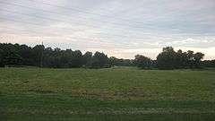
Ross Trails Adena Circle |
Upload image |
000000001975-10-10-0000October 10, 1975
(#75001339) |
Grounds of the former Ross Trails Girl Scout Camp[16]
|
Ross Township |
|
| 71 |
Rossville Historic District |
|
000000001975-10-06-0000October 6, 1975
(#75001332) |
Roughly bounded by B, E, Main, and Amberly Dr.
39°24′00″N 84°34′14″W / 39.4°N 84.570556°W / 39.4; -84.570556 (Rossville Historic District) |
Hamilton |
|
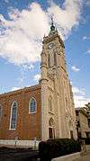
| 72 |
St. Stephen Church and Rectory |
|
000000001982-07-29-0000July 29, 1982
(#82003549) |
224 Dayton St.
39°24′07″N 84°33′36″W / 39.401944°N 84.56°W / 39.401944; -84.56 (St. Stephen Church and Rectory) |
Hamilton |
|
| 73 |
Peter Schrock Jr. Farm |
|
000000001984-11-01-0000November 1, 1984
(#84000210) |
Edgewood Dr.
39°28′39″N 84°28′14″W / 39.477500°N 84.470556°W / 39.477500; -84.470556 (Peter Schrock Jr. Farm) |
Trenton |
|
| 74 |
John Scott Barn and Granary |
|
000000002005-10-04-0000October 4, 2005
(#05001142) |
3681 Hamilton-New London Rd., east of Shandon
39°19′41″N 84°41′39″W / 39.328056°N 84.694167°W / 39.328056; -84.694167 (John Scott Barn and Granary) |
Ross Township |
|
| 75 |
Shaw Farm |
|
000000001974-07-24-0000July 24, 1974
(#74001405) |
3357 Cincinnati-Brookville Rd., west of Ross
39°18′25″N 84°40′22″W / 39.306944°N 84.672778°W / 39.306944; -84.672778 (Shaw Farm) |
Ross Township |
|
| 76 |
Sigma Alpha Epsilon Chapter House of Miami University |
|
000000002005-02-08-0000February 8, 2005
(#05000022) |
310 Tallawanda Rd.
39°30′51″N 84°44′06″W / 39.514167°N 84.735°W / 39.514167; -84.735 (Sigma Alpha Epsilon Chapter House of Miami University) |
Oxford |
|
| 77 |
Dan F. Snider Ford Dealership Building |
|
000000002014-12-11-0000December 11, 2014
(#14001050) |
101 N. Main St.
39°31′06″N 84°24′12″W / 39.518333°N 84.403333°W / 39.518333; -84.403333 (Dan F. Snider Ford Dealership Building) |
Middletown |
|
| 78 |
South Main Street District |
|
000000001978-03-21-0000March 21, 1978
(#78002015) |
S. Main St.
39°30′45″N 84°24′33″W / 39.5125°N 84.409167°W / 39.5125; -84.409167 (South Main Street District) |
Middletown |
|
| 79 |
Spread Eagle Tavern-James D. Conrey House |
|
000000002003-10-24-0000October 24, 2003
(#03001100) |
9797 Cincinnati-Columbus Rd., north of Cincinnati
39°18′30″N 84°23′05″W / 39.308333°N 84.384722°W / 39.308333; -84.384722 (Spread Eagle Tavern-James D. Conrey House) |
West Chester Township |
|
| 80 |
Symmes Mission Chapel |
|
000000001980-06-12-0000June 12, 1980
(#80002946) |
5139 Pleasant Ave.
39°20′22″N 84°33′37″W / 39.339444°N 84.560278°W / 39.339444; -84.560278 (Symmes Mission Chapel) |
Fairfield |
|
| 81 |
Thomas Select School |
|
000000001977-04-11-0000April 11, 1977
(#77001046) |
3637 Millville-Shandon Rd. at Shandon
39°19′41″N 84°42′53″W / 39.327917°N 84.714861°W / 39.327917; -84.714861 (Thomas Select School) |
Morgan Township |
|
| 82 |
John B. Tytus House |
|
000000001975-05-27-0000May 27, 1975
(#75001335) |
300 S. Main St.
39°30′47″N 84°23′49″W / 39.513056°N 84.396944°W / 39.513056; -84.396944 (John B. Tytus House) |
Middletown |
|
| 83 |
Union Township Works II |
|
000000001971-10-07-0000October 7, 1971
(#71000635) |
Southern side of Dimmick Rd. on the eastern side of Sharon Creek[9]:48
39°18′28″N 84°22′03″W / 39.307778°N 84.367500°W / 39.307778; -84.367500 (Union Township Works II) |
West Chester Township |
Near Pisgah
|
| 84 |
Unzicker-Cook House |
|
000000001974-07-24-0000July 24, 1974
(#74001404) |
2975 Oxford-Middletown Rd., northeast of Oxford
39°31′59″N 84°39′27″W / 39.533056°N 84.657500°W / 39.533056; -84.657500 (Unzicker-Cook House) |
Morgan Township |
|
| 85 |
John Vaughan House |
|
000000001975-05-29-0000May 29, 1975
(#75001340) |
3756 Hamilton-New London Rd. at Shandon
39°19′35″N 84°42′38″W / 39.326250°N 84.710556°W / 39.326250; -84.710556 (John Vaughan House) |
Morgan Township |
|
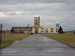
| 86 |
Voice of America Bethany Relay Station |
|
000000002006-11-28-0000November 28, 2006
(#06001081) |
8070 Tylersville Rd., north of West Chester
39°21′18″N 84°21′24″W / 39.355°N 84.356667°W / 39.355; -84.356667 (Voice of America Bethany Relay Station) |
West Chester Township |
|
| 87 |
Western Female Seminary |
|
000000001979-09-17-0000September 17, 1979
(#09000083) |
Junction of U.S. Route 27 and State Route 73, Western College, Miami University
39°30′14″N 84°43′36″W / 39.503889°N 84.726667°W / 39.503889; -84.726667 (Western Female Seminary) |
Oxford |
|
| 88 |
Williamson Mound Archeological District |
|
000000001975-05-29-0000May 29, 1975
(#75001334) |
East of U.S. Route 42 on the western edge of the Wetherington Golf and Country Club[9]:54
39°22′01″N 84°23′04″W / 39.366944°N 84.384444°W / 39.366944; -84.384444 (Williamson Mound Archeological District) |
West Chester Township |
|


.jpg)

