Westcliffe, Colorado
| Westcliffe, Colorado | |
|---|---|
| Town | |
|
Sangre de Cristo Range viewed from Westcliffe | |
 Location in Custer County and the state of Colorado | |
| Coordinates: 38°7′58″N 105°27′57″W / 38.13278°N 105.46583°WCoordinates: 38°7′58″N 105°27′57″W / 38.13278°N 105.46583°W | |
| Country |
|
| State |
|
| County[1] | Custer County - seat[2] |
| Incorporated | November 21, 1887[3] |
| Government | |
| • Type | Statutory Town[1] |
| • Mayor | Christy Patterson |
| Area | |
| • Total | 1.2 sq mi (3.2 km2) |
| • Land | 1.2 sq mi (3.2 km2) |
| • Water | 0 sq mi (0 km2) |
| Elevation[4] | 7,867 ft (2,398 m) |
| Population (2010) | |
| • Total | 568 |
| • Density | 455/sq mi (175.7/km2) |
| Time zone | Mountain (MST) (UTC-7) |
| • Summer (DST) | MDT (UTC-6) |
| ZIP code[5] | 81252 |
| Area code(s) | 719 |
| FIPS code | 08-83450 |
| GNIS feature ID | 0192151 |
| Website |
townofwestcliffe |

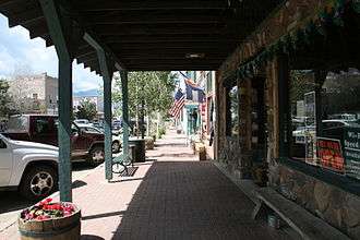
Westcliffe is a statutory town that is the county seat of Custer County, Colorado, United States.[6][2] At the 2010 U.S. Census, the population was 568,[7] up from 417 in 2000.
History
Westcliff had its start in 1881 when the Denver and Rio Grande Western Railroad was extended to that point.[8] The community was named after Westcliff-on-Sea, a town in England.[9]
Geography
Westcliffe is located west of the geographic center of Custer County at 38°7′58″N 105°27′57″W / 38.13278°N 105.46583°W (38.132874, -105.465920).[10] It lies in the Wet Mountain Valley, between the Wet Mountains to the east and the Sangre de Cristo Range to the west. The town of Silver Cliff is immediately to the east of Westcliffe.
According to the United States Census Bureau, the town has a total area of 1.2 square miles (3.2 km2), all of it land.[7]
Dark skies
Westcliffe, and neighboring Silver Cliff, Colorado are recognized as IDA International Dark Sky Communities by The International Dark-Sky Association. Gentle persuasion has resulted in residents and business in the towns and surrounding ranch land reducing the amount of light pollution.[11]
Demographics
| Historical population | |||
|---|---|---|---|
| Census | Pop. | %± | |
| 1890 | 192 | — | |
| 1900 | 256 | 33.3% | |
| 1910 | 232 | −9.4% | |
| 1920 | 338 | 45.7% | |
| 1930 | 335 | −0.9% | |
| 1940 | 429 | 28.1% | |
| 1950 | 390 | −9.1% | |
| 1960 | 306 | −21.5% | |
| 1970 | 243 | −20.6% | |
| 1980 | 324 | 33.3% | |
| 1990 | 312 | −3.7% | |
| 2000 | 417 | 33.7% | |
| 2010 | 568 | 36.2% | |
| Est. 2015 | 577 | [12] | 1.6% |
As of the census[14] of 2000, there were 417 people, 194 households, and 108 families residing in the town. The population density was 367.1 people per square mile (141.2/km²). There were 246 housing units at an average density of 216.6 per square mile (83.3/km²). The racial makeup of the town was 95.44% White, 1.92% Native American, 0.24% Asian, and 2.40% from two or more races. Hispanic or Latino of any race were 2.16% of the population.
There were 194 households out of which 23.2% had children under the age of 18 living with them, 46.9% were married couples living together, 6.2% had a female householder with no husband present, and 44.3% were non-families. 42.3% of all households were made up of individuals and 19.1% had someone living alone who was 65 years of age or older. The average household size was 2.11 and the average family size was 2.91.
In the town the population was spread out with 22.3% under the age of 18, 6.5% from 18 to 24, 23.3% from 25 to 44, 31.9% from 45 to 64, and 16.1% who were 65 years of age or older. The median age was 44 years. For every 100 females there were 93.1 males. For every 100 females age 18 and over, there were 98.8 males.
The median income for a household in the town was $23,125, and the median income for a family was $36,250. Males had a median income of $28,542 versus $18,750 for females. The per capita income for the town was $14,047. About 14.4% of families and 20.4% of the population were below the poverty line, including 29.5% of those under age 18 and 10.3% of those age 65 or over.
Notable people
- Adolph Treidler (1886 - 1981), artist, born in Westcliffe
See also
References
- 1 2 "Active Colorado Municipalities". State of Colorado, Department of Local Affairs. Retrieved 2007-09-01.
- 1 2 "Colorado County Seats". State of Colorado, Department of Public Health and Environment. Retrieved 2007-12-31.
- ↑ "Colorado Municipal Incorporations". State of Colorado, Department of Personnel & Administration, Colorado State Archives. 2004-12-01. Retrieved 2007-09-02.
- ↑ "US Board on Geographic Names". United States Geological Survey. 2007-10-25. Retrieved 2008-01-31.
- ↑ "ZIP Code Lookup" (JavaScript/HTML). United States Postal Service. Retrieved 2008-01-08.
- ↑ "Find a County". National Association of Counties. Retrieved 2011-06-07.
- 1 2 "Geographic Identifiers: 2010 Demographic Profile Data (G001): Westcliffe town, Colorado". U.S. Census Bureau, American Factfinder. Retrieved June 24, 2014.
- ↑ Fielder, John (2002). "John Fielder's Best of Colorado". Big Earth Publishing. p. 297. Retrieved 4 November 2013.
- ↑ Dawson, John Frank. Place names in Colorado: why 700 communities were so named, 150 of Spanish or Indian origin. Denver, CO: The J. Frank Dawson Publishing Co. p. 51.
- ↑ "US Gazetteer files: 2010, 2000, and 1990". United States Census Bureau. 2011-02-12. Retrieved 2011-04-23.
- ↑ Jack Healy (August 12, 2016). "Colorado Towns Work to Preserve a Diminishing Resource: Darkness". The New York Times. Retrieved August 13, 2016.
- ↑ "Annual Estimates of the Resident Population for Incorporated Places: April 1, 2010 to July 1, 2015". Retrieved July 2, 2016.
- ↑ "Census of Population and Housing". Census.gov. Retrieved June 4, 2015.
- ↑ "American FactFinder". United States Census Bureau. Retrieved 2008-01-31.
External links
| Wikimedia Commons has media related to Westcliffe, Colorado. |
Nonprofit cultural groups
- High Mountain Hay Fever Bluegrass Festival
- Wet Mountain Western Days
- Westcliffe Center for the Performing Arts
- Wet Mountain Valley Community Foundation
Media
Municipalities and communities of Custer County, Colorado, United States | ||
|---|---|---|
| Towns | 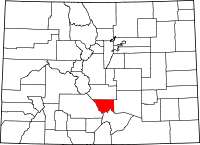 | |
| Unincorporated community | ||
| Ghost towns | ||
