West Knighton, Dorset
| West Knighton | |
 West Knighton |
|
 West Knighton |
|
| Population | 375 [1] |
|---|---|
| OS grid reference | SY733875 |
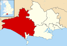
| District | West Dorset |
| Shire county | Dorset |
| Region | South West |
| Country | England |
| Sovereign state | United Kingdom |
| Police | Dorset |
| Fire | Dorset and Wiltshire |
| Ambulance | South Western |
| EU Parliament | South West England |
| UK Parliament | West Dorset |
Coordinates: 50°41′16″N 2°22′49″W / 50.6878°N 2.3803°W
West Knighton is a village and civil parish in south Dorset, England, situated 3 miles (4.8 km) southeast of the county town Dorchester. It has an 11th-century church and a village pub. In the 2011 census the civil parish had a population of 375.[1]
The village name derives from the Old English cniht and tūn, meaning the village or farmstead of the young men or retainers.[2] At Little Mayne Farm 0.5 miles (0.80 km) southwest of the village is the site of a deserted medieval village, which was recorded in the Domesday Book as Maine[3] and in 1201 was known as Parva Maene.[4]
West Knighton parish historically developed out of the amalgamation of four medieval settlements within the ancient hundred of Cullifordtree:[5] the existing main village, the previously mentioned Parva Maene, another medieval settlement at Friarmayne to the south—also deserted and now within neighbouring Broadmayne civil parish[6]—and the fourth at Lewell to the north (now just a farmhouse).[7]
References
- 1 2 "Area: West Knighton (Parish), Key Figures for 2011 Census: Key Statistics". Neighbourhood Statistics. Office for National Statistics. Retrieved 27 May 2014.
- ↑ David Mills, ed. (2011). A Dictionary of British Place Names. Oxford University Press. p. 281. ISBN 978-0-19-960908-6. Retrieved 27 May 2014.
- ↑ http://domesdaymap.co.uk/place/SY7286/mayne/ Open Domesday: Mayne
- ↑ West Dorset, Holiday and Tourist GUide. West Dorset District Council. c. 1982. p. 21.
- ↑ http://domesdaymap.co.uk/hundred/cullifordtree/ Open Domesday: Cullifordtree
- ↑ Ordnance Survey 1:25,000 map
- ↑ "'Knighton, West', An Inventory of the Historical Monuments in Dorset, Volume 2: South East (1970), pp. 135-140.". British History Online. University of London & History of Parliament Trust. November 2013. Retrieved 28 May 2014.
External links
| Wikimedia Commons has media related to West Knighton, Dorset. |