Rampisham
| Rampisham | |
 Cottages in Rampisham village |
|
 Rampisham |
|
| Population | 110 [1] |
|---|---|
| OS grid reference | ST562022 |
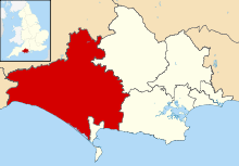
| District | West Dorset |
| Shire county | Dorset |
| Region | South West |
| Country | England |
| Sovereign state | United Kingdom |
| Police | Dorset |
| Fire | Dorset and Wiltshire |
| Ambulance | South Western |
| EU Parliament | South West England |
Coordinates: 50°49′07″N 2°37′26″W / 50.8186°N 2.6238°W

Rampisham (pronounced 'Ransom')[2] is a village and civil parish in the county of Dorset in southern England, situated in the West Dorset administrative district approximately 11 miles (18 km) northwest of the county town Dorchester. The village is sited on greensand in a valley surrounded by the chalk hills of the Dorset Downs. The parish includes the hamlet of Uphall northwest of the main village.
Dorset County Council's 2013 mid-year estimate for the population of Rampisham parish is 110.[1] The principal means of making a living is agricultural, mainly grain production.
History
In 1799 a Roman pavement was found about 1 mile (1.6 km) northnorthwest of the church; it measured approximately 14 feet (4.3 m) by 10 feet (3.0 m) and was well preserved, having a pattern of concentric rings and a floral decoration, but it was removed by treasure-hunters.[3]
In the Domesday Book in 1086 Rampisham was recorded as Ramesham.[4] It was in the hundred of Tollerford, had seventeen households and the tenant-in-chief was Bishop Odo of Bayeaux.[5]
Rampisham's parish church, dedicated to St Michael and All Saints, has a medieval south tower which was built in phases in the early 14th (1326) and 15th centuries.[3][6] The rest of the building was largely rebuilt in two bouts of Victorian restoration: first in 1845–7 and then in 1858–60.[2][3][6] Augustus Pugin was involved in the first restoration, designing a new east window and chancel.[6] He also built a school and rectory for the village, though both these are now private houses.[7] The second restoration involved an extension to the tower and a rebuilding of the nave; this was undertaken by John Hicks, possibly with assistance from a young Thomas Hardy.[6]
A quarter of a mile northnortheast of the church is the base and part of the shaft of a 15th-century wayside cross.[3]
Geography
Rampisham village is sited on greensand at an altitude of 125 to 145 metres (410 to 476 ft) in a tributary valley of the River Frome. It is surrounded by the chalk hills of the Dorset Downs, which rise to 224 metres (735 ft) at West Hill to the north.[8][9] Measured directly, the village is 8 miles (13 km) northeast of Bridport, 11 miles (18 km) northwest of Dorchester and 8.5 miles (13.7 km) south of Yeovil in Somerset.[10]
Communications station
In November 1939 the BBC acquired 189 acres (76 ha) of land on Rampisham Down, a hill southwest of the village. It became the location of one of the main transmitters of the BBC World Service in Europe until it was shut in 2011. There were 26 transmitter pylons on the down.
References
- 1 2 "Parish Population Data". Dorset County Council. 20 January 2015. Retrieved 7 March 2015.
- 1 2 Roland Gant (1980). Dorset Villages. Robert Hale Ltd. p. 102. ISBN 0 7091 8135 3.
- 1 2 3 4 "'Rampisham', An Inventory of the Historical Monuments in Dorset, Volume 1: West (1952), pp. 191-193". British History Online. University of London & History of Parliament Trust. November 2013. Retrieved 30 March 2014.
- ↑ "Dorset H–R". The Domesday Book Online. domesdaybook.co.uk. 1999–2013. Retrieved 5 April 2014.
- ↑ "Place: Rampisham". Open Domesday. domesdaymap.co.uk. Retrieved 5 April 2014.
- 1 2 3 4 "Rampisham". Dorset OPC Project. Retrieved 31 March 2014.
- ↑ Steve White; Clive Hannay (November 2009). "In the footsteps of Treves — The Tollers, Wynford Eagle, Rampisham and Evershot". Dorset Life Magazine. Retrieved 31 March 2014.
- ↑ Ralph Wightman (1983). Portrait of Dorset (4 ed.). Robert Hale Ltd. pp. 16, 95. ISBN 0 7090 0844 9.
- ↑ Ordnance Survey 1:25,000 Pathfinder Series, Sheet ST 40/50 Crewkerne & Beaminster, published 1984
- ↑ Bartholomew 1:100,000 National Map Series, Sheet 4 Dorset, published by John Bartholomew & Son Ltd, 1980. ISBN 0 7028 0327 8
External links
| Wikimedia Commons has media related to Rampisham. |
- mb21 - BBCWS Transmitter Site
- Image of Merlin - BBCWS Relay Station Signage - http://tx.mb21.co.uk/gallery/rampisham/rampisham-mc-04.jpg