Alton Pancras
| Alton Pancras | |
 Alton Pancras parish church |
|
 Alton Pancras |
|
| Population | 175 [1] |
|---|---|
| OS grid reference | ST699022 |
| – London | 130 miles (209 km) |
| Civil parish | Alton Pancras |
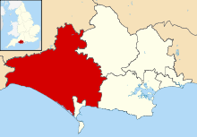
| District | West Dorset |
| Shire county | Dorset |
| Region | South West |
| Country | England |
| Sovereign state | United Kingdom |
| Post town | DORCHESTER |
| Postcode district | DT2 |
| Dialling code | 01300 |
| Police | Dorset |
| Fire | Dorset and Wiltshire |
| Ambulance | South Western |
| EU Parliament | South West England |
| UK Parliament | West Dorset |
Coordinates: 50°49′15″N 2°25′40″W / 50.8207°N 2.4278°W

Alton Pancras is a small village and civil parish in the West Dorset district of Dorset, England. In the 2011 census the civil parish had a population of 175.
The village church is dedicated to Saint Pancras, which provides part of the village name. The parish was formerly a liberty, containing only the parish itself.[2]
History
Evidence of prehistoric human activity within the parish includes two round barrows on the hills to the east of the village (one on West Hill and one on Church Hill), the remains of 'Celtic' fields and strip lynchets on many of the surrounding hills, and a possible settlement just south of the summit of Church Hill. Dating is not definite but the 'Celtic' fields were probably in use between the Bronze Age and the end of the Romano-British period. The possible settlement is probably Romano-British. Subsequent cultivation, particularly in modern times, has destroyed much of the evidence.[3][4]
The village itself was likely first settled by Saxons during the expansion of the Kingdom of Wessex. The name of the village was then Awultune, meaning in West Saxon 'village at the source of the river' (the River Piddle).[5] The village was previously two separate settlements: Barcombe and Alton, both of which had their own open field system.[3] In 1086 in the Domesday Book the village was recorded as Altone. It had 26 households, was in Cerne, Totcombe and Modbury Hundred, and the tenant-in-chief was the Bishop of Salisbury.[6][7] After conversion to Christianity, the village name incorporated the little-known St Pancras and by the time of the Battle of Agincourt was known as Aulton Pancras.[8]
The current church was restored in the 19th century after an earlier Norman church was near collapse. All that remains of the old church is the 15th century tower and a Norman arch. The church organ used to be a fairground organ. The floor tiles were created by Poole Pottery.
Governance
Alton Pancras is in the West Dorset parliamentary constituency which is currently represented in the UK national parliament by the Conservative Member of Parliament Oliver Letwin. In local government, Alton Pancras is governed by Dorset County Council at the county level and West Dorset District Council at the district level.
In national parliament and district council elections, West Dorset is divided into 24 electoral wards, with Alton Pancras being within Piddle Valley ward.[9][10][11] In district council elections these 24 wards elect 42 councillors to West Dorset District Council, with Piddle Valley ward electing one of these. The Conservative Party currently has overall control of the district council.[12] In county council elections, Alton Pancras is in the Three Valleys electoral division, one of 42 divisions that elect councillors to Dorset County Council.[13]
At the parish level – the lowest tier of local government – Alton Pancras is one of three parishes governed by Piddle Valley Group Parish Council. The other parishes are Piddlehinton and Piddletrenthide.[14]

Geography
Alton Pancras civil parish covers 920 hectares (2,280 acres) at the head of the valley of the River Piddle.[3] The valley is on the dip slope of the Dorset Downs and drains from north to south. Several small side combes extend east and west. In the east the parish includes part of a tributary valley at Watcombe Bottom, north of Plush, and in the northeast it extends north of the escarpment to Alton Common in the Blackmore Vale.[15] The underlying geology of the parish is mostly chalk, except for the Alton Common extension, which is on greensand, gault and Kimmeridge clay.[3] Alton Pancras village is sited in the valley near the source of the River Piddle at an altitude of about 125 metres (410 ft). The altitude of the parish is between about 255 metres (837 ft) at its highest point on the hills to the west, to about 110 metres (360 ft) at its lowest point where the river leaves the parish in the south.[15] The broadcaster and agriculturist Ralph Wightman, who was born and lived in the nearby village of Piddletrenthide, described the hills surrounding the village as "very much in the centre of Dorset".[16] All of Alton Pancras parish is within the Dorset Area of Outstanding Natural Beauty.[17] Horse Close Wood on Alton Common is a Woodland Trust wood, though it is not open to the public.[15][18]
Alton Pancras village is situated on the B3143 road, which connects it to the county town of Dorchester 9 miles (14 km) to the south. Other local travel links include Maiden Newton railway station 7 miles (11 km) to the south-west, and Bournemouth International Airport 26 miles (42 km) to the east.
Demography
In the 2011 census Alton Pancras civil parish had 72 dwellings,[19] 71 households and a population of 175.[1] The average age of parish residents was 42, compared to 39.3 for England as a whole. 16.0% of residents were age 65 or over, compared to 16.4% for England as a whole.[20]
References
- 1 2 "Area: Alton Pancras (Parish), Key Figures for 2011 Census: Key Statistics". Neighbourhood Statistics. Office for National Statistics. Retrieved 7 January 2014.
- ↑ The Parliamentary Gazetteer of England and Wales. 1840. p. 36. Retrieved 28 March 2015.
- 1 2 3 4 "'Alton Pancras', in An Inventory of the Historical Monuments in Dorset, Volume 3, Central (London, 1970), pp. 1–4". British History Online. University of London. Retrieved 26 March 2015.
- ↑ "'Celtic' Field Groups', in An Inventory of the Historical Monuments in Dorset, Volume 3, Central (London, 1970), pp. 318–346". British History Online. University of London. Retrieved 27 March 2015.
- ↑ Meaning of Alton
- ↑ "Dorset A-G". The Domesday Book Online. domesdaybook.co.uk. Retrieved 10 February 2015.
- ↑ "Place: Alton [Pancras]". Open Domesday. opendomesday.org. Retrieved 10 February 2015.
- ↑ Various names of Alton Pancras through the ages
- ↑ "The West Dorset (Electoral Changes) Order 2015". legislation.gov.uk. Retrieved 30 September 2015.
- ↑ "Dorset West: Seat, Ward and Prediction Details". electoralcalculus.co.uk. Retrieved 30 September 2015.
- ↑ "Interactive map of District councillors". dorsetforyou.com. Dorset County Council. Retrieved 30 September 2015.
- ↑ "West Dorset district councillors". dorsetforyou.com. Dorset County Council. 15 June 2015. Retrieved 30 September 2015.
- ↑ "Electoral division profiles 2013". dorsetforyou.com. Dorset County Council. Retrieved 26 March 2015.
- ↑ "Piddle Valley Grouped Parish Council". dorsetforyou.com. Dorset County Council. 11 November 2014. Retrieved 26 March 2015.
- 1 2 3 Ordnance Survey (1986), 1:25,000 Pathfinder map series, sheet 1299 (ST 60/70) (Cerne Abbas & Hazelbury Bryan), ISBN 0-319-21299-8
- ↑ Ralph Wightman (1983). Portrait of Dorset (4 ed.). Robert Hale Ltd. p. 106. ISBN 0 7090 0844 9.
- ↑ "Dorset Explorer". Natural England. Retrieved 28 March 2015.
- ↑ "Horse Close Wood". Woodland Trust. Retrieved 28 March 2015.
- ↑ "Area: Alton Pancras (Parish). Dwellings, Household Spaces and Accommodation Type, 2011 (KS401EW)". Neighbourhood Statistics. Office for National Statistics. Retrieved 10 February 2015.
- ↑ "Area: Alton Pancras (Parish). Age Structure, 2011 (KS102EW)". Neighbourhood Statistics. Office for National Statistics. 30 January 2013. Retrieved 27 March 2015.
External links
| Wikimedia Commons has media related to Alton Pancras. |