Beer Hackett
| Beer Hackett | |
 Church Farm, Beer Hackett |
|
 Beer Hackett |
|
| Population | 100 [1] |
|---|---|
| OS grid reference | ST600118 |
| District | West Dorset |
| Shire county | Dorset |
| Region | South West |
| Country | England |
| Sovereign state | United Kingdom |
| Police | Dorset |
| Fire | Dorset and Wiltshire |
| Ambulance | South Western |
| EU Parliament | South West England |
| UK Parliament | West Dorset |
Coordinates: 50°54′16″N 2°34′17″W / 50.9044°N 2.5714°W
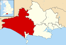
Beer Hackett is a small village and civil parish in west Dorset, England, situated 3 miles (4.8 km) southwest of Sherborne and 5 miles (8.0 km) southeast of Yeovil. The civil parish includes the small settlement of Knighton to the east. Dorset County Council's 2013 mid-year estimate of the population of the civil parish is 100.[1]
Beer Hackett was not recorded in the Domesday Book of 1086.[2] The nave and west tower of the parish church were originally built in the early 15th century, though the whole building was radically restored in the 19th century.[3]
Notes
- 1 2 "Parish Population Data". Dorset County Council. 20 January 2015. Retrieved 18 February 2015.
- ↑ Darby, H; Versey, G (2008). Domesday Gazetteer. Cambridge University Press. p. 116. Retrieved 18 February 2015.
- ↑ "'Beer Hackett', in An Inventory of the Historical Monuments in Dorset, Volume 1, West (London, 1952), pp. 27-28". British History Online. University of London. Retrieved 18 February 2015.
External links
![]() Media related to Beer Hackett at Wikimedia Commons
Media related to Beer Hackett at Wikimedia Commons
This article is issued from Wikipedia - version of the 2/18/2015. The text is available under the Creative Commons Attribution/Share Alike but additional terms may apply for the media files.