Union Grove, Alabama
| Union Grove, Alabama | |
|---|---|
| Town | |
 Location in Marshall County and the state of Alabama | |
| Coordinates: 34°24′0″N 86°26′46″W / 34.40000°N 86.44611°W | |
| Country | United States |
| State | Alabama |
| County | Marshall |
| Area | |
| • Total | 0.6 sq mi (1.5 km2) |
| • Land | 0.6 sq mi (1.5 km2) |
| • Water | 0 sq mi (0 km2) |
| Elevation | 1,027 ft (313 m) |
| Population (2010) | |
| • Total | 77 |
| • Density | 130/sq mi (51/km2) |
| Time zone | Central (CST) (UTC-6) |
| • Summer (DST) | CDT (UTC-5) |
| ZIP code | 35175 |
| Area code(s) | 256 |
| FIPS code | 01-77784 |
| GNIS feature ID | 0128307 |
Union Grove is a town in Marshall County, Alabama, United States, and is included in the Huntsville-Decatur Combined Statistical Area. Union Grove is located approximately 3 miles (5 km) from Guntersville Lake and 6 miles (10 km) from Arab. Electricity service in Union Grove is provided through Arab Electric Cooperative, which comes through the Tennessee Valley Authority. As of the 2010 census, the population of the town was 77.[1]
Geography
Union Grove is located at 34°24′0″N 86°26′46″W / 34.40000°N 86.44611°W (34.400088, -86.446049).[2]
According to the U.S. Census Bureau, the town has a total area of 0.6 square miles (1.6 km2), all land.
Demographics
| Historical population | |||
|---|---|---|---|
| Census | Pop. | %± | |
| 1970 | 118 | — | |
| 1980 | 127 | 7.6% | |
| 1990 | 119 | −6.3% | |
| 2000 | 94 | −21.0% | |
| 2010 | 77 | −18.1% | |
| Est. 2015 | 79 | [3] | 2.6% |
| U.S. Decennial Census[4] 2013 Estimate[5] | |||
As of the census[6] of 2000, there were 94 people, 38 households, and 28 families residing in the town. The population density was 165.5 people per square mile (63.7/km²). There were 41 housing units at an average density of 72.2 per square mile (27.8/km²). The racial makeup of the town was 97.87% White, 1.06% Native American and 1.06% Asian.
There were 38 households out of which 31.6% had children under the age of 18 living with them, 60.5% were married couples living together, 7.9% had a female householder with no husband present, and 26.3% were non-families. 21.1% of all households were made up of individuals and 13.2% had someone living alone who was 65 years of age or older. The average household size was 2.47 and the average family size was 2.89.
In the town the population was spread out with 21.3% under the age of 18, 6.4% from 18 to 24, 30.9% from 25 to 44, 22.3% from 45 to 64, and 19.1% who were 65 years of age or older. The median age was 41 years. For every 100 females there were 108.9 males. For every 100 females age 18 and over, there were 100.0 males.
The median income for a household in the town was $36,250, and the median income for a family was $36,250. Males had a median income of $32,292 versus $19,375 for females. The per capita income for the town was $15,467. There were 15.4% of families and 9.8% of the population living below the poverty line, including no under eighteens and 20.0% of those over 64.
Education
Union Grove is served by the Marshall County School System. Most of its school age children go to Brindlee Mountain Primary from kindergarten through the 2nd grade, Brindlee Mountain Elementary from the 3rd through the 5th grade, then Brindlee Mountain Middle School from 6th to 8th and the Brindlee Mountain High School from the 9th through 12th grades.
In the Civil War the Union troops camped there for some time after passing through Parches Cove. It became known thereafter as Union Grove.
Notable People
Lindsey Dukeminier (feminist)
References
- ↑ "Profile of General Population and Housing Characteristics: 2010 Demographic Profile Data (DP-1): Union Grove town, Alabama". U.S. Census Bureau, American Factfinder. Retrieved June 5, 2012.
- ↑ "US Gazetteer files: 2010, 2000, and 1990". United States Census Bureau. 2011-02-12. Retrieved 2011-04-23.
- ↑ "Annual Estimates of the Resident Population for Incorporated Places: April 1, 2010 to July 1, 2015". Retrieved July 2, 2016.
- ↑ "U.S. Decennial Census". Census.gov. Retrieved June 6, 2013.
- ↑ "Annual Estimates of the Resident Population: April 1, 2010 to July 1, 2013". Retrieved June 3, 2014.
- ↑ "American FactFinder". United States Census Bureau. Retrieved 2008-01-31.
Coordinates: 34°24′00″N 86°26′46″W / 34.400088°N 86.446049°W
Municipalities and communities of Marshall County, Alabama, United States | ||
|---|---|---|
| Cities | 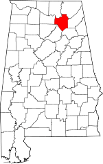 | |
| Towns | ||
| CDPs | ||
| Unincorporated communities | ||
| Ghost town | ||
| Footnotes | ‡This populated place also has portions in an adjacent county or counties | |