Hartselle, Alabama
| Hartselle | |
|---|---|
| City | |
|
The Hartselle Downtown Commercial Historic District was added to the National Register of Historic Places on April 22, 1999. | |
| Nickname(s): The City of Southern Hospitality | |
 Location of Hartselle, Alabama | |
| Coordinates: 34°26′25″N 86°56′25″W / 34.44028°N 86.94028°W | |
| Country | United States |
| State | Alabama |
| County | Morgan |
| Established | 1870 |
| Government | |
| • Mayor | Randy Garrison |
| Area | |
| • City | 14.9 sq mi (38.5 km2) |
| • Land | 14.9 sq mi (38.5 km2) |
| • Water | 0.0 sq mi (0.0 km2) 0.07% |
| • Urban | 1 sq mi (3 km2) |
| Elevation | 676 ft (206 m) |
| Population (2010) | |
| • City | 14,255 |
| • Density | 809/sq mi (312.3/km2) |
| Time zone | CST (UTC-6) |
| • Summer (DST) | CDT (UTC-5) |
| ZIP code | 35640 |
| Area code(s) | 256 |
| FIPS code | 01-33448 |
| GNIS feature ID | 0151802 |
| Website | www.hartselle.org |

Hartselle is the second largest city in Morgan County, Alabama, United States, about 10 miles (16 km) south of Decatur, and is included in the Decatur Metropolitan Area, and the Huntsville-Decatur Combined Statistical Area.
As of the 2010 U.S. Census, the population of the city was 14,255. Hartselle was founded in 1870 with the arrival of the South and North Alabama Railroad. It takes its name from George Hartsell, one of the railroad's owners. The post office opened in 1873. It was formally incorporated on March 1, 1875.[1] Most of the oldest buildings were destroyed by a disastrous fire in 1916.
Geography
Hartselle is located at 34°26′25″N 86°56′25″W / 34.44028°N 86.94028°WCoordinates: 34°26′25″N 86°56′25″W / 34.44028°N 86.94028°W (34.440383, -86.940385).[2]
According to the U.S. Census Bureau, the city has a total area of 14.9 square miles (39 km2), of which 14.9 square miles (39 km2) is land and 0.07% is water.
Demographics
| Historical population | |||
|---|---|---|---|
| Census | Pop. | %± | |
| 1880 | 226 | — | |
| 1890 | 596 | 163.7% | |
| 1900 | 670 | 12.4% | |
| 1910 | 1,374 | 105.1% | |
| 1920 | 2,009 | 46.2% | |
| 1930 | 2,204 | 9.7% | |
| 1940 | 2,584 | 17.2% | |
| 1950 | 3,429 | 32.7% | |
| 1960 | 5,000 | 45.8% | |
| 1970 | 7,355 | 47.1% | |
| 1980 | 8,858 | 20.4% | |
| 1990 | 10,795 | 21.9% | |
| 2000 | 12,019 | 11.3% | |
| 2010 | 14,255 | 18.6% | |
| Est. 2015 | 14,493 | [3] | 1.7% |
| U.S. Decennial Census[4] 2013 Estimate[5] | |||
As of the census[6] of 2000, there were 12,019 people, 4,816 households, and 3,534 families residing in the city. The population density was 809.0 people per square mile (312.3/km²). There were 5,170 housing units at an average density of 348.0 per square mile (134.3/km²). The racial makeup of the city was 92.25% White, 5.16% Black or African American, 0.63% Native American, 0.31% Asian, 0.02% Pacific Islander, 0.33% from other races, and 1.31% from two or more races. 1.29% of the population were Hispanic or Latino of any race.
There were 4,816 households out of which 35.4% had children under the age of 18 living with them, 59.1% were married couples living together, 10.9% had a female householder with no husband present, and 26.6% were non-families. 24.4% of all households were made up of individuals and 11.2% had someone living alone who was 65 years of age or older. The average household size was 2.49 and the average family size was 2.97.
In the city the population was spread out with 25.5% under the age of 18, 7.7% from 18 to 24, 29.3% from 25 to 44, 23.5% from 45 to 64, and 14.0% who were 65 years of age or older. The median age was 37 years. For every 100 females there were 92.3 males. For every 100 females age 18 and over, there were 88.8 males.
The median income for a household in the city was $40,461, and the median income for a family was $47,685. Males had a median income of $40,211 versus $24,124 for females. The per capita income for the city was $20,727. About 6.6% of families and 8.6% of the population were below the poverty line, including 8.8% of those under age 18 and 11.9% of those age 65 or over.
2010 census
As of the census[7] of 2010, there were 14,255 people, 5,678 households, and 4,128 families residing in the city. The population density was 956.7 people per square mile (370.3/km²). There were 6,076 housing units at an average density of 407.8 per square mile (157.8/km²). The racial makeup of the city was 91.5% White, 4.3% Black or African American, 0.8% Native American, 0.4% Asian, 0.0% Pacific Islander, 1.3% from other races, and 1.7% from two or more races. 2.5% of the population were Hispanic or Latino of any race.
There were 5,678 households out of which 33.7% had children under the age of 18 living with them, 57.2% were married couples living together, 11.2% had a female householder with no husband present, and 27.3% were non-families. 24.4% of all households were made up of individuals and 10.7% had someone living alone who was 65 years of age or older. The average household size was 2.51 and the average family size was 2.97.
In the city the population was spread out with 25.4% under the age of 18, 7.5% from 18 to 24, 26.2% from 25 to 44, 26.8% from 45 to 64, and 14.2% who were 65 years of age or older. The median age was 38.7 years. For every 100 females there were 93.2 males. For every 100 females age 18 and over, there were 93.7 males.
The median income for a household in the city was $47,306, and the median income for a family was $57,585. Males had a median income of $47,343 versus $28,855 for females. The per capita income for the city was $21,746. About 9.4% of families and 11.7% of the population were below the poverty line, including 12.8% of those under age 18 and 14.9% of those age 65 or over.
Notable people
- Jay Burleson, filmmaker
- Randy Campbell, former Auburn University quarterback and assistant coach
- Anna Craig, American country singer
- Lane Hughes, actor and musician
- William Bradford Huie, journalist, editor, publisher and author
- Don Logan, former chairman of Time Warner Media and Communications Group, owner Bass Anglers Sportsman Society
- Mortal Treason, Christian metal band
- Tommy Neill, former Major League Baseball player
- Vickie Orr, former member of the United States women's national basketball team
- Tommy Ed Roberts, Alabama businessman and legislator
- John Sparkman, United States Congressman, Senator, and Vice-Presidential Nominee
- Bud Stallworth, former NBA player
- Steve Woodard, former MLB player
- Gary Chandler, semi-pro golfer
- Jill Alper, electoral strategist
- Wilford S. Bailey, former NCAA president and former Auburn University president
- Scott Beason, member of the Alabama Senate from 2006 to 2014
References
- ↑ https://books.google.com/books?id=FqoikVyYs4wC&pg=PA259&lpg=PA259&dq=%22flint%22+%22morgan+county%22+%22incorporated%22&source=bl&ots=aQ-3rSX-Ns&sig=59xtYC5xTolnNJWj7NUlRZOJg4U&hl=en&sa=X&ved=0ahUKEwjy-6_Nn43LAhUMwiYKHUnaDfkQ6AEITDAJ#v=onepage&q=%22flint%22%20%22morgan%20county%22%20%22incorporated%22&f=false
- ↑ "US Gazetteer files: 2010, 2000, and 1990". United States Census Bureau. 2011-02-12. Retrieved 2011-04-23.
- ↑ "Annual Estimates of the Resident Population for Incorporated Places: April 1, 2010 to July 1, 2015". Retrieved July 2, 2016.
- ↑ "U.S. Decennial Census". Census.gov. Retrieved June 6, 2013.
- ↑ "Annual Estimates of the Resident Population: April 1, 2010 to July 1, 2013". Retrieved June 3, 2014.
- ↑ "American FactFinder". United States Census Bureau. Retrieved 2008-01-31.
- ↑ "American FactFinder". United States Census Bureau. Retrieved 2015-08-05.
External links
Municipalities and communities of Morgan County, Alabama, United States | ||
|---|---|---|
| Cities | 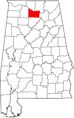 | |
| Towns | ||
| Unincorporated communities | ||
| Ghost town | ||
| Footnotes | ‡This populated place also has portions in an adjacent county or counties | |