Moulton Heights, Alabama
| Moulton Heights, Alabama | |
|---|---|
| Unincorporated community | |
 Moulton Heights, Alabama Location in Alabama. | |
| Coordinates: 34°35′50″N 87°00′52″W / 34.59722°N 87.01444°W | |
| Country | United States |
| State | Alabama |
| County | Morgan |
| Elevation | 614 ft (187 m) |
| Time zone | Central (CST) (UTC-6) |
| • Summer (DST) | CDT (UTC-5) |
| Area code(s) | 256 |
| GNIS feature ID | 123135[1] |
Moulton Heights is an unincorporated community suburb of Decatur in Morgan County, Alabama, United States, and is included in the Huntsville-Decatur Combined Statistical Area, as well as the Decatur Metropolitan Area. Moulton Heights is surrounded by the city of Decatur, Alabama, and The Beltline (Alabama 67).
Moulton Heights is bordered to the West by Beltline Road (a bypass built and owned by the City of Decatur), and the North, East, and South by the City of Decatur. Certain zoning ordinances put in place by Decatur stall the process of Decatur absorbing Moulton Heights, because of the proximity between industries, residential areas, businesses, and schools.
See also
References
Municipalities and communities of Morgan County, Alabama, United States | ||
|---|---|---|
| Cities | 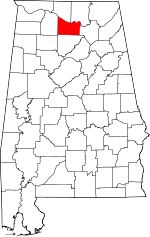 | |
| Towns | ||
| Unincorporated communities | ||
| Ghost town | ||
| Footnotes | ‡This populated place also has portions in an adjacent county or counties | |
This article is issued from Wikipedia - version of the 11/29/2015. The text is available under the Creative Commons Attribution/Share Alike but additional terms may apply for the media files.