Hillsboro, Alabama
| Hillsboro, Alabama | |
|---|---|
| Town | |
 Location in Lawrence County and the state of Alabama | |
| Coordinates: 34°38′17″N 87°11′18″W / 34.63806°N 87.18833°W | |
| Country | United States |
| State | Alabama |
| County | Lawrence |
| Area | |
| • Total | 1.9 sq mi (5 km2) |
| • Land | 1.9 sq mi (5 km2) |
| • Water | 0 sq mi (0 km2) |
| Elevation | 597 ft (182 m) |
| Population (2010) | |
| • Total | 552 |
| • Density | 320/sq mi (121.6/km2) |
| Time zone | Central (CST) (UTC-6) |
| • Summer (DST) | CDT (UTC-5) |
| ZIP code | 35643 |
| Area code(s) | 256 |
| FIPS code | 01-34816 |
| GNIS feature ID | 0120137 |
Hillsboro is a town in Lawrence County, Alabama, and is included in the Decatur Metropolitan Area, as well as the Huntsville-Decatur Combined Statistical Area. It was incorporated in 1899.[1] As of the 2010 census, the population of the town is 552, down from its record high of 608 in 2000. Along with North Courtland, it is one of two majority black communities in Lawrence County out of its six populated communities as of 2010.[2]
Geography
Hillsboro is located at 34°38′17″N 87°11′18″W / 34.63806°N 87.18833°W (34.638029, -87.188287).[3]
According to the U.S. Census Bureau, the town has a total area of 1.9 square miles (4.9 km2), all land.
Demographics
| Historical population | |||
|---|---|---|---|
| Census | Pop. | %± | |
| 1880 | 218 | — | |
| 1900 | 256 | — | |
| 1910 | 202 | −21.1% | |
| 1920 | 248 | 22.8% | |
| 1930 | 240 | −3.2% | |
| 1940 | 292 | 21.7% | |
| 1950 | 257 | −12.0% | |
| 1960 | 218 | −15.2% | |
| 1970 | 222 | 1.8% | |
| 1980 | 278 | 25.2% | |
| 1990 | 587 | 111.2% | |
| 2000 | 608 | 3.6% | |
| 2010 | 552 | −9.2% | |
| Est. 2015 | 519 | [4] | −6.0% |
| U.S. Decennial Census[5] 2013 Estimate[6] | |||
As of the census[7] of 2000, there were 608 people, 221 households, and 169 families residing in the town. The population density was 317.2 people per square mile (122.3/km²). There were 249 housing units at an average density of 129.9 per square mile (50.1/km²). The racial makeup of the town was 14.64% White, 82.24% Black or African American, 1.81% Native American, 0.16% from other races, and 1.15% from two or more races. 0.99% of the population were Hispanic or Latino of any race.
There were 221 households out of which 34.8% had children under the age of 18 living with them, 50.2% were married couples living together, 23.1% had a female householder with no husband present, and 23.1% were non-families. 21.7% of all households were made up of individuals and 9.0% had someone living alone who was 65 years of age or older. The average household size was 2.75 and the average family size was 3.22.
In the town the population was spread out with 27.0% under the age of 18, 8.1% from 18 to 24, 31.7% from 25 to 44, 23.2% from 45 to 64, and 10.0% who were 65 years of age or older. The median age was 35 years. For every 100 females there were 83.1 males. For every 100 females age 18 and over, there were 76.2 males.
The median income for a household in the town was $40,714, and the median income for a family was $52,000. Males had a median income of $26,979 versus $22,083 for females. The per capita income for the town was $14,457. About 3.9% of families and 7.4% of the population were below the poverty line, including 5.9% of those under age 18 and 22.9% of those age 65 or over.
Notable person
- Rudolph M. Clay, former mayor of Gary, Indiana and member of the Indiana Senate[8]
References
- ↑ http://www.encyclopediaofalabama.org/article/h-3471
- ↑ 2000 & 2010 U.S. Census figures on Lawrence County, Alabama Communities
- ↑ "US Gazetteer files: 2010, 2000, and 1990". United States Census Bureau. 2011-02-12. Retrieved 2011-04-23.
- ↑ "Annual Estimates of the Resident Population for Incorporated Places: April 1, 2010 to July 1, 2015". Retrieved July 2, 2016.
- ↑ "U.S. Decennial Census". Census.gov. Archived from the original on May 11, 2015. Retrieved June 6, 2013.
- ↑ "Annual Estimates of the Resident Population: April 1, 2010 to July 1, 2013". Retrieved June 3, 2014.
- ↑ "American FactFinder". United States Census Bureau. Retrieved 2008-01-31.
- ↑ Bill Dolan (2013-06-12). "Rudy Clay laid to rest with honors : Gary Community News". Nwitimes.com. Retrieved 2014-06-12.
Coordinates: 34°38′17″N 87°11′18″W / 34.638029°N 87.188287°W
Municipalities and communities of Lawrence County, Alabama, United States | ||
|---|---|---|
| City | 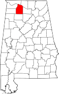 | |
| Towns | ||
| CDP | ||
| Unincorporated communities | ||