Trinity, Alabama
| Trinity, Alabama | |
|---|---|
| Town | |
 Location in Morgan County and the state of Alabama | |
| Coordinates: 34°36′14″N 87°5′10″W / 34.60389°N 87.08611°WCoordinates: 34°36′14″N 87°5′10″W / 34.60389°N 87.08611°W | |
| Country | United States |
| State | Alabama |
| County | Morgan |
| Area | |
| • Total | 3.6 sq mi (9.4 km2) |
| • Land | 3.6 sq mi (9.4 km2) |
| • Water | 0 sq mi (0 km2) |
| Elevation | 640 ft (195 m) |
| Population (2010) | |
| • Total | 2,095 |
| • Density | 511.4/sq mi (195.9/km2) |
| Time zone | Central (CST) (UTC-6) |
| • Summer (DST) | CDT (UTC-5) |
| ZIP code | 35673 |
| Area code(s) | 256 |
| FIPS code | 01-76872 |
| GNIS feature ID | 0158095 |
Trinity is a town in Morgan County, Alabama, United States and is included in the Decatur Metropolitan Area, as well as the Huntsville-Decatur Combined Statistical Area. As of the 2010 census, the population of the town was 2,095, up from 1,841 in 2000. It was incorporated in 1901.[1]
Demographics
| Historical population | |||
|---|---|---|---|
| Census | Pop. | %± | |
| 1880 | 142 | — | |
| 1900 | 191 | — | |
| 1910 | 198 | 3.7% | |
| 1920 | 243 | 22.7% | |
| 1930 | 208 | −14.4% | |
| 1940 | 249 | 19.7% | |
| 1950 | 342 | 37.3% | |
| 1960 | 454 | 32.7% | |
| 1970 | 881 | 94.1% | |
| 1980 | 1,328 | 50.7% | |
| 1990 | 1,380 | 3.9% | |
| 2000 | 1,841 | 33.4% | |
| 2010 | 2,095 | 13.8% | |
| Est. 2015 | 2,157 | [2] | 3.0% |
| U.S. Decennial Census[3] 2013 Estimate[4] | |||
As of the census[5] of 2000, there were 1,841 people, 691 households, and 563 families residing in the town. The population density was 508.5 people per square mile (196.4/km²). There were 728 housing units at an average density of 201.1 per square mile (77.6/km²). The racial makeup of the town was 88.00% White, 9.61% Black or African American, 1.25% Native American, 0.11% Asian, 0.16% from other races, and 0.87% from two or more races. 1.14% of the population were Hispanic or Latino of any race.
There were 691 households out of which 38.4% had children under the age of 18 living with them, 69.9% were married couples living together, 8.5% had a female householder with no husband present, and 18.4% were non-families. 16.2% of all households were made up of individuals and 6.5% had someone living alone who was 65 years of age or older. The average household size was 2.65 and the average family size was 2.96.
In the town the population was spread out with 25.7% under the age of 18, 6.1% from 18 to 24, 31.2% from 25 to 44, 26.1% from 45 to 64, and 10.8% who were 65 years of age or older. The median age was 38 years. For every 100 females there were 94.6 males. For every 100 females age 18 and over, there were 91.1 males.
The median income for a household in the town was $54,271, and the median income for a family was $60,139. Males had a median income of $43,393 versus $27,552 for females. The per capita income for the town was $21,467. About 4.6% of families and 6.0% of the population were below the poverty line, including 7.7% of those under age 18 and 5.8% of those age 65 or over.
2010 census
As of the census[6] of 2010, there were 2,095 people, 783 households, and 647 families residing in the town. The population density was 581.9 people per square mile (221.84/km²). There were 823 housing units at an average density of 228.6 per square mile (87.6/km²). The racial makeup of the town was 88.6% White, 6.7% Black or African American, 1.1% Native American, 0.2% Asian, 1.7% from other races, and 1.6% from two or more races. 3.3% of the population were Hispanic or Latino of any race.
There were 783 households out of which 35.8% had children under the age of 18 living with them, 71.9% were married couples living together, 6.9% had a female householder with no husband present, and 17.4% were non-families. 14.6% of all households were made up of individuals and 5.4% had someone living alone who was 65 years of age or older. The average household size was 2.68 and the average family size was 2.95.
In the town the population was spread out with 25.8% under the age of 18, 6.0% from 18 to 24, 26.2% from 25 to 44, 29.5% from 45 to 64, and 12.6% who were 65 years of age or older. The median age was 40.3 years. For every 100 females there were 100.7 males. For every 100 females age 18 and over, there were 101.9 males.
The median income for a household in the town was $61,060, and the median income for a family was $71,818. Males had a median income of $54,250 versus $34,205 for females. The per capita income for the town was $28,628. About .9% of families and 2.7% of the population were below the poverty line, including 1.7% of those under age 18 and 3.7% of those age 65 or over.
Geography
According to the U.S. Census Bureau, the town has a total area of 3.6 square miles (9.3 km2), all land.
References
- ↑ http://www.encyclopediaofalabama.org/article/h-3330
- ↑ "Annual Estimates of the Resident Population for Incorporated Places: April 1, 2010 to July 1, 2015". Retrieved July 2, 2016.
- ↑ "U.S. Decennial Census". Census.gov. Retrieved June 6, 2013.
- ↑ "Annual Estimates of the Resident Population: April 1, 2010 to July 1, 2013". Retrieved June 3, 2014.
- ↑ "American FactFinder". United States Census Bureau. Retrieved 2008-01-31.
- ↑ "American FactFinder". United States Census Bureau. Retrieved 2015-08-06.
Municipalities and communities of Morgan County, Alabama, United States | ||
|---|---|---|
| Cities | 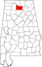 | |
| Towns | ||
| Unincorporated communities | ||
| Ghost town | ||
| Footnotes | ‡This populated place also has portions in an adjacent county or counties | |