Township 4, Benton County, Arkansas
| Township 4 | |
|---|---|
| Township | |
 Township 4 Location in Arkansas | |
| Coordinates: 36°16′16″N 94°11′33″W / 36.27111°N 94.19250°WCoordinates: 36°16′16″N 94°11′33″W / 36.27111°N 94.19250°W | |
| Country |
|
| State |
|
| County | Benton |
| Area | |
| • Total | 49.693 sq mi (128.70 km2) |
| • Land | 49.346 sq mi (127.81 km2) |
| • Water | 0.347 sq mi (0.90 km2) |
| Population (2010) | |
| • Total | 25,596 |
| • Density | 518.70/sq mi (200.27/km2) |
| Time zone | CST (UTC-6) |
| • Summer (DST) | CDT (UTC-5) |
| Area code(s) | 479 |
Township 4 is one of thirteen current townships in Benton County, Arkansas, USA. As of the 2010 census, its total population was 25,596.
Geography
According to the United States Census Bureau, Township 4 covers an area of 49.693 square miles (128.70 km2); 49.346 square miles (127.81 km2) of land and 0.347 square miles (0.90 km2) of water.
Cities, towns, and villages
- Cave Springs
- Elm Springs (small parts)
- Lowell (part)
- Rogers (part)
- Springdale (part)
References
- United States Census Bureau 2008 TIGER/Line Shapefiles
- United States Board on Geographic Names (GNIS)
- United States National Atlas
External links
Municipalities and communities of Benton County, Arkansas, United States | ||
|---|---|---|
| Cities | 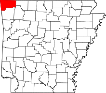 | |
| Towns | ||
| Townships | ||
| CDPs | ||
| Other communities |
| |
| Ghost town | ||
| Footnotes | ‡This populated place also has portions in an adjacent county or counties | |
This article is issued from Wikipedia - version of the 9/10/2013. The text is available under the Creative Commons Attribution/Share Alike but additional terms may apply for the media files.