Hiwasse, Arkansas
| Hiwasse, Arkansas | |
|---|---|
| Census-designated place | |
 Hiwasse, Arkansas | |
| Coordinates: 36°25′54″N 94°20′02″W / 36.43167°N 94.33389°WCoordinates: 36°25′54″N 94°20′02″W / 36.43167°N 94.33389°W | |
| Country | United States |
| State | Arkansas |
| County | Benton |
| Area[1] | |
| • Total | 4.943 sq mi (12.80 km2) |
| • Land | 4.942 sq mi (12.80 km2) |
| • Water | 0.001 sq mi (0.003 km2) |
| Elevation | 1,332 ft (406 m) |
| Population (2010)[2] | |
| • Total | 497 |
| • Density | 100/sq mi (39/km2) |
| Time zone | Central (CST) (UTC-6) |
| • Summer (DST) | CDT (UTC-5) |
| Area code(s) | 479 |
| GNIS feature ID | 77191[3] |
Hiwasse was an unincorporated census-designated place in Benton County, Arkansas, United States. As of the 2010 census, its population is 497.[2] It is the location of (or is the nearest community to) Hiwasse Bank Building, which is located at Main St., AR 279 and Banks House, which is located on AR 72 west of Hiwasse. Both are listed on the National Register of Historic Places.[4]
Hiwasse faced a great division in 2007-2008 when two groups faced off about the incorporation of Hiwasse. In the end the voters decided not to incorporate. Instead adjacent Gravette annexed the community in 2012.
Education
Public education for elementary and secondary students is provided by Gravette School District, which leads to graduation from Gravette High School.
References
- ↑ "US Gazetteer files: 2010, 2000, and 1990". United States Census Bureau. 2011-02-12. Retrieved 2011-04-23.
- 1 2 "American FactFinder". U.S. Census Bureau. Retrieved 3 May 2011.
- ↑ U.S. Geological Survey Geographic Names Information System: Hiwasse, Arkansas
- ↑ National Park Service (2009-03-13). "National Register Information System". National Register of Historic Places. National Park Service.
Municipalities and communities of Benton County, Arkansas, United States | ||
|---|---|---|
| Cities | 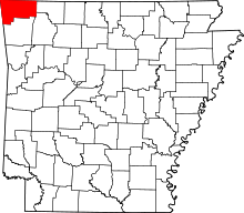 | |
| Towns | ||
| Townships | ||
| CDPs | ||
| Other communities |
| |
| Ghost town | ||
| Footnotes | ‡This populated place also has portions in an adjacent county or counties | |
This article is issued from Wikipedia - version of the 9/7/2015. The text is available under the Creative Commons Attribution/Share Alike but additional terms may apply for the media files.