Centerton, Arkansas
| Centerton, Arkansas | |
|---|---|
| City | |
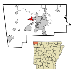 Location in Benton County and the state of Arkansas | |
| Coordinates: 36°21′42″N 94°17′12″W / 36.36167°N 94.28667°WCoordinates: 36°21′42″N 94°17′12″W / 36.36167°N 94.28667°W | |
| Country | United States |
| State | Arkansas |
| County | Benton |
| Area | |
| • Total | 11.9 sq mi (30.8 km2) |
| • Land | 11.7 sq mi (30.4 km2) |
| • Water | 0.1 sq mi (0.3 km2) |
| Elevation | 1,253 ft (382 m) |
| Population (2010) | |
| • Total | 9,515 |
| • Density | 809/sq mi (312.5/km2) |
| Time zone | Central (CST) (UTC-6) |
| • Summer (DST) | CDT (UTC-5) |
| ZIP code | 72719 |
| Area code(s) | 479 |
| FIPS code | 05-12820 |
| GNIS feature ID | 0076573 |
| Website |
www |
Centerton is a city in Benton County, Arkansas, United States. The population was 9,515 at the 2010 census.[1] Centerton is part of the Fayetteville–Springdale–Rogers, AR-MO Metropolitan Statistical Area.
History
A tornado destroyed 40 homes, damaged 150, and injured 12 people on March 12, 2006.
Geography
Centerton is located near the center of Benton County at 36°21′42″N 94°17′12″W / 36.36167°N 94.28667°W (36.361541, -94.286543).[2] Arkansas Highway 102 runs through the center of the city and leads east 5 miles (8 km) to Bentonville and west 11 miles (18 km) to Decatur.
According to the United States Census Bureau, the city has a total area of 11.9 square miles (30.8 km2), of which 11.7 square miles (30.4 km2) is land and 0.12 square miles (0.3 km2), or 1.13%, is water.[1]
Demographics
| Historical population | |||
|---|---|---|---|
| Census | Pop. | %± | |
| 1920 | 212 | — | |
| 1930 | 206 | −2.8% | |
| 1940 | 219 | 6.3% | |
| 1950 | 200 | −8.7% | |
| 1960 | 177 | −11.5% | |
| 1970 | 312 | 76.3% | |
| 1980 | 425 | 36.2% | |
| 1990 | 491 | 15.5% | |
| 2000 | 2,146 | 337.1% | |
| 2010 | 9,515 | 343.4% | |
| Est. 2015 | 12,023 | [3] | 26.4% |
2014 Estimate[5] | |||
As of the 2010 census Centerton had a population of 9,515. The racial and ethnic composition of the population was 78.7% non-Hispanic white, 3.5% non-Hispanic black, 1.2% Native American, 2.3% Asian, 0.1% Pacific Islander, 2.6% from two or more races and 12.2% Hispanic or Latino.[6]
As of the census[7] of 2000, there were 2,146 people, 730 households, and 602 families residing in the city. The population density was 533.8 people per square mile (206.1/km²). There were 796 housing units at an average density of 198.0 per square mile (76.5/km²). The racial makeup of the city was 96.37% White, 0.14% Black or African American, 0.93% Native American, 0.19% Asian, 0.70% from other races, and 1.68% from two or more races. 4.05% of the population were Hispanic or Latino of any race.
There were 730 households out of which 50.5% had children under the age of 18 living with them, 69.3% were married couples living together, 10.3% had a female householder with no husband present, and 17.4% were non-families. 13.3% of all households were made up of individuals and 3.7% had someone living alone who was 65 years of age or older. The average household size was 2.94 and the average family size was 3.23.
In the city the population was spread out with 34.6% under the age of 18, 7.5% from 18 to 24, 38.5% from 25 to 44, 13.1% from 45 to 64, and 6.3% who were 65 years of age or older. The median age was 29 years. For every 100 females there were 94.6 males. For every 100 females age 18 and over, there were 91.8 males.
The median income for a household in the city was $46,600, and the median income for a family was $50,000. Males had a median income of $31,216 versus $22,731 for females. The per capita income for the city was $17,530. About 6.2% of families and 7.7% of the population were below the poverty line, including 10.1% of those under age 18 and 5.8% of those age 65 or over.
Education
Public education for elementary and secondary students is provided by Bentonville School District, which leads to graduation from Bentonville High School. Centerton is home to the one of the distirict's schools, Centeron Gamble Elementary School, which serves kindergarten through grade 4.
References
- 1 2 "Geographic Identifiers: 2010 Demographic Profile Data (G001): Centerton city, Arkansas". U.S. Census Bureau, American Factfinder. Retrieved September 20, 2013.
- ↑ "US Gazetteer files: 2010, 2000, and 1990". United States Census Bureau. 2011-02-12. Retrieved 2011-04-23.
- ↑ "Annual Estimates of the Resident Population for Incorporated Places: April 1, 2010 to July 1, 2015". Retrieved July 2, 2016.
- ↑ "Census of Population and Housing". Census.gov. Archived from the original on May 11, 2015. Retrieved June 4, 2015.
- ↑ "Annual Estimates of the Resident Population for Incorporated Places: April 1, 2010 to July 1, 2015". Retrieved June 26, 2016.
- ↑ 2010 general profile of population and housing characteristics of Centerton from the US census
- ↑ "American FactFinder". United States Census Bureau. Archived from the original on 2013-09-11. Retrieved 2008-01-31.
External links
Municipalities and communities of Benton County, Arkansas, United States | ||
|---|---|---|
| Cities | 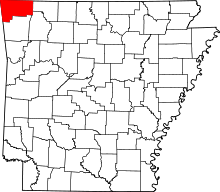 | |
| Towns | ||
| Townships | ||
| CDPs | ||
| Other communities |
| |
| Ghost town | ||
| Footnotes | ‡This populated place also has portions in an adjacent county or counties | |