Taylor County, West Virginia
| Taylor County, West Virginia | |
|---|---|
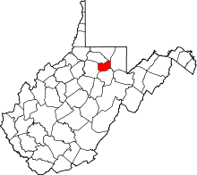 Location in the U.S. state of West Virginia | |
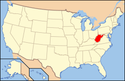 West Virginia's location in the U.S. | |
| Founded | January 19, 1844 |
| Named for | John Taylor of Caroline |
| Seat | Grafton |
| Largest city | Grafton |
| Area | |
| • Total | 176 sq mi (456 km2) |
| • Land | 173 sq mi (448 km2) |
| • Water | 2.9 sq mi (8 km2), 1.7% |
| Population (est.) | |
| • (2015) | 16,912 |
| • Density | 99/sq mi (38/km²) |
| Congressional district | 1st |
| Time zone | Eastern: UTC-5/-4 |
| Website |
www |
Taylor County is a county located in the U.S. state of West Virginia. As of the 2010 census, the population was 16,895.[1] Its county seat is Grafton.[2] The county was formed in 1844.[3] and named for Senator John Taylor of Caroline
Taylor County is part of the Clarksburg, WV Micropolitan Statistical Area.
History
This area was populated by the Adena culture in the Pre-Columbian Woodland period of the Native Americans in the United States.
Some of the first Europeans to visit the area are thought to have been British Army deserters from Fort Pitt, who reportedly fled their post in 1761 during the French and Indian War and roamed northwestern Virginia for several years thereafter. A European trader with the Hudson's Bay Company reportedly set foot in these lands as early as 1764.[4]
Pruntytown is the oldest known white settlement in what is now Taylor County. Initially known as Cross Roads, on January 1, 1801 it was renamed Williamsport in honor of Abraham Williams, a longtime resident. The name was changed again on January 23, 1845 to honor pioneer resident John Prunty. This town served as the county seat of government from the county's founding in 1844 until a county election in 1878 moved that honor to Grafton, West Virginia.[4]
The county was established by the Virginia General Assembly on January 19, 1844. It was formed out of parts of Barbour, Harrison, and Marion counties in Virginia. Most historians think the county was named after John Taylor of Caroline, while a minority believe it was named after Zachary Taylor.[4]
The county became part of West Virginia in 1863. The county is home of Anna Jarvis, founder of the Mother's Day holiday, as well as the International Mother's Day Shrine.
Geography
According to the U.S. Census Bureau, the county has a total area of 176 square miles (460 km2), of which 173 square miles (450 km2) is land and 2.9 square miles (7.5 km2) (1.7%) is water.[5] It is the fifth-smallest county in West Virginia by area.
Major highways
Adjacent counties
- Monongalia County (north)
- Preston County (east)
- Barbour County (south)
- Harrison County (west)
- Marion County (northwest)
Demographics
| Historical population | |||
|---|---|---|---|
| Census | Pop. | %± | |
| 1850 | 5,367 | — | |
| 1860 | 7,463 | 39.1% | |
| 1870 | 9,367 | 25.5% | |
| 1880 | 11,455 | 22.3% | |
| 1890 | 12,147 | 6.0% | |
| 1900 | 14,978 | 23.3% | |
| 1910 | 16,554 | 10.5% | |
| 1920 | 18,742 | 13.2% | |
| 1930 | 19,114 | 2.0% | |
| 1940 | 19,919 | 4.2% | |
| 1950 | 18,422 | −7.5% | |
| 1960 | 15,010 | −18.5% | |
| 1970 | 13,878 | −7.5% | |
| 1980 | 16,584 | 19.5% | |
| 1990 | 15,144 | −8.7% | |
| 2000 | 16,089 | 6.2% | |
| 2010 | 16,895 | 5.0% | |
| Est. 2015 | 16,912 | [6] | 0.1% |
| U.S. Decennial Census[7] 1790–1960[8] 1900–1990[9] 1990–2000[10] 2010–2015[1] | |||
2000 census
As of the census[11] of 2000, there were 16,089 people, 6,320 households, and 4,487 families residing in the county. The population density was 93 people per square mile (36/km²). There were 7,125 housing units at an average density of 41 per square mile (16/km²). The racial makeup of the county was 98.07% White, 0.83% Black or African American, 0.19% Native American, 0.17% Asian, 0.04% Pacific Islander, 0.06% from other races, and 0.63% from two or more races. 0.59% of the population were Hispanic or Latino of any race.
There were 6,320 households out of which 30.90% had children under the age of 18 living with them, 56.40% were married couples living together, 10.90% had a female householder with no husband present, and 29.00% were non-families. 25.50% of all households were made up of individuals and 12.60% had someone living alone who was 65 years of age or older. The average household size was 2.47 and the average family size was 2.95.
In the county, the population was spread out with 22.90% under the age of 18, 7.90% from 18 to 24, 28.50% from 25 to 44, 24.90% from 45 to 64, and 15.80% who were 65 years of age or older. The median age was 39 years. For every 100 females there were 95.70 males. For every 100 females age 18 and over, there were 92.90 males.
The median income for a household in the county was $27,124, and the median income for a family was $32,222. Males had a median income of $29,349 versus $20,116 for females. The per capita income for the county was $13,681. About 15.30% of families and 20.30% of the population were below the poverty line, including 27.00% of those under age 18 and 16.10% of those age 65 or over.
2010 census
As of the 2010 United States Census, there were 16,895 people, 6,778 households, and 4,703 families residing in the county.[12] The population density was 97.8 inhabitants per square mile (37.8/km2). There were 7,541 housing units at an average density of 43.6 per square mile (16.8/km2).[13] The racial makeup of the county was 97.5% white, 0.7% black or African American, 0.4% Asian, 0.2% American Indian, 0.1% from other races, and 1.0% from two or more races. Those of Hispanic or Latino origin made up 0.8% of the population.[12] In terms of ancestry, 26.1% were German, 22.9% were Irish, 11.3% were American, 10.3% were English, 7.2% were Italian, and 5.1% were Dutch.[14]
Of the 6,778 households, 29.3% had children under the age of 18 living with them, 53.6% were married couples living together, 10.6% had a female householder with no husband present, 30.6% were non-families, and 26.1% of all households were made up of individuals. The average household size was 2.42 and the average family size was 2.89. The median age was 42.3 years.[12]
The median income for a household in the county was $36,956 and the median income for a family was $45,620. Males had a median income of $38,085 versus $26,292 for females. The per capita income for the county was $18,562. About 11.3% of families and 15.8% of the population were below the poverty line, including 21.6% of those under age 18 and 16.0% of those age 65 or over.[15]
Politics
| Year | Republican | Democrat |
|---|---|---|
| 2016 | 71.74% 4,701 | 22.63% 1,483 |
| 2012 | 64.85% 3,840 | 32.78% 1,941 |
| 2008 | 58.12% 3,605 | 39.69% 2,462 |
| 2004 | 59.43% 3,893 | 39.95% 2,617 |
| 2000 | 54.69% 3,124 | 43.29% 2,473 |
Communities
City
- Grafton (county seat)
Town
Unincorporated communities
See also
- National Register of Historic Places listings in Taylor County, West Virginia
- Pruntytown Wildlife Management Area
- Tygart Lake State Park
- Valley Falls State Park
References
- 1 2 "State & County QuickFacts". United States Census Bureau. Retrieved January 11, 2014.
- ↑ "Find a County". National Association of Counties. Retrieved 2011-06-07.
- ↑ http://www.wvculture.org/history/counties/taylor.html
- 1 2 3 ["Early History of Taylor County," West Virginia University http://www.polsci.wvu.edu/wv/Taylor/tayhistory.html]
- ↑ "2010 Census Gazetteer Files". United States Census Bureau. August 22, 2012. Retrieved July 31, 2015.
- ↑ "County Totals Dataset: Population, Population Change and Estimated Components of Population Change: April 1, 2010 to July 1, 2015". Retrieved July 2, 2016.
- ↑ "U.S. Decennial Census". United States Census Bureau. Retrieved January 11, 2014.
- ↑ "Historical Census Browser". University of Virginia Library. Retrieved January 11, 2014.
- ↑ "Population of Counties by Decennial Census: 1900 to 1990". United States Census Bureau. Retrieved January 11, 2014.
- ↑ "Census 2000 PHC-T-4. Ranking Tables for Counties: 1990 and 2000" (PDF). United States Census Bureau. Retrieved January 11, 2014.
- ↑ "American FactFinder". United States Census Bureau. Retrieved 2011-05-14.
- 1 2 3 "DP-1 Profile of General Population and Housing Characteristics: 2010 Demographic Profile Data". United States Census Bureau. Retrieved 2016-04-03.
- ↑ "Population, Housing Units, Area, and Density: 2010 - County". United States Census Bureau. Retrieved 2016-04-03.
- ↑ "DP02 SELECTED SOCIAL CHARACTERISTICS IN THE UNITED STATES – 2006-2010 American Community Survey 5-Year Estimates". United States Census Bureau. Retrieved 2016-04-03.
- ↑ "DP03 SELECTED ECONOMIC CHARACTERISTICS – 2006-2010 American Community Survey 5-Year Estimates". United States Census Bureau. Retrieved 2016-04-03.
- ↑ "Dave Leip's Atlas of U.S. Presidential Elections". Retrieved 2016-11-18.
External links
- West Virginia Archives and History references for Taylor County, West Virginia
- Taylor County Public Library
 |
Marion County | Monongalia County | | |
| Harrison County | |
Preston County | ||
| ||||
| | ||||
| Barbour County |
Coordinates: 39°20′N 80°03′W / 39.34°N 80.05°W