Ohio County, West Virginia
| Ohio County, West Virginia | |
|---|---|
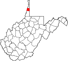 Location in the U.S. state of West Virginia | |
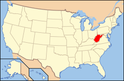 West Virginia's location in the U.S. | |
| Founded | October 7, 1776 |
| Named for | Ohio River |
| Seat | Wheeling |
| Largest city | Wheeling |
| Area | |
| • Total | 109 sq mi (282 km2) |
| • Land | 106 sq mi (275 km2) |
| • Water | 3.2 sq mi (8 km2), 2.9% |
| Population (est.) | |
| • (2015) | 43,066 |
| • Density | 409/sq mi (158/km²) |
| Congressional district | 1st |
| Time zone | Eastern: UTC-5/-4 |
| Website |
www |
Ohio County is a county located in the Northern Panhandle of the U.S. state of West Virginia. As of the 2010 census, the population was 44,443.[1] Its county seat is Wheeling.[2] The county was formed from the District of West Augusta, Virginia in 1776.[3] It was named for the Ohio River, which forms its western boundary. West Liberty (formerly Black's Cabin) was the county seat from 1777 to 1797.
Ohio County is part of the Wheeling, WV-OH Metropolitan Statistical Area.
Geography
According to the U.S. Census Bureau, the county has a total area of 109 square miles (280 km2), of which 106 square miles (270 km2) is land and 3.2 square miles (8.3 km2) (2.9%) is water.[4] It is the third-smallest county in West Virginia by area. The highest point of elevation in Ohio County is approximately 1,420 ft (430 m) and located about 1-mile (1.6 km) southwest of West Alexander, PA.[5] The county is drained by Wheeling and other small creeks.[6]
Major highways
.svg.png) I-70
I-70.svg.png) I-470
I-470 U.S. Route 40 – National Road
 U.S. Route 250
 West Virginia Route 2
 West Virginia Route 88
Adjacent counties
- Brooke County (north)
- Washington County, Pennsylvania (east)
- Marshall County (south)
- Belmont County, Ohio (west)
- Jefferson County, Ohio (northwest)
Ohio County is one of four counties in the United States to border a state with which it shares the same name (the other three counties are Nevada County, California, Texas County, Oklahoma, and Delaware County, Pennsylvania).
National protected area
Demographics
| Historical population | |||
|---|---|---|---|
| Census | Pop. | %± | |
| 1790 | 5,212 | — | |
| 1800 | 4,740 | −9.1% | |
| 1810 | 9,182 | 93.7% | |
| 1820 | 9,182 | 0.0% | |
| 1830 | 15,584 | 69.7% | |
| 1840 | 13,357 | −14.3% | |
| 1850 | 18,006 | 34.8% | |
| 1860 | 22,422 | 24.5% | |
| 1870 | 28,831 | 28.6% | |
| 1880 | 37,457 | 29.9% | |
| 1890 | 41,557 | 10.9% | |
| 1900 | 48,024 | 15.6% | |
| 1910 | 57,572 | 19.9% | |
| 1920 | 62,892 | 9.2% | |
| 1930 | 72,077 | 14.6% | |
| 1940 | 73,115 | 1.4% | |
| 1950 | 71,672 | −2.0% | |
| 1960 | 68,437 | −4.5% | |
| 1970 | 64,197 | −6.2% | |
| 1980 | 61,389 | −4.4% | |
| 1990 | 50,871 | −17.1% | |
| 2000 | 47,427 | −6.8% | |
| 2010 | 44,443 | −6.3% | |
| Est. 2015 | 43,066 | [7] | −3.1% |
| U.S. Decennial Census[8] 1790–1960[9] 1900–1990[10] 1990–2000[11] 2010–2015[1] | |||
2000 census
As of the census[12] of 2000, there were 47,427 people, 19,733 households, and 12,155 families residing in the county. The population density was 447 people per square mile (172/km²). There were 22,166 housing units at an average density of 209 per square mile (81/km²). The racial makeup of the county was 94.50% White, 3.57% Black or African American, 0.09% Native American, 0.78% Asian, 0.03% Pacific Islander, 0.13% from other races, and 0.91% from two or more races. 0.50% of the population were Hispanic or Latino of any race. 27.0% were of German, 13.7% Irish, 10.4% English, 8.4% Italian, 8.3% American and 6.7% Polish ancestry.
There were 19,733 households out of which 25.90% had children under the age of 18 living with them, 47.30% were married couples living together, 11.20% had a female householder with no husband present, and 38.40% were non-families. 33.70% of all households were made up of individuals and 16.00% had someone living alone who was 65 years of age or older. The average household size was 2.27 and the average family size was 2.91.
In the county, the population was spread out with 21.30% under the age of 18, 10.50% from 18 to 24, 25.10% from 25 to 44, 24.40% from 45 to 64, and 18.80% who were 65 years of age or older. The median age was 41 years. For every 100 females there were 87.80 males. For every 100 females age 18 and over, there were 84.00 males.
The median income for a household in the county was $30,836, and the median income for a family was $41,261. Males had a median income of $31,132 versus $21,978 for females. The per capita income for the county was $17,734. About 11.50% of families and 15.80% of the population were below the poverty line, including 20.10% of those under age 18 and 10.40% of those age 65 or over.
2010 census
As of the 2010 United States Census, there were 44,443 people, 18,914 households, and 11,181 families residing in the county.[13] The population density was 420.0 inhabitants per square mile (162.2/km2). There were 21,172 housing units at an average density of 200.1 per square mile (77.3/km2).[14] The racial makeup of the county was 93.2% white, 3.7% black or African American, 0.8% Asian, 0.1% American Indian, 0.2% from other races, and 1.9% from two or more races. Those of Hispanic or Latino origin made up 0.8% of the population.[13] In terms of ancestry, 34.0% were German, 19.1% were Irish, 14.4% were English, 8.5% were Italian, 7.2% were Polish, and 5.7% were American.[15]
Of the 18,914 households, 24.6% had children under the age of 18 living with them, 43.4% were married couples living together, 11.7% had a female householder with no husband present, 40.9% were non-families, and 35.3% of all households were made up of individuals. The average household size was 2.21 and the average family size was 2.86. The median age was 43.5 years.[13]
The median income for a household in the county was $39,669 and the median income for a family was $54,909. Males had a median income of $42,213 versus $28,211 for females. The per capita income for the county was $23,950. About 11.9% of families and 15.9% of the population were below the poverty line, including 25.2% of those under age 18 and 9.0% of those age 65 or over.[16]
Government
Ohio County is governed by a three-member county commission. The three county commissioners are elected from single-member magisterial districts and serve six-year terms, staggered so that one seat is up for election every even year. The County Commission annually chooses its own President. The Ohio County Commissioners in 2013 are Orphy Klempa, Tim McCormick, and Randy Wharton, all Democrats. Mr. Klempa was elected in November 2012. The county commission typically appoints a county administrator to oversee the daily executive duties for the Commission. The current county administrator is Greg Stewart. In addition to the three members of the county commission, other elected officials include a county clerk, currently Patty Fahey, and a county assessor, currently Kathie Hoffmann. Both are Democrats.
Ohio County is part of the West Virginia's First Judicial Circuit, which also includes nearby Hancock and Brooke cuties. In West Virginia, circuit judges are elected in partisan elections to eight-year terms. The current judges of the First Judicial Circuit are the Jason A. Cuomo, James Mazzone, David Sims, and Ronald E. Wilson. All are Democrats and were elected in November 2016. The clerk of the circuit court is also elected in a partisan election and serves a six-year term. The current clerk of the First Judicial Circuit in Ohio County is Democrat Brenda Miller. Ohio County is part of the First Family Court Circuit of West Virginia, which covers the same three territories as the First Judicial Circuit. In West Virginia, Family Court judges began to be elected to eight-year terms beginning in 2008. The current judges are the Joyce Chernenko and William Sinclair, both elected to eight-year terms in November 2008.
Magistrates are elected in partisan elections serving four-year terms. Vacancies occurring in unexpired terms can be filled by a respective Circuit Court judge. Unlike Circuit Court and Family Court judges, magistrates are not required to be attorneys. Ohio County currently has four magistrates: Charles W. Murphy, Patricia Murphy, and Harry Radcliffe (Democrats) and Joseph Roxby (a Republican).
In West Virginia, prosecuting attorneys in each county are elected in partisan elections to four-year terms. The current prosecuting attorney in Ohio County is Scott Smith, a Democrat, re-elected in November 2012. County sheriffs (who also serve ex-officio as county treasurer) are also elected by each county to a four-year term, although unlike prosecuting attorneys, sheriffs are limited to serving only two terms. The current Ohio County sheriff is Pat Butler, a Republican, whose second term began in 2013.
Politics
All the members of Ohio County's delegation to the West Virginia Legislature are Democrats and United States Congress are Republicans .
In the West Virginia Senate, most of Ohio County is part of the first Senate district along with Hancock, Brooke, and Marshall counties. The current State Senators for the first district are Rocky Fitzsimmons from Ohio County and Jack Yost from Brooke County. State Senate seats are elected in staggered four-year terms. Fitzsimmons's seat is up for election in 2014, and Yost's seat is up for election in 2016.
In the West Virginia House of Delegates, parts of Ohio County are represented by the second, third, and fourth House of Delegates districts. The Second District is represented by Delegate Philip Diserio (D-Follansbee). The Third District is represented by Delegate Ryan Ferns (R-Wheeling) and Delegate Erikka Storch (R-Wheeling). The Fourth District is represented by Delegate David Evans (R-Cameron) and Delegate Michael Ferro (D-McMechen). All Delegates to the state House serve two-year terms.
In the United States House of Representatives, Ohio County is part of the West Virginia's 1st congressional district, which includes nearly all of the northern part of the state. The current Representative is David McKinley, a Republican from Wheeling in Ohio County. West Virginia's two Senators, who represent the entire state, are Shelley Moore Capito and Joe Manchin, A Republican and a Democrat from Charleston and Fairmont, respectively.
| Year | Republican | Democrat |
|---|---|---|
| 2016 | 61.22% 11,077 | 30.13% 5,452 |
| 2012 | 59.96% 10,768 | 37.79% 6,786 |
| 2008 | 54.73% 10,694 | 43.98% 8,593 |
| 2004 | 57.35% 11,694 | 41.89% 8,543 |
| 2000 | 53.48% 9,607 | 42.60% 7,653 |
Education
Colleges and universities
- West Liberty University
- Wheeling Jesuit University
- West Virginia Northern Community College
- West Virginia Business College
Public schools
All public schools within Ohio County operate under the jurisdiction of Ohio County Schools with the consolidated high school housing grades 9–12, middle schools housing grades 6–8, and elementary schools housing grades K-5.
Ohio County Schools has a five-member elected Board of Education (Timothy B. Birch, Christine N. Carder, Gary A. Kestner, Sarah C. Koegler, and President Shane M. Mallett), a Superintendent (Dianna Vargo), and an Assistant Superintendent (Bernard Dolan). In addition the Board of Education has an Attendance Director (Wm. Jeffrey Laird).
- Wheeling Park High School
- Bridge Street Middle School
- Triadelphia Middle School
- Warwood Middle School
- Wheeling Middle School
- Bethlehem Elementary School
- Elm Grove Elementary School
- Madison Elementary School
- Middle Creek Elementary School
- Ritchie Elementary School
- Steenrod Elementary School
- Warwood Grade School
- Woodsdale Elementary School
Private and parochial schools
The Diocese of Wheeling-Charleston operates several K-8 schools and one high school in Ohio County.
- Wheeling Central Catholic High School
- Corpus Christi Parish School
- Our Lady of Peace School (Located in Marshall County but also serves Ohio County students)
- St. Michael Parish School
- St. Vincent de Paul Parish School
- Wheeling Catholic Elementary (Closed)
Additionally, there is also one private school in Ohio County.
- Linsly School
- Wheeling Country Day School
Communities
City
- Wheeling (county seat; partly in Marshall County)
Towns
Villages
Unincorporated communities
The Communities of Warwood, Woodsdale, Elm Grove, Betty Zane Addition, Greggsville, North Park, Overbrook, Edgwood and Linwood are all incorporated into the city of Wheeling
Notable residents
- George W. Atkinson (R) – Governor of West Virginia (1897–1901);
- Nathan B. Scott (R) – U.S. Senator (1899–1911)
- Walter L. Fisher (R) – United States Secretary of the Interior (1911–1913)
Miscellaneous information
Dog Races and Gaming
In 2007, the West Virginia Legislature adopted HB2718 which created Chapter 29-22 C of the West Virginia Code and permits county residents where racetracks are located to vote on expansion to table games. Ohio County was the first county in West Virginia to take action concerning the matter when the Ohio County Commission initiated a special election date of June 9 for the referendum. The ballot initiative successfully passed in Ohio County with 66% of the vote. The measure permits Wheeling Island Racetrack and Gaming Center to operate table games such as blackjack and poker. On June 9, Jefferson County voters rejected their ballot measure. On June 30, Hancock County voters approved their ballot measure. Kanawha County has scheduled a special election for August 11. While the West Virginia Family Foundation vowed to challenge the constitutionality of HB 2718,[18] it announced on August 7 that it would not file any appeal on the matter.[19] According to newspaper accounts, the West Virginia Lottery Commission has set November 1, 2007 as the latest date at which table games will begin preliminary operation at Wheeling Island Racetrack and Gaming Center.[20]
Metro government
In 2006, the West Virginia Legislature adopted a new section to the West Virginia code – Chapter 7A – which provided for the consolidation of cities, cities with counties, or counties with counties.[21] Interest has been expressed by some Ohio County residents and officials and has become the main political endeavour of a local council of churches called "Hopeful City". As of March 2007, no official action has been taken in Ohio County on this matter. Other municipalities in West Virginia are considering consolidation including Beckley-Raleigh County and Fairmont-Marion County.[22] The most significant proposals under this legislation include a consolidation of Wirt County with Wood County and a population consolidation for Kanawha-Putnam-Cabell counties.[23]
Other Topics
- The Ohio County Fair is held annually in October at Site 1 in Oglebay Park.
- When Ohio County was formed in 1776, its area was much larger totaling 1,432 sq mi (3,710 km2) and included portions of what is now Washington and Greene Counties in Pennsylvania. The formation of the Mason–Dixon line and resolution of border disputes between Pennsylvania and Virginia began the first in a long series of reductions in the county's size.[24]
See also
- Bear Rock Lakes Wildlife Management Area
- Castleman Run Lake Wildlife Management Area
- National Register of Historic Places listings in Ohio County, West Virginia
- List of County Routes in Ohio County, West Virginia
References
- 1 2 "State & County QuickFacts". United States Census Bureau. Retrieved January 11, 2014.
- ↑ "Find a County". National Association of Counties. Archived from the original on May 31, 2011. Retrieved 2011-06-07.
- ↑ "Archived copy". Archived from the original on January 1, 1970. Retrieved July 23, 2013.
- ↑ "2010 Census Gazetteer Files". United States Census Bureau. August 22, 2012. Retrieved July 30, 2015.
- ↑ Ohio County High Point Trip Report. Cohp.org (2000-08-20). Retrieved on 2010-12-24.
- ↑
 Ripley, George; Dana, Charles A., eds. (1879). "Ohio. I. A N. W. county of West Virginia". The American Cyclopædia.
- ↑ "County Totals Dataset: Population, Population Change and Estimated Components of Population Change: April 1, 2010 to July 1, 2015". Retrieved July 2, 2016.
- ↑ "U.S. Decennial Census". United States Census Bureau. Archived from the original on May 11, 2015. Retrieved January 11, 2014.
- ↑ "Historical Census Browser". University of Virginia Library. Retrieved January 11, 2014.
- ↑ "Population of Counties by Decennial Census: 1900 to 1990". United States Census Bureau. Retrieved January 11, 2014.
- ↑ "Census 2000 PHC-T-4. Ranking Tables for Counties: 1990 and 2000" (PDF). United States Census Bureau. Retrieved January 11, 2014.
- ↑ "American FactFinder". United States Census Bureau. Archived from the original on September 11, 2013. Retrieved 2011-05-14.
- 1 2 3 "DP-1 Profile of General Population and Housing Characteristics: 2010 Demographic Profile Data". United States Census Bureau. Retrieved 2016-04-03.
- ↑ "Population, Housing Units, Area, and Density: 2010 - County". United States Census Bureau. Retrieved 2016-04-03.
- ↑ "DP02 SELECTED SOCIAL CHARACTERISTICS IN THE UNITED STATES – 2006-2010 American Community Survey 5-Year Estimates". United States Census Bureau. Retrieved 2016-04-03.
- ↑ "DP03 SELECTED ECONOMIC CHARACTERISTICS – 2006-2010 American Community Survey 5-Year Estimates". United States Census Bureau. Retrieved 2016-04-03.
- ↑ "Dave Leip's Atlas of U.S. Presidential Elections". Retrieved 2016-11-18.
- ↑
- ↑ Archived February 5, 2012, at the Wayback Machine.
- ↑ Nov. 1 Target For Casino Regulators. Tracks prepare to get cards shuffling for poker, The Intelligencer / Wheeling News-Register, September 28, 2007
- ↑ West Virginia Code – 7A Archived September 29, 2007, at the Wayback Machine.
- ↑ Wheeling Intellgencer – March 4, 2007
- ↑ Charleston Gazette – June 21, 2006 Archived February 14, 2012, at the Wayback Machine.
- ↑ History of Wheeling City & Ohio County, West Virginia – Book. Lindapages.com. Retrieved on 2010-12-24.
External links
- Community Foundation for the Ohio Valley, Inc. Website
- Ohio County Schools Website
- Ohio County Sheriff's Department Website
- Ohio County Public Library Website
- Ohio County Economic Development Home Page
- Wheeling Area Genealogical Website
- History of Wheeling City and Ohio County, West Virginia compiled by the Hon. Gibson Lamb Cranmer
 |
Jefferson County, Ohio | Brooke County | | |
| Belmont County, Ohio | |
Washington County, Pennsylvania | ||
| ||||
| | ||||
| Marshall County |
Municipalities and communities of Ohio County, West Virginia, United States | ||
|---|---|---|
| City | | |
| Towns | ||
| Villages | ||
| Unincorporated communities | ||
| Ghost town | ||
| Footnotes | ‡This populated place also has portions in an adjacent county or counties | |
Coordinates: 40°06′N 80°37′W / 40.10°N 80.62°W