Spring Valley Township, Cherokee County, Kansas
| Spring Valley Township | |
|---|---|
| Township | |
 Location in Cherokee County | |
| Coordinates: 37°03′30″N 094°46′51″W / 37.05833°N 94.78083°WCoordinates: 37°03′30″N 094°46′51″W / 37.05833°N 94.78083°W | |
| Country | United States |
| State | Kansas |
| County | Cherokee |
| Area | |
| • Total | 47.2 sq mi (122.25 km2) |
| • Land | 47.03 sq mi (121.82 km2) |
| • Water | 0.17 sq mi (0.44 km2) 0.36% |
| Elevation | 853 ft (260 m) |
| Population (2000) | |
| • Total | 1,007 |
| • Density | 21.4/sq mi (8.3/km2) |
| GNIS feature ID | 0469373 |
Spring Valley Township is a township in Cherokee County, Kansas, USA. As of the 2000 census, its population was 1,007.
Geography
Spring Valley Township covers an area of 47.2 square miles (122 km2) and contains one incorporated settlement, Baxter Springs. According to the USGS, it contains seven cemeteries: Baxter Springs, Beasley, Brush Creek, Crum, Dockery, Pleasant View and Usrey.
The streams of Bitter Creek, Brush Creek and Willow Creek run through this township.
Transportation
Spring Valley Township contains one airport or landing strip, Walter A Swalley Airpark.
References
External links
Municipalities and communities of Cherokee County, Kansas, United States | ||
|---|---|---|
| Cities | 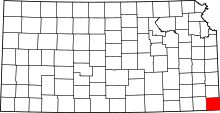 | |
| CDPs | ||
| Unincorporated communities | ||
| Ghost towns | ||
| Townships | ||
| Footnotes | ‡This populated place also has portions in an adjacent county or counties | |
This article is issued from Wikipedia - version of the 7/2/2016. The text is available under the Creative Commons Attribution/Share Alike but additional terms may apply for the media files.