West Mineral, Kansas
| West Mineral, Kansas | |
|---|---|
| City | |
|
Big Brutus near West Mineral (2006) | |
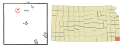 Location within Cherokee County and Kansas | |
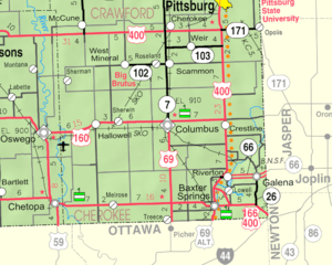 KDOT map of Cherokee County (legend) | |
| Coordinates: 37°17′0″N 94°55′34″W / 37.28333°N 94.92611°WCoordinates: 37°17′0″N 94°55′34″W / 37.28333°N 94.92611°W | |
| Country | United States |
| State | Kansas |
| County | Cherokee |
| Area[1] | |
| • Total | 0.34 sq mi (0.88 km2) |
| • Land | 0.34 sq mi (0.88 km2) |
| • Water | 0 sq mi (0 km2) |
| Elevation | 902 ft (275 m) |
| Population (2010)[2] | |
| • Total | 185 |
| • Estimate (2015)[3] | 177 |
| • Density | 540/sq mi (210/km2) |
| Time zone | CST (UTC-6) |
| • Summer (DST) | CDT (UTC-5) |
| ZIP code | 66782 |
| Area code | 620 |
| FIPS code | 20-77150 [4] |
| GNIS ID | 0469627 [5] |

West Mineral is a city in Cherokee County, Kansas, United States. It is the home of Big Brutus, the second largest electric shovel in the world. As of the 2010 census, the city population was 185.[6]
History
West Mineral was named from the coal mines found there.[7][8] A post office was established in West Mineral in 1899.[9]
Geography
West Mineral is located at 37°17′0″N 94°55′34″W / 37.28333°N 94.92611°W (37.283404, -94.926130).[10] According to the United States Census Bureau, the city has a total area of 0.34 square miles (0.88 km2), all of it land.[1]
Demographics
| Historical population | |||
|---|---|---|---|
| Census | Pop. | %± | |
| 1910 | 1,770 | — | |
| 1920 | 938 | −47.0% | |
| 1930 | 491 | −47.7% | |
| 1940 | 486 | −1.0% | |
| 1950 | 349 | −28.2% | |
| 1960 | 262 | −24.9% | |
| 1970 | 232 | −11.5% | |
| 1980 | 229 | −1.3% | |
| 1990 | 226 | −1.3% | |
| 2000 | 243 | 7.5% | |
| 2010 | 185 | −23.9% | |
| Est. 2015 | 177 | [3] | −4.3% |
| U.S. Decennial Census | |||
2010 census
As of the census[2] of 2010, there were 185 people, 81 households, and 49 families residing in the city. The population density was 544.1 inhabitants per square mile (210.1/km2). There were 95 housing units at an average density of 279.4 per square mile (107.9/km2). The racial makeup of the city was 93.5% White, 1.6% Native American, and 4.9% from two or more races. Hispanic or Latino of any race were 2.2% of the population.
There were 81 households of which 30.9% had children under the age of 18 living with them, 44.4% were married couples living together, 9.9% had a female householder with no husband present, 6.2% had a male householder with no wife present, and 39.5% were non-families. 38.3% of all households were made up of individuals and 14.8% had someone living alone who was 65 years of age or older. The average household size was 2.28 and the average family size was 2.96.
The median age in the city was 40.1 years. 23.8% of residents were under the age of 18; 8.6% were between the ages of 18 and 24; 26.4% were from 25 to 44; 25.4% were from 45 to 64; and 15.7% were 65 years of age or older. The gender makeup of the city was 49.2% male and 50.8% female.
2000 census
As of the census[4] of 2000, there were 243 people, 100 households, and 73 families residing in the city. The population density was 709.2 people per square mile (275.9/km²). There were 121 housing units at an average density of 353.2 per square mile (137.4/km²). The racial makeup of the city was 96.30% White, 2.06% Native American, and 1.65% from two or more races. Hispanic or Latino of any race were 2.47% of the population.
There were 100 households out of which 28.0% had children under the age of 18 living with them, 54.0% were married couples living together, 13.0% had a female householder with no husband present, and 27.0% were non-families. 23.0% of all households were made up of individuals and 16.0% had someone living alone who was 65 years of age or older. The average household size was 2.43 and the average family size was 2.82.
In the city the population was spread out with 25.1% under the age of 18, 7.8% from 18 to 24, 28.8% from 25 to 44, 24.3% from 45 to 64, and 14.0% who were 65 years of age or older. The median age was 36 years. For every 100 females there were 97.6 males. For every 100 females age 18 and over, there were 97.8 males.
The median income for a household in the city was $31,042, and the median income for a family was $40,000. Males had a median income of $28,036 versus $22,500 for females. The per capita income for the city was $15,176. About 8.3% of families and 15.4% of the population were below the poverty line, including 16.7% of those under the age of eighteen and 8.3% of those sixty five or over.
Notable people
- Orval Grove, Major League Baseball player
See also
Further reading
References
- 1 2 "US Gazetteer files 2010". United States Census Bureau. Retrieved 2012-07-06.
- 1 2 "American FactFinder". United States Census Bureau. Retrieved 2012-07-06.
- 1 2 "Annual Estimates of the Resident Population for Incorporated Places: April 1, 2010 to July 1, 2015". Retrieved July 2, 2016.
- 1 2 "American FactFinder". United States Census Bureau. Retrieved 2008-01-31.
- ↑ "US Board on Geographic Names". United States Geological Survey. 2007-10-25. Retrieved 2008-01-31.
- ↑ "2010 City Population and Housing Occupancy Status". U.S. Census Bureau. Retrieved December 3, 2011.
- ↑ Kansas State Historical Society (1916). Biennial Report of the Board of Directors of the Kansas State Historical Society. Kansas State Printing Plant. p. 157.
- ↑ "Profile for West Mineral, Kansas". ePodunk. Retrieved 6 June 2014.
- ↑ "Kansas Post Offices, 1828-1961, page 2". Kansas Historical Society. Retrieved 6 June 2014.
- ↑ "US Gazetteer files: 2010, 2000, and 1990". United States Census Bureau. 2011-02-12. Retrieved 2011-04-23.
External links
| Wikimedia Commons has media related to West Mineral, Kansas. |
- City
- Schools
- USD 247, local school district
- Maps
Municipalities and communities of Cherokee County, Kansas, United States | ||
|---|---|---|
| Cities | 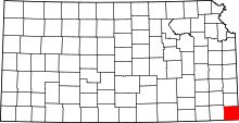 | |
| CDPs | ||
| Unincorporated communities | ||
| Ghost towns | ||
| Townships | ||
| Footnotes | ‡This populated place also has portions in an adjacent county or counties | |