Mineral Township, Cherokee County, Kansas
| Mineral Township | |
|---|---|
| Township | |
 Location in Cherokee County | |
| Coordinates: 37°16′00″N 094°46′31″W / 37.26667°N 94.77528°WCoordinates: 37°16′00″N 094°46′31″W / 37.26667°N 94.77528°W | |
| Country | United States |
| State | Kansas |
| County | Cherokee |
| Area | |
| • Total | 30.65 sq mi (79.38 km2) |
| • Land | 30.6 sq mi (79.26 km2) |
| • Water | 0.05 sq mi (0.12 km2) 0.15% |
| Elevation | 922 ft (281 m) |
| Population (2000) | |
| • Total | 254 |
| • Density | 8.3/sq mi (3.2/km2) |
| GNIS feature ID | 0469331 |
Mineral Township is a township in Cherokee County, Kansas, USA. As of the 2000 census, its population was 254.
Geography
Mineral Township covers an area of 30.65 square miles (79.4 km2). The community of Scammon sits on it western border with Ross Township. According to the USGS, it contains three cemeteries: Hosey Hill, Lone Elm and Saint Bridget.
References
External links
Municipalities and communities of Cherokee County, Kansas, United States | ||
|---|---|---|
| Cities | 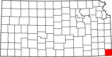 | |
| CDPs | ||
| Unincorporated communities | ||
| Ghost towns | ||
| Townships | ||
| Footnotes | ‡This populated place also has portions in an adjacent county or counties | |
This article is issued from Wikipedia - version of the 6/24/2016. The text is available under the Creative Commons Attribution/Share Alike but additional terms may apply for the media files.