Lola Township, Cherokee County, Kansas
| Lola Township | |
|---|---|
| Township | |
 Location in Cherokee County | |
| Coordinates: 37°09′30″N 095°01′55″W / 37.15833°N 95.03194°WCoordinates: 37°09′30″N 095°01′55″W / 37.15833°N 95.03194°W | |
| Country | United States |
| State | Kansas |
| County | Cherokee |
| Area | |
| • Total | 44.72 sq mi (115.82 km2) |
| • Land | 44.49 sq mi (115.24 km2) |
| • Water | 0.22 sq mi (0.58 km2) 0.5% |
| Elevation | 830 ft (253 m) |
| Population (2000) | |
| • Total | 382 |
| • Density | 8.6/sq mi (3.3/km2) |
| GNIS feature ID | 0469277 |
Lola Township is a township in Cherokee County, Kansas, USA. As of the 2000 census, its population was 382.
Geography
Lola Township covers an area of 44.72 square miles (115.8 km2) and contains no incorporated settlements. According to the USGS, it contains four cemeteries: Cherokee, Dove, Garrison and Spickelmire.
The streams of Deer Creek, Denny Branch, Fly Creek, Fourmile Creek, Lightning Creek and Wolf Creek run through this township.
Transportation
Lola Township contains one airport or landing strip, Oswego Municipal Airport.
References
External links
Municipalities and communities of Cherokee County, Kansas, United States | ||
|---|---|---|
| Cities | 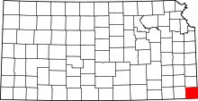 | |
| CDPs | ||
| Unincorporated communities | ||
| Ghost towns | ||
| Townships | ||
| Footnotes | ‡This populated place also has portions in an adjacent county or counties | |
This article is issued from Wikipedia - version of the 6/22/2016. The text is available under the Creative Commons Attribution/Share Alike but additional terms may apply for the media files.