Crestline, Kansas
| Crestline, Kansas | |
|---|---|
| Unincorporated community | |
 Crestline, Kansas  Crestline, Kansas | |
| Coordinates: 37°10′15″N 94°42′16″W / 37.17083°N 94.70444°WCoordinates: 37°10′15″N 94°42′16″W / 37.17083°N 94.70444°W[1] | |
| Country | United States |
| State | Kansas |
| County | Cherokee |
| Elevation[1] | 869 ft (265 m) |
| Time zone | CST (UTC-6) |
| • Summer (DST) | CST (UTC-5) |
| ZIP code | 66728 |
| Area code | 620 |
| FIPS code | 20-16325 [1] |
| GNIS feature ID | 0469323 [1] |
Crestline is an unincorporated community in Cherokee County, Kansas, United States.[1] Crestline is located on U.S. Route 400 7.5 miles (12.1 km) east of Columbus. Crestline has a post office with ZIP code 66728.[2]
History
Crestline was a station on the St. Louis–San Francisco Railway.[3]
References
- 1 2 3 4 5 Geographic Names Information System (GNIS) details for Crestline, Kansas; United States Geological Survey (USGS); October 13, 1978.
- ↑ "Free ZIP Code Lookup with area code, county, geocode, MSA/PMSA, population.". www.zipinfo.com. Retrieved 2016-09-16.
- ↑ Blackmar, Frank Wilson (1912). Kansas: A Cyclopedia of State History, Embracing Events, Institutions, Industries, Counties, Cities, Towns, Prominent Persons, Etc. Standard Publishing Company. p. 484.
Further reading
- History of Cherokee County, Kansas; Nathanial Allison; Biographical Publishing; 646 pages; 1904. (Download 31MB PDF eBook)
External links
- USD 493, local school district
- Cherokee County Map, KDOT
Municipalities and communities of Cherokee County, Kansas, United States | ||
|---|---|---|
| Cities | 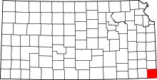 | |
| CDPs | ||
| Unincorporated communities | ||
| Ghost towns | ||
| Townships | ||
| Footnotes | ‡This populated place also has portions in an adjacent county or counties | |
This article is issued from Wikipedia - version of the 9/16/2016. The text is available under the Creative Commons Attribution/Share Alike but additional terms may apply for the media files.