Sogod, Southern Leyte
| Sogod | ||
|---|---|---|
| Municipality | ||
| Municipality of Sogod | ||
|
The town of Sogod, as seen from the town of Bontoc, Southern Leyte | ||
| ||
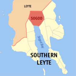 Map of Southern Leyte showing the location of Sogod | ||
.svg.png) Sogod Location within the Philippines | ||
| Coordinates: 10°23′N 124°59′E / 10.383°N 124.983°ECoordinates: 10°23′N 124°59′E / 10.383°N 124.983°E | ||
| Country | Philippines | |
| Region | Eastern Visayas (Region VIII) | |
| Province | Southern Leyte | |
| Congressional District | Lone District of Southern Leyte | |
| Founded | September 6, 1571 (as a district of the Leyte encomienda); 1603 (as a Catholic mission station) | |
| Established | May 18, 1700 (as a barangay) | |
| Incorporated | June 10, 1853 (as a municipality) | |
| Barangays | 45 | |
| Government | ||
| • Type | Sangguniang Bayan | |
| • Mayor | Imelda Uy-Tan (LP) | |
| • Vice mayor | Rufo Caindoy-Olo (LP) | |
| • Town Council |
Council members
| |
| Area[1] | ||
| • Total | 192.70 km2 (74.40 sq mi) | |
| Elevation | 15.0 m (49.2 ft) | |
| Population (2015)[2] | ||
| • Total | 44,986 | |
| • Density | 230/km2 (600/sq mi) | |
| Demonym(s) | Sogodnons | |
| Time zone | PST (UTC+8) | |
| ZIP code | 6606 | |
| Dialing code | +63 (0)53 | |
| Language | Cebuano, Tagalog, Waray-Waray, English | |
| Income class | 2nd Class | |
| Classification | Partially Urban | |


Sogod (pronounced [ˈsuɡud]), officially the municipality of Sogod, is a second class municipality in the province of Southern Leyte, Philippines.[1] The name of the municipality originated from the Cebuano word, sogod, meaning "to start." Founded as a Catholic mission station by the Society of Jesus in 1601, Sogod became a regular municipality on June 10, 1853. According to the 2015 National Statistics Office (NSO) census, it has a population of 44,986 inhabitants.[3]
Sogod is located along the Southern Leyte section of the Pan-Philippine Highway, 126 kilometers (78 miles) south of Tacloban City, the regional center of Eastern Visayas. Rugged mountains enveloped most of the town's northern terrain with numerous river systems crept throughout the southern lowlands. These rivers sustain the production of rice, corn, coconuts, tobacco, abaca and root crops. Quarrying firms in the river of Subangdaku greatly affect the economic performance of Sogod.
The municipality is home to Southern Leyte State University (SLSU) Main Campus and Saint Thomas Aquinas College (STAC), one of the oldest parochial schools in the province, established in 1946.[4]
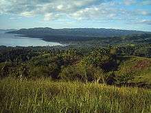
Lying within Sogod Bay, the town is the center of trade, commerce and industry.
History
The dearth of resource materials brought difficulty in providing a complete historical account of Sogod from the pre-Hispanic era up to today. Most of the references identified in the account were chronicles written by Spanish missionaries - the Jesuits, the Augustinians, and the Seculars (the Franciscans were assigned to parishes of northeastern Leyte and Samar) - who administered the town. It should be noted that the island provinces of Leyte and Samar, at the forefront of colonization, were neglected by the Spanish colonial government, resulting to short-term revolts and insurrections.[5] In addition, it is worthy to attribute the Catholic Church's influence in the islands which further improved the shaping of cultural, political, economic and spiritual dimension of the people of Sogod.
Pre-Hispanic Period
The earliest site of the town was then located near the mouth of the Subangdaku River. It was then a satellite territory under the domain of Seilani, which comprises the areas from Sogod to the island of Panaon. Around 1544, due to unfavorable winds, a Spanish expedition headed by Ruy López de Villalobos arrived at the eastern town of Abuyog, Leyte where an aged inhabitant informed Garcia de Escalante Alvarado, the chronicler of the expedition, on the presence of trading posts found in the archipelago:
"I asked him [writes Escalante], whether there was a big town anywhere on the island of Abuyo [mistakenly referred by the Spaniards as Leyte] and he said yes, on the other side of the island to the north-west [south-west?] there was a big town called Sugut whither Chinese junks come every year and where there are resident Chinese who have a house for their merchandise. He said that what they buy there is gold and slaves..."[6]
On September 6, 1571, Leyte was established as an encomienda with Tandaya as the command post of the Spanish colony in the island. An encomienda was not actually a piece of land, but a favor from the Spanish monarch under which the Spaniard, or the encomendero, receiving the favor was given the right to collect tributes or taxes from the inhabitants of an area assigned to him. Miguel Lopez de Legazpi, the first Governador-General of the Philippines, assigned Juan de Trujillo as the first encomendero of Tandaya. Miguel de Loarca, one of the first Spanish conquistadores to arrive in the Philippines and conducted one of the earliest census in the country, affirmed that Sogod was already drafted to the encomienda system in 1582. However, the town was pronounced as Tugud or Tugut:
"Island of Baybay [mistakenly referred by the Spaniards as Leyte]. About three leagues [fourteen kilometers from Camotes] farther east lies the island of Baybay, or Leyte, as it is also called. It is a large and well-provisioned island, although the people dress in medriñaque [a fiber from the sago palm in the Philippines]. Leyte is thickly settled; it may have a population of fourteen or fifteen thousand Indians, ten thousand of whom pay tribute because that has been a people hard to conquer. There are twelve encomenderos; but his Majesty owns none of the Indians. This island is about eighty leagues in circumference, and fifteen or sixteen wide. Its principal settlements and rivers are Vaybay, Yodmuc, Leyte, Cavigava, Barugo, Maraguincay [a river and a current village in Tanauan, Leyte], Palos, Abuyo, Dulaque, Longos, Bito [mistakenly referred by local historians as the present-town of Bato, Leyte; a lake between the present towns of MacArthur and Abuyog in Leyte] , Cabalian, Calamocan [local historians claimed that it was the old name of Inopacan, Leyte][7] and Tugud. This island possesses neither mines nor gold-placers; the only cloth it produces is medriñaque, which, as I have said before, resembles calico, and is made from a kind of wild banana."[8]
The Early Years of Jesuit Evangelization
Although the first religious missionaries assigned to Leyte in 1580 were the priests belonging to the Order of Saint Augustine, the Society of Jesus continued the Christianization efforts of their predecessors in 1595. Padre Antonio Sedeño, the Vice-Provincial of the Jesuit mission in the Philippines, had his eye on setting the islands of Leyte and Samar as a mission field. Invited by the citizens of Zebu for the founding of a central house there, Padre Sedeño chose four priests, Pedro Chirino, Antonio Pereira, Juan del Campo, and Cosme de Flores, and one lay brother, Gaspar Garay to open the mission of Leyte with the appointment of Padre Chirino as superior of the expedition. The missionaries landed in the town of Carigara on the morning of July 16, 1595, the feast of the Exaltation of the Holy Cross. They introduced themselves to the encomendero of Carigara, Cristobal de Trujillo, and presided an assembly for the construction of the mission residence there. While the rest of the Jesuits studied Waray-Waray and orienting the natives to the Faith, Padre Chirino and Padre Pereira pushes towards the eastern coast, in Dulac, for the founding of a residencia [central mission house] facing the Pacific Ocean. Within a span of two years, the Sons of Saint Ignatius of Loyola founded five permanent mission stations: Carigara (July 1595), Dulag (September 1595), Palo (October 1596), Alangalang (May or June 1595) and Ogmoc (1597).[6]
Padre Fabrizio Sersali, an Italian Jesuit from Naples and superior of Carigara, was among the two Jesuit pioneers sent for evangelizing the south, in particular the towns of Sogod [in some narratives, the name was spelled as Sogor] and Cabalian.[6] But on arriving at Panaon, he and his companion, Padre Cristobal Jimenez, then parish priest of Palo in 1595, could not find a single inhabitant. He later stated to Padre Diego Garcia, the Jesuit vice-provincial of the Philippines, in his letter dated November 24, 1602, that the natives considered the missionaries as cannibals. Suspecting that they were coming from Cabalian, the natives fled to the mountains. Padre Sersali then planted the cross, after having burned the place of the Mag-anitos, and went to nearby Sogod. He was successful in his catechesis that the datu and his household were convinced to embrace the Faith in the shore of the village through the Sacrament of Baptism. Afterwards, an improvised chapel of nipa, bamboo and cogon was constructed in 1603. This significant event laid the foundation of Christendom in the town.
"Sogod, Sogod!"
The dark years of Leyte started at the middle of the 15th and 18th centuries. The Mindanao Muslims raided and plundered the south-western and northern portions of the island. The Leyte settlements, that includes the town of Sogor, became prey to these piratical raids. Most of these victims were sold as slaves in the markets of Sulu and some were held as hostages. As a result, these marauders were able to extract money from the religious orders for their release.[5]
The year 1622 brought additional disarray in the colonial administration of the island. At the same period, in the nearby island of Bohol, a babaylan [spiritualist] named Tamblot rebelled against Jesuit hamletting.[9] This revolt would spread to Leyte and influenced Bancao, the Christian datu of Limasawa. The son of a certain Mangaris, Bancao had been having trouble with Muslim onslaughts in his territory. He had witnessed the massacre and bloodshed brought about by the raids of the Moros on his land and kinsmen. When the Moros gave out a condition that they would stop the plundering if the Christian natives would abandon the Church, Bancao grasped what it meant and returned to his old pagan religion. The datu then consigned to halt the conversion process undergone by the Jesuits to the Leyteños. With Pagali, his high priest, Bancao solicited the assistance of other chieftains of the neighboring settlements of Baibai, Panaon, and Sogod and easily won his way across the island to the very capital in the north which was Carigara. The rebels, as they were divided all over the settlements that revolted, were not equal, however, to the force of fifty Spaniards and 1,000 Cebuanos that Don Juan de Alcarazo, the alcalde mayor [equivalent to a governor] of Cebu, quickly mustered to suppress the rebellion. After refusing to surrender, Bancao and his followers died valiantly in their defense of Calanaga, situated equidistant from Limasawa, Panaon and Sogod.[5] Local narratives in Carigara claim that the attack was held in a valley between the interior barrios of Sogod and Hiraan.[10]
Historical narratives accounted that it was during this period that Sogod begot its name.[11] Since the town was frequented by Moro raids, a baluarte [watchtower] was built to warn villagers against the approach of the raiders. In such crisis, Bancao, who was, and until now, revered as Mangkaw, emerged among the populace. Notorious for his defense against the pirates, Mangkaw was a known net-fisherman. Already a fishing ground that it is today, Sogod then had houses clustered close to shore around the watchtower. Being an expert in the art of casting the net, Laya, he could send out the casting net in a perfect circle in the sea. As the community grew bigger, the residents agitated for a name for their place. Meetings after meetings were held presided by Mangkaw. But every time a meeting is ongoing, a shoal of fish would be seen by the subtle wave of the surface or quick shifting shadow beneath the surface. The eyes of the pondering datu kept stalking it, interfering with the meeting. Satisfying his unequalled fisherman's instinct, he would leave the meeting unattended and his body language was being watched by the attendees, feasting their eyes on the artful slide of the feet of the datu so as not to disturb the surface, his eyes fixed on the school. Then, he shared his catch with the people for the asking, even by strangers. After which, shouts of "Sogod, sogod!" (vernacular for "to begin") would reconvene the meeting. Thus the word "Sogod" became the name of the village then and the town as it is today.[12]
Although, the name Sogod already existed before the 1600s, the Mancao account remains to be the accepted etymological basis of the name of the town. However, it might be deduced that the first name, which is pronounced as (sú.gut.), which literally means "to consent" or "to comply," fits the Escalante description as a bustling commercial town of the pre-Hispanic era. The major means of initiating trade during those days were done in barter, that is to comply, or to consent with the suggested value offered by the merchant to the townsfolk of Sogod - "ming-súgut." Tugud, on the other hand, seems like a concealed version of the former. The Spaniards, as accounted by many town histories in Leyte [such as the case of the town of Barugo, Leyte], has difficulty in pronouncing Visayan to Spanish.
Moro Attacks
Padre Juan Francisco de Luzon succeeded Padre Sersali as pastor of Sogod. It was around 1634 that a squadron of twenty rowboats under the command of Cachil Corralat, a chieftain in Mindanao, devastated and plundered the islands of Bohol and Leyte. This dreadful event brought havoc to Baibai, Cabalian, Ogmoc, and Sogor, with members of the clergy held as captives. Fortunately in Sogod, Padre de Luzon, together with a good number of indios was able to escape this incident. However, local establishments, like the chapel and the houses of the natives were not spared. These structures were burned and other precious items were seized.[4]
Another Jesuit in the name of Padre Juan del Carpio, a fifty-one-year-old Spaniard, was slain to death by the Muslims. He was then in-charge of the areas of Cabalian, Ogmoc and Sogor. After his pastoral visit in Sogod, the padre sailed towards Cabalian for a Eucharistic celebration there. While on sea, his boat was captured by the Moros. Padre del Carpio had hardly jumped into dry land as the enemies boarded the vessel and took his chalice and holy ornaments. It was remembered that this missionary priest, a native of the province of Avila, was one of the first Jesuits in Leyte, along with Padre Alonso de Humanes. He had been in the Visayan Islands for eighteen years.[6]
The Muslims of Jolo sacked the islands of Camotes, Leyte and Samar around 1663.[5] The communes located in these areas were Poro, Baibai, Sogod, Cabalian, Basey, Bangajon, Gibatan, and Capul. The main residencia in Carigara was then coping from the 1629 raid done by the same pillagers. Again Sogor was reduced to ruins at that time. The dreadful event prompted the coming of Padre Pedro Oriol, a Catalan, to Leyte. He entered the Society on 1658 as an aspirant. Before taking his assignments in Bohol, Cebu, Iloilo and Cavite, Sogod and Cabalian were his first pastoral posts. During the visit of the Jesuit Provincial in 1675 to the country, the priest was tasked to go to Carigara for his profession of vows.[6] With no questions asked he went to the place on foot, traversing mountains and forests and experiencing unspeakable fatigue. He died peacefully on September 28, 1705 at Catbalogan, in Samar.[4]
The Kampanang Bulaw and the Latter Years of Jesuit Evangelization

On May 18, 1700, Sogod was made a regular pueblo [municipality], however, not fully constituted. Years after Sogor’s recognition, another visita, Consolacion, was founded on February 3, 1730.[12] A number of churches were built and gracefully embellished in the province for the administration and teaching of Catholicism in the year 1718. These places of worship stood at the towns of Abuyog, Sogod, Liloan, and Tanauan,[4] where the dedications of different Christian festivities were celebrated with greater solemnity and banquets. The Jesuits through the mandate of the Most Reverend Sebastian Foronda, OSA, bishopric of Cebu, organized the construction of the church in Sogod in 1718 and was finished in 1720.[11] Nevertheless, this stone edifice was razed to the ground when a battalion of Moros stormed the visita in 1754. There were no records on the level of fatalities and damage done by the said pillage.
The 1720 church boasts of a bell made out of pure gold, the Kampanang Bulaw. Moments before the siege, the watcher from the baluarte signaled the villagers of the incoming attack. Sounds of budyong, a conch shell used as a warning devise by Visayan settlements for upcoming Moro raid, enveloped the air of the settlement. In a hurried state, the priest and some concerned villagers took the artifact and buried it in the rice fields opposite the present Subangdaku River. However, the older Sogodnons foretold a different account: the kampana was tossed to a nearby quicksand, in what is now today the bus station in barangay Zone III, the old site of Sogod poblacion. The bell was never been recovered until today.[11]
Although Jilongos was never mentioned in the Jesuit campaign of 1595 to 1675, the pueblo was made a residencia in 1737 with Dagami and Carigara functioning as residencies covering the north-east towns of Leyte. At this time, Sogod was under the central residence of Hilongos, which holds jurisdiction over the parroquias [parishes] of Baybay, Maasin, Sogod, Cabalian, and Hinundayan.[5]
Around the year 1737, the Diocese of Cebu listed Sogor as one of its parishes under the spiritual administration of the Society of Jesus. The towns administered by the Society also includes Abuyog, Alangalang, Barugo, Baybay, Burabuen, Cabalian, Carigara, Dagami, Dulag, Jaro, Hilongos, Hinundayan, Leyte, Liloan, Maasin, Ogmoc, Palompon, Palo, and Tanauan. During this period, the Jesuits allocated most of their time in understanding the sentiments of the Indios. They were vocal in portraying government abuses in the colony and criticizing Spanish civil authorities for unjust treatments among the populace. The priests knew well the native dialect and vowed to provide the people with alternative sources of livelihood through raising cash crops and contributing them with the needed technology. As a result, trade flourished in the province, acquiring new products and services from other areas of Leyte and environs, and the Indios residing in the hinterlands started to settle around villages with chapels and churches maintained by the mission.[13]
Due to distance and the lack of personnel in the Church and State, Sogod and Consolacion were deduced as visitas [satellite barrio with chapel] of Maasin in 1755. Later, the two settlements were ceded to Malitbog during the 1768 Jesuit expulsion.[11]
The Post-Jesuit Years
On May 19, 1768, after 187 years of administering the Philippines, Carlos III sanctioned the exclusion of the Sons of Saint Ignatius of Loyola from all Spanish territories. The religious order was charged with treason because of their illicit cooperation during the 1763 British invasion of Manila and defaming the Spanish monarchy. A few months later, on October 4 of the same year, after the expulsion orders were signed and with the consent of Leyte alcalde mayor Don Jose Campos, Don Pablo Verdote, commander of the royal navy, with an Augustinian missionary, Padre Francisco Martinez, took charge of rounding up the Jesuits on Leyte and conveying them to Manila. Ormoc was the first parish to be closed down and a quick inventory of the town and church possessions was made.[13] Padre Joaquin Romeo was the last Jesuit serving in the mission of Sogod. Due to the shortage of missionaries at this time, the parishes of Hinundayan, Cabalian and Sogod was clustered into one ecclesiastical district.[6]
At the time of their dismissal, the Society of Jesus had established strong local government units and parishes which were potent mechanisms for the evangelization of the indios. Exemplar communities such as the towns of Alangalang, Baybay, Barugo, Burauen, Cabalian, Carigara, Dulag, Hinunangan, Hinundayan, Jaro, Leyte, Maasin, Palo, Ormoc, Palompon, Sogod and Tanauan were patterned after Spanish cities. Typical streets running in straight lines, opening towards a plaza and at the center of the plaza was the iglesia [parish church], convento [parish rectory], the municipio [town hall] and the escuela [parochial school]. On the other side were the houses of the natives grouped into different sections to avoid from fire. Leyte had already 11,000 tributos, as Padre Agustin Maria de Castro, one of the Augustinians sent to the place, reported to authorities in Manila. However, owing to the 1754 raid, Sogod was not included on Padre de Castro’s Relacion, a summary of towns on the condition of stone churches and fortifications. Only Barugo, Cabalian, Carigara, Dagami, Dulag, Ormoc, Palo, Palompon and Tanauan were mentioned.[13]
The Augustinian Years
Unfortunately, the Augustinian friars were shorthanded and encountered difficulties in their staying at Leyte. At first, there were only three priests administering the pueblos of the eastern and southern sections of the province. The sudden departure of their predecessors led some settlements to dispersion and neglect because the natives were not accustomed to the reduccion system but prefer to live in the wilderness and thick forests. The friars were not well received in most of the towns. In addition to that Babaylanes, spread rumors that the friars were royal agents who procured babies to fatten tigers of the King of Spain.
The Augustinians were more concerned on the economic development of Leyte. They were responsible for the construction of roads and land cultivation. The friars also appealed to the Spanish monarch for the restructuring and rebuilding of fortresses and supply of ammunition in the pueblos. The order was also responsible for the presence of stone churches in the island and established a strong foundation of the Catholic faith among the Leyteños during this period.[13]
In October 1770, Padre Joseph Victoria, the Augustinian Provincial Superior, appealed to the King for additional religious priests capable of conversing the Visayan language. In response, Madrid has sent four additional clerics. Later, he went over to the island and visited the missionary activities of the faith done by the priests.
The superior also ordered the priests to established schools for boys and girls in the parishes. These educational institutions flourished in the towns of Abuyog, Alangalang, Barugo, Baybay, Burauen, Dagami, Dulag, Hilongos, Jaro, Cabalian, Maasin, Ormoc, Palo, San Miguel, Sogod, Tacloban, and Tanauan between 1768 and 1804. There were four secondary schools for boys and girls located in the visitas of Sogod poblacion, Buntuk, Hipgasan [now the present-day barangay of San Pedro] and Consolacion from 1774 to 1785. Also, several rural schools were also put up along these areas. By the late 19th century, the education thrust continued with young girls enjoying privileges in education with boys. Official interest in education mounted as decrees were issued requiring children living within an hour’s walk from these educational institutions to go to school.[14]
Most of the islands covered by the Sons of Saint Ignatius of Loyola were now ceded to the Franciscans, Recollects and lastly by the Calced Augustinians. Cebu, Leyte, Panay, and three parishes in Samar were annexed by the latter. At the Extract for the Plan of Souls of the Diocese of Cebu dated 1778, ten years after the 1768 expulsion, there were only seven priests assigned in eighteen parishes in the island of Leyte with a total population of 34,054 Catholics, of which there are 1,702 souls who were exempted from tributos and 12,867 souls subject for tributos.[4] Calced Augustinian Padre Tomas Sanchez, a thirty-two year old Spaniard, was in charge of five parishes in the eastern area: Abuyog, Cabalian, Dulag, Hinundayan, and Sogod. The parish of Dulag, under the auspices of the Nuestra Señiora de Refugio [Our Lady of Refuge of Sinners], was then the center of the district. Of the five parishes, only Cabalian and Dulag were registered under the said census, with 2,432 and 1,338. While Abuyog, Hinundayan and Sogod has none.[4]
Around 1843, the Franciscans replaced the Calced Augustinians, in accordance to a Royal Decree issued on October 29, 1837. They occupied sixteen parishes in the eastern part of Leyte. The towns under the care of the Franciscans were Abuyog, Alangalang, Babatngon, Barugo, Burauen, Carigara, Dagami, Dulag, Hinunangan, Hinundayan, Jaro, Leyte, Malibago [now a barangay of Babatngon town], Palo, San Miguel, Tacloban, Tanauan, and Tolosa. Most of the churches being built at this time were made out of nipa and bamboo and has no attached rectories.
At that period, the provincial population increased, more infrastructures were developed, and agricultural output in the pueblos was maximized. Education was also prioritized, as what the Augustinians started, and more schools were built along the villages. Churches were also remodeled and refurbished. Muslim attacks had practically ceased and the existence of major trade centers spurred the progress among these towns. Large barrios were becoming independent from the poblacion, and separated as pueblos. This was the scene from 1850s onward.
The Establishment of a Pueblo and a Parroquia
The Seculars of the diocese of Cebu, only in the middle of the 19th century, had already settled in the Cebuano-speaking areas of the province: Albuera, Baybay, Cabalian, Hilongos, Maasin, Macrohon, Malitbog, Ormoc, Palompon, Quiot, Sogod and Villaba. Although Sogod was founded years before Malitbog was made a parish and a municipality on December 14, 1849, the latter enjoyed the civil privileges being conferred from Manila. Malitbog was then part of Maasin, long established as a visita in 1755. Together with Malitbog were the visitas of Buntuk, Cabalian, Consolacion, Himay-angan [a barangay in Liloan], Hipgasan, Inolinan [former name of the town of San Ricardo], Liloan, San Francisco and Sogod – these were under Maasin’s jurisdiction.[4]
A move to create Sogod an independent pueblo was pushed by the tenientes del barrio [equivalent to a village chairman] of Sogod, Consolacion and Buntuk. These chieftains were Juan Cavales (now spelled as Cabales), German Catajoy, Antonio Prima, Enero Cegales (now spelled as Segales), Juan Dagaas, Juan Barcelon, Silverio Bilisa (now spelled as Billesa) and Miguel Tubia. After several years, Sogod was erected as a pueblo on June 10, 1853 and Cabalian, with the approval from Manila, was granted the same position on September 15, 1860. Don Juan Cavales was appointed as the gobernadorcillo [equivalent to a town mayor] of Sogod. But the formal validation as a full-pledged parish was stalled to May 14, 1866. While Cabalian was already elevated to a parochial status with San Juan Bautista as the patron saint and recognized by the diocese of Cebu on January 31, 1861, Sogod was made an annex of the Santo Niño parish of Malitbog.
And again the formal inauguration of the parish was delayed for almost three years. On April 8, 1869, through a Diocesan decree, the parish of Sogod was acknowledged by Cebu Bishop, the Most Reverend Romualdo Ximeno Ballesteros, OSA. Padre Don Tomas Logroño assumed as the town’s first permanent curate and was among the first Diocesan priests assigned in Leyte. The new parish has taken the northern part of the old Malitbog parroquia. However, the 1868 survey of the diocese of Cebu shows that the records of Sogod were still merged with Malitbog, with a total population 12,262 Catholics, 417 exempted souls and the number of tributos exceed to 2,026.[4]
The church, dedicated to the La Purisima Concepcion de Maria, as described by Padre Felipe Redondo Sendino in 1886, was provisional, made out of light materials. The structure measured 52 varas (45.36 meters) long, 7 varas (5.88 meters) wide, and 4 varas (3.36 meters) high. Padre Don Ramon Abarca initiated the ongoing construction of a new, concrete edifice to replace the temporary edifice. Like the church, the rectory was of nipa and bamboo, but in a dilapidated state. It measures 25 varas (21 meters) long and 3 varas (2.52 meters) high. Entrenched with live trees as fences, the cemetery has a measurement of 48 varas (40.32 meters) long and 47 varas (39.48 meters) wide. Unfortunately, there are no remains of Spanish architecture in Sogod today.[4]

Brief information of the visitas under the parish of Sogod was also included in the summary of Padre Redondo:
- Consolacion, 2 ½ leguas (14.8 kilometers) away from Sogod, [going eastward, with the Most Holy Name of Jesus as the patron saint];
- Buntuk, 3 ½ leguas (19.7 kilometers) away, [monitoring westwards, from the cabecera; chapel dedicated to the Santo Niño]; and,
- Hipgasan, 2 ½ leaguas (14.8 kilometers) [north from the poblacion, has a chapel under the advocacy of San Pedro and San Pablo].[4]
These chapels have attached interim rectories constructed out of light materials.
Padre Redondo also accounted the geographical location of the town:
"The town of Sogod is located on the shore of the great inlet of Malitbog to the south of the island of Leyte, in the western coast of the said inlet and adjoins Cabalian on the east with island of Panaon further south, some three hours away. The town of Malitbog in the south-west is two to three hour crossing through the said inlet… The old [site] of Sogod… was situated at the end of a great inlet where the ruins of the walls of coral stone and lime mortar masonry of the iglesia [church] during the Jesuit period, are still preserved. Presently, the center of this town is transferred some 3 leagues from that one in the western coast of the same inlet."[4]
List of Municipal Executives from 1853 up to present
The newly created municipality was governed by duly elected Gobernadorcillos, Presidente Municipales and Municipal Mayors like:[11]
| Term | Gobernadorcillos |
|---|---|
| 1853–1855 | Don Juan Cavales. The first municipal executive of Sogod, duly-appointed by the Leyte Provincial Government. |
| 1856–1857 | Don Antonio Prima |
| 1858–1859 | Don Eulogio Cavales |
| 1876–1878 | Don Patricio Tubia |
| 1885–1887 | Don Nicolas Idjao. He initiated the transferring of the poblacion to the barrio of Libagon, being a resident there. The old poblacion of Sogod then became Sogod Viejo (sometimes called Sogod Del Norte), meaning "Old Sogod" and Libagon became Sogod Nuevo (sometimes called Sogod Del Sur), meaning "New Sogod". |
| 1887–1889 | Don Eleuterio Faelnar |
| 1891–1893 | Don Luis Espina |
| 1893–1895 | Don Nicolas Idjao |
| 1895–1897 | Don Luis Espina |
| 1898–1903 | A nationalist revolt in the late 1890s led by Andres Bonifacio was sweeping the nation. The Katipunan movement, which Bonifacio founded, had encouraged Filipino commoners form Luzon, Visayas and northern Mindanao to raise arms for independence. There were anti-Spanish skirmishes in Manila, Cebu, Negros, Ilocos, Batangas and Pampanga after Jose Rizal’s execution on December 30, 1896. A secularization activity among the local clergy was also campaigning for the Filipinization of the Church which was dominated by the Spanish clerics. Social unrest in Leyte in the last decades of the Spanish colonial regime may not have been as noted as the ferment in Manila and surrounding provinces but the early Katipunan months has somehow filtered down to the provinces, taking shape in varied cultural, political and religious forms.[13] It had secure autonomy to the island province of Leyte when Catalino Tarcela, capitan municipal [equivalent to a municipal mayor] of Tacloban, replaced Gabriel Galza, a peninsulares, [a Philippine-born Spaniard] as governor of Leyte in 1898.[14] So far, there are no recorded names as mayors of Sogod from 1897 to 1903. |
| Term | Presidentes Municipal |
|---|---|
| 1903–1904 | Captain Don Benito Faelnar became the first Capitan Municipal (equivalent to present-day Mayor). The poblacion and parish was returned to Sogod. |
| 1904–1905 | Capitan Ladislao Decenteceo relocated the seat of government again to Barangay Consolacion. Decenteceo was proclaimed winner after Faelnar, running for reelection, lost. The voting process was done by whispering the name of a candidate of the voter's choice to the municipal secretary. |
| 1905–1907 | Capitan Dionisio Labata was the first candidate in the town who won the first election by balloting. The term presidente municipal (municipal president) replaced the Capitan Municipal as the municipal judge of the town. |
| 1908–1912 | Capitan Gregorio Leviste |
| 1912–1916 | Don Vicente Cariño restored the seat of government to Sogod. On October 16, 1913, Libagon was made an independent municipality, appointing the first municipal president, Mariano Espina. Espina was formerly a member of the municipal council of Sogod, representing Libagon. |
| 1917–1919 | Don Estanislao Flores |
| 1920–1922 | Don Floro Espina |
| 1923–1925 | Don Estanislao Flores |
| 1926–1931 | Don Filomeno Mercado |
| 1932–1940 | Don Gervacio Cadavos |
| Term | Municipal Mayors |
|---|---|
| 1941–1942 | Severino Macasocol. His untimely death led him to serve the town for several months . |
| 1943–1944 | Hospicio Labata. The Japanese-sponsored Philippine government was a puppet-state established on October 14, 1943. During this era, in which the country was occupied the Japanese, the Commonwealth was abolished and new officials were appointed to maintain control of the country. Labata was chosen as the puppet mayor for the town. |
| 1944–1947 | Francisco Villamor. The 1944 Leyte Landings signified the country’s liberation from the Japanese invaders. The reign of Villamor saw the massive restoration of the civil government of Sogod. The war paralyzed numerous properties: farms, factories, roads, bridges, and schools. |
| 1947–1950 | Federico dela Plana |
| 1950–1951 | Cecilio Gonzales. During his tenure, Bontoc was made a regular municipality on July 29, 1950 through the provisions of Republic Act No. 522. |
| 1952–1955 | Gregorio Bagares |
| 1956–1959 | Jovencio Caday |
| 1960–1964 | Jose Veloso |
| 1964–1986 | Ignacio Siega. He served during the Marcos administration (1965-1986), making him as the longest running Mayor of Sogod for over twenty-two years. |
| 1986 – November 30, 1987 | Doctor Gonzalo D. Yong Jr. Yong served as Officer-in-charge (OIC) during the post-EDSA People Power Revolution of February 1986. |
| December 1, 1987 – January 1, 1998 | Oscar T. Rio. He took over as caretaker after the EDSA People Power Revolution of February 1986. |
| January 2, 1998 – March 27, 1998 | Doctor Gonzalo D. Yong Jr. During this period, Yong’s administration was marred by economic progress. He laid out the plans for the complete pavement of streets in the poblacion. The construction of the municipal wharf, municipal auditorium and bus terminal were one of his notable achievements. Recently, the terminal was renamed Gonzalo D. Yong, Jr. Memorial Bus Terminal. |
| March 28, 1998 – June 30, 1998 | Amalia M. Yap |
| July 1, 1998 – June 30, 2004 | Doctor Edmundo R. Villa. Sogod was declared a drug-free municipality in 2001. |
| July 1, 2004 – June 30, 2013 | Shefferd Lino S. Tan. A native of San Juan town, Tan made multiple changes in Sogod and made it the economic hub of the province’s eastern region. He was elected for three terms from 2004 to 2013. Tan ran for the vice-gubernatorial post during the 2013 general elections and won. |
| July 1, 2013 – Present | Imelda U. Tan. She is the wife of the current Vice Governor Shefferd Lino Tan. |
Barangay etymologies

- Benit
- The sitio, formerly under the territorial jurisdiction of barangay Magatas, was established as a barangay on June 21, 1959, through the mandated provisions of Republic Act No. 2563.[15]
- Buac Daku and Buac Gamay
- Although "Burak" is the generic Cebuano term for flower (burak in Cebuano; bulaklak in Tagalog), now virtually unused, it specifically refers to the ilang-ilang (Cananga odorata), a tree whose flowers are very fragrant, and whose oil is used in the perfume industry. Barangay Buac Gamay houses the Consolacion Catholic Cemetery. Currently, Buac is divided into two villages with Buac Gamay in the south, occupying a small parcel of this large barrio, and Buac Daku in the north.
- Cabadbaran
- It is named after a local shrub or tree known as "Badba-an", which abounds in the area even at present. The barangay was officially established on June 21, 1959, through the provisions of the Republic Act No. 2563.[16] It was formerly a sitio of Barangay Libas.
- Consolacion and Maac
- These districts once form a large barrio located in the southern extreme in the municipality of Sogod. Considered as one of the oldest villages in the municipality, Consolacion was founded on February 3, 1730. It was formerly known as “Maak," a shortened term for “Maa” or river current. The barangay straddles along five minor rivers: Buac, Combongbong, Maak, Magapso and Panong. Situated in a floodplain, these rivers would cause massive flooding during the rainy seasons. Maak, which was renamed Consolacion during the Spanish era, was then originally undivided. Prior to the increasing population of the area, the barangay council decided to expand the area of the barangay. During the barrio’s enlargement, two major sitios in the barangay existed, Consolacion poblacion and Maak. The rapid growth of Sogod had benefited the village’s growth. As the years passed, more barrios were created from Consolacion: Javier, Maac, Mahayahay, Maria Plana and Salvacion.
- Dagsa
- It was made a barangay on June 21, 1959 through the mandated provisions of Republic Act No. 2563. The village was formerly a sitio of barangay San Isidro.[17] With a potential for tourism, the village is locally famed for its Dagsa Falls.
- Hibod-Hibod
- It was created as a barangay through the mandated provisions stated by the Republic Act No. 2563, dated June 21, 1959. Hibod-hibod was formerly a part of barangay San Isidro.[18]
- Hindangan
- The barangay is named after the Hindang, also known as Anubing (Artocarpus ovatus), a tree reaching a height of about 30 meters and a diameter of about 100 centimeters. The tree is used to be a marker of the barangay's location during the early-1920s. Hindangan was made a barangay on June 21, 1959, through the provisions of the Republic Act No. 2563.[19]
- Hipantag
- This interior barangay was established on June 19, 1965, through the provisions mandated by the Republic Act No. 4306. Hipantag is only accessible by footpath with its starting point in sitio Balintulay in barangay Kahupian. It is one of the farthest barangays of Sogod.[20]
- Immaculada Concepcion (Concepcion I) and La Purissima Concepcion (Concepcion II)
- Formerly known as Punong, this large coastal village is named after its patroness, La Purissima Concepcion de Maria. The barangay was split into two political subdivisions after the Republic Act No. 2600.[21] on was formalized on June 21, 1959. The sitio was known to be a favorite fishing ground during the 1960s, earning its name Punong (local term for fishpond). Mangko (Euthynnus affinis) once thrived the shores of this village.
- Javier
- Daniel Falcon Javier, a former teacher and principal of the Cebu Normal College (now Cebu Normal University), was a native of barangay Consolacion. His achievement as a principal of the university and providing education, health and extensive farming activities to the communities of Cabadbaran, Agusan del Norte and in barangay Bugho, Abuyog, Leyte, gave prestige in naming the sitio after him. Bugho was renamed after him, eight years after the barangay was elevated a municipality in 1957. The barrio was formerly a sitio of barangay Maac.
- Kahupian
- Considered as the seedbed of abaca and copra industries in the entire municipality, Kahupian is the largest and northernmost barangay in Sogod. The abaca is a large herbaceous plant of the banana family that yields Manila hemp. The hemp is extracted from the trunk or pseudostem. The fiber was originally used for making twines and ropes; now most abaca is pulped and used in a variety of specialized paper products including tea bags, filter paper and banknotes. While the copra is the dried coconut meat extracted into coconut oil, an edible oil used for food, medicine and industry. These industries brought great economic impact to the local farmers of the town. Local residents of Kahupian accounted that the village was once flourished by the Hupi fruit. Because of this phenomenon, the place was coined "Kahupian," an area where the fruit is abundant. It was created as a barangay on June 19, 1971, under the mandated provisions by the Republic Act No. 6230. The sitios of Bood Taas, Tabunan, Hap-on, Kabugua-an, Tigbawan, Lubong Sapa, Kahupian-Centro and Pangalkagan (Sitio Balintulay) were drafted to the barangay during its creation.[22]
- Kanangkaan
- Named after the Nangka (Artocarpus heterophyllus), a species of tree in the mulberry family, Kanangkaan is one of the villages situated near the riverbanks of Subangdaku. Local villagers of this barrio narrated that a cluster of Nangka serves as boundary markers for the village’s territory. Kanangkaan became the adapted name during its recognition as a barangay by the local government. With the recent opening of a new resort complex, the Negulian Mountain Resort, in the barangay, it is expected that it can boost the town's northeastern areas' potential for eco-tourism.
- Kauswagan
- It was created as a barangay on June 21, 1959 through the Republic Act No. 2563.[23] However it was on June 19, 1960 that the Republic Act No. 2810 was passed to ensure that the jurisdiction of the new barrio will be the sitios of Kantabuan, Baycasili, Mamingaw, Tag-abaca and Kampuwa. The name of the place means progress. Kauswagan was once a sitio of barangay Libas.[24]
- Libas
- This large farming barrio is named after the Libas (Spondias pinnata), a medium-to-tall tree reaching a height of about 25 meters and a diameter of about 60 centimeters. The tree is endemic in the place and the villagers choose the tree as the namesake of the barangay. Coconut farming is the main livelihood of the people of Libas. Situated along the Bonbon River, Libas is one of the most populous barangays in the municipality.
- Lum-an
- Known for its waterfalls, the village was then a sitio of barangay Libas.
- Mabicay
- This landlocked barangay was separated from barangay Tampoong on June 21, 1959 through Republic Act No. 2563.[25]
- Magatas
- A landlocked village nestled in a valley, the name of the barangay is derived from the word “Gatason”, because of the water flowing from the stream are whitish or milk-like in color. This gatason phenomena originated from the kinds of trees found in the slopes of the barangay.
- Mahayahay
- It is one of the former sitios of barangay Consolacion. "Mahayahay" is a local exclamation for airy or refreshing. Most of the residents here rely on farming and fishing.
- Malinao
- Formerly called as Ilo, The sitio was elevated into a barangay status on June 21, 1959 through the mandated provisions of Republic Act No. 2563. Nevertheless, the Republic Act No. 2810 of June 19, 1960 defined the proper metes and boundaries of the village. In the vicinity of Malinao lies a large reservoir, which was then described by the locals as Malinao or clear. This reservoir serves as the main water source supplying the south-eastern villages of the town.[26]
- Maria Plana
- Formerly a sitio of barangay Mahayahay, it was formally established as a barangay on June 21, 1959, through the provisions of Republic Act No. 2563.[27]
- Milagroso
- It existed as a barangay on June 21, 1959, through the provisions stated by the Republic Act No. 2563. The name Milagroso is vernacular for miraculous. Milagroso was once a part of Barangay San Roque. A circumferential road connects the barrio from barangay San Roque and barangay San Pedro.[28]
- Olisihan
- In the former days, the sitio of Olisihan was located atop a mountain ridge. The abundance of Olisi trees got the attention of the natives. The residents called the place "Olisihan", a foliage of Olisi trees. When the national highway was constructed at the mountainside, many barrio folks transferred near the road leaving the old site abandoned. The populace still remained in this area until it was granted a barangay status on June 21, 1959, through Republic Act No 2563. It was then under the territorial jurisdiction of barangay Suba.[29]
- Pancho Villa
- This densely populated barangay was formerly known as Pinamonoan. After it was formalized as a barangay on June 21, 1959 through Republic Act No 2563, the name of the village was changed in honor of the first Filipino boxer Pancho Villa.[30]
- Pandan
- Named after the Pandan (Pandanus amaryllifolius), it was believed that the village had then an abundance of Pandan plants growing in the area. Presently, it has been the site of a new 10-mega volt ampere Sogod power substation which provide the whole Sogod Bay area with electricity.[31]
- Rizal
- Named in honor of José Rizal, the national hero of the Philippines, barangay Rizal has been the residential suburb of the town. Being a university town, Sogod has been the favorable site of students coming from the other parts of the province. The barangay is home to various low-price lodges, dormitories and apartments for students enrolled at the province's only state university. It was on June 21, 1959 that Rizal was elevated as a barangay through the provisions of Republic Act No. 2563.[32]
- Salvacion
- The zone expansion of Consolacion prompted to the creation of a new barrio called Salvacion. Two educational institutions are located in this highway barangay: the Consolacion Elementary School and the Consolacion National High School.
- San Francisco Mabuhay
- Founded in 1952 after the World War II by settlers from the poblacion, San Francisco Mabuhay got its name from a combination of words. Francisco Garlet, the teniente del barrio of this far-flung sitio, spearheaded the move to declare the sitio as an independent barangay. Thus, the barrio was named Francisco. During its declaration, loud shouts of "Mabuhay, Mabuhay!" would circulate through the villagers. In addition, "San" (Spanish for Saint or Holy) was placed before "Francisco", as an honorary title of the founder of the new district. Later, Mabuhay was attached to the official name of the barangay. The barangay of San Francisco Mabuhay was formally recognized as a barangay on June 21, 1959 through the mandated provisions of Republic Act No. 2563.[33]
- San Isidro
- The village is known locally as Malupao. Nestled along the town's rice producing area, the barrio folks renamed it after San Isidro Labrador, the patron saint of farmers.
- San Jose
- The sitio of Sudlon was founded in 1948 as part of barangay San Pedro. Since it is distant from the village of San Pedro, the sitio earned the name "Sudlonon". The growth and expansion of the poblacion led to the creation of this barangay on June 21, 1959, through the enactment of Republic Act. No. 2563. Representative Nicanor E. Yñiguez sponsored this bill to creation of barangays in the then 3rd District of Leyte.[34] San Jose's pebbled shorelines are dotted with beach resorts which attracted local tourists. Renamed after its patron saint, residents celebrate the annual fiesta of San Jose every March 19.
- San Juan
- The barangay was formerly called as Agta, a legendary creature that resides on trees and far-flung places. Many residents believed that the Agta owned and lived in the present site of the village. A certain educated stranger later emerged in the barrio and christened the name of the barangay. It was decided that barangay will be named after its patron saint, San Juan el Bautista. It was made a barangay on June 21, 1959 under Republic Act No. 2563. The sitios of Hubasan, Agta Proper, Manduduknay, Kabas-an and Cabadbaran were merged to the newly created barangay on June 19, 1960.[35]
- San Miguel
- San Miguel was once a mother barangay of the barrio of Pandan. According to old folks, the village got its name from a big tree called "Batang" found in the place whom the folks believed was floating in water when once there was a flood. Being predominantly Catholic, the residents decided that the barangay will be renamed in honor of their patron saint, San Miguel Arcangel.
- San Pedro
- One of the three oldest barangays of Sogod, it was named after the Hipgasan River which passes through the village. The villagers changed its name after its patron saint, San Pedro Apostol
- San Roque
- The barangay is named in honor of San Roque de Montpellier, the patron saint of pilgrims. San Roque is the site of the Southern Leyte State University (SLSU), the province's state university.
- San Vicente
- San Vicente was founded in 1950. Situated in the foot of a mountain, the place was subjected by mudslides. Hence, the word Anas, vernacular for "landslides", was adapted by the villagers as the name of the place. However, the name was later changed to the village's patron saint, San Vicente Ferrer. On June 21, 1959, the place was formally established as a barangay through the provisions of Republic Act No. 2563.[36]
- Santa Maria
- It was officially carved out from Barangay Libas on June 21, 1959, through the provisions of Republic Act No. 2563. The patron saint of the barangay is the Santo Niño de Cebú.[37]
- Suba
- Located along the Subangdaku River, Suba was once a barangay composed of Hipantag, Kahupian and San Francisco Mabuhay. It was dissolved in 1959, when the Congress approved the move to create Hipantag, Pancho Villa and San Francisco Mabuhay to be barangays; Kahupian became a barrio in 1971.
- Tampoong
- It is one of the densely populated barangays in Sogod, having a population of more than 1,700 inhabitants.
- Zone I
- Before the division of the town center into five different barangays in 1973, Zone I was named after its patron saint, San Antonio de Padua. Today, it is the residential, educational, and commercial core of the poblacion. The barrio houses the municipal hall, Regional Trial Court (RTC), Sogod Central School, Sogod SPED Center, Sogod National High School and other educational and commercial establishments.
- Zone II
- This barangay is popularly known by the residents as Kalanggaman, meaning a haven for birds. The town center was divided into five different barangays in 1973.
- Zone III
- This historic barangay was formerly known as San Lorenzo Ruiz, the village's patron saint. Much of its site was the former locus of a Hispanic-era pueblo of Sogod. Barangay Zone III is the economic hub of the town with Sogod Integrated Market and Doctor Gonzalo Yong Bus Terminal as its major landmarks. The town center was divided into five different barangays in 1973.
- Zone IV
- Situated in the innermost area of the poblacion, Zone IV is considered as the residential and commercial hub of Sogod. The barangay is the site of the Sogod Auditorium, Police Station, Firemen’s Hall, the Association of Barangay Councils (ABC) Office, Rural Health Unit (RHU) Building, a government-run birthing facility and other national and provincial offices. The town center was divided into five different barangays in 1973.
- Zone V
- It is the most populous barangay in the municipality. Barangay Zone V is also the largest barangay, in terms of land area, among the poblacion districts. The barangay is the site of Southern Leyte Provincial Public Safety Company (SLPPSC) Headquarters, Gaisano Capital Mall of Sogod, Corrompido Specialty Hospital and among others. The town center was divided into five different barangays in 1973.
Geography
The town covered a total land area of 236.4 square kilometers (91.3 square miles) until 1953.[38] Due to the enactment of Republic Act No. 522 on June 15, 1950 which establishes the municipality of Bontoc, the municipal area of Sogod decreased . However, the newly-ordained act was proven to be lax in nature. The juridical boundaries of the town of Bontoc were not fully indicated, causing much tension between the two municipalities.
After the 1959 promulgation of the Executive Order No. 368, all conflicting areas between the municipalities of Sogod and Bontoc were reorganized and reevaluated. Many complaints and petitions were sent to the Provincial Board of Southern Leyte and to the Regional Trial Court (RTC) to reconcile the disputed villages to Sogod, but all were in vain. As a result, the land area of the municipality was reduced to 19,270 hectares (47,600 acres) in land area.
With the coordinates of 10°23'10 North Longitude and 124°58'48 East Latitude, Sogod is situated in the northern portion of the province of Southern Leyte and in the south-central side of Leyte Island, facing the Sogod Bay. It is approximately 72 kilometers east from the city of Maasin, the provincial capital of Southern Leyte; 127 kilometers south from Tacloban City, the regional center of Eastern Visayas and the provincial capital of Leyte; 106 kilometers from Ormoc City, a port city on the north-western coast of Leyte.

The town is bounded by the municipality of Mahaplag, approximately 38 kilometers northbound via the Maharlika Highway; in the east are the municipalities of Silago, Hinunangan, and Saint Bernard; in the southeast is the municipality of Libagon, about 22 kilometers eastbound via the national highway; facing to the south is Sogod Bay, the only water form that divides the province from west to east; 6 kilometers south-west lies the municipality of Bontoc; in the west are the towns of Bato, Hindang, Hilongos, and Inopacan.
The Mahaplag-Sogod mountain rim is the boundary line of the two provinces of Leyte and Southern Leyte. Two bridges in Sitio Balintulay, Barangay Kahupian serve as markers for the boundary. In the east and west sides of the municipality are much similar to the north. The slopes serve as barricades from the municipalities facing the eastern Pacific. However, feeder roads in this part of the town are impassable during the rainy season. Frequent landslips occurred in this region. The southern part is bordered by rivers and creeks. The Santa Cruz Creek serves as a demarcation line between the towns of Bontoc and Sogod. Gakat Creek functions as boundary between Sogod and Libagon.
Topography
The municipality has flat-to-rolling plains in the southern part, with rivers crisscrossing the lowland. The rivers of Subangdaku and San Francisco are the major waterways of the town. The headwaters of these rivers are at the Abuyog-Liloan Cordillera and Mahaplag Cordillera. The rivers flow southward from the villages of Kahupian, Pancho Villa, San Francisco Mabuhay and San Juan to its mouth at the Sogod Bay near the Sogod poblacion.
Numerous springs are located in the town. Some of them are situated in Barangay Consolacion, Hibod-Hibod, Kahupian, Lum-an, Pancho Villa, and San Juan. The Magaupas Spring in Barangay Pandan and Banat-e Spring in Barangay San Pedro supplies the water needs of the Sogodnons. The distribution of water in the town is spearheaded by the Sogod Water District (SWD).
Rugged peaks covered the town’s northern area. These slopes are dotted with thick rain forests which served as habitat for rare species of flora and fauna, like the Philippine Eagle and Tarsier. Of the twenty-four mountains in Southern Leyte province, five are located in Sogod. These are the mountains of Bitanhuan (3,169 feat/966 meters), Cagbano (725 feet/221 meters), Capuloan (2,583 feet/787 meters), Llave (2,583 feet/787 meters) and Panjongon (1,259 feet/384 meters).[39]
Recently, two new species of frogs belonging to the genus Platymantis were discovered specifically inhabiting the montane and mossy forests of the Nacolod Mountain Range (the Hinunangan-Silago-Sogod corridor of Abuyog-Liloan Cordillera) in Southern Leyte. Both species differ markedly from other known species of Philippine Platymantis frogs by their body size, coloration patterns, and advertisement calls. The two species are allied to two different species groups, the Platymantisguentheri group and Platymantishazelae group. This is the first time that a Platymantis species belonging to the Hazelae group has been discovered in Mindanao faunal region, of which the island of Leyte belongs to.[40]
There are three mountain ranges that separates the municipality from the other towns of the province, these are: Baybay-Maasin Cordillera, the Abuyog-Liloan Cordillera and Mahaplag mountain range.
- The Baybay-Maasin Cordillera consists of rolling hills and varied upland plains. This area is known for its lush and productive coconut and abaca plantations. Rice paddies formed the rest of the agricultural thicket of the area.
- The Abuyog-Liloan Cordillera is regarded as the bounty for endangered animals such as tarsiers, eagles, deers and monkeys. The mountain range has an altitude of about 2,000 above sea level. In the recent years, this part of the province had experienced deforestation. Due to massive exploitation of hardwood in the area, it resulted to severe flowing of the Subangdaku River and landslides in Sogod’s mountain villages. In the mid-1980s, the Philippine Government issued the banning of timber cutting in the entire country, leading to the massive restoration of the forests in the country.
- The Mahaplag cordillera is an arm of the Abuyog-Liloan mountain range and has the same characteristics with the other mountain ranges. Being isolated by human activities, it is also home to rare species of flora and fauna.
Sogod is a coastal town. The bay that divides the province into two regions is named after the municipality. Noted for its rocky beaches and mangrove thickets, the town has the shortest shoreline in the province.
Subangdaku River
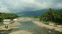
Subangdaku is the largest river in the province of Southern Leyte that empties into Sogod Bay. Based on the physical description of rivers done by the Ateneo de Naga University, Subangdaku is considered a braided river since there are several channels that divide and reunite forming an alluvial fan with very wide floodplain. It is this floodplain that becomes flooded during a strong typhoon of heavy rainfall and the time when sediments of various sizes are deposited. The larger materials are deposited first while the finest materials such as silt and clay are deposited last as the river moves towards its mouth to meet the sea. This is a natural occurrence.[41]
The town of Sogod and some barangays along the banks of Subangdaku was reportedly affected by a strong flood similar to that experienced with Typhoon Amy in 1951. Typhoon Amy had the strength and volume of water that caused sediments of various sizes to roll downstream sweeping away several villages, vegetation, and farm animals. Older persons in the villages have never forgotten such devastation. After the typhoon, lots of logs were seen floating in Sogod Bay together with dead bodies. For months, the people of Sogod and surrounding villages did not eat fish caught from the bay.

Recent typhoons did not result to the terrible destruction brought about by Typhoon Amy. Flooding happens only during heavy rains. Some of the destroyed agricultural lands were those long the floodplain that were reclaimed by local people when this portion dried out possibly as a result of quarrying and rechanneling activities.[42] The river has been known to meander along its course, ever changing its way over time.
In 2001, portion of the road and banks in Barangay San Miguel along the river were destroyed.[41] The road slip hampered the economic activities of the local residents as well as national because the destroyed portion is part of the Philippine National Road. The local officials blamed the rechannelization and uncontrolled quarrying of gravel and sand at the side of river as the cause of the flood. At a meeting on March 18, 2002, a government agency alleged that the reason of the incidents of flood and other environmental problems in the river was due to the Philippine Fault System which caused rocks to rumble down. However, the reason was contended because the fault is a geological feature and environmental problems in the province just occurred that time.[41]
Exploitation

For years, following the floodings of the river, Subangdaku created an issue over the province. The quarrying in the area became rampant and destructive. After many attempts of conserving the site, the issue remained unsolved until today.
On June 9, 1993, the Department of Public Works and Highways (DPWH) recommended to the then Southern Leyte Governor Oscar Tan, for the rechannelling of the river in order to “redirect the flow of water straight to the bridge (present Subangdaku Bridge in barangay Suba) waterway.” A permit was granted to Shemberg with the “objective of rechannelling the meandering Subangdaku River, thereby protecting the existing infrastructure, the lives and properties of Sogodnons” on July 13, 1993. Rechannelling was commenced shortly after. In 1998, a group of Sogodnons complained about the destruction in the river allegedly due to the quarrying operations of Shemberg. Supporting papers in 1998 backed the continued rechannelling operations of said company, thus quarrying and rechanneling activities were resumed.
Shemberg-Rockland Marketing Corporation was granted an Environmental Compliance Certificate (ECC) by the Regional Department of Environment of Natural Resources (DENR-8), through the Mines and Geosciences Bureau (MGB-8), to conduct quarrying operations in the river. Although the ECC allowed them to extract 60,000 cubic meters per year (ECC granted by DENR Regional Executive Director Augustus L. Momongan on June 25, 1993), some sectors in the local community believe that what was extracted was more than this amount. For instance, it was alleged that small operators and local residents also collect sand and gravel and sell them to Shemberg. In addition, on June 5, 1998, MGB-8 issued a renewal of permit (SAG No. IP-98-011) to Shemberg Marketing Corporation (SMC) allowing it to extract 350,000 cubic meters for five years, renewable for the same period and volume. This amount has increased by 10,000 cubic meters annually. Aside from Shemberg, there were also other operators that extracted SAG such as Reeline Commercial Aggregates and a Gaudencio Ang.
On December 12, 2001, Typhoon Nanang brought heavy rains causing bank erosion and damage to a road in Barangay San Miguel. Shemberg however denies responsibility for the destruction. It reports that its total concession area is only 19 hectares which occupies about 2 kilometers of the river and that its “upstream boundary is located near the concrete structure, at the bend of San Miguel and is approximately 300 meters downstream of the newly collapsed road pavement.”
The Save Subangdaku Movement (SSDM) requested for assistance from the people hearing mass at the Immaculate Conception of the Blessed Virgin Mary Parishduring the celebration of the town fiesta on December 15, 2001.
The local officials blamed the rechannelization and uncontrolled quarrying of gravel and sand at the side of river as the cause of the flood. At a meeting on March 18, 2002, a government agency alleged that the reason of the incidents of flood and other environmental problems in the river was due to the Philippine Fault System which caused rocks to rumble down. However, the reason was contended because the fault is a geological feature and environmental problems in the province just occurred that time.
In response, the Institute for Environmental Conservation and Research (INECAR) team visited Sogod in May 20–23 and September 2–3, 2002 to investigate the alleged impacts of quarrying in the river. Some of the local residents, the SSDM in particular, feared that the cause of the destruction of a portion of the road in Barangay San Miguel was quarrying. They were also worried that the present destruction is a prelude to a larger destruction that will affect the town of Sogod itself and adjacent villages when the rainy and typhoon season comes.

The team identified the probable reasons why the roadslip and erosion occurred in barangay San Miguel: a) increased in energy upstream as a result of rechanneling downstream and b) the river has been fragmented by quarrying operations creating channels that are directed towards the area of the barangay concerned.[41]
The provincial government pushed for immediate rechanneling of Subangdaku considering that the river has been tagged by the Department of Environment and Natural Resources (DENR-8) as very susceptible to flash floods. The restoration led to the construction of dikes along the barangays of Suba, San Isidro, San Miguel and Inmaculada Concepcion in 2007.[43]
An irrigation dam was constructed beneath the Subangdaku Bridge I in Barangay Suba to control the flow of the current to the farmlands in the south-eastern portion of the municipality. However, the dam was destroyed after strong river currents breached the infrastructure in January 2011.
The Subangdaku Bridge II was inaugurated in March 2013, connecting it to barangay San Miguel and barangay Inmaculada Concepcion. It was seen as a solution to cut the travel time from Maasin City to the rest of the province.
Today
The provincial government is seeking for the immediate suspension of two-decade-old quarrying operation in the river after numerous violations done by the permit holders. Last August 20, 2013, Governor Roger Mercado told the press that the government is "waiting for the complete assessment report from the Mines and Geosciences Bureau (MGB) and Environmental Management Bureau (EMB)."
The suspension of sand and gravel extraction of Subangdaku will give way to delineation of the areas as part of the revised rechanneling plan. Extractors are to resume operations after implementing the rechanneling plan, under the supervision of the Provincial Environment and Natural Resources Office (PENRO).
The governor added that the Cebu-based Shemberg Marketing Corporation "keep on renewing from MGB-8 since 1993." The quarrying firm never sought an approval from the provincial governor and committed a grave violation under existing environmental laws and the local government code.
Records of the MGB regional office showed that as of June 2013, there are two existing sand and gravel industrial permits. Shemberg Marketing Corporation has the biggest concession area at 19 hectares. Selena Salas, a permit holder from Cebu City were given go signal to quarry in 12.53 hectares.There are two pending application for sand and gravel industrial permits in the area. These local firms are owned by Emily Chiongbian and Rodolfo Gervacio with a combined proposed extraction area of 13.73 hectares.
Despite of the clarion for suspension, MGB clarified thatthe provincial government of Southern Leyte has no authority to suspend quarrying operations along Subangdaku. The latter can only recommend for suspension of sand and gravel extraction but it has to be approved by the MGB regional office. The office also added that the permit holders have no violations.[44]
Sogod Bay
Sogod is situated at the head of Sogod Bay. The bay, home to a variety of fishes, provided food and livelihood to the people of Sogod and nearby municipalities.
The Subangdaku River is a major tributary of the bay, emptying into the bay at the municipality of Sogod. Human activity, such as quarrying and rechanneling, within the rivers watershed has disturbed the river's ecology. This has resulted in degraded habitats of Sogod Bay and major water quality issues of the area.
Sogod-Bontoc Boundary Dispute
On June 15, 1950, Congress passed Republic Act No. 522 creating the municipality of Bontoc, formerly a barrio under the municipality of Sogod. The newly-constituted town was composed of the barrios of Beniton, Bontoc, Catmon, Divisoria, Hilaan, Mahayahay, Paku, Santa Cruz, Taa, Union and their corresponding sitios.
A boundary dispute however, later arose between the municipalities of Bontoc and Sogod with the latter claiming that the former exercised jurisdiction not only over the barrios above-mentioned but also over other ten barangays allegedly belonging to Sogod.
The Provincial Board of Leyte issued Resolution No. 617 directing the holding of a plebiscite among the barrios of Pangi, Taa, Santa Cruz, Tuburan, Lawgawan and their corresponding sitios on June 17, 1952,. The purpose of the plebiscite is to determine whether the people in these villages would like to remain with Sogod or with Bontoc. The plebiscite was conducted on August 1, 1952, and the results show that more votes were cast in favor of Sogod.
On April 4, 1959, the Provincial Board of Leyte issued Resolution No. 519 recommending to the President of the Philippines and/or to the Congress of the Philippines that Republic Act 522 be amended to include in the said republic act the following barrios claimed by Sogod but not included in the said law, namely: Baugo, Bunga, Dao,Esperanza, Hibagwan, Himakilo, Mahayahay, Mauylab and Pamahawan. The Board also recommended that a law be enacted annexing to the town of Sogod the barrios which are nearest to Sogod and are claimed by the latter but are included in the law creating Bontoc, namely: Lawgawan, Pangi, Santa Cruz, Taa andTuburan. The board further recommended that the boundary line between the two municipalities be placed at Granada Creek.
Presidente Carlos P. Garcia promulgated Executive Order No. 368, which approved the recommendation of the provincial board of Leyte and reconstituted the barrios and sitiosunder the territorial dispute between the two municipalities with Granada Creek as its boundary line, on December 28, 1959.
However, on July 14, 1960, then Executive Secretary Castillo sent a telegram to the Provincial Board of Southern Leyte which states as follows:
BY DIRECTION OF PRESIDENT PLEASE SUSPEND IMPLEMENTATION OF EXECUTIVE ORDER 368 SERIES 1959 RECONSTITUTION (sic) BARRIOS AND SITIOS TO COMPOSE MUNICIPALITIES OF SOGOD AND BONTOC AND READJUSTING TERRITORIES SAID MUNICIPALITIES UNTIL FURTHER ADVISE STOP TO DETERMINE TRUE WISHES OF INHABITANTS PLEASE SUPERVISE HOLDING OF PLEBISCITE IN BARRIO AND SITIOS AFFECTED ADVISING THIS OFFICE IMMEDIATELY OF RESULT.SEC. CASTILLO (P. 20, Rollo)
The Provincial Board of newly established Southern Leyte passed Resolution No. 62 suspending the implementation of Executive Order 368 on July 18, 1960. The Board also created a committee to conduct the holding of a plebiscite in the barrios and sitios affected by the Executive Order and to finally settle the boundary dispute.
On June 24, 1970, the municipality of Sogod filed Civil Case No. R-1706 for certiorari and prohibition with the Court of First Instance of Southern Leyte (now Regional Trial Court [RTC]), to enjoin the provincial board and provincial governor from taking cognizance of the long pending boundary dispute between the two municipalities and to enjoin Bontoc town from exercising territorial jurisdiction over the said barrios. However, the trial court dismissed the action for lack of jurisdiction over the subject matter of the case on August 31, 1973.
On December 17, 1973, the trial court denied petitioner’s motion for reconsideration. Hence, this petition was filed alleging that the respondent judge acted with grave abuse of discretion in dismissing the case.[45]
Climate
The average climate in Sogod presents a low mean seasonality in comparison to similar climates in other parts of the world. This means that, on average, seasons (whether hot or cold or dry or wet) are not marked. The mean monthly temperature ranges from 23.6 °C to 25.4 °C and Precipitation from 147 to 351 millimeters/month.
According to the Coronas Classification, the main climate classification system used in the Philippines, the largest part of Sogod falls under Type II, which characterized by the absence of a dry season and months with the largest rainfalls between November and January. A small part of Sogod, the western part of the province of Southern Leyte, falls under Type IV and has an even more evenly distributed rainfall throughout the year.
| Climate data for Sogod, Southern Leyte, Philippines | |||||||||||||
|---|---|---|---|---|---|---|---|---|---|---|---|---|---|
| Month | Jan | Feb | Mar | Apr | May | Jun | Jul | Aug | Sep | Oct | Nov | Dec | Year |
| Average high °C (°F) | 29 (84) |
30 (86) |
31 (88) |
32 (90) |
33 (91) |
32 (90) |
31 (88) |
31 (88) |
31 (88) |
31 (88) |
31 (88) |
30 (86) |
33 (91) |
| Average low °C (°F) | 23 (73) |
23 (73) |
23 (73) |
24 (75) |
25 (77) |
25 (77) |
24 (75) |
24 (75) |
24 (75) |
24 (75) |
24 (75) |
23 (73) |
23 (73) |
| Average precipitation mm (inches) | 415 (16.34) |
261 (10.28) |
233 (9.17) |
68 (2.68) |
131 (5.16) |
170 (6.69) |
132 (5.2) |
234 (9.21) |
301 (11.85) |
185 (7.28) |
259 (10.2) |
242 (9.53) |
2,631 (103.58) |
| Source: http://www.sunmap.eu/weather/asia/philippines/southern-leyte/sogod | |||||||||||||
Demographics
| Population census of Sogod | ||
|---|---|---|
| Year | Pop. | ±% p.a. |
| 1990 | 31,342 | — |
| 1995 | 31,062 | −0.17% |
| 2000 | 37,402 | +4.06% |
| 2007 | 39,864 | +0.88% |
| 2010 | 41,411 | +1.40% |
| 2015 | 44,986 | +1.59% |
| Source: National Statistics Office[2] | ||
Ethnicity and Language
The local populace of Sogod is of Boholano and Cebuano descent with Cebuano as the major language spoken in the municipality. But most native speakers have Boholano (Bol-anon) intonation because of its proximity to Bohol province. Waray-Waray and Surigaonon are regarded as secondary languages. However, Tagalog is still the lingua franca when conversing to other ethnic groups.
Natives also understood foreign languages such as English and Spanish.
Population
The population of Sogod exceeded 45,000 during the 2015 Philippine National Census. Of about 3,382 inhabitants, Zone V is the most populous barangay in Sogod, followed by Zone III and Maac with the population of 1,934 inhabitants and 1,869 inhabitants, respectively. But the barangay with the lowest population is Lum-an, having a population of only 90 individuals; followed by Hindangan and Buac Daku with the population of 116 and 119.
Pandan, Rizal, San Jose, San Miguel, San Pedro, San Roque, Tampoong and Casao and Santa Cruz in Bontoc are the immigration barangays within the poblacion. Mountain barangays such as Benit, Lum-an, Hindangan, Hipantag, Maria Plana and Santa Maria are experiencing a decline in numbers of population. Employment and livelihood lead the people from these villages to settle in the poblacion and in other urban centers in the province. The lack of road systems and infrastructures connecting these villages to the town proper is one of the factors that attribute to this problem. This migratory pattern is called Rural Exodus. It is exacerbated when the population decline leads to the loss of rural services (such as business enterprises and schools), which leads to greater loss of population as people leave to seek those features.
Religion
The majority of the population of Sogod belongs to the Roman Catholic Church, with a percentage of about 93%. Other Christian sects such as the Seventh-day Adventist Church, United Church of Christ in the Philippines (UCCP), Iglesia ni Cristo (INC), The Church of Jesus Christ of Latter-day Saints (Mormons), Members Church of God International, Filipino Crusaders World Army (Moncados), Sogod Fundamental Baptist Church, Jehovah’s Witnesses, Christian and Missionary Alliance Churches of the Philippines (CAMACOP)-Sogod Alliance Church, Assemblies of God and among others, formed the remaining 7% of the census. Considered as one of the largest churches in the province, the Immaculate Conception Parish in barangay Rizal falls under the jurisdiction of the Roman Catholic Diocese of Maasin.
Roman Catholicism in Sogod
Catholicism is a deeply rooted institution in this municipality. Sogod, under the Roman Catholic Diocese of Maasin since 1968, is divided into two parishes, namely:
- Holy Child Parish, barangay Consolacion
- Immaculate Conception of the Blessed Virgin Mary Parish, barangay Rizal
Presently, the town is the seat of the Vicariate of the Immaculate Conception, which is composed of six parishes (Bontoc,barangay Consolacion, barangay Divisoria, Libagon, Sogod and Saint Tomas Oppus parishes).
On May 8, 2011, the Diocese of Maasin underwent reshuffling of the appointment of priests of their respected assignments. The new set of priests assigned as parish pastor of Sogod is Monsignor Nestor S. Astillo, PC with Father Pepito Generan, Jr., Father Ikenna Sabinnus Chukwonyonyerem, and Father Merwin Kangleon as parochial vicars, in collaboration with the parish priest. While Father Ronaldo Lago was designated as parish priest of barangay Consolacion.
Holy Child Parish

The parish was established in 1967 by tBishop Teotimo Pacis, Archdiocese of Palo. As of the 1993 census, the total Catholic population is 9,616.
At present, the parish has maintained a number of mandated religious organizations which are active in the various fields of church apostolates, namely: Catholic Women's League, Legion of Mary, Catholic Charismatic Renewal Movement, and cofradias (confraternities) like the Birhen sa Lourdes (Our Lady of Lourdes), Sagrada Corazon (Sacred Heart), Inahan sa Kanunayng Panabang (Our Lady of Perpetual Help), San Jose (Saint Joseph) and San Antonio (Saint Anthony of Padua). Other organizations are the Knights of the Santo Niño (established by Father Oliver Edulan), Lay Ministers, Catechists, Catholic Faith Lay Apostolic Movement of the Philippines (CF-LAMP), Parish Emergency Action Team and the Knights of the Altar (KOA).
From September 1992 to March 1993, the parish launched an intensive doctrinal and spiritual formation program through the Catholic Faith Lay Apostolic Movement of the Philippines (CF-LAMP), a local group tasked of defending the Catholic faith from proselytizing sects. This program has brought about remarkable conversations especially among the nominal and indifferent Catholics that the effects have been dubbed balik-Simbahan. One of the fruits of this program is that the barrio faithful have also embarked on renovations and extensions of their respective chapels.
It is the hope of the parish to mold, form and activate small Christian communities so that they will ultimately become the images of Christ here on earth – that of a worshipping, evangelizing, and serving community.
List of Parish Priests serving the Holy Child Parish from 1967 until present
| Period of Tenure | Parish Priest |
|---|---|
| 1967 - 1968; June - July 1969 | Father Gregorio Florendo |
| April - June 1969 | Father Dominador Sudario |
| 1969 - 1971 | Father Crutato Arceño |
| 1971 - 1973 | Father Vicente Lora |
| 1973 - 1976 | Father Nestor Sarvida Astillo [now a Monsignor] |
| 1976 - 1977 | Father Patrick Kelly, SFM |
| 1977 - 1979 | Father Amado Ducot Olayvar [now a Monsignor] |
| 1979 - 1981 | Father Celso Sanchez Rojas |
| 1981 - 1982 | Father Wilson Rosios De los Reyes |
| 1983 - 1984 | Father Urcisino Luzon [elevated as a Monsignor, now deceased; Parochial Administrator] |
| 1984 - 1986 | Father Marianito Tandoc Dondoyano |
| 1986 - 1988 | Father Prospero Paz Pael |
| 1988 - 1992 | Father Oliver Cornejo Edulan |
| 1992 - 1999 | Father Santos Sabondo, Jr. |
| 1999 - April 2005 | Father Dioscoro Aporador Rasonabe |
| April 2005 - 2011 | Father Norberto Piao Cordoves |
| May 9, 2011 - March 2014 | Father Jose Bonito de la Victoria Labrador |
| March 23, 2014 – present | Father Ronaldo Doguiles Lago |
List of Barangay Chapels under Holy Child Parish
| Barangay | Patron Saint | Feast Day |
|---|---|---|
| Buac Daku | ||
| Buac Gamay | Saint Isidore the Laborer | May 16 |
| Concepcion | Immaculate Conception of the Blessed Virgin Mary | December 8 |
| Consolacion | Holy Child Jesus | Last Saturday of January |
| Hubasan (San Juan) | ||
| Javier | Saint Peter the Apostle | June 27 |
| Kanangkaan | ||
| La Purisima Concepcion | Immaculate Conception of the Blessed Virgin Mary | December 8 |
| Liberty (Maac) | ||
| Maac | Christ the King | October 30 |
| Mahayahay | Holy Child Jesus | January 15 |
| Malinao | Saint Isidore the Laborer | May 12 |
| Maria Plana | ||
| Olisihan | Saint Isidore the Laborer | May 15 |
| Salvacion | Saint Isidore the Laborer | May 25 |
| San Juan | Saint John the Baptizer | June 24 |
| San Vicente | Saint Vincent Ferrer | April 28 |
| Suba | Saint Isidore the Laborer | May 15 |
Immaculate Conception Parish
"Sogod", Cebuano term meaning "to start" and this word aptly describes this booming town located at the innermost part of the bay on the southern portion of Leyte island. One look at the map of the island, and one certainly cannot miss this town.[46]
.JPG)
Aptly so, because Sogod is where thousand start their journey to other parts of the archipelago. In other words, this town is a junction to many places. One can take a ride to the capital city with ease, for buses and jeepneys go there by the hour. You need to go to a regional office in Tacloban City, and several buses a day can take you there. The ferry terminal in Liloan is just an hour's ride away, and Mindanao is almost at the doorstep from there. A trip to Manila is not a problem, for long-distance transport is available. Indeed, Sogod is a good place to start when one wants to go to somewhere.[46]
Demised Mariologists may turn in their graves, but the patroness of Sogod can also be said to be a Sogodnon. For, technically speaking (may God allow the use of this phrase in His divine plan), Immaculada Concepcion speaks of the beginning of the Incarnation. The Blessed Virgin, chosen by God to become the Mother of his Son, is starting her earthly life through an "Immaculate Conception" in her mother's womb. Aptly chosen as the patroness of the parish as well by the community, indeed.[46]

Of course, under the mantle of the Our Lady, the Sogodnons have already begun their journey towards salvation. It all began when the people of Sogod started building a church of light materials. But Moro pirates, as legend tells it, razed the structure to the ground. Unfazed, the people again started to build another church – now made of strong materials, and a watchtower. The Moro invaders returned and burned and destroyed the church and the watch tower. In spite of these tragedies, the people remained where they were. It is regarded as a test of faith to see their churches burned time and again, the Sogodnons transformed their community into a church with a capital 'C'. This community – God's people became a parish on May 14, 1866, under the patronage of the Immaculate Conception of the Blessed Virgin Mary by virtue of a Real Aprobacion. Another leg of the journey had been overcome.
The history of Sogod Parish seems to be an endless cycle of starts and beginnings (Even its present church building which was started in the early 1960s and considered one of the biggest in the diocese is still unfinished.) But this is where one can find the charm of the place and its people. Undaunted by events that somehow destroy what they had begun, the Sogodnons can always be counted to rise up and start all over again.[47]
List of Parish Priests serving the Immaculate Conception Parish from 1869 until present

The chuch structure was once constructed in barangay Zone III, made out of light materials during the time of Father Don Tomas Logroño. It remained there until the early 1930s, until it was moved to the new town hall site in barangay Zone I. Old parishioners recall that the building was made out of hardwood. Around the 1960s, a lot was donated in barangay Rizal for the construction of a conrcete edifice, which is now the present church and rectory of Sogod.

The chaos of the Japanese occupation (1941-1944) brought during the Second World War resulted in the disarray of the Catholic populace, most of whom struggled for survival during the nadir point of Sogod’s history. The end of the Second World War re-awakened the people’s awareness of their being a Church community, but it was long and tedious process. The Filipino priests encouraged the establishment of traditional mandated or devotional religious organizations or cofradias. But one of the extant documents states that only few Catholics attended Holy Mass regularly. Another report stated that majority of the faithful could not avail of the Church’s services due to the remoteness and inaccessibility of the hinterland barrios. In general, the local clergy had difficulty in tending to their apostolic tasks. Unfortunately, due to the war, the town lost the majority of its records and documents that could give an accurate historical account of the parish of Sogod.
| Period of Tenure | Parish Priest |
|---|---|
| +1603 | Father Fabrizio Sersali, SJ |
| +1634 | Father Juan Francisco de Luzon, SJ |
| +1634 | Father Juan del Carpio, SJ |
| +1663 | Father Pedro Oriol, SJ |
| until 1768 | Father Joaquin Romeo, SJ |
| +1775 | Father Tomas Sanchez, OAD |
| June 1869 - April 1882 | Father Don Tomas Logroño. The first parish curate to be installed as parish priest. During his term, the barrio of Libagon was temporarily created as a parish in 1869. Father Logroño would visit the barrio once a week or so and ministered the spiritual and pastoral needs of the parishioners. |
| April 1882 - November 1902 | Father Ramon Abarca. He succeeded Father Logroño. As the town government was transferred to Libagon, the parochial status of Sogod was demoted to a mere visita. |
| November 1902 - December 1903 | Father Domingo Javier. The parish and the poblacion was again reinstated to Sogod during his administration. The 1903 census, conducted by the Leyte Provincial Government after the elections, Sogod had a total population of 4,055 inhabitants and 1,011 of whom were registered voters while Libagon had 4,642 inhabitants and registered voters exceeds to 1,073. |
| December 1903 - June 1908 | Father Diego Paras. The seat of the municipal government was again moved to barrio Consolacion but the parish was still in Sogod. Major religious activities and celebrations, such as the feast day of saints, Misa de Gallo, Holy Week Services, Flores de Mayo etc., were held favorably in Sogod than that of Consolacion. The parish enjoyed relative tranquility in this era. According to the 1911 census made by the Diocese of Calbayog, the parish of Sogod had a total population of 9,597 baptized Catholics. This census included the main barrios of Sogod: Buntuk, Consolacion and Libagon. |
| June 1908 - December 1910 | Father Pelagio Aviles |
| December 1910 - February 1916 | Father Segundo Espiritu. During his tenure, Libagon was still dependent of the parish of Sogod during this era. |
| March 1916 - June 1921 | Father Pablo Cui |
| June 1921 - October 1924 | Father Roman Enciso |
| January 1924 -June 1925 | Father Januario Cordobes |
| July 1925 - December 1925 | Father Francisco Sacro |
| December 1925 - July 1926 | Father Pedro Morfe |
| July 1926 - October 1933 | Father Abino B. Abrera |
| October 1933 - November 1933 | Father Januario Cordobes |
| November 1933 - March 1944 | Father Pedro Aruta |
| April 1944 - April 1957 | Father Luis Caintic. A native of Baybay City, he started the renovation of the church made of wood and light materials, after it was severely damage by Typhoon Amy in December 1951. He founded the Saint Thomas Aquinas Academy on January 6, 1946. On December 26, 1956, Bontoc became a fully pledge parish under the advocacy of the Holy Child Jesus. Six years before its parochial inauguration, Bontoc was elevated into a municipality on July 29, 1950. [conferred as a Monsignor (Domestic Prelate) on 1961] |
| 1953 | Father Generoso Nielo [Co-adjutor] |
| August 1957 - November 1957 | Father John Li [Co-adjutor] |
| November 1957 - April 1961 | Father Sergio Osmeña. The church was moved from Barangay Zone I (at the back of the current municipal hall) to Barangay Rizal (at the junction of Concepcion and Flores Streets); started the construction of a new concrete church which was larger than the previous one. It was the third relocation of the church. |
| September 1958 - April 1961 | Father Juan Gaborni [Co-adjutor] |
| May 1961 - May 1963 | Father Licerio S. Oledan |
| May 1963 - April 1972 | Father Porfirio Paulo Suarez. His tenure earmarked the creation of barangay Consolacion as an autonomous parish. The newly born barangay parish, dedicated to the Holy Child Jesus, was graced by Bishop Teotimo Pacis in 1967. Father Gregorio Florendo served as its first pastor. |
| April 1972 - May 1981 | Father Vicente S. Lora |
| 1980 - 1981 | Father Wilson Rosios De los Reyes [Assistant Parish Priest] |
| June 1981 - May 1986 | Father Juanito Arreglo [Parish Priest; elevated as a Monsignor, now deceased] |
| May 1986 - June 1986 | Monsignor Amado Ducot Olayvar, PC. He was responsible for the college accreditation of the parish-run Saint Thomas Aquinas College in August 1997. The parish fiesta was moved from the 15th to the 21st of December in the early 1990s. [Parish Priest] |
| July 1986 - June 1992 | Father Manuel S. Nueve [Parish Priest] |
| June 1992 - February 1999 | Monsignor Amado Ducot Olayvar, PC. Barangay Divisoria became an independent parish on June 5, 1995, under the guidance of Saint Isidore the Laborer. It was once a part of Bontoc parish. [Parish Priest] |
| 1994 - 1995 | Father Cruf Fernandez Climaco [Parochial Vicar] |
| April 1998 - 1999 | Father Melgabar Necio Enero [Parochial Vicar] |
| 1999 - 2000 | Father Jose Bonito de la Victoria Labrador [Parochial Vicar] |
| February 1999 – May 2004 | Father Lorenzo Suarez changed the parish fiesta to its original date: the 15th of December. [Parish Priest] |
| November 2002 - 2005 | Father Merwin Labastida Kangleon. Shortly after his ordination, he supervised the 2004 renovation of the church through solicitation and aid from the parishioners. His initiative provided the structure with a new roof and flooring and fencing the church lot. The good padre, being the chairman of the Diocesan Commission of Education, was able to construct two four-storey buildings and improved the existing facilities of the Saint Thomas Aquinas College. [Parochial Vicar] |
| September 2004 - April 2005 | Father Leonardo Galozo Kilat [Resident Priest] |
| April 2005 - 2011 | Monsignor Felix Dayola Paloma, PC. The monsignor led the construction of a shrine dedicated to the beloved patroness of the municipality, Immaculate Conception of Mary. He was responsible for the acquisition of a new tabernacle in the church sanctuary and the modernization of the parish office. [Parish Priest] |
| April 2005 - 2011 | Father Pablo Felicilda Acedo [Parochial VIcar] |
| 2005 - 2012 | Father Merwin Labastida Kangleon [Resident Priest] |
| October 2005 - May 2006 | Father Wonderly Jay Valdez Madrona [Parochial Vicar] |
| 2010 | Father Wilson Rosios De los Reyes [Resident Priest] |
| May 8, 2011 – present | Monsignor Nestor Sarvida Astillo, PC. He continued the repairs in the church and in the convent: relocation of the adoration chapel, installation and repair of the sound system and fans in the church and the refurnishing of the pews. He remodeled the former construction of the church façade by removing the interior pillars and replacing it with two medium-sized bell towers and choir loft. The monsignor also initiated the construction of a large, multi-purpose covered court, that would soon cater for different activities in the parish. [Parish Priest] |
| May 9, 2011 - July 2011 | Father Carlo Joven Caracut [Parochial Vicar] |
| May 9, 2011 - July 2011 | Father Wilson Rosios De los Reyes [Parochial Vicar] |
| May 9, 2011 - August 2011 | Father Roy Jarabe Royeras [Co-adjutor] |
| September 2011 – present | Father Pepito Pusa Generan [Parochial Vicar] |
| October 2014 – August 2016 | Father Ikenna Sabinnus Chukwonyonyerem [Parochial Vicar] |
| 2014 – present | Father Merwin Labastida Kangleon [Resident Priest] |
| November 2016 – present | Father Ernesto Banal Sabandal IV [Resident Priest] |
List of Barangay Chapels under Immaculate Conception Parish
| Barangay | Patron Saint | Feast Day |
|---|---|---|
| Balintulay (Kahupian) | Immaculate Conception of the Blessed Virgin Mary | December 6 |
| Benit | Our Lady of Perpetual Help | June 27 |
| Cabadbaran | Saint Isidore the Laborer | May 5 |
| Casao, Bontoc town | Holy Cross | May 20 |
| Curva (Dagsa) | Holy Cross / Saint Isidore the Laborer | May 19 |
| Dagsa | Saint Joseph | March 19 |
| Dampoy (Pancho Villa) | Saint Augustine of Hippo | August 28 |
| Hagna (Kahupian) | Saint Isidore the Laborer | May 20 |
| Hibod-Hibod | Saint Isidore the Laborer | May 22 |
| Hindangan | Saint Isidore the Laborer | May 25 |
| Hipantag | Saint Isidore the Laborer | May 15 |
| Hon-ob (San Francisco Mabuhay) | Saint Roch | August 15 |
| Kabernal (Kahupian) | ||
| Kahupian | Our Lady of Perpetual Help | June 26 |
| Kauswagan | Saint Vincent Ferrer | Last Saturday of April |
| Lawgawan, Bontoc town | Holy Child Jesus | January 21 |
| Layog (Benit) | Our Lady of Perpetual Help | June 27 |
| Libas | Saint Isidore the Laborer | May 16 |
| Lubong Sapa (Kahupian) | Holy Child Jesus | January |
| Lum-an | Holy Child Jesus | January 20 |
| Mabicay | Saint Isidore the Laborer | May 15 |
| Magatas | Saint Philomena | August 11 |
| Matalwa (San Miguel) | Holy Cross | May 17 |
| Milagroso | Our Lady of the Most Holy Rosary | Third Saturday of October |
| Pancho Villa | Saint Augustine of Hippo | August 27 |
| Pandan | Holy Child Jesus | Last Saturday of January |
| Pangi, Bontoc town | Saint Isidore the Laborer | May 18 |
| Paril (Mabicay) | Saint Isidore the Laborer | May 21 |
| Rizal | Holy Child Jesus | January 16 |
| San Francisco Mabuhay | Saint Vincent Ferrer | April 25 |
| San Isidro | Saint Isidore the Laborer | Last Saturday of May |
| San Jose | Saint Joseph | March 19 |
| San Miguel | Saint Michael the Archangel | September 29 |
| San Pedro | Saints Peter and Paul | June 29 |
| San Roque | Saint Roch | August 16 |
| Santa Cruz, Bontoc town | Holy Cross | May 24 |
| Santa Maria | Holy Child Jesus | Last Monday of January |
| Silao Bato (Kahupian) | Sacred Heart of Jesus | June 16 |
| Ta-a, Bontoc town | Our Lady of the Most Holy Rosary / Sacred Heart of Jesus | October 7 |
| Tampoong | Holy Cross | May 3 |
| Tinina-an (Magatas) | Holy Cross | May 3 |
| Tigao (Magatas) | Saint Philomena | August 10 |
| Tuburan, Bontoc town | ||
| Zone I | Saint Anthony of Padua | June 13 |
| Zone II | Saint Roch | August 21 |
| Zone III | Saint Lorenzo Ruiz | September 28 |
| Zone IV | Our Lady of the Most Holy Rosary | Third Saturday of October |
| Zone V | Our Lady of Light | September 8 |
Economy
| Major industries |
|---|
| Charcoal (Burnt Coconut shells), Abaca Fibers, Ceramics, Furnitures, Garments, Hollow Blocks, Gravel, Sand, Rice Refining, Textiles, Saw Mill |
| Major products |
| Rice, white corn, sugar cane, copra, Abaca production, root crops, bread, Coconuts, Poultry, Hog Raising, fisheries |

At present, the municipality still relies much on the Internal Revenue Allotment (IRA) from the national government. However, it is worthwhile noting that local revenue collection has been increasing from year to year without passing a new revenue-raising ordinance. Sogod is now classified as a second class municipality.
The total Internal Revenue Allotment (IRA) share of Sogod for the fiscal year of 2012 was ₱64,820,215.00 and ₱24,200,000.00 for the local-sourced revenues that become one of the fastest growing economies in province.
Gaisano Capital Group, one of largest shopping mall chains in the country, opened its first branch in the province during the town’s 158th founding anniversary on June 10, 2011.[48]
List of Banking Institutions
| Name of Bank | Address |
|---|---|
| Cantilan Bank, Inc. | Osmeña Street, barangay Zone II |
| Landbank | Doctor Gonzalo Yong Bus Terminal, barangay Zone III |
| Metrobank | Rizal Street, barangay Zone IV |
| Philippine National Bank | Osmeña Street, barangay Zone II |
| Rural Bank of Hindang, Inc. | RIzal Street, barangay Zone IV |
| United Coconut Planters Bank | Osmeña Street, barangay Zone IV |
Industry
Manufacturing and trade

Manufacturing is small scale: charcoal (burnt coconut shells or uling), abaca products, ceramics, coconut oil, furniture making, hollow block making, and gravel and sand. Export products are copra, abaca, abaca handicrafts and fiber craft items.
Minerals
As of 1992, the province of Southern Leyte's metallic reserves totaled 771,830 metric tons. All of the municipalities and one city in the province have mineral deposits including Sogod. The town has magnesite, gold, silver and copper deposits. However, Sogod's mountains are unexplored and the soil is not suitable for mining due to soft clay surface.[12]
Metalworks
Except for blacksmithing, work is undertaken principally in the poblacion and in the barrios of Sogod, turning out working bolos, machete and steel fabrication of window grills and other household needs; metalwork for the past years changed but the old process in molding metals are still being used. The body repairs of vehicles are carried out by small metal shops, doubling as jack-of-all-trade. Metalwork is concerned with an accessory fabrication for pump boats that abound in the town's waters and building construction where steel had replaced the disappearing wood as housing material.[12]
Media
Two provincial newspapers are circulating in the town, these are the Southern Leyte Times (English) and the Southern Leyte Balita (Cebuano). The newspapers are based in the capital city of Maasin and gives accurate and constructive news in the province of Southern Leyte and Leyte. National newspapers such as the Philippine Daily Inquirer, The Philippine Star and the Manila Bulletin have reached the town before the establishment of provincial newspaper companies.
Radio Station
There are two radio stations operating in Sogod: Radyo ng Bayan Sogod (DYSL-FM 104.7), a branch of the Philippine Broadcasting Service (PBS), and the Radyo Natin Sogod (DYSC 101.1 FM), one of the radio stations owned by Radyo Natin Network.
Cable Television
The Sogod Cable TV provides the town concessionaires with forty to fifty channels. Recently, the cable television have expanded its services in the towns of Bontoc and Libagon. Other cable operators operating in the town are Dream Satellite TV and Cignal Digital TV.
Local Government
Municipal Officials
The 2016 general election in the Philippines had appointed seats for the executive and legislative branches for all levels of government – national, provincial, and local, except for the barangay officials.
With a total of 13,809 votes, Imelda Uy-Tan (LP) retains her position as the municipal mayor of Sogod against incumbent Zone III barangay chairman Nathan Abihay-Gabronino (IND), who only bagged 10,529 votes. Also seeking for reelection, incumbent Vice Mayor Rufo Caindoy-Olo (LP) also won against Clementino Pelisan-Napalan (IND), with the former having 12,471 vote while the latter with 8,654.[49] The Tans have been active in politics since 2004.
| Mayor | Imelda Uy-Tan |
| Vice Mayor | Rufo Caindoy-Olo |
| Municipal Councilor |
|
Political Subdivisions
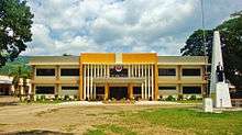
Sogod is politically subdivided into forty-five barangays; ten of which compose the poblacion (town proper): Rizal, San Jose, San Pedro, San Roque, Tampoong, Zone I, Zone II, Zone III, Zone IV and Zone V.

Kahupian is the largest barangay in the municipality, in terms of land area. Other large villages such as San Francisco Mabuhay, Hipantag, Kauswagan, Javier, Hindangan and Magatas are only accessible by habal-habal via feeder roads (with the exception of barangay Javier, which is reachable by jeepney and motorcab plying for Libagon town).
Most of the smaller barangays are found in densely populated areas in the municipality, particularly in the poblacion. These barangays are Zone I, Zone II, Zone III, Zone IV and Zone V, San Jose, Rizal, Mabicay and Consolacion.
List of Barangays
These are the districts that constitute the municipality of Sogod:[38]
| Name of Barangay | Population (2010)[2] | Number of Households (2000) |
|---|---|---|
| Benit | 328 | 54 |
| Buac Daku | 101 | 29 |
| Buac Gamay | 742 | 125 |
| Cabadbaran | 179 | 49 |
| Consolacion | 1,161 | 246 |
| Dagsa | 483 | 94 |
| Hibod-Hibod | 368 | 92 |
| Hindangan | 125 | 26 |
| Hipantag | 298 | 47 |
| Immaculada Concepcion (Concepcion I) | 1,179 | 206 |
| Javier | 721 | 133 |
| Kahupian | 1,363 | 261 |
| Kanangkaan | 309 | 61 |
| Kauswagan | 321 | 73 |
| La Purissima Concepcion (Concepcion II) | 1,075 | 173 |
| Libas | 1,865 | 304 |
| Lum-an | 127 | 24 |
| Maac | 1,788 | 334 |
| Mabicay | 719 | 92 |
| Magatas | 1,139 | 201 |
| Mahayahay | 914 | 167 |
| Malinao | 497 | 76 |
| Maria Plana | 234 | 32 |
| Milagroso | 657 | 100 |
| Olisihan | 440 | 60 |
| Pancho Villa | 1,030 | 177 |
| Pandan | 1,182 | 179 |
| Rizal | 1,852 | 287 |
| Salvacion | 710 | 137 |
| San Francisco Mabuhay | 437 | 83 |
| San Isidro (Malupao) | 1,030 | 173 |
| San Jose | 1,326 | 243 |
| San Juan (Agta) | 668 | 129 |
| San Miguel (Batang) | 1,269 | 184 |
| San Pedro (Hipgasan) | 1,707 | 241 |
| San Roque | 1,528 | 279 |
| San Vicente | 189 | 30 |
| Santa Maria | 209 | 42 |
| Suba | 1,031 | 218 |
| Tampoong | 1,622 | 285 |
| Zone I (San Antonio) | 1,531 | 297 |
| Zone II | 821 | 184 |
| Zone III (San Lorenzo Ruiz) | 2,138 | 352 |
| Zone IV | 462 | 107 |
| Zone V | 3,536 | 580 |
Education
| Statistics on Education | |
|---|---|
.JPG) | |
| Literacy Rate | 98% |
| Pre-Elementary : | Public: 28 Private: 6 |
| Elementary : | Public: 28 Private: 7 |
| Secondary : | Public: 3 Private: 1 |
| Tertiary : | Public: 1 Private: 2 |
Recently, the municipality of Sogod is divided into two school districts. The school districts under the Department of Education (DepEd), oversee the implementation of programs and thrusts of the department. The School districts are consists of Sogod (Sogod Central School) as the center of the west district and barangay Consolacion (Consolacion Elementary School) as the center of the east district.

Secondary education is being provided by three National High Schools and a Catholic-run institution, which makes the municipality as a thriving centre for education in the north-central part of the province. Last 2014, Representative Damian G. Mercado filed two house bills, namely: House Bill No. 1743 and House Bill No. 1739, establishing National Vocational High Schools in the barangays of Kahupian and San Isidro. Students from the northern barangays of Benit, Hibod-hibod, Hipantag, Kahupian, Magatas, Pancho Villa, San Isidro, San Juan, San Francisco Mabuhay, San Isidro, San Vicente and Suba would travel to the poblacion or to barangay Polahongon in Mahaplag for basic High School education. The House Bills are now pending for approbation in the Congress.
Tertiary Education is being concentrated in four colleges in the poblacion with Ormoc City Institute of Technology as the latest addition to the town’s educational facilities.
List of Elementary Schools
| Name of School | Address |
|---|---|
| Benit Primary School | barangay Benit |
| Buac Adventist Elementary School | barangay Buac Gamay |
| Buac Elementary School | barangay Buac Gamay |
| Cabadbaran Primary School | barangay Cabadbaran |
| Concepcion Elementary School | barangay Concepcion |
| Consolacion Elementary School | barangay Salvacion |
| Dagsa Primary School | barangay Dagsa |
| Grace Baptist School of Sogod (GCS) | Tranquilino Dagohoy Street, barangay Zone I (Poblacion) |
| Hindangan Primary School | barangay Hindangan |
| Hipantag Primary School | barangay Hipantag |
| Kahupian Elementary School | National Highway, barangay Kahupian |
| Kanangkaan Elementary School | barangay Kanangkaan |
| Kauswagan Primary School | barangay Kauswagan |
| Libas Elementary School | barangay Libas |
| Lum-an Primary School | barangay Lum-an |
| Maac Elementary School | barangay Maac |
| Magatas Elementary School | barangay Magatas |
| Marianne Learning Center (Primary) | G. Ruiz Street, barangay San Jose (Poblacion) |
| Merryhills Academy of Sogod (Primary) | Veloso Street, barangay Rizal (Poblacion) |
| Milagroso Elementary School | barangay Milagroso |
| Olisihan Elementary School | National Highway, barangay Olisihan |
| Our Lady of Consolation Kindergarten School | barangay Consolacion |
| Pancho Villa Elementary School | National Highway, barangay Pancho Villa |
| Pandan – San Miguel Elementary School | National Highway, barangay San Miguel |
| Rizal Primary School | barangay Rizal |
| Royal Waldorf School | Jovencio Caday Street (formerly San Antonio Street), barangay Zone I (Poblacion) |
| San Isidro Elementary School | National Highway, barangay San Isidro |
| San Juan Elementary School | barangay San Juan |
| San Pedro Elementary School | Kangleon Drive Extension, barangay San Pedro |
| San Vicente Primary School | barangay San Vicente |
| Sogod Adventist Multigrade School | barangay Rizal |
| Sogod Central School | Dela Plana Street, barangay Zone I |
| Sogod Special Education Division School (SPED) | Dela Plana Street, barangay Zone I (Poblacion) |
| Saint Thomas Aquinas College (STAC) | Concepcion Street, barangay Zone IV (Poblacion) |
| Suba Elementary School | National Highway, barangay Suba |
List of Secondary Schools
| Name of School | Address |
|---|---|
| Consolacion National High School (CNHS) | National Highway, barangay Salvacion |
| Libas National High School (LNHS) | barangay Libas |
| Saint Thomas Aquinas College (STAC) | Concepcion Street, barangay Zone IV (Poblacion) |
| Sogod National High School (SNHS) | Flores Street, Barangay Zone I (Poblacion) |
List of Colleges and Universities
| Name of College/University | Address |
|---|---|
| Ormoc City Institute of Technology - Sogod Branch (OCIT) | Panfilo Regis Building, Leopoldo Regis Street, barangay Zone V (Poblacion) |
| Saint Thomas Aquinas College (STAC) | Concepcion Street, barangay Zone IV (Poblacion) |
| Southern Leyte State University (SLSU) Main Campus | Concepcion Street, barangay San Roque (Poblacion) |
Health

The planning and the implementation of health care programs in the municipality are shouldered by the Sogod Rural Health Unit (RHU). The department operates a number of Rural Health Centers (RHC), Barangay Health Stations (BHS) and one municipal-run hospital, the Sogod District Hospital (SDH), with a total bed capacity of fifty. The private sector, mostly medical practitioners from the Sogod District Hospital, operates three hospitals in Sogod. Medical clinics present in the town proper are being serviced by attending doctors from the local health department.
List of Hospitals
| Name of Hospital | Address |
|---|---|
| Consuelo K. Tan Memorial Medical Center, Inc. (established in 1960) | Osmeña Street, Barangay Zone II (Poblacion) |
| Corrompido Specialty Hospital (established in 1960) | Leopoldo Regis Street, Barangay Zone V (Poblacion) |
| Pudpud Polyclinic and Specialty Hospital | National Highway, Barangay San Miguel |
| Sogod District Hospital | Osmeña Street, Barangay Zone I (Poblacion) |
Infrastructure
Transportation
Jeepneys, habal-habals and potpots are common means of public transportation in the municipality. A converted army jeep outfitted with many decorations, jeeepneys are often used for short trips and plays an integral part of the town’s public transportation system. Jeepneys in the town bound for these routes:
- Sogod – Bato/Hilongos
- Sogod – Maasin City
- Sogod – Malitbog/Padre Burgos
- Sogod – TONC
- Sogod – Paku
- Sogod – Libagon
- Sogod – Himay-angan/Liloan
- Sogod – Saint Bernard/Hinunangan
Habal-habal, a motorcycle modified to seat more than six persons, is used by commuters plying for the interior and far-flung areas of the municipality. Most habal-habals terminate at:
- Mahaplag town proper
- Polahongon
- Kahupian/Kabernal/Lubong Sapa/Hagna
- San Vicente/San Juan
- Magatas/Benit
- Buac Gamay
- Dagsa
- Matalwa
- Milagroso
- Libas/Kauswagan/Pangi
- Taa/Guinsangaan
- Hilaan/Pamigsian/Beniton
- Paku/Buenavista
- Catmon
- Dao/Mauylab
A potpot is a type of an auto rickshaw carrying nine to twelve passengers, including the driver. In Sogod, the rickshaws are classified into three color types: blue, white and red. The blue potpots roam around the vicinity of the poblacion and the barangays of Santa Cruz, Mabicay, Tampoong, San Pedro, San Roque, Rizal, Pandan and San Miguel. The white potpots cover the western areas of Sogod Bay, covering from barrio Casao, passing through Bontoc town proper and barrios Divisoria and San Vicente, to the poblacion of Tomas Oppus town. And the red potpots span the eastern section of the bay, starting from barangays San Miguel and Suba to barangay Nahulid of Libagon town.
The town of Sogod can be reached via land, air and sea. Sogod is a three-to-six-hour-ride from Cebu City via sea travel (ships dock at the ports of Bato and Hilongos, in the province of Leyte) and a three-day drive from Manila through the Pan-Philippine Highway.
Sogod is also accessible by air from Manila through Tacloban City’s Daniel Z. Romualdez Airport. Though heavily damaged by Typhoon Haiyan, the airport remains a vital thoroughfare in travelling to other points of Eastern Visayas. From Tacloban Transport Terminal in narangay Abucay, Tacloban City, one can take a Public Utility Vehicle (PUV) or a bus bound for Sogod. Buses from the cities of Baybay, Maasin, Ormoc and Tacloban terminate daily at the town’s Doctor Gonzalo D. Yong, Jr. Bus Terminal. The town is a vital link connecting Visayas and Mindanao because of its nearness to the ports of Liloan and Benit in San Ricardo town. These seaports provide daily trips to Surigao City, the gateway of Mindanao.
Utilities
Water and Electricity
Water services are managed by the Sogod Water District (SWD), which is presently serving a total of 2,524 concessionaires throughout the town. The water district was created pursuant to the Presidential Decree 188 (Provincial Water Utilization Act of 1973) with the approval of the municipal government of Sogod. After the issuance of Conditional Certificate of Conformance No. 188, the SWD was given authority to start its operation to supply and maintain potable water to the residents of the town.
Electricity is powered by the Southern Leyte Electric Cooperative (SoLeCo), the only electric power distributor in Southern Leyte. Created under Presidential Decree 269 as a non-stock and non-profit, service oriented cooperative for the purpose of supplying electricity in an area coverage basis, the SOLECO began its operation in December 1, 1975. Electrification efforts in the province was first launched in the towns of Macrohon and Padre Burgos (February 15, 1976), Malitbog (August 2, 1976), Tomas Oppus (January 11, 1977), Bontoc (May 10, 1977) and Sogod (December 26, 1977). The second phase of the electrification started only after the electric company signed into a contract with Engineering and Development Corporation of the Philippines (EDCOP) for the latter's architecture and engineering services in the survey and design of the expansion in Libagon, the Pacific area and Panaon island in 1979.[50]
Communications
Telecommunication facilities, broadband and wireless internet connections are provided by Globe Telecoms, Smart Communications and Sun Cellular.
Tourism

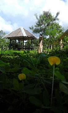
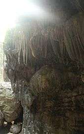
The main attraction of the town is the Agas-Agas Bridge, the country’s tallest viaduct. Other sites found in the municipality are the Banat-e Spring of barangay San Pedro, the CTL Farms in barangay Concepcion, Dagsa-Pasanon Falls in barangay Dagsa, the Lanao Spring in barangay San Juan, the Calvary Trail of barangays San Roque and Milagroso, the mighty Subangdaku River in the barangays of Suba and San Miguel, the Buac-Malinao Reservoir of barangay Malinao, La Caridad Farms in barangay Buac Gamay, Labong Cave in barangay Javier, the Magapso Fish and Marine Sanctuary of barangay Maac, the Manubsuab Falls in barangay Kanangkaan, the black sand beach of barangay Consolacion and the Prima, Cabadoy and Palanca Pebble Beaches in barangay San Jose. Inns and hotel accommodations are concentrated in the poblacion.
Agas-Agas Bridge and Adventure Park
Cainting Cave and Falls
A hidden cave has recently been discovered by foreign visitors trailing in the northern mountainous area of the town. Undisturbed by human activities, the cave matched with a cascading falls has not yet been fully explored. This site served as meeting point of three rivers which offers a scenic junction of a natural pool. The presence of leeches locally known as “limatok” added to the excitement of the trip. This site is a part of the lush Sogod Rainforest.
It can be reached after a five-kilometer walk from the road proper in barangay Pancho Villa to the barrio of San Francisco Mabuhay. Pancho Villa is a 20-minute habal-habal ride from Doctor Gonzalo Yong Bus Terminal in the poblacion. Cainting Cave and Falls is located near the famous Agas-agas Bridge of Kahupian.[51]
Magsuhot Park
The 500-hectare forested Magsuhot National Park, located three kilometers from barangay Mahayahay, has a four 20-meter high waterfalls falling into a common basin.
References
- 1 2 "Province: Southern Leyte". PSGC Interactive. Makati City, Philippines: National Statistical Coordination Board. Retrieved 8 July 2013.
- 1 2 3 "Total Population by Province, City, Municipality and Barangay: as of May 1, 2010" (PDF). 2010 Census of Population and Housing. National Statistics Office. Retrieved 8 July 2013.
- ↑ PSA; Census of Population (2015), "Region VIII (EASTERN VISAYAS)", Total Population by Province, City, Municipality and Barangay, retrieved 30 May 2016
- 1 2 3 4 5 6 7 8 9 10 11 Breve Reseña de lo que fue y de lo que es la Diocesis de Cebu en las Islas Filipinas. Cebu CIty: University of San Carlos Press. 2014. Check date values in:
|access-date=(help); - 1 2 3 4 5 Imperial, Reynaldo (1996). Leyte, 1898-1902 : the Philippine-American War _ Philippine-American War. Diliman, Quezon CIty: Office of Research Coordination, University of the Philippines.
- 1 2 3 4 5 6 de la Costa, Rev. Fr. Horacio (1965). Readings in Philippine History. Manila: Bookmark, Inc.
- ↑ "Inopacan Profile: Culture and History". inopacanprofile. Retrieved 2016-01-13.
- ↑ "The Philippine Islands, 1493-1803, Volume V., 1582-1583". Retrieved January 14, 2015.
- ↑ Dimayuga, Paul. "Messianic Leaders of the Revolution". Philippine History Group of Los Angeles. Retrieved January 24, 2016.
- ↑ Borrinaga, Rolando (September 25–28, 2000). "Leyte: A Forgotten Symbol of Resistance Movements in the Visayas". http://www.oocities.org. Retrieved May 7, 2014. External link in
|publisher=(help) - 1 2 3 4 5 Gan, Edito (1990). Sogod, Southern Leyte: Then and Now. Sogod, Southern Leyte: Sogod Local Government Unit.
- 1 2 3 4 Chong, Joaquin (1996). Southern Leyte (Book II - Towns). Maasin City, Southern Leyte. pp. 50–51. Check date values in:
|access-date=(help); - 1 2 3 4 5 "Leyte Historical Junctures". oocities. Retrieved January 14, 2016.
- 1 2 Borrinaga, Rolando (2006). The Colonial Odyssey of Leyte (1521-1914), a translation of Reseña de la Provincia de Leyte by Manuel Artigas y Cuerva. Quezon City: New Days Publisher.
- ↑ "The sitio of Benit to be known as the barrio of Benit". lawph.com. June 21, 1959. Retrieved May 3, 2011.
- ↑ "The sitio of Cabadbaran to be known as the barrio of Cabadbaran". lawph.com. June 21, 1959. Retrieved May 3, 2011.
- ↑ "The sitio of Dagsa to be known as the barrio of Dagsa". lawph.com. June 21, 1959. Retrieved May 3, 2011.
- ↑ "The sitio of Hibod-Hibod to be known as the barrio of Hibod-Hibod". lawph.com. June 21, 1959. Retrieved May 3, 2011.
- ↑ "The sitio of Hindangan to be known as the barrio of Hindangan". lawph.com. June 21, 1959. Retrieved May 3, 2011.
- ↑ "The sitio of Hipantag to be known as the barrio of Hipantag". lawph.com. June 19, 1965. Retrieved May 3, 2011.
- ↑ "The sitio of Punong in the Municipality of Sogod, Province of Leyte, is hereby converted into a barrio to be known as Barrio La Purisima Concepcion". lawph.com. June 21, 1959. Retrieved May 3, 2011.
- ↑ "An act creating the barrio of Kahupian". http://laws.chanrobles.com. June 19, 1971. Retrieved May 8, 2014. External link in
|publisher=(help) - ↑ "The sitio of Kauswagan to be known as the barrio of Kauswagan". lawph.com. June 21, 1959. Retrieved May 3, 2011.
- ↑ "Sitios Kantabuan, Baycasili, Mamingaw, Tagabaca and Kampuwa, into a barrio to be named Barrio Kauswagan". lawph.com. June 19, 1960. Retrieved May 3, 2011.
- ↑ "The sitio of Mabicay to be known as the barrio of Mabicay". lawph.com. June 21, 1959. Retrieved May 3, 2011.
- ↑ "The sitio of Malinao to be known as the barrio of Malinao". lawph.com. June 21, 1959. Retrieved May 3, 2011.
- ↑ "The sitio of Maria Plana to be known as the barrio of Maria Plana". lawph.com. June 21, 1959. Retrieved May 3, 2011.
- ↑ "The sitio of Milagroso to be known as the barrio of Milagroso". lawph.com. June 21, 1959. Retrieved May 3, 2011.
- ↑ "The sitio of Olisihan to be known as the barrio of Olisihan". lawph.com. June 21, 1959. Retrieved May 3, 2011.
- ↑ "The sitio of Pinamono-an to be known as the barrio of Pinamono-an". http://philippinelaw.info. June 21, 1959. Retrieved May 9, 2014. External link in
|publisher=(help) - ↑ Pedalino, Marcelo. "New substation solves low power woes in Sogod Bay". http://news.pia.gov.ph. Retrieved May 9, 2014. External link in
|publisher=(help) - ↑ "The sitio of Rizal to be known as the barrio of Rizal". lawph.com. June 21, 1959. Retrieved May 3, 2011.
- ↑ "The sitio of San Francisco Mabuhay to be known as the barrio of San Francisco Mabuhay". lawph.com. June 21, 1959. Retrieved May 3, 2011.
- ↑ "The sitio of San Jose to be known as the barrio of San Jose". lawph.com. June 21, 1959. Retrieved May 3, 2011.
- ↑ "The sitio of San Juan to be known as the barrio of San Juan". lawph.com. June 21, 1959. Retrieved May 3, 2011.
- ↑ "The sitio of San Vicente to be known as the barrio of San Vicente". lawph.com. June 21, 1959. Retrieved May 3, 2011.
- ↑ "The sitio of Sta. Maria to be known as the barrio of Sta. Maria". lawph.com. June 21, 1959. Retrieved May 3, 2011.
- 1 2 "Total Population by Province, City, Municipality and Barangay as of 2010 (Southern Leyte)". www.blgs.gov.ph. June 2010. Retrieved June 2010. Check date values in:
|access-date=(help) - ↑ "Southern Leyte mountains and peaks". http://www.peakery.com. Retrieved May 7, 2014. External link in
|publisher=(help) - ↑ "New Species of Frogs Discovered in the Philippine Forest of Southern Leyte - A Critical Biodiversity Area". Department of Environment and Natural Resources. Retrieved May 7, 2014.
- 1 2 3 4 Inercar Paper
- ↑ Southern Leyte-News on Samar 5
- ↑ "Southern Leyte governor seeks suspension of Subang Daku River quarrying". www.manilanewsonline.com. 2003-12-11. Retrieved May 7, 2014.
- ↑ "Subang Daku quarrying issue in S. Leyte heats up". Sun Star Tacloban. August 13, 2013. Retrieved May 7, 2014.
- ↑ "G.R. No. L-38204 September 24, 1991 THE MUNICIPALITY OF SOGOD, petitioner, vs. HON. AVELINO S. ROSAL, as Judge of the Court of First instance of Southern Leyte, Branch III, THE PROVINCIAL BOARD OF SOUTHERN LEYTE, HON. SALVACION O. YNIGUEZ, in her capacity as Governor of Southern Leyte and the MUNICIPALITY OF BONTOC, respondents. G.R. No. 38205 September 24, 1991 THE MUNICIPALITY OF SOGOD, petitioner, vs. HON. AVELINO S. ROSAL, as Judge of the Court of First Instance of Southern Leyte, Branch III and the Municipality of Bontoc, respondents.". www.lawphil.net. September 24, 1991. Retrieved September 24, 1991. Check date values in:
|access-date=(help) - 1 2 3 Pedalino, Bong (1993). Silver Anniversary Diocese of Maasin. Maasin City, Southern Leyte: Diocese of Maasin. p. 47. Check date values in:
|access-date=(help); - ↑ (Holy Child Parish - Consolacion) Silver Anniversary Diocese of Maasin. Maasin City, Southern Leyte: Diocese of Maasin. 1993. p. 48. Check date values in:
|access-date=(help); - ↑ "Local Government Performance Management System". www.blgs.gov.ph. March 31, 2012. Retrieved March 31, 2012.
- ↑ "2016 Election Results: Sogod, Southern Leyte". http://election-results.rappler.com. May 10–12, 2016. Retrieved May 10, 2016. External link in
|publisher=(help) - ↑ "History of Southern Leyte Electric Cooperative (SOLECO)". Southern Leyte Electric Cooperative. Retrieved May 18, 2016.
- ↑ "Kainting Cave in Sogod attracts tourists". www.pia.gov.ph. 2003-12-11. Retrieved May 7, 2011.
External links
| Wikimedia Commons has media related to Sogod, Southern Leyte. |
| Wikivoyage has a travel guide for Sogod, Southern Leyte. |
- Sogod Official Website
- 2007 National Satistical Coordination Board
- Southern Leyte Official Website
- Philippine Standard Geographic Code
- Philippine Census Information
- Local Governance Performance Management System
 |
Inopacan, Leyte | Mahaplag, Leyte | Silago | |
| Hindang, Leyte Hilongos, Leyte |
|
|||
| ||||
| | ||||
| Bontoc | Sogod Bay | Libagon |
