Jiabong, Samar
| Jiabong Hia-an | |
|---|---|
| Municipality | |
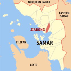 Map of Samar with Jiabong highlighted | |
.svg.png) Jiabong Location within the Philippines | |
| Coordinates: 11°46′N 124°57′E / 11.767°N 124.950°ECoordinates: 11°46′N 124°57′E / 11.767°N 124.950°E | |
| Country | Philippines |
| Region | Eastern Visayas (Region VIII) |
| Province | Samar |
| Congr. district | 2nd district of Samar |
| Barangays | 34 |
| Government[1] | |
| • Mayor | Jocelyn U. De Jesus |
| Area[2] | |
| • Total | 67.70 km2 (26.14 sq mi) |
| Population (2010)[3] | |
| • Total | 17,075 |
| • Density | 250/km2 (650/sq mi) |
| Time zone | PST (UTC+8) |
| ZIP code | 6701 |
| Dialing code | 55 |
Jiabong is a fifth class municipality in the province of Samar, Philippines. According to the 2010 census, it has a population of 17,075 people.[3]
Jiabong was created in 1948 from the barrios of Jiabong, Jia-an, Malino, San Fernando, Casapa, Camorubo-an, Lulugayan, Macabitas Paglayogan, Dogongan, Bayog, and Malobago, formerly part of Catbalogan.[4]
History
In 1882, during the Spanish regime in the Philippines, Jiabong was made into a town or municipio. It was made as the cabeza de barangay, incorporating the barangays of Jia-an, San Fernando, Malino, Camarubo-an and the rest of the barangays that were founded later. During the Filipino-American war in 1900 to 1904, Catbalogan City, Samar, the capital town, was placed under military rule. Jiabong became a barrio of Catbalgan from 1905 until June 15, 1948
Jiabong became a separate municipality of Samar and got its independence from the Municipality of Catbalogan on October 22, 1948 when Congress approved House Bill No. 1812 into law. Under Republic Act. No. 269. On October 27, 1948 Jiabong was inaugurated as a municipality. President Elpidio Qurino appointed Domingo Jabinal as the Municipal Mayor and Eleuterio Bacarra as the Vice Mayor.
Legend History
The name Jiabong is a combination of the terms “Hiya-an” which means a “place of preparation before an attack” and “bong” which is actually “the sound of a canon gun”. According to the legend, during Spanish time, villagers from Motiong, Paranas and San Sebastian fled to Casandig (now Jiabong) to seek refuge from the invading pirates who killed, robbed and held them as captives.
To rescue the villagers, the Spanish soldiers and guardia civil camped at Casandig and mounted their preparations for an eventual pirate attack. The Spanish soldiers cried “Ensiqueda Fuego, Hia-bong!” as cannons were fired on the invaders. After this victorious fight, remained two words: Jia-bong.
Barangays
Jiabong is politically subdivided into 34 barangays.[2]
- Bawang
- Bugho
- Camarubo-an
- Candayao
- Cantongtong
- Casapa
- Catalina
- Cristina
- Dogongan
- Garcia
- Hinaga
- Jia-an
- Jidanao
- Lulugayan
- Macabetas
- Malino
- Malobago (Villalinda)
- Mercedes
- Nagbac
- Parina
- Barangay No. 1 (Pob.)
- Barangay No. 2 (Pob.)
- Barangay No. 3 (Pob.)
- Barangay No. 4 (Pob.)
- Barangay No. 5 (Pob.)
- Barangay No. 6 (Pob.)
- Barangay No. 7 (Pob.)
- Barangay No. 8 (Pob.)
- Salvacion
- San Andres
- San Fernando
- San Miguel
- Tagbayaon
- Victory
Demographics
| Population census of Jiabong | ||
|---|---|---|
| Year | Pop. | ±% p.a. |
| 1990 | 12,751 | — |
| 1995 | 15,484 | +3.71% |
| 2000 | 15,397 | −0.12% |
| 2007 | 15,968 | +0.50% |
| 2010 | 17,075 | +2.47% |
| Source: National Statistics Office[3][5] | ||
Weather
Energy and Water
15 (25KVA Transformers)
Jiabong Water Services and Hydrant
Education
Jiabong has 27 public primary and elementary schools:
Jiabong also has three public high schools:
- Casapa National High School
- Jiabong National High School
- Malino National High School
References
- ↑ "Municipalities". Quezon City, Philippines: Department of the Interior and Local Government. Retrieved 15 May 2013.
- 1 2 "Province: Samar (Western Samar)". PSGC Interactive. Makati City, Philippines: National Statistical Coordination Board. Retrieved 15 May 2013.
- 1 2 3 "Total Population by Province, City, Municipality and Barangay: as of May 1, 2010" (PDF). 2010 Census of Population and Housing. National Statistics Office. Retrieved 15 May 2013.
- ↑ "An act creating the municipality of Jiabong, province of Samar". LawPH.com. Retrieved 2011-04-08.
- ↑ "Province of Western Samar". Municipality Population Data. LWUA Research Division. Retrieved 21 August 2013.
External links
- Philippine Standard Geographic Code
- Philippine Census Information
- Local Governance Performance Management System
- Photos and information on Jiabong Municipality
 |
San Jorge | San Jose de Buan | | |
| Catbalogan | |
Motiong | ||
| ||||
| | ||||
| Maqueda Bay Zumarraga |
|
Maqueda Bay San Sebastian |
Catbalogan (capital) | |
| Municipalities | |
| Component cities | |