Giporlos, Eastern Samar
| Giporlos | |
|---|---|
| Municipality | |
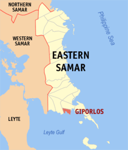 Map of Northern Samar with Giporlos highlighted | |
.svg.png) Giporlos Location within the Philippines | |
| Coordinates: 11°07′N 125°27′E / 11.12°N 125.45°ECoordinates: 11°07′N 125°27′E / 11.12°N 125.45°E | |
| Country | Philippines |
| Region | Eastern Visayas (Region VIII) |
| Province | Eastern Samar |
| Congr. district | Lone district of E. Samar |
| Barangays | 18 |
| Government[1] | |
| • Mayor | Mark S. Biong |
| Area[2] | |
| • Total | 97.51 km2 (37.65 sq mi) |
| Population (2015 census)[3] | |
| • Total | 13,308 |
| • Density | 140/km2 (350/sq mi) |
| Time zone | PST (UTC+8) |
| ZIP code | 6811 |
| Dialing code | +63 (0)55 |
| Website |
www |
Giporlos is a fifth class municipality in the province of Eastern Samar, Philippines. According to the 2015 census, it has a population of 13,308 people.[3]
Formerly Giporlos was a barangay part of Municipality of Balangiga.
Legend
Giporlos comes from the word "Hi-Podolos". "Gi" (pronounce as "Hi") is referring to person (man/woman). "Podlos" means "slipped". Legend says that there is a shore called "Rawis" in Giporlos where one woman was collecting sea shells. Suddenly, one Japanese soldier saw her and tried to raped her. But the woman ("Hi") fought back until her hands slipped ("Podlos") under the hands of moro soldier and she ran away. From that time on, the place was called "Hipodlos" and eventually became Giporlos.
Barangays
Giporlos is politically subdivided into 18 barangays.[2]
- Barangay 1 (Poblacion)
- Barangay 2 (Pob.)
- Barangay 3 (Pob.)
- Barangay 4 (Pob.)
- Barangay 5 (Pob.)
- Barangay 6 (Pob.)
- Barangay 7 (Pob.)
- Barangay 8 (Pob.)
- Biga
- Coticot
- Gigoso
- Huknan
- Parina
- Paya
- President Roxas
- San Miguel
- Santa Cruz (Cansingkol)
- San Isidro (Malabag)
Demographics
| Population census of Giporlos | ||
|---|---|---|
| Year | Pop. | ±% p.a. |
| 1990 | 11,001 | — |
| 1995 | 10,050 | −1.68% |
| 2000 | 10,218 | +0.36% |
| 2007 | 11,286 | +1.38% |
| 2010 | 12,040 | +2.38% |
| 2015 | 13,308 | +1.92% |
| Source: Philippine Statistics Authority[3][4][5] | ||
The population of Giporlos in the 2015 census was 13,308 people,[3] with a density of 140 inhabitants per square kilometre or 360 inhabitants per square mile.
References
- ↑ "Municipalities". Quezon City, Philippines: Department of the Interior and Local Government. Retrieved 24 April 2013.
- 1 2 "Province: Eastern Samar". PSGC Interactive. Makati City, Philippines: National Statistical Coordination Board. Retrieved 24 April 2013.
- 1 2 3 4 "Region VIII (EASTERN VISAYAS)". Census of Population (2015): Total Population by Province, City, Municipality and Barangay (Report). PSA. Retrieved 20 June 2016.
- ↑ "Total Population by Province, City, Municipality and Barangay: as of May 1, 2010" (PDF). 2010 Census of Population and Housing. National Statistics Office. Retrieved 24 April 2013.
- ↑ "Province of Eastern Samar". Municipality Population Data. LWUA Research Division. Retrieved 20 August 2013.
External links
- Philippine Standard Geographic Code
- Philippine Census Information
- Local Governance Performance Management System
 |
Quinapondan | | ||
| Balangiga | |
Quinapondan Bay | ||
| ||||
| | ||||
| Leyte Gulf |
Borongan (capital) | |
| Municipalities | |
| Component city | |