Santa Rita, Samar
| Santa Rita Lalawiton | ||
|---|---|---|
| Municipality | ||
|
The famous Surtidos Festival of Santa Rita is one of the typical local festivity in Samar. | ||
| ||
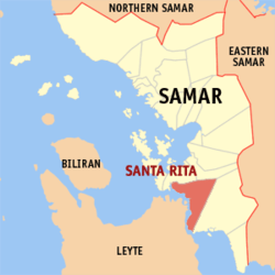 Map of Samar with Sta. Rita highlighted | ||
.svg.png) Santa Rita Location within the Philippines | ||
| Coordinates: 11°28′N 124°57′E / 11.467°N 124.950°ECoordinates: 11°28′N 124°57′E / 11.467°N 124.950°E | ||
| Country | Philippines | |
| Region | Eastern Visayas (Region VIII) | |
| Province | Samar | |
| Congr. district | 2nd district of Samar | |
| Barangays | 38 | |
| Government[1] | ||
| • Mayor | JOVEN P. TIU | |
| Area[2] | ||
| • Total | 411.77 km2 (158.99 sq mi) | |
| Population (2010)[3] | ||
| • Total | 38,082 | |
| • Density | 92/km2 (240/sq mi) | |
| Time zone | PST (UTC+8) | |
| ZIP code | 6718 | |
| Dialing code | 55 | |


Santa Rita is a fourth class municipality in the province of Samar, Philippines. According to the 2010 census, it has a population of 38,082 people.[3] Santa Rita is connected to Tacloban and Leyte Island by the San Juanico Bridge.
History
Santa Rita is a town known but to a few people of Samar. However, in a few years, the San Juanico Bridge will be completed. This multi-million bridge will be a water link between Tacloban City at one end and Santa Rita at the other. This link, which is the Philippine-Japan Friendship Highway, formerly known as the Philippine Highway, is envisioned to connect the entire archipelago from horth to south, facilitating travel and communication between Samar and Leyte and the provinces of Luzon and Mindanao. The tiny island between Samar and Leyte, known to many people as Tabucan Island, became the first site of poblacion. Local tradition dates the founding of the town to the early part of the eighteenth century. No historical records however and whatsoever could be found. The early settlers, according to the aged inhabitants, were the tribes of Agoy, Amistoso, Lacambara clans. Joaquin Amistoso rose to be their leader. San Juanico Strait was supposed to have been named in his honor. The people made their living by small-scale fishing. In 1800, Capitan Bartolome Sanchez, the head of the Spanish Expedition, was enticed by the people's friendliness and stayed to help the people of the island. He called nearby tribes to unite with them and made Joaquin Amistoso as Cabeza de Barangay. The ruin of the watch tower locally called Barawalti, are mute evidence of Moro raids. A fleet of moro vintas defeated Capitan Tiago and men. This fleet was headed by the famous Sultan Kudarat. Some of the people escaped to the marshy shores of the mainland of Samar. These refugees founded a barangay called Lalawiton with peril Lacambra as their capitan. The site of Lalawiton is the present site of the poblacion. In 1863, the municipality of Santa Rita was officially recognized by the Spanish authorities. Before that time it belonged to the Municipality of Basey, Santa Rita was reverted to its former status as a barangay of Basey from 1904 to 1906. Pedro Amistoso was elected as municipal president in the first local election held in 1908. Succeeding him were Mamerto Ilagan, 1910; Alipio Ragarit 1912; Inocencio Hilvano 1916; Florentino Nerviol, 1928; and Margarito Caberic 1932–1940. Conrado Adolfo was elected municipal mayor in 1941 but was unable to serve his full-time because of the onset of the Second World War. Florentino Nerviol served as Mayor from 1942 to 1944 and as [PCAU] (Philippine Civil Affairs Unit) mayor to January 6, 1945, and Margarito Caberic succeeded him up to May 31, 1946. Isidro Zeta was appointed mayor until the held in 1947. Succeeding him were Simplicio Lacaba 1948; Pedro Hilvano, acting 1952 and elected in 1956; Gaudencio Espino in 1960; re-elect in 1964 and again Pedro Hilvano elected in 1968 and re-elected in the latest election.
Barangays
Santa Rita is politically subdivided into 38 barangays.[2] In 1957, sitio Dampigan was converted into a barrio.[4]
- Alegria
- Anibongon
- Aslum
- Bagolibas
- Binanalan
- Cabacungan
- Cabunga-an
- Camayse
- Cansadong
- Caticugan
- Dampigan
- Guinbalot-an
- Hinangudtan
- Igang-igang
- La Paz
- Lupig
- Magsaysay
- Maligaya
- New Manunca
- Old Manunca
- Pagsulhogon
- Salvacion
- San Eduardo
- San Isidro
- San Juan
- San Pascual (Crossing)
- San Pedro
- San Roque
- Santa Elena
- Tagacay
- Tominamos
- Tulay
- Union
- Santan Pob. (Zone I)
- Bougainvilla Pob. (Zone II)
- Rosal Pob. (Zone III)
- Gumamela Pob. (Zone IV)
- Bokinggan Pob. (Zone V)
Demographics
| Population census of Sta. Rita | ||
|---|---|---|
| Year | Pop. | ±% p.a. |
| 1990 | 25,202 | — |
| 1995 | 28,930 | +2.62% |
| 2000 | 30,118 | +0.87% |
| 2007 | 34,959 | +2.08% |
| 2010 | 38,082 | +3.16% |
| Source: National Statistics Office[3][5] | ||
References
- ↑ "2013 Election Result". MAYOR of SAMAR (WESTERN SAMAR) - SANTA RITA
As of 2013-May-18 10:06 PM. line feed character in
|publisher=at position 44 (help) - 1 2 "Province: Samar (Western Samar)". PSGC Interactive. Makati City, Philippines: National Statistical Coordination Board. Retrieved 15 May 2013.
- 1 2 3 "Total Population by Province, City, Municipality and Barangay: as of May 1, 2010" (PDF). 2010 Census of Population and Housing. National Statistics Office. Retrieved 15 May 2013.
- ↑ "An Act Converting the Sitio of Dampigan in the Municipality of Santa Rita, Province of Samar, into a Barrio". LawPH.com. Retrieved 2011-04-12.
- ↑ "Province of Western Samar". Municipality Population Data. LWUA Research Division. Retrieved 21 August 2013.
External links
- Current Photos of Sta Rita, Samar
- Philippine Standard Geographic Code
- Philippine Census Information
- Local Governance Performance Management System
 |
Villareal | Pinabacdao | | |
| Babatngon, Leyte / San Juanico Strait | |
Basey | ||
| ||||
| | ||||
| San Juanico Strait Tacloban |
Catbalogan (capital) | |
| Municipalities | |
| Component cities | |