Pastrana, Leyte
| Pastrana | ||
|---|---|---|
| Municipality | ||
| ||
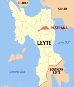 Map of Leyte with Pastrana highlighted | ||
.svg.png) Pastrana Location within the Philippines | ||
| Coordinates: 11°08′N 124°53′E / 11.133°N 124.883°ECoordinates: 11°08′N 124°53′E / 11.133°N 124.883°E | ||
| Country | Philippines | |
| Region | Eastern Visayas (Region VIII) | |
| Province | Leyte | |
| Congr. district | 2nd district of Leyte | |
| Barangays | 29 | |
| Government[1] | ||
| • Mayor | Ernesto N. Martillo | |
| Area[2] | ||
| • Total | 86.35 km2 (33.34 sq mi) | |
| Population (2010)[3] | ||
| • Total | 16,649 | |
| • Density | 190/km2 (500/sq mi) | |
| Time zone | PST (UTC+8) | |
| ZIP code | 6514 | |
| Dialing code | 53 | |

Pastrana is a fifth class municipality in the province of Leyte, Philippines. According to the 2010 census, it has a population of 16,649 people.[3]
Barangays
Pastrana is politically subdivided into 29 barangays.[2]
- Arabunog
- Aringit
- Bahay
- Cabaohan
- Calsadahay
- Cancaraja
- Canino-an
- Capilla
- Colawen
- Dumarag
- Guindapunan
- Halaba
- Jones
- Lanawan
- Lima
- Lourdes
- Macalpi-ay
- Malitbogay
- Manaybanay
- Maricum
- Patong
- District 1 (Pob.)
- District 2 (Pob.)
- District 3 (Pob.)
- District 4 (Pob.)
- Sapsap
- Socsocon
- Tingib
- Yapad
History
Sometimes referred to as the "land of the fairies," Pastrana is an interior town of the province. Geographically, it is in the southwestern part of Leyte, and about twenty-seven kilometers away from Tacloban City. Its rice fields and coconut plantations are the main assets of the place. The people are peace-loving, the climate cool and the soil fertile.
Before the coming of the Spaniards, the settlement was called "Pamagpagan" because of the way the native inhabitants left their hair in disarray. In 1891, Captain Wenceslao Nielo, with the aid of a Spanish Franciscan friar by the name of Fr. Eusebio Ibanez, organized the settlement into a town and was transferred from Guinbaya-an to its present site. Father Ibanez blessed it with a holy mass. As a token of gratitude, the inhabitants called the town "Pastrana" in honor of Fr. Ibanez who was a native of Pastrana, Spain.
Shortly afterwards, parochial schools were established. At this time, the unit of local administration was the pueblo which embraced a number of barrios. The first gobernadorcillo was Captain Wenceslao Nielo. He was assisted in the administration of the pueblo by the "Guinhaupan," a group of men equivalent to the present councilors, by the "tenientes" and by the "Cabezas de barangay."
When the Philippine revolution broke out in 1898, the people fled to the mountains and for a time, the local government then headed by Andres Villablanca, was temporarily suspended. It was at this moment in the history of the town that Jorge Capili, a guerrilla leader, burned the whole town. By the year 1901, Gregorio Marquez was appointed municipal president. The Americans who occupied the whole country, stationed a detachment at Dagami. They came once in a while to Pastrana to look after the affairs of the little town. In 1903, the town was reverted into a barrio of Dagami due to inadequate finances.
Pastrana for a time remained a barrio of Dagami. In 1912, Agaton Villablanca worked for the establishment of the barrio to a municipality so that its former status was finally regained. In gratitude, the people appointed Agaton Villablanca president. After five years when the first municipal election was held, Agaton Villablanca retained his leadership of the municipal government.
When the Japanese occupied Pastrana in 1942, the people secretly fled to the mountains. The incumbent mayor also evacuated and his elder brother took his place. The Japanese did not stay long. The guerillas burned down the buildings and for some time there were no Japanese in the town. But in 1943, the Japanese returned, this time for long, for the soldiers constructed a garrison. The Japanese invaders ordered the civilians to live in the town proper. For two long years, the town residents suffered severely under the Japanese oppression.
In 1944 when the American liberation forces drove out the Japanese, Francisco Villablanca, who was the pre-war mayor, automatically resumed his position and under him, the town was restored to its former status as a peaceful community.
At present, Pastrana is fast progressing in the agricultural field because of the biggest gravity irrigation system in eastern Visayas, located at Barrio Tingib, lacing the whole municipality with irrigation canals. A direct road to Palo as well as feeder roads have been constructed. The Binaha-an Dam provides an ideal picnic site with the stately Amandawing mountain in the background.
The completion of the construction of a water system at Tingib designed to supply Tacloban and neighboring municipalities will mean further upliftment of the quality of life of the Pastrana people.
Demographics
| Population census of Pastrana | ||
|---|---|---|
| Year | Pop. | ±% p.a. |
| 1990 | 12,565 | — |
| 1995 | 14,442 | +2.64% |
| 2000 | 14,351 | −0.14% |
| 2007 | 16,008 | +1.52% |
| 2010 | 16,649 | +1.44% |
| Source: National Statistics Office[3] | ||
References
- ↑ "Municipalities". Quezon City, Philippines: Department of the Interior and Local Government. Retrieved 24 June 2013.
- 1 2 "Province: Leyte". PSGC Interactive. Makati City, Philippines: National Statistical Coordination Board. Retrieved 24 June 2013.
- 1 2 3 "Total Population by Province, City, Municipality and Barangay: as of May 1, 2010" (PDF). 2010 Census of Population and Housing. National Statistics Office. Retrieved 24 June 2013.
External links
- Philippine Standard Geographic Code
- Philippine Census Information
- Local Governance Performance Management System
 |
Jaro | Alangalang | Santa Fe | |
| Ormoc | |
Palo | ||
| ||||
| | ||||
| Dagami |
Tacloban (capital) | |
| Municipalities |
|
| Component city | |
| Independent component city |
|
| Highly urbanized city |
|