Shorewood, Wisconsin
| Shorewood, Wisconsin | |
|---|---|
| Village | |
 Location of Shorewood, Wisconsin | |
| Coordinates: 43°5′31″N 87°53′11″W / 43.09194°N 87.88639°WCoordinates: 43°5′31″N 87°53′11″W / 43.09194°N 87.88639°W | |
| Country | United States |
| State | Wisconsin |
| County | Milwaukee |
| Area[1] | |
| • Total | 1.59 sq mi (4.12 km2) |
| • Land | 1.59 sq mi (4.12 km2) |
| • Water | 0 sq mi (0 km2) |
| Elevation[2] | 679 ft (207 m) |
| Population (2010)[3] | |
| • Total | 13,162 |
| • Estimate (2012[4]) | 13,196 |
| • Density | 8,278.0/sq mi (3,196.2/km2) |
| Time zone | Central (CST) (UTC-6) |
| • Summer (DST) | CDT (UTC-5) |
| Area code(s) | 414 |
| FIPS code | 55-73725[5] |
| GNIS feature ID | 1574071[2] |
| Website |
villageofshorewood |
Shorewood is a village in Milwaukee County, Wisconsin, United States. The population was 13,162 at the 2010 census. Howell Raines of The New York Times said in 1979 that "[t]his maple-studded town on Lake Michigan dotes on its reputation as Milwaukee's most liberal suburb."[6]
Geography
Shorewood is located at 43°05′31″N 87°53′11″W / 43.092061°N 87.886333°W (43.092061, -87.886333).[7]
Nestled between the Milwaukee River and Lake Michigan, Shorewood is bordered by the City of Milwaukee to the south and west and Whitefish Bay to the north. According to the United States Census Bureau, the village has a total area of 1.59 square miles (4.12 km2), all of it land.[1]
History
Shorewood originally seceded from the Town of Milwaukee in 1900 and was known as East Milwaukee until changing to its present name in 1917.[8]
Demographics
| Historical population | |||
|---|---|---|---|
| Census | Pop. | %± | |
| 1910 | 707 | — | |
| 1920 | 2,650 | 274.8% | |
| 1930 | 13,479 | 408.6% | |
| 1940 | 15,184 | 12.6% | |
| 1950 | 16,199 | 6.7% | |
| 1960 | 15,990 | −1.3% | |
| 1970 | 15,576 | −2.6% | |
| 1980 | 14,327 | −8.0% | |
| 1990 | 14,116 | −1.5% | |
| 2000 | 13,763 | −2.5% | |
| 2010 | 13,162 | −4.4% | |
| Est. 2015 | 13,311 | [9] | 1.1% |
2010 census
As of the census[3] of 2010, there were 13,162 people, 6,381 households, and 3,109 families residing in the village. The population density was 8,278.0 inhabitants per square mile (3,196.2/km2). There were 6,750 housing units at an average density of 4,245.3 per square mile (1,639.1/km2). The racial makeup of the village was 88.1% White, 2.9% African American, 0.2% Native American, 5.6% Asian, 0.8% from other races, and 2.3% from two or more races. Hispanic or Latino of any race were 3.4% of the population.
There were 6,381 households of which 23.2% had children under the age of 18 living with them, 38.0% were married couples living together, 7.6% had a female householder with no husband present, 3.0% had a male householder with no wife present, and 51.3% were non-families. 39.0% of all households were made up of individuals and 11.5% had someone living alone who was 65 years of age or older. The average household size was 2.06 and the average family size was 2.83.
The median age in the village was 37.2 years. 19.2% of residents were under the age of 18; 13% were between the ages of 18 and 24; 28% were from 25 to 44; 26.6% were from 45 to 64; and 13% were 65 years of age or older. The gender makeup of the village was 46.8% male and 53.2% female.
2000 census
As of the census[5] of 2000, there were 13,763 people, 6,539 households, and 3,328 families residing in the village. The population density was 8,599.5 people per square mile (3,321.2/km2), the highest in the state of Wisconsin. There were 6,696 housing units at an average density of 4,183.9 per square mile (1,615.8/km2). The racial makeup of the village was 91.43% White, 2.41% African American, 0.23% Native American, 3.19% Asian, 0.04% Pacific Islander, 0.84% from other races, and 1.85% from two or more races. Hispanic or Latino of any race were 2.51% of the population.
There were 6,539 households out of which 25.3% had children under the age of 18 living with them, 40.8% were married couples living together, 7.9% had a female householder with no husband present, and 49.1% were non-families. 39.5% of all households were made up of individuals and 12.3% had someone living alone who was 65 years of age or older. The average household size was 2.08 and the average family size was 2.87.
In the village the population was spread out with 21.0% under the age of 18, 8.4% from 18 to 24, 31.8% from 25 to 44, 24.3% from 45 to 64, and 14.5% who were 65 years of age or older. The median age was 38 years. For every 100 females there were 85.1 males. For every 100 females age 18 and over, there were 80.4 males.
The median income for a household in the village was $47,224, and the median income for a family was $67,589. Males had a median income of $47,616 versus $34,294 for females. The per capita income for the village was $32,950. About 3.8% of families and 6.7% of the population were below the poverty line, including 3.5% of those under age 18 and 7.5% of those age 65 or over.
Education
The Shorewood School District maintains four public schools:
- Shorewood High School – serving grades 9 through 12
- Shorewood Intermediate School – serving grades 7 and 8
- Atwater Elementary School – serving 4K through grade 6
- Lake Bluff Elementary School – serving 4K through grade 6
The Archdiocese of Milwaukee maintains one Catholic school in Shorewood, St. Robert School, which serves kindergarten through grade 8.
Landmarks and notable buildings
- Benjamin Church House (also known as Kilbourntown House) — The one-story Greek Revival house was built in 1844 for his family by Benjamin F. Church, a pioneer builder from New York, on N. Fourth Street in the Kilbourntown settlement. In 1938, after significant preservation efforts, the house was moved from its original site to its present location in Estabrook Park in Shorewood. The house was added to the National Register of Historic Places in 1972.[11]
- Hubbard Park — The wooded, terraced park spanning almost 5 acres (20,000 m2) along the east bank of the Milwaukee River has a colorful history. In its earlier years, the site used for Indian hunting grounds, a resort, a series of amusement parks, fishing shanties, to name a few. It is home to the Hubbard Park Lodge, constructed as a WPA project in 1936. It is also home to Hubbard Park Lodge Restaurant.[12]
- Shorewood High School campus — The school’s the 19-acre (77,000 m2) campus, built between 1924 and 1938, includes separate buildings for administration, physical education, arts and science, industrial arts, and theater arts. The auditorium was modeled after the RKO Theater in New York City.[13]
- Shorewood Village Hall — Originally built as a four-room schoolhouse in 1908, the building was purchased in 1916 by the Village of East Milwaukee for use as a village hall. It was extensively remodeled in 1937 with WPA funds, and again in 1985. The building was added to the National Register of Historic Places in 1984.[14]
- WITI TV Tower — Built in 1962, it was once one of the tallest free-standing lattice towers in the world, rising 1,078 feet (329 m).[15]
- Hayek Pharmacy — Located at 4001 N. Downer Ave, the original interior of the pharmacy was featured on the cover of the Images of America book on Shorewood's historic buildings. It is one of the oldest retail buildings in Shorewood, dating back to the turn of the 20th century.[16]
 Benjamin Church House
 Shorewood Village Hall
 Atwater Park
Notable people
- Marcus Monroe - Comedian, Juggler, Winner of the Andy Kaufman Award, Olivier Award, Off-Broadway Alliance Award
- Frankie Abernathy - reality TV star
- Les Aspin - U.S. House of Representatives (1971–1993), U.S. Secretary of Defense (1993–1994)
- Kate Baldwin - Broadway actress, 2010 Tony Award nominee for Best Performance by a Leading Actress in a Musical for Finian's Rainbow[17]
- Bill Carollo - NFL referee
- Dickey Chapelle - photojournalist and first female war correspondent[18]
- John Fiedler - (1925–2005) voice actor and character actor in stage, film, television, and radio; voice of Piglet in Disney's Winnie the Pooh productions, played role of Mr. Peterson, nervous patient on The Bob Newhart Show.[19]
- Paul C. Gartzke - Presiding Judge of the Wisconsin Court of Appeals
- Herschel Burke Gilbert - film and television composer
- Jerry Harrison - keyboardist for the Talking Heads and The Modern Lovers
- Walter Heller - Economic adviser to Presidents Lyndon B. Johnson and John F. Kennedy
- Kirby Hendee - Wisconsin State Senator
- Ari Herstand - singer/songwriter, now based out of L.A.
- Robert Watson Landry - Wisconsin State Assemblyman
- Stephen R. Leopold - Wisconsin State Assemblyman
- Jack Nagle - NBA scout
- Betty Jo Nelsen - Wisconsin State Assemblywoman
- Pat Peppler - NFL general manager and head coach
- Charlotte Rae - actress on The Facts of Life, 1944 graduate of Shorewood High School
- William Rehnquist - U.S. Supreme Court Chief Justice, 1941 graduate of Shorewood High School
- Ben L. Salomon - recipient of World War II Medal of Honor
- Jim Sensenbrenner - U.S. Representative
- Leif Shiras - professional tennis player
- Judy Tyler - actress.[20]
- Aaron Weistrop - American guitarist and composer.
- Jerry Zucker, David Zucker, and Jim Abrahams - co-directors of movies Airplane! and Top Secret! grew up in Shorewood; the bogus East German national anthem sung in Top Secret! is actually the Shorewood High School fight song with comic lyrics.
References
- 1 2 "US Gazetteer files 2010". United States Census Bureau. Archived from the original on January 24, 2012. Retrieved 2012-11-18.
- 1 2 "US Board on Geographic Names". United States Geological Survey. 2007-10-25. Retrieved 2008-01-31.
- 1 2 "American FactFinder". United States Census Bureau. Retrieved 2012-11-18.
- ↑ "Population Estimates". United States Census Bureau. Archived from the original on June 17, 2013. Retrieved 2013-06-24.
- 1 2 "American FactFinder". United States Census Bureau. Retrieved 2008-01-31.
- ↑ Raines, Howell. "Whites Grow Reluctant to Back Integration Steps; Overshadowed by Other Events." The New York Times. December 2, 1979. Section not stated, Page 1. Retrieved on November 5, 2011.
- ↑ "US Gazetteer files: 2010, 2000, and 1990". United States Census Bureau. 2011-02-12. Retrieved 2011-04-23.
- ↑ Shorewood Historical Society "Village History", Shorewood, Wisconsin Historical Society, 2009, Retrieved 17-01-2010.
- ↑ "Annual Estimates of the Resident Population for Incorporated Places: April 1, 2010 to July 1, 2015". Retrieved July 2, 2016.
- ↑ "Census of Population and Housing". Census.gov. Archived from the original on May 11, 2015. Retrieved June 4, 2015.
- ↑ Milwaukee County Historical Society, "Shorewood Landmarks", 2008. Retrieved 2010-07-03.
- ↑ "Shorewood Parks", Village Of Shorewood. Retrieved 2010-07-11
- ↑ Milwaukee County Historical Society, "Shorewood Landmarks", 2008. Retrieved 2010-07-04.
- ↑ Shorewood Historical Society, "Historical Markers", n.d. Retrieved 2010-07-02.
- ↑ "WITI-TV Tower", "Skyscraper Source Media Inc.", 2010. Retrieved 2010-07-03.
- ↑ Shorewood Historical Society (Shorewood, Wis.). (2000). Shorewood, Wisconsin: Images of America. Chicago, IL: Arcadia. ISBN 0-7385-0713-X.
- ↑ Newsday, Journal Sentinel staff. "Shorewood actress earns Tony nomination", "Milwaukee Journal Sentinel", May 4, 2010. Retrieved 2010-07-10.
- ↑ "Dickey Chapelle", Wisconsin Historical Society, 2010. Retrieved 2010-07-10.
- ↑ O'Donnell, Michelle. "John Fiedler, 80, Stage Actor and Film Voice of Pooh's Piglet, Dies", New York Times, June 27, 2005. Accessed December 15, 2007. "He graduated from Shorewood High School in 1943 and enlisted in the United States Navy, serving stateside until World War II's end."
- ↑ Singer Judy Tyler dies in car crash
External links
Municipalities and communities of Milwaukee County, Wisconsin, United States | ||
|---|---|---|
| Cities | 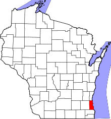 | |
| Villages | ||
| Ghost towns/ neighborhoods | ||
| Indian reservation | ||
| Footnotes | ‡This populated place also has portions in another county or counties | |
| Central city | 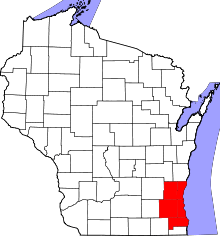 | |
|---|---|---|
| Largest municipalities (over 25,000 in 2010) | ||
| Municipalities (over 10,000 in 2010) | ||
| Smaller municipalities (under 10,000 in 2010) | ||
| Counties | ||